How to get to Alpine Towing by bus?
Click on the bus route to see step by step directions with maps, line arrival times and updated time schedules.
From Mai-Kai Restaurant And Polynesian Show, Fort Lauderdale
35 minFrom Butterfly World, Pompano Beach
79 minFrom E Broward Blvd / W Broward Blvd, Fort Lauderdale
40 minFrom Fort Lauderdale Florida, Fort Lauderdale
39 minFrom City of Oakland Park, Fort Lauderdale
19 minFrom Central Terminal, Fort Lauderdale
36 minFrom A1A, Fort Lauderdale
50 minFrom Cash Escorts, Fort Lauderdale
36 minFrom City of Lauderdale Lakes, Fort Lauderdale
55 minFrom Intersection : N Andrews Ave & Sample Rd., Pompano Beach
63 min
How to get to Alpine Towing by train?
Click on the train route to see step by step directions with maps, line arrival times and updated time schedules.
Bus stops near Alpine Towing in Pompano Beach
Train station near Alpine Towing in Pompano Beach
- Cypress Creek Station, 43 min walk,VIEW
Bus lines to Alpine Towing in Pompano Beach
What are the closest stations to Alpine Towing?
The closest stations to Alpine Towing are:
- Dixie Highway/Southwest 8th Street is 103 yards away, 2 min walk.
- Cypress Road/Southwest 7th Street is 1320 yards away, 16 min walk.
- Andrews Avenue Extension/Southwest 8th Street is 2834 yards away, 34 min walk.
- Cypress Creek Station is 3601 yards away, 43 min walk.
Which bus line stops near Alpine Towing?
50 (Hillsboro - SW 3 Av Via Northeast Transit Center)
Which train line stops near Alpine Towing?
TRIRAIL (Northbound To Mangonia Park)
What’s the nearest bus station to Alpine Towing in Pompano Beach?
The nearest bus station to Alpine Towing in Pompano Beach is Dixie Highway/Southwest 8th Street. It’s a 2 min walk away.
What time is the first train to Alpine Towing in Pompano Beach?
The TRIRAIL is the first train that goes to Alpine Towing in Pompano Beach. It stops nearby at 4:38 AM.
What time is the last train to Alpine Towing in Pompano Beach?
The TRIRAIL is the last train that goes to Alpine Towing in Pompano Beach. It stops nearby at 10:43 PM.
What time is the first bus to Alpine Towing in Pompano Beach?
The 20 is the first bus that goes to Alpine Towing in Pompano Beach. It stops nearby at 5:03 AM.
What time is the last bus to Alpine Towing in Pompano Beach?
The 50 is the last bus that goes to Alpine Towing in Pompano Beach. It stops nearby at 11:42 PM.
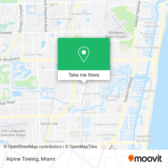
See Alpine Towing, Pompano Beach, on the map
Public Transit to Alpine Towing in Pompano Beach
Wondering how to get to Alpine Towing in Pompano Beach? Moovit helps you find the best way to get to Alpine Towing with step-by-step directions from the nearest public transit station.
Moovit provides free maps and live directions to help you navigate through your city. View schedules, routes, timetables, and find out how long does it take to get to Alpine Towing in real time.
Looking for the nearest stop or station to Alpine Towing? Check out this list of stops closest to your destination: Dixie Highway/Southwest 8th Street; Cypress Road/Southwest 7th Street; Andrews Avenue Extension/Southwest 8th Street; Cypress Creek Station.
Bus: 50, 20, 60.Train: TRIRAIL.
Want to see if there’s another route that gets you there at an earlier time? Moovit helps you find alternative routes or times. Get directions from and directions to Alpine Towing easily from the Moovit App or Website.
We make riding to Alpine Towing easy, which is why over 1.5 million users, including users in Pompano Beach, trust Moovit as the best app for public transit. You don’t need to download an individual bus app or train app, Moovit is your all-in-one transit app that helps you find the best bus time or train time available.
For information on prices of bus and train, costs and ride fares to Alpine Towing, please check the Moovit app.
Use the app to navigate to popular places including to the airport, hospital, stadium, grocery store, mall, coffee shop, school, college, and university.
Alpine Towing Address: 810 S Dixie Hwy W Pompano Beach, FL 33060 street in Pompano Beach
- WMF Auto Repair,
- Viking Customs,
- Renegade Motor Sports,
- My Passion on A Plate,
- Jimbo Wings,
- 2 Hotty's Cafe,
- Pompano Meat & Fish,
- Urieta Towing,
- Maria's Interior Design,
- Embroiderybroward,
- Preferred Family Care,
- John A Janus Pa,
- Bartek Locksmith,
- A Casino Event Florida,
- Jardin Kitchen,
- Alterations by Reina,
- Southern Baptist Convention,
- Memorial Caring Hands Senior Services,
- KG Appliance Repair Ex,
- Roof Xperts
Places Near Alpine Towing (Pompano Beach)
- Wynwood, Miami,
- Brickell City Centre, Miami,
- Sawgrass Mall, Miami,
- Miami VA Hospital, Miami,
- Little Havana, Miami,
- Sawgrass mall ( FL ), Miami Beach,
- Dolphin Mall, Miami,
- Aventura Mall, Miami Beach,
- Miami-Dade County Courthouse, Miami,
- Zoo Miami, Miami,
- Hard Rock Stadium, Miami Gardens,
- Port of Miami Cruise Terminal, Miami,
- Miami Freedom Park, Miami,
- Keiser University Flagship Campus, West Palm Beach,
- Bayside Marketplace, Miami,
- Marlins Park, Miami,
- Dolphin Mall Bus, Miami,
- Miami Design District, Miami,
- Aventura Mall, Miami,
- Richard E. Gerstein Justice Building, Miami
How to get to popular places in Miami with public transit
Get around Pompano Beach by public transit!
Traveling around Pompano Beach has never been so easy. See step by step directions as you travel to any attraction, street or major public transit station. View bus and train schedules, arrival times, service alerts and detailed routes on a map, so you know exactly how to get to anywhere in Pompano Beach.
When traveling to any destination around Pompano Beach use Moovit's Live Directions with Get Off Notifications to know exactly where and how far to walk, how long to wait for your line, and how many stops are left. Moovit will alert you when it's time to get off — no need to constantly re-check whether yours is the next stop.
Wondering how to use public transit in Pompano Beach or how to pay for public transit in Pompano Beach? Moovit public transit app can help you navigate your way with public transit easily, and at minimum cost. It includes public transit fees, ticket prices, and costs. Looking for a map of Pompano Beach public transit lines? Moovit public transit app shows all public transit maps in Pompano Beach with all Bus, Train, Light Rail and Ferry routes and stops on an interactive map.
Miami has 4 transit type(s), including: Bus, Train, Light Rail and Ferry, operated by several transit agencies, including Broward County Transit, Miami-Dade Transit, Metrorail, Palm Tran, Tri-Rail, Brightline, MARTY, City of Homestead Trolley, Key West Transit, Treasure Coast Connector, GoLine IRT, Amtrak, Greyhound-us, FlixBus-us and Aventura Express Shuttle Bus