Alt-Treptow stop - Thursday schedule
| Line | Direction | Time |
|---|---|---|
| N60 | S+U Alexanderplatz Bhf/Memhardstr. | 03:03 |
| N65 | S+U Alexanderplatz Bhf/Memhardstr. | 03:23 |
| N60 | S+U Alexanderplatz Bhf/Memhardstr. | 03:33 |
| N65 | S+U Alexanderplatz Bhf/Memhardstr. | 03:53 |
| N60 | S+U Alexanderplatz Bhf/Memhardstr. | 04:03 |
| N65 | S+U Alexanderplatz Bhf/Memhardstr. | 04:23 |
| N60 | Elsenstr./S Treptower Park | 04:33 |
| 165 | U Märkisches Museum/Inselstr. | 04:42 |
| 165 | U Märkisches Museum | 04:42 |
| 265 | Elsenstr./S Treptower Park | 04:52 |
| 165 | U Märkisches Museum/Inselstr. | 05:02 |
| 165 | U Märkisches Museum | 05:02 |
| 166 | Elsenstr./S Treptower Park | 05:03 |
| 265 | Elsenstr./S Treptower Park | 05:12 |
| 165 | U Märkisches Museum/Inselstr. | 05:22 |
| 165 | U Märkisches Museum | 05:22 |
| 166 | Elsenstr./S Treptower Park | 05:23 |
| 265 | Elsenstr./S Treptower Park | 05:32 |
| 165 | U Märkisches Museum/Inselstr. | 05:42 |
| 165 | U Märkisches Museum | 05:42 |
| 166 | Elsenstr./S Treptower Park | 05:43 |
| 265 | Elsenstr./S Treptower Park | 05:52 |
| 165 | U Märkisches Museum/Inselstr. | 05:57 |
| 165 | U Märkisches Museum | 05:57 |
| 166 | Weisestr. | 05:58 |
Directions to Alt-Treptow with public transportation
The following transit lines have routes that pass near Alt-Treptow
How to get to Alt-Treptow by bus?
Click on the bus route to see step by step directions with maps, line arrival times and updated time schedules.
How to get to Alt-Treptow by train?
Click on the train route to see step by step directions with maps, line arrival times and updated time schedules.
How to get to Alt-Treptow by subway?
Click on the subway route to see step by step directions with maps, line arrival times and updated time schedules.
Bus stations near Alt-Treptow
- Bulgarische Str., 6 min walk,
- Friedrich-Junge-Str., 29 min walk,
Train stations near Alt-Treptow
- S Plänterwald, 17 min walk,
- Plänterwald, 17 min walk,
- S Treptower Park, 18 min walk,
Light Rail stations near Alt-Treptow
- Kosanke-Siedlung, 46 min walk,
Bus lines to Alt-Treptow
- N60, S Schöneweide/Sterndamm,
- N65, S+U Alexanderplatz Bhf/Memhardstr.,
- 165, Müggelschlößchenweg,
- 166, Elsenstr./S Treptower Park,
- 265, U Stadtmitte,
- M43, Fontanestr./Flughafenstr.,
- 347, S Ostbahnhof,
What are the closest stations to Alt-Treptow?
The closest stations to Alt-Treptow are:
- Bulgarische Str. is 394 meters away, 6 min walk.
- S Plänterwald is 1255 meters away, 17 min walk.
- Plänterwald is 1258 meters away, 17 min walk.
- S Treptower Park is 1397 meters away, 18 min walk.
- Friedrich-Junge-Str. is 2204 meters away, 29 min walk.
- Kosanke-Siedlung is 3562 meters away, 46 min walk.
Which train lines stop near Alt-Treptow?
These train lines stop near Alt-Treptow: S41, S42, S9.
Which subway lines stop near Alt-Treptow?
These subway lines stop near Alt-Treptow: U1, U5.
Which bus lines stop near Alt-Treptow?
These bus lines stop near Alt-Treptow: 165, 265.
What’s the nearest train station to Alt-Treptow?
The nearest train stations to Alt-Treptow are S Plänterwald and Plänterwald. The closest one is a 17 min walk away.
What’s the nearest bus stop to Alt-Treptow?
The nearest bus stop to Alt-Treptow is Bulgarische Str.. It’s a 6 min walk away.
What time is the first light rail to Alt-Treptow?
The 21 is the first light rail that goes to Alt-Treptow. It stops nearby at 6:51 AM.
What time is the last light rail to Alt-Treptow?
The 21 is the last light rail that goes to Alt-Treptow. It stops nearby at 12:32 AM.
What time is the first train to Alt-Treptow?
The S9 is the first train that goes to Alt-Treptow. It stops nearby at 3:03 AM.
What time is the last train to Alt-Treptow?
The S9 is the last train that goes to Alt-Treptow. It stops nearby at 2:03 AM.
What time is the first bus to Alt-Treptow?
The M43 is the first bus that goes to Alt-Treptow. It stops nearby at 3:01 AM.
What time is the last bus to Alt-Treptow?
The N65 is the last bus that goes to Alt-Treptow. It stops nearby at 3:54 AM.
How much is the subway fare to Alt-Treptow?
The subway fare to Alt-Treptow costs about €2.40 - €3.50.
How much is the train fare to Alt-Treptow?
The train fare to Alt-Treptow costs about €1.80 - €4.40.
How much is the bus fare to Alt-Treptow?
The bus fare to Alt-Treptow costs about €2.40 - €3.50.
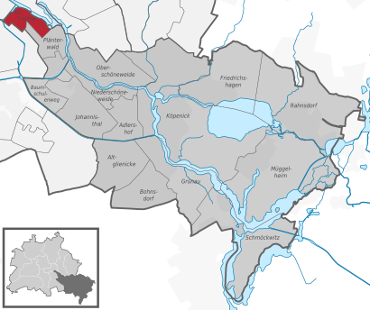
See Alt-Treptow on the map
Public transit to Alt-Treptow stop (ID: 900190501)
Looking for directions to Alt-Treptow in Alt-Treptow, Germany?
Download the Moovit App to find the current schedule and step-by-step directions for Bus, Train or Subway routes that pass through Alt-Treptow.
Looking for the nearest stops closest to Alt-Treptow ? Check out this list of closest stops to your destination: Bulgarische Str.; S Plänterwald; Plänterwald; S Treptower Park; Friedrich-Junge-Str.; Kosanke-Siedlung.
Train: S41, S42, S9, S8, S45, S46, S47.Subway: U1, U5.Bus: 165, 265, N60, N65, 166, M43, 347.
We make riding on public transit to Alt-Treptow easy, which is why over 1.5 million users, including users in Alt-Treptow trust Moovit as the best app for public transit.
Use the app to navigate to popular places including to the airport, hospital, stadium, grocery store, mall, coffee shop, school, college, and university.
Alt-Treptow stop’s code is 900190501
The first line to this stop is N60, at 03:03, and the last line is N65 at 02:53.
Alt-Treptow, Berlin, Germany
This stop serves BVG’s lines
Light Rail station near Alt-Treptow
Kosanke-SiedlungPopular public transit stations in Alt-Treptow
Glienicke (Los) Försterei,S+U Schönhauser Allee,Breslack Ulmenstr.,Finsterwalde Friedrichpassage,Großwoltersdorf (Ohv) Neubau,Judith-Auer-Str.,Trebbin Markt,Fichtenberg Gemeindeamt,Wismarer Str.,Dallgow-Döberitz Artilleriepark,S Hackescher Markt,Fanningerstr.,Strausberger Platz,Köllnischer Platz,Damelang,Heckmannufer,Nauen Umspannwerk,Golßen Bahnhof,Paul-Junius-Str.,Frankfurter TorGet around Berlin - Brandenburg by public transit!
Traveling around Berlin - Brandenburg has never been so easy. See step by step directions as you travel to any attraction, street or major public transit station. View bus and train schedules, arrival times, service alerts and detailed routes on a map, so you know exactly how to get to anywhere in Berlin - Brandenburg.
When traveling to any destination around Berlin - Brandenburg use Moovit's Live Directions with Get Off Notifications to know exactly where and how far to walk, how long to wait for your line, and how many stops are left. Moovit will alert you when it's time to get off — no need to constantly re-check whether yours is the next stop.
Wondering how to use public transit in Berlin - Brandenburg or how to pay for public transit in Berlin - Brandenburg? Moovit public transit app can help you navigate your way with public transit easily, and at minimum cost. It includes public transit fees, ticket prices, and costs. Looking for a map of Berlin - Brandenburg public transit lines? Moovit public transit app shows all public transit maps in Berlin - Brandenburg with all Bus, Train, Subway, Light Rail and Ferry routes and stops on an interactive map.
Berlin - Brandenburg has 5 transit type(s), including: Bus, Train, Subway, Light Rail and Ferry, operated by several transit agencies, including BVG, VBB, S-Bahn, Cottbusverkehr, Schöneicher Rüdersdorfer Straßenbahn, Strausberger Eisenbahn GmbH, Stadtverkehrsgesellschaft Tram, Verkehrsbetriebe Brandenburg, Verkehrsverbund Potsdam, DB Regio Bus, Barnimer Busgesellschaft, Busverkehr Oder-Spree GmbH, A. Reich, ANG, Busverkehr Gerd Schmidt