How to get to Alter Way by bus?
Click on the bus route to see step by step directions with maps, line arrival times and updated time schedules.
From 7e Arrondissement, Paris
58 minFrom Le Trianon, Paris
79 minFrom Avenue Hoche, Paris
48 minFrom Mémorial de la Shoah, Paris
71 minFrom Boulevard de Sébastopol, Paris
73 minFrom Port de la Conférence, Paris
50 minFrom Porte de Champerret, Paris
58 minFrom Théâtre Marigny, Paris
54 minFrom Théâtre de L'Atelier, Paris
79 minFrom Rue D Hauteville, Paris
76 min
How to get to Alter Way by train?
Click on the train route to see step by step directions with maps, line arrival times and updated time schedules.
How to get to Alter Way by metro?
Click on the metro route to see step by step directions with maps, line arrival times and updated time schedules.
From 7e Arrondissement, Paris
37 minFrom Le Trianon, Paris
52 minFrom Avenue Hoche, Paris
37 minFrom Mémorial de la Shoah, Paris
48 minFrom Boulevard de Sébastopol, Paris
43 minFrom Port de la Conférence, Paris
35 minFrom Porte de Champerret, Paris
54 minFrom Théâtre Marigny, Paris
39 minFrom Théâtre de L'Atelier, Paris
49 minFrom Rue D Hauteville, Paris
47 min
Bus stops near Alter Way in Saint-Cloud
Train station near Alter Way in Saint-Cloud
- Saint-Cloud, 14 min walk,VIEW
Metro station near Alter Way in Saint-Cloud
- Boulogne Jean Jaurès, 16 min walk,VIEW
Light Rail stations near Alter Way in Saint-Cloud
- Les Milons, 25 min walk,VIEW
Bus lines to Alter Way in Saint-Cloud
- 6246, Gambetta,VIEW
- 160, Nanterre - Ville RER,VIEW
- 467, Rueil-Malmaison RER,VIEW
- 7815, Parc de Saint-Cloud,VIEW
- 175, Les Bruyères,VIEW
- 52, Porte D'Auteuil,VIEW
- 72, Porte de Saint-Cloud,VIEW
- 126, Parc de Saint-Cloud,VIEW
- 5117, Gare de Plaisir Grignon - Quai 1,VIEW
- L, Gare de Versailles - Rive Droite,VIEW
- U, La Défense - Terminal Jules Verne,VIEW
What are the closest stations to Alter Way?
The closest stations to Alter Way are:
- La Colline is 28 meters away, 1 min walk.
- Parc de Saint-Cloud is 160 meters away, 3 min walk.
- Pont de Saint-Cloud - Albert Kahn is 480 meters away, 7 min walk.
- Gare de Saint-Cloud is 708 meters away, 10 min walk.
- Saint-Cloud is 1076 meters away, 14 min walk.
- Boulogne Jean Jaurès is 1184 meters away, 16 min walk.
- Les Milons is 1924 meters away, 25 min walk.
Which train line stops near Alter Way?
L (Cergy-le-Haut/ Versailles-Rive-Droite/ Saint-Nom-la-Bretèche - Forêt de Marly)
Which metro line stops near Alter Way?
10 (Gare D'Austerlitz)
Which bus lines stop near Alter Way?
These bus lines stop near Alter Way: 175, 52, 72.
Which light rail line stops near Alter Way?
T2 (Porte de Versailles)
What’s the nearest light rail station to Alter Way in Saint-Cloud?
The nearest light rail station to Alter Way in Saint-Cloud is Les Milons. It’s a 25 min walk away.
What’s the nearest metro station to Alter Way in Saint-Cloud?
The nearest metro station to Alter Way in Saint-Cloud is Boulogne Jean Jaurès. It’s a 16 min walk away.
What’s the nearest train station to Alter Way in Saint-Cloud?
The nearest train station to Alter Way in Saint-Cloud is Saint-Cloud. It’s a 14 min walk away.
What’s the nearest bus station to Alter Way in Saint-Cloud?
The nearest bus station to Alter Way in Saint-Cloud is La Colline. It’s a 1 min walk away.
What time is the first light rail to Alter Way in Saint-Cloud?
The T2 is the first light rail that goes to Alter Way in Saint-Cloud. It stops nearby at 5:13 AM.
What time is the last light rail to Alter Way in Saint-Cloud?
The T2 is the last light rail that goes to Alter Way in Saint-Cloud. It stops nearby at 12:56 AM.
What time is the first metro to Alter Way in Saint-Cloud?
The 10 is the first metro that goes to Alter Way in Saint-Cloud. It stops nearby at 5:35 AM.
What time is the last metro to Alter Way in Saint-Cloud?
The 10 is the last metro that goes to Alter Way in Saint-Cloud. It stops nearby at 1:10 AM.
What time is the first train to Alter Way in Saint-Cloud?
The L is the first train that goes to Alter Way in Saint-Cloud. It stops nearby at 5:01 AM.
What time is the last train to Alter Way in Saint-Cloud?
The L is the last train that goes to Alter Way in Saint-Cloud. It stops nearby at 10:25 PM.
What time is the first bus to Alter Way in Saint-Cloud?
The 467 is the first bus that goes to Alter Way in Saint-Cloud. It stops nearby at 5:37 AM.
What time is the last bus to Alter Way in Saint-Cloud?
The L is the last bus that goes to Alter Way in Saint-Cloud. It stops nearby at 1:53 AM.
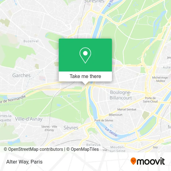
See Alter Way, Saint-Cloud, on the map
Public Transit to Alter Way in Saint-Cloud
Wondering how to get to Alter Way in Saint-Cloud? Moovit helps you find the best way to get to Alter Way with step-by-step directions from the nearest public transit station.
Moovit provides free maps and live directions to help you navigate through your city. View schedules, routes, timetables, and find out how long does it take to get to Alter Way in real time.
Looking for the nearest stop or station to Alter Way? Check out this list of stops closest to your destination: La Colline; Parc de Saint-Cloud; Pont de Saint-Cloud - Albert Kahn; Gare de Saint-Cloud; Saint-Cloud; Boulogne Jean Jaurès; Les Milons.
Train: L, U.Metro: 10.Bus: 175, 52, 72, 6246, 160, 467, 7815.Light Rail: T2.
Want to see if there’s another route that gets you there at an earlier time? Moovit helps you find alternative routes or times. Get directions from and directions to Alter Way easily from the Moovit App or Website.
We make riding to Alter Way easy, which is why over 1.5 million users, including users in Saint-Cloud, trust Moovit as the best app for public transit. You don’t need to download an individual bus app or train app, Moovit is your all-in-one transit app that helps you find the best bus time or train time available.
For information on prices of metro, bus, train, light rail and RER, costs and ride fares to Alter Way, please check the Moovit app.
Use the app to navigate to popular places including to the airport, hospital, stadium, grocery store, mall, coffee shop, school, college, and university.
Alter Way Address: 1 rue Royale street in Saint-Cloud
- Sungard Finance,
- Espace Fumeurs Bureaux de la Colline,
- Croc Pain,
- Sodexo RIE Bureaux De La Colline,
- Pont de Saint-Cloud,
- Moody's Analytics,
- 146 Bureaux de la Colline,
- Snowrental,
- Rue Royale,
- Art Culinaire International,
- O Club,
- Al Dayaa,
- Seoulsienne,
- Ethypharm,
- Linea Roma,
- Parking Bureaux De La Colline,
- Qualidigital,
- Equalit,
- Saint-Cloud 92 S,
- Diac
Places Near Alter Way (Saint-Cloud)
- Hôpital Henri Mondor, Creteil,
- Hôpital Saint-Joseph, Paris,
- Centre Hospitalier des 15/20, Paris,
- Hopital Foch, Suresnes,
- Institut Curie, Paris,
- Hôpital Necker, Paris,
- Créteil Soleil, Creteil,
- Galeries Lafayette, Paris,
- Hopital Lariboisière, Paris,
- Galeries Lafayette Haussmann, Paris,
- 29 Rue Manin, Paris,
- Hôpital Pitié Salpêtrière, Paris,
- Marché Saint-Pierre, Paris,
- Fondation Louis Vuitton, Paris,
- Hôpital Cochin, Paris,
- Gare Routière Flixbus, Paris,
- Atelier Des Lumieres, Paris,
- Théâtre Mogador, Paris,
- Hôpital de la Pitié-Salpêtrière, Paris,
- Hôpital Beaujon, Clichy
How to get to popular places in Paris with public transit
Get around Saint-Cloud by public transit!
Traveling around Saint-Cloud has never been so easy. See step by step directions as you travel to any attraction, street or major public transit station. View bus and train schedules, arrival times, service alerts and detailed routes on a map, so you know exactly how to get to anywhere in Saint-Cloud.
When traveling to any destination around Saint-Cloud use Moovit's Live Directions with Get Off Notifications to know exactly where and how far to walk, how long to wait for your line, and how many stops are left. Moovit will alert you when it's time to get off — no need to constantly re-check whether yours is the next stop.
Wondering how to use public transit in Saint-Cloud or how to pay for public transit in Saint-Cloud? Moovit public transit app can help you navigate your way with public transit easily, and at minimum cost. It includes public transit fees, ticket prices, and costs. Looking for a map of Saint-Cloud public transit lines? Moovit public transit app shows all public transit maps in Saint-Cloud with all Bus, Train, Metro, Light Rail, RER, Funicular and Gondola routes and stops on an interactive map.
Paris has 7 transit type(s), including: Bus, Train, Metro, Light Rail, RER, Funicular and Gondola, operated by several transit agencies, including RATP, RER, RER Bus de remplacement, Train, Train Bus de remplacement, Tramway Bus de remplacement, TER, ADP, Magical Shuttle, Argenteuil - Boucles de Seine, Autocars Dominique, Bièvre, Brie et 2 Morin, Le Bus - C.C. du Clermontois and Cœur d’Essonne