How to get to Amazon Counter by bus?
Click on the bus route to see step by step directions with maps, line arrival times and updated time schedules.
From Florence Galluzzo, Florence
36 minFrom Marconi Street 50, Prato
52 minFrom Coverciano, Florence
47 minFrom Mondo Convenienza, Prato
60 minFrom Farewell Chapels of Misericordia of Antella, Bagno a Ripoli
57 minFrom Signa, Signa
82 minFrom Fiesole, Fiesole
60 minFrom Giuseppe Bessi Street, Scandicci
72 minFrom Lastra A Signa, Lastra A Signa
82 minFrom Prada Outlet, Florence
42 min
How to get to Amazon Counter by train?
Click on the train route to see step by step directions with maps, line arrival times and updated time schedules.
Bus stops near Amazon Counter in Florence
Light Rail stations near Amazon Counter in Florence
- Buonsignori - Da Vinci High School, 7 min walk,VIEW
Bus lines to Amazon Counter in Florence
What are the closest stations to Amazon Counter?
The closest stations to Amazon Counter are:
- Redi San Donato is 264 meters away, 4 min walk.
- Forlanini Rastrelli is 391 meters away, 6 min walk.
- Puccini Factory is 433 meters away, 6 min walk.
- Tartini Puccini is 461 meters away, 7 min walk.
- Puccini Square is 496 meters away, 7 min walk.
- Buonsignori - Da Vinci High School is 507 meters away, 7 min walk.
Which bus lines stop near Amazon Counter?
These bus lines stop near Amazon Counter: 17, 30, 35.
Which train line stops near Amazon Counter?
R (Empoli/Firenze)
Which light rail line stops near Amazon Counter?
T2 (San Marco > Peretola)
What’s the nearest light rail station to Amazon Counter in Florence?
The nearest light rail station to Amazon Counter in Florence is Buonsignori - Da Vinci High School. It’s a 7 min walk away.
What’s the nearest bus station to Amazon Counter in Florence?
The nearest bus station to Amazon Counter in Florence is Redi San Donato. It’s a 4 min walk away.
What time is the first light rail to Amazon Counter in Florence?
The T2 is the first light rail that goes to Amazon Counter in Florence. It stops nearby at 5:05 AM.
What time is the last light rail to Amazon Counter in Florence?
The T2 is the last light rail that goes to Amazon Counter in Florence. It stops nearby at 12:48 AM.
What time is the first bus to Amazon Counter in Florence?
The 30 is the first bus that goes to Amazon Counter in Florence. It stops nearby at 5:15 AM.
What time is the last bus to Amazon Counter in Florence?
The 35 is the last bus that goes to Amazon Counter in Florence. It stops nearby at 1:11 AM.
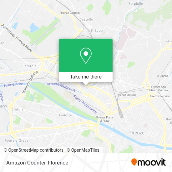
See Amazon Counter, Florence, on the map
Public Transit to Amazon Counter in Florence
Wondering how to get to Amazon Counter in Florence? Moovit helps you find the best way to get to Amazon Counter with step-by-step directions from the nearest public transit station.
Moovit provides free maps and live directions to help you navigate through your city. View schedules, routes, timetables, and find out how long does it take to get to Amazon Counter in real time.
Looking for the nearest stop or station to Amazon Counter? Check out this list of stops closest to your destination: Redi San Donato; Forlanini Rastrelli; Puccini Factory; Tartini Puccini; Puccini Square; Buonsignori - Da Vinci High School.
Bus: 17, 30, 35, 55, 56, 57, ST6, 301 A, 365 A.Train: R.Light Rail: T2.
Want to see if there’s another route that gets you there at an earlier time? Moovit helps you find alternative routes or times. Get directions from and directions to Amazon Counter easily from the Moovit App or Website.
We make riding to Amazon Counter easy, which is why over 1.5 million users, including users in Florence, trust Moovit as the best app for public transit. You don’t need to download an individual bus app or train app, Moovit is your all-in-one transit app that helps you find the best bus time or train time available.
For information on prices of bus, light rail and train, costs and ride fares to Amazon Counter, please check the Moovit app.
Use the app to navigate to popular places including to the airport, hospital, stadium, grocery store, mall, coffee shop, school, college, and university.
Amazon Counter Address: Via della Villa Demidoff, 84 50127 Firenze street in Florence
- Unitech,
- Munay Pisco Bar,
- Sevi,
- Fuego,
- Kabab Ponte Basso,
- Shi Qi Men Hot Pot,
- 92 Demidoff Villa Street,
- Gestum,
- Ye Haichao,
- Yummy Sri Lanka,
- Domenico Marcello Fazio,
- Rumega Sorinel,
- M & E Srl Management and Engineering,
- M&E Technical Engineering Studio,
- Novoli Street / Villa Demidoff Street,
- Dr. Luca Gori Psychologist Psychotherapist,
- R.B.L. Roberti Roberto and Diacciati Cesare,
- My Copy Srl C.R.,
- Patronato Anmil Provincial Headquarters,
- Elcagliadortattoo
Places Near Amazon Counter (Florence)
- Field of Mars, Florence,
- Asmana, Campi Bisenzio,
- Santa Maria Novella Station, Florence,
- Torregalli Hospital Scandicci *, Scandicci,
- Visarno Arena, Florence,
- Santa Maria Nuova Hospital, Florence,
- Piero Palagi Hospital Facility-Florence, Florence,
- Cascine Park, Florence,
- Campi Bisenzio, Campi Bisenzio,
- Artemio Franchi Municipal Stadium, Florence,
- Michelangelo Square, Florence,
- OOO, Florence,
- Verdi Theater, Florence,
- IKEA Florence, Sesto Fiorentino,
- I Gigli, Campi Bisenzio,
- Tobacco Manufacture, Florence,
- Nelson Mandela Forum, Florence,
- Visarno Hippodrome, Florence,
- Mandela Forum (Nelson Mandela Forum), Florence,
- Michelangelo Square, Florence
How to get to popular places in Florence with public transit
Get around Florence by public transit!
Traveling around Florence has never been so easy. See step by step directions as you travel to any attraction, street or major public transit station. View bus and train schedules, arrival times, service alerts and detailed routes on a map, so you know exactly how to get to anywhere in Florence.
When traveling to any destination around Florence use Moovit's Live Directions with Get Off Notifications to know exactly where and how far to walk, how long to wait for your line, and how many stops are left. Moovit will alert you when it's time to get off — no need to constantly re-check whether yours is the next stop.
Wondering how to use public transit in Florence or how to pay for public transit in Florence? Moovit public transit app can help you navigate your way with public transit easily, and at minimum cost. It includes public transit fees, ticket prices, and costs. Looking for a map of Florence public transit lines? Moovit public transit app shows all public transit maps in Florence with all Bus, Train, Light Rail, Ferry and Funicular routes and stops on an interactive map.
Florence has 5 transit type(s), including: Bus, Train, Light Rail, Ferry and Funicular, operated by several transit agencies, including Florence Urban - Tuscan Bus Lines, GEST, Livorno and Province - Tuscan Bus Lines, Arezzo, Florence and Provinces - Tuscan Bus Lines, Prato and Province - Tuscan Bus Lines, Lucca and Province - Tuscan Bus Lines, Massa, Carrara and Province - Tuscan Bus Lines, Pisa and Province - Tuscan Bus Lines, Grosseto, Siena and Provinces - Tuscan Bus Lines, Arezzo, Siena and Provinces - Tuscan Bus Lines, Florence and Province - Tuscan Bus Lines, Pistoia and Province - Tuscan Bus Lines, Siena and Province - Tuscan Bus Lines, Arezzo and Province - Tuscan Bus Lines and Trenitalia