How to get to Amazon Counter by bus?
Click on the bus route to see step by step directions with maps, line arrival times and updated time schedules.
How to get to Amazon Counter by train?
Click on the train route to see step by step directions with maps, line arrival times and updated time schedules.
Bus stops near Amazon Counter in San Romano in Garfagnana
Train station near Amazon Counter in San Romano in Garfagnana
- Camporgiano, 37 min walk,VIEW
Bus lines to Amazon Counter in San Romano in Garfagnana
What are the closest stations to Amazon Counter?
The closest stations to Amazon Counter are:
- SP16 Canepai is 41 meters away, 1 min walk.
- San Romano is 335 meters away, 5 min walk.
- Carasciale Locality is 1238 meters away, 17 min walk.
- Camporgiano is 2839 meters away, 37 min walk.
Which bus lines stop near Amazon Counter?
These bus lines stop near Amazon Counter: E53, E54.
Which train line stops near Amazon Counter?
R (Livorno)
What’s the nearest bus station to Amazon Counter in San Romano in Garfagnana?
The nearest bus station to Amazon Counter in San Romano in Garfagnana is SP16 Canepai. It’s a 1 min walk away.
What time is the first train to Amazon Counter in San Romano in Garfagnana?
The R is the first train that goes to Amazon Counter in San Romano in Garfagnana. It stops nearby at 6:09 AM.
What time is the last train to Amazon Counter in San Romano in Garfagnana?
The R is the last train that goes to Amazon Counter in San Romano in Garfagnana. It stops nearby at 10:07 PM.
What time is the first bus to Amazon Counter in San Romano in Garfagnana?
The E4 is the first bus that goes to Amazon Counter in San Romano in Garfagnana. It stops nearby at 7:12 AM.
What time is the last bus to Amazon Counter in San Romano in Garfagnana?
The E4 is the last bus that goes to Amazon Counter in San Romano in Garfagnana. It stops nearby at 11:11 PM.
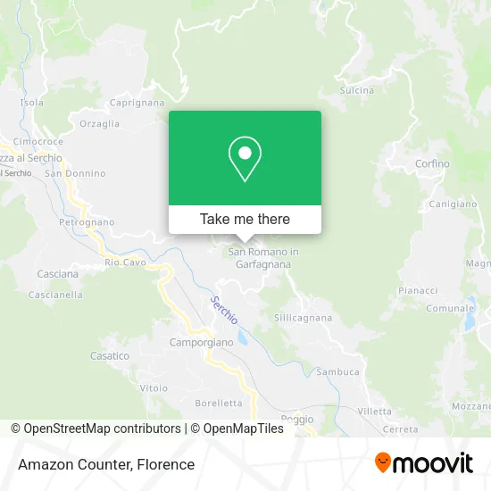
See Amazon Counter, San Romano in Garfagnana, on the map
Public Transit to Amazon Counter in San Romano in Garfagnana
Wondering how to get to Amazon Counter in San Romano in Garfagnana? Moovit helps you find the best way to get to Amazon Counter with step-by-step directions from the nearest public transit station.
Moovit provides free maps and live directions to help you navigate through your city. View schedules, routes, timetables, and find out how long does it take to get to Amazon Counter in real time.
Looking for the nearest stop or station to Amazon Counter? Check out this list of stops closest to your destination: SP16 Canepai; San Romano; Carasciale Locality; Camporgiano.
Bus: E53, E54, E49, E4.Train: R.
Want to see if there’s another route that gets you there at an earlier time? Moovit helps you find alternative routes or times. Get directions from and directions to Amazon Counter easily from the Moovit App or Website.
We make riding to Amazon Counter easy, which is why over 1.5 million users, including users in San Romano in Garfagnana, trust Moovit as the best app for public transit. You don’t need to download an individual bus app or train app, Moovit is your all-in-one transit app that helps you find the best bus time or train time available.
For information on prices of train and bus, costs and ride fares to Amazon Counter, please check the Moovit app.
Use the app to navigate to popular places including to the airport, hospital, stadium, grocery store, mall, coffee shop, school, college, and university.
Amazon Counter Address: Via Roma, 22 55038 San Romano in Garfagnana street in San Romano in Garfagnana
- At the Canipai,
- S.P. 16 Canepai,
- Hostel Parking Headquarters,
- Pieretti Vincenzo & Co.,
- Sant'Antonio Oratory,
- Buffardello Forest,
- Buffardello Forest Adventure Park,
- Verrucole Fortress - Archeopark,
- Municipal School,
- Delfo De Lucia,
- Là Cantine Home Restaurant,
- Pelliccioni-Marazzini Palace,
- Vittoria Inn,
- Rewind Bar and Pizzeria,
- Pelliccioni Square,
- Santi Noel,
- L'Aperitivo,
- Buffardello Forest Adventure Park,
- San Romano in Garfagnana Municipality,
- Melchiorre Photo
Places Near Amazon Counter (San Romano in Garfagnana)
- Santa Maria Nuova Hospital, Florence,
- OOO, Florence,
- Field of Mars, Florence,
- Verdi Theater, Florence,
- Asmana, Campi Bisenzio,
- Michelangelo Square, Florence,
- I Gigli, Campi Bisenzio,
- Mandela Forum (Nelson Mandela Forum), Florence,
- Campi Bisenzio, Campi Bisenzio,
- Viola Park, Bagno a Ripoli,
- Michelangelo Square, Florence,
- Tobacco Manufacture, Florence,
- Piero Palagi Hospital Facility-Florence, Florence,
- Cascine Park, Florence,
- Nelson Mandela Forum, Florence,
- Wanny Palace, Florence,
- Artemio Franchi Municipal Stadium, Florence,
- IKEA Florence, Sesto Fiorentino,
- Torregalli Hospital Scandicci *, Scandicci,
- Santa Maria Novella Station, Florence
How to get to popular places in Florence with public transit
Get around San Romano in Garfagnana by public transit!
Traveling around San Romano in Garfagnana has never been so easy. See step by step directions as you travel to any attraction, street or major public transit station. View bus and train schedules, arrival times, service alerts and detailed routes on a map, so you know exactly how to get to anywhere in San Romano in Garfagnana.
When traveling to any destination around San Romano in Garfagnana use Moovit's Live Directions with Get Off Notifications to know exactly where and how far to walk, how long to wait for your line, and how many stops are left. Moovit will alert you when it's time to get off — no need to constantly re-check whether yours is the next stop.
Wondering how to use public transit in San Romano in Garfagnana or how to pay for public transit in San Romano in Garfagnana? Moovit public transit app can help you navigate your way with public transit easily, and at minimum cost. It includes public transit fees, ticket prices, and costs. Looking for a map of San Romano in Garfagnana public transit lines? Moovit public transit app shows all public transit maps in San Romano in Garfagnana with all Bus, Train, Light Rail, Ferry and Funicular routes and stops on an interactive map.
Florence has 5 transit type(s), including: Bus, Train, Light Rail, Ferry and Funicular, operated by several transit agencies, including Florence Urban - Tuscan Bus Lines, GEST, Florence and Province - Tuscan Bus Lines, Livorno and Province - Tuscan Bus Lines, Arezzo, Florence and Provinces - Tuscan Bus Lines, Prato and Province - Tuscan Bus Lines, Massa, Carrara and Province - Tuscan Bus Lines, Pisa and Province - Tuscan Bus Lines, Grosseto, Siena and Provinces - Tuscan Bus Lines, Arezzo, Siena and Provinces - Tuscan Bus Lines, Pistoia and Province - Tuscan Bus Lines, Siena and Province - Tuscan Bus Lines, Arezzo and Province - Tuscan Bus Lines, Lucca and Province - Tuscan Bus Lines and Trenitalia