How to get to Amazon Counter by bus?
Click on the bus route to see step by step directions with maps, line arrival times and updated time schedules.
From Poirino, Poirino
163 minFrom Alba, Alba
89 minFrom Pralormo, Pralormo
225 minFrom Pralormo Castle, Pralormo
221 minFrom Medford Square, Alba
89 minFrom Messer Tulipano - Pralormo Castle, Pralormo
221 minFrom Ferrero S.P.A, Alba
89 minFrom Santo Spirito Hospital, Casale Monferrato
134 minFrom Santo Spirito Hospital Casale Monferrato, Casale Monferrato
142 minFrom Castelnuovo Don Bosco, Castelnuovo Don Bosco
81 min
How to get to Amazon Counter by train?
Click on the train route to see step by step directions with maps, line arrival times and updated time schedules.
Bus stops near Amazon Counter in Asti
- Dante Avenue - Anita Garibaldi Street, 1 min walk,VIEW
- Dante Avenue - Todi Street, 2 min walk,VIEW
- Dante Avenue - Verdi Street, 4 min walk,VIEW
- Victory of Veneto Square - 15, 4 min walk,VIEW
- Asti - Lugano Square, 7 min walk,VIEW
- Via Conte Verde 9 - Lugano Square, 8 min walk,VIEW
- Lugano Square - Park, 8 min walk,VIEW
- Fortino Road - 55, 8 min walk,VIEW
Train station near Amazon Counter in Asti
- Asti, 16 min walk,VIEW
Bus lines to Amazon Counter in Asti
- ASTI TIGLIOLE, Tigliole,VIEW
- B, Train Station - Cemetery - Health Center - Spandre,VIEW
- FR1, Valgera,VIEW
- SC1, Castiglione Pontesuero,VIEW
- FR2, Viatosto,VIEW
- 4, Our Lady of Lourdes,VIEW
- SC4, Quarto Valenzani,VIEW
- FR5, Vaglierano,VIEW
- 6, San Fedele Circular,VIEW
- 7, Hospital Zone - Via Foscolo,VIEW
- R7, Marello Street,VIEW
- A, Railway Station - Spandre - Health Center - Cemetery,VIEW
- SC2, San Grato,VIEW
- FR3, Serravalle,VIEW
- SC3, Montemarzo,VIEW
- FR4, Valleandona,VIEW
- FR6, San Marzanotto,VIEW
- 2, Cemetery - Via Spandre,VIEW
- 2/, Valle Re - Spandre Street,VIEW
- 1, Torrazzo - Trenches,VIEW
What are the closest stations to Amazon Counter?
The closest stations to Amazon Counter are:
- Dante Avenue - Anita Garibaldi Street is 42 meters away, 1 min walk.
- Dante Avenue - Todi Street is 88 meters away, 2 min walk.
- Dante Avenue - Verdi Street is 275 meters away, 4 min walk.
- Victory of Veneto Square - 15 is 278 meters away, 4 min walk.
- Asti - Lugano Square is 501 meters away, 7 min walk.
- Via Conte Verde 9 - Lugano Square is 538 meters away, 8 min walk.
- Lugano Square - Park is 547 meters away, 8 min walk.
- Fortino Road - 55 is 615 meters away, 8 min walk.
- Asti is 1219 meters away, 16 min walk.
Which bus lines stop near Amazon Counter?
These bus lines stop near Amazon Counter: 034, 045, 7.
Which train line stops near Amazon Counter?
SFM6 (Asti)
What’s the nearest train station to Amazon Counter in Asti?
The nearest train station to Amazon Counter in Asti is Asti. It’s a 16 min walk away.
What’s the nearest bus station to Amazon Counter in Asti?
The nearest bus station to Amazon Counter in Asti is Dante Avenue - Anita Garibaldi Street. It’s a 1 min walk away.
What time is the first train to Amazon Counter in Asti?
The R is the first train that goes to Amazon Counter in Asti. It stops nearby at 5:50 AM.
What time is the last train to Amazon Counter in Asti?
The R is the last train that goes to Amazon Counter in Asti. It stops nearby at 11:18 PM.
What time is the first bus to Amazon Counter in Asti?
The 1 is the first bus that goes to Amazon Counter in Asti. It stops nearby at 6:22 AM.
What time is the last bus to Amazon Counter in Asti?
The 4 is the last bus that goes to Amazon Counter in Asti. It stops nearby at 8:24 PM.
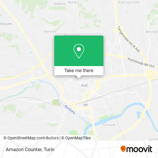
See Amazon Counter, Asti, on the map
Public Transit to Amazon Counter in Asti
Wondering how to get to Amazon Counter in Asti? Moovit helps you find the best way to get to Amazon Counter with step-by-step directions from the nearest public transit station.
Moovit provides free maps and live directions to help you navigate through your city. View schedules, routes, timetables, and find out how long does it take to get to Amazon Counter in real time.
Looking for the nearest stop or station to Amazon Counter? Check out this list of stops closest to your destination: Dante Avenue - Anita Garibaldi Street; Dante Avenue - Todi Street; Dante Avenue - Verdi Street; Victory of Veneto Square - 15; Asti - Lugano Square; Via Conte Verde 9 - Lugano Square; Lugano Square - Park; Fortino Road - 55; Asti.
Bus: 034, 045, 7, ASTI TIGLIOLE, B, FR1, SC1, FR2, A, SC2, FR3, SC3, FR4, 2, 2/, 1, 1/, 050, 051.Train: SFM6, R, R, R, R, R.
Want to see if there’s another route that gets you there at an earlier time? Moovit helps you find alternative routes or times. Get directions from and directions to Amazon Counter easily from the Moovit App or Website.
We make riding to Amazon Counter easy, which is why over 1.5 million users, including users in Asti, trust Moovit as the best app for public transit. You don’t need to download an individual bus app or train app, Moovit is your all-in-one transit app that helps you find the best bus time or train time available.
For information on prices of bus and train, costs and ride fares to Amazon Counter, please check the Moovit app.
Use the app to navigate to popular places including to the airport, hospital, stadium, grocery store, mall, coffee shop, school, college, and university.
Amazon Counter Address: Corso Dante Alighieri, 103 14100 Asti street in Asti
- Alphabeta by Ganci Caterina,
- Adriano Giusti & C.,
- Olympic,
- Specialcase di Rabellino Paola & C.,
- Borgoglio Roella,
- Dante Alighieri Primary School,
- Gieffe,
- Massimo Tramontano,
- Bassignana Mario,
- Gatto Paola,
- Skull Boxe Canavesana,
- Piccinino Eng. Giorgio,
- Bakery Pastry Shop,
- DJ Bar Two,
- WWF Valmanera Oasis,
- Bottello Alviero,
- Constructions,
- Arch. Flavio Chiola,
- Demma Canio,
- Giaccone Architecture Studio
Places Near Amazon Counter (Asti)
- Porta Palazzo, Torino,
- Cavour Street 31, Torino,
- Porta Susa, Torino,
- Mauriziano Hospital, Torino,
- Arturo Farinelli Street 25, Torino,
- Martini Hospital, Torino,
- Sant'Anna Hospital, Torino,
- Molinette Hospital, Torino,
- New Gate, Torino,
- Regina Margherita Children's Hospital, Torino,
- Koelliker Hospital, Torino,
- Pacchiotti Giacinto Street 4, Torino,
- CDC Via Grazioli 11, Torino,
- Castle Square, Torino,
- Shopville Le Gru, Grugliasco,
- CTO Hospital, Torino,
- San Giovanni Bosco Hospital, Torino,
- Le Gru, Grugliasco,
- Prarostino Street 10/A, Torino,
- San Luigi Hospital, Orbassano
How to get to popular places in Turin with public transit
Get around Asti by public transit!
Traveling around Asti has never been so easy. See step by step directions as you travel to any attraction, street or major public transit station. View bus and train schedules, arrival times, service alerts and detailed routes on a map, so you know exactly how to get to anywhere in Asti.
When traveling to any destination around Asti use Moovit's Live Directions with Get Off Notifications to know exactly where and how far to walk, how long to wait for your line, and how many stops are left. Moovit will alert you when it's time to get off — no need to constantly re-check whether yours is the next stop.
Wondering how to use public transit in Asti or how to pay for public transit in Asti? Moovit public transit app can help you navigate your way with public transit easily, and at minimum cost. It includes public transit fees, ticket prices, and costs. Looking for a map of Asti public transit lines? Moovit public transit app shows all public transit maps in Asti with all Bus, Train, Metro, Light Rail, Funicular and Gondola routes and stops on an interactive map.
Turin has 6 transit type(s), including: Bus, Train, Metro, Light Rail, Funicular and Gondola, operated by several transit agencies, including GTT Urban Service, GTT Suburban Service, GTT Tourist Services, Trenitalia, Arenaways, Sadem, Cavourese, Grandabus Consortium, Bus Company - GrandaBus, Bus Company, Gelosobus, Nuova S.a.a.r., SAC, Giors Bus Lines and Allasia Bus Lines