How to get to Amazon Counter-Cellulars C2go by bus?
Click on the bus route to see step by step directions with maps, line arrival times and updated time schedules.
From Target, Miami Beach
36 minFrom South Beach, Miami Beach
61 minFrom South Pointe Park, Miami Beach
47 minFrom Miami Marine Stadium, Key Biscayne
67 minFrom 72nd Ave. & 25th St. @ Miami, North Westside
51 minFrom The Kampong, National Tropical Botanical Garden, Miami
82 minFrom Ocean Reef Suites Miami Beach FL USA, Miami Beach
51 minFrom Doral Inn & Suites Miami Airport West, North Westside
83 minFrom watsco center, Miami
71 minFrom Nikki Beach, Miami Beach
47 min
How to get to Amazon Counter-Cellulars C2go by train?
Click on the train route to see step by step directions with maps, line arrival times and updated time schedules.
Bus stops near Amazon Counter-Cellulars C2go in Miami
Train station near Amazon Counter-Cellulars C2go in Miami
- Santa Clara, 31 min walk,VIEW
Bus lines to Amazon Counter-Cellulars C2go in Miami
What are the closest stations to Amazon Counter-Cellulars C2go?
The closest stations to Amazon Counter-Cellulars C2go are:
- Nw 20 St & Nw 19 Av is 177 yards away, 3 min walk.
- Nw 22 Av & Nw 18 Te is 306 yards away, 4 min walk.
- Santa Clara is 2617 yards away, 31 min walk.
Which bus lines stop near Amazon Counter-Cellulars C2go?
These bus lines stop near Amazon Counter-Cellulars C2go: 20, 22, 32.
Which train line stops near Amazon Counter-Cellulars C2go?
GREEN (Dadeland South Stat.rail Northbound→Palmetto Station Rail Northbound)
What’s the nearest bus station to Amazon Counter-Cellulars C2go in Miami?
The nearest bus station to Amazon Counter-Cellulars C2go in Miami is Nw 20 St & Nw 19 Av. It’s a 3 min walk away.
What time is the first train to Amazon Counter-Cellulars C2go in Miami?
The ORANGE is the first train that goes to Amazon Counter-Cellulars C2go in Miami. It stops nearby at 5:08 AM.
What time is the last train to Amazon Counter-Cellulars C2go in Miami?
The GREEN is the last train that goes to Amazon Counter-Cellulars C2go in Miami. It stops nearby at 12:37 AM.
What time is the first bus to Amazon Counter-Cellulars C2go in Miami?
The 20 is the first bus that goes to Amazon Counter-Cellulars C2go in Miami. It stops nearby at 4:29 AM.
What time is the last bus to Amazon Counter-Cellulars C2go in Miami?
The 32 is the last bus that goes to Amazon Counter-Cellulars C2go in Miami. It stops nearby at 12:09 AM.
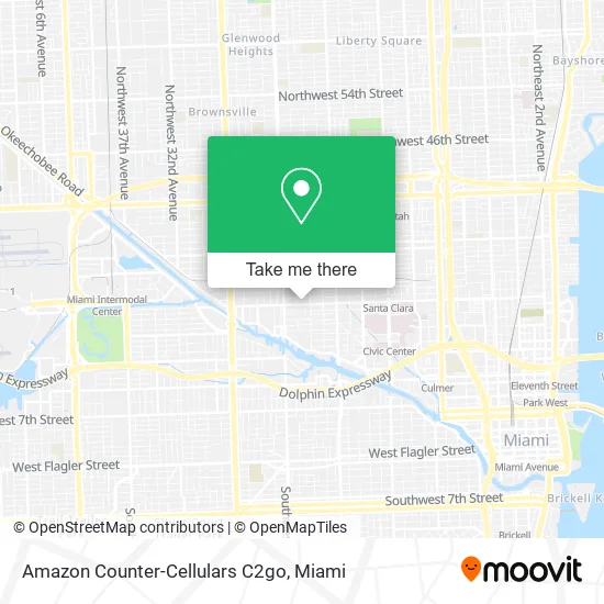
See Amazon Counter-Cellulars C2go, Miami, on the map
Public Transit to Amazon Counter-Cellulars C2go in Miami
Wondering how to get to Amazon Counter-Cellulars C2go in Miami? Moovit helps you find the best way to get to Amazon Counter-Cellulars C2go with step-by-step directions from the nearest public transit station.
Moovit provides free maps and live directions to help you navigate through your city. View schedules, routes, timetables, and find out how long does it take to get to Amazon Counter-Cellulars C2go in real time.
Looking for the nearest stop or station to Amazon Counter-Cellulars C2go? Check out this list of stops closest to your destination: Nw 20 St & Nw 19 Av; Nw 22 Av & Nw 18 Te; Santa Clara.
Bus: 20, 22, 32, MIAALP.Train: GREEN, ORANGE.
Want to see if there’s another route that gets you there at an earlier time? Moovit helps you find alternative routes or times. Get directions from and directions to Amazon Counter-Cellulars C2go easily from the Moovit App or Website.
We make riding to Amazon Counter-Cellulars C2go easy, which is why over 1.5 million users, including users in Miami, trust Moovit as the best app for public transit. You don’t need to download an individual bus app or train app, Moovit is your all-in-one transit app that helps you find the best bus time or train time available.
For information on prices of bus and train, costs and ride fares to Amazon Counter-Cellulars C2go, please check the Moovit app.
Use the app to navigate to popular places including to the airport, hospital, stadium, grocery store, mall, coffee shop, school, college, and university.
Amazon Counter-Cellulars C2go Address: 2027 NW 20th St Miami, FL 33142 street in Miami
- Atlantic Water,
- NT by Amati,
- Perfumax,
- Piro Import and Export,
- NEPA Wholesale,
- Miami-Dade Ruby Locksmith,
- San Lee Trading,
- Championfit,
- Tortillas la Catracha,
- Residential Levi Locksmith,
- Rising Revolt,
- La Colmena Mini Market,
- Feisty Burrito Bowls,
- Mia Jewelry,
- Waist Magic,
- Break Room,
- HYUNDAI Fashions,
- Ministerio Internacional Nuevo Nacimiento,
- La Maison Perfumes,
- June Dollar Store Plus
Places Near Amazon Counter-Cellulars C2go (Miami)
- Aventura Mall, Miami Beach,
- Dolphin Mall, Miami,
- Sawgrass Mall, Miami,
- Zoo Miami, Miami,
- Marlins Park, Miami,
- Richard E. Gerstein Justice Building, Miami,
- Bayside Marketplace, Miami,
- Dolphin Mall Bus, Miami,
- Wynwood, Miami,
- Hard Rock Stadium, Miami Gardens,
- Port of Miami Cruise Terminal, Miami,
- Miami Design District, Miami,
- Little Havana, Miami,
- Brickell City Centre, Miami,
- Miami VA Hospital, Miami,
- Keiser University Flagship Campus, West Palm Beach,
- Aventura Mall, Miami,
- Miami-Dade County Courthouse, Miami,
- Miami Freedom Park, Miami,
- Sawgrass mall ( FL ), Miami Beach
How to get to popular places in Miami with public transit
Get around Miami by public transit!
Traveling around Miami has never been so easy. See step by step directions as you travel to any attraction, street or major public transit station. View bus and train schedules, arrival times, service alerts and detailed routes on a map, so you know exactly how to get to anywhere in Miami.
When traveling to any destination around Miami use Moovit's Live Directions with Get Off Notifications to know exactly where and how far to walk, how long to wait for your line, and how many stops are left. Moovit will alert you when it's time to get off — no need to constantly re-check whether yours is the next stop.
Wondering how to use public transit in Miami or how to pay for public transit in Miami? Moovit public transit app can help you navigate your way with public transit easily, and at minimum cost. It includes public transit fees, ticket prices, and costs. Looking for a map of Miami public transit lines? Moovit public transit app shows all public transit maps in Miami with all Bus, Train, Light Rail and Ferry routes and stops on an interactive map.
Miami has 4 transit type(s), including: Bus, Train, Light Rail and Ferry, operated by several transit agencies, including Broward County Transit, Miami-Dade Transit, Metrorail, Palm Tran, Tri-Rail, Brightline, MARTY, City of Homestead Trolley, Key West Transit, Treasure Coast Connector, GoLine IRT, Amtrak, Greyhound-us, FlixBus-us and Aventura Express Shuttle Bus