How to get to Amazon Counter-Tobacco Shop by bus?
Click on the bus route to see step by step directions with maps, line arrival times and updated time schedules.
From SS. Cosma and Damiano Hospital of Pescia, Pescia
99 minFrom Monsummano Terme, Monsummano Terme
70 minFrom Green Area, Capannori
87 minFrom Cesare Battisti Square, Montecatini Terme
37 minFrom Campo di Marte Health Citadel, Lucca
44 minFrom Le Panteraie Discotheque Montecatini Lidò, Montecatini-Terme
60 minFrom Pescia Hospital, Pescia
99 minFrom Montecatini Terme, Montecatini Terme
39 minFrom San Luca Hospital, Lucca
35 min
How to get to Amazon Counter-Tobacco Shop by train?
Click on the train route to see step by step directions with maps, line arrival times and updated time schedules.
Bus stops near Amazon Counter-Tobacco Shop in Altopascio
Train station near Amazon Counter-Tobacco Shop in Altopascio
- Altopascio, 45 min walk,VIEW
Bus lines to Amazon Counter-Tobacco Shop in Altopascio
What are the closest stations to Amazon Counter-Tobacco Shop?
The closest stations to Amazon Counter-Tobacco Shop are:
- Via Cavour near Middle School is 183 meters away, 3 min walk.
- Gavinana Street is 293 meters away, 4 min walk.
- Altopascio Benedetto Croce Square is 405 meters away, 6 min walk.
- Altopascio is 638 meters away, 9 min walk.
Which bus lines stop near Amazon Counter-Tobacco Shop?
These bus lines stop near Amazon Counter-Tobacco Shop: 851, E8.
Which train line stops near Amazon Counter-Tobacco Shop?
R (Pistoia/Pisa)
What’s the nearest bus station to Amazon Counter-Tobacco Shop in Altopascio?
The nearest bus station to Amazon Counter-Tobacco Shop in Altopascio is Via Cavour near Middle School. It’s a 3 min walk away.
What time is the first train to Amazon Counter-Tobacco Shop in Altopascio?
The R is the first train that goes to Amazon Counter-Tobacco Shop in Altopascio. It stops nearby at 7:09 AM.
What time is the last train to Amazon Counter-Tobacco Shop in Altopascio?
The R is the last train that goes to Amazon Counter-Tobacco Shop in Altopascio. It stops nearby at 11:16 PM.
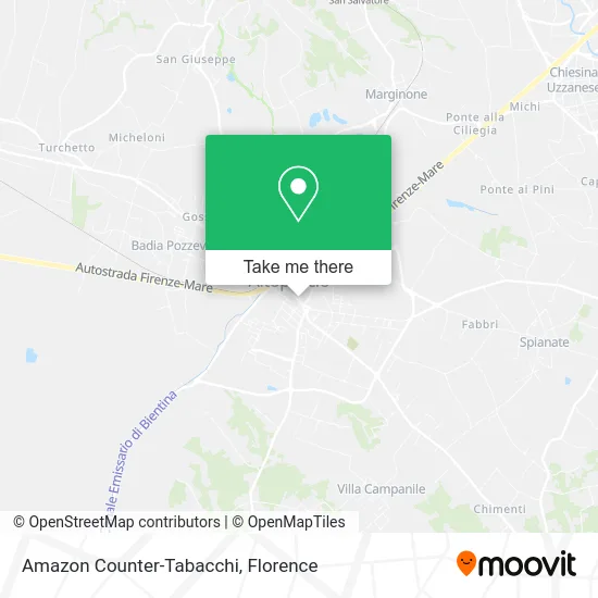
See Amazon Counter-Tobacco Shop, Altopascio, on the map
Public Transit to Amazon Counter-Tobacco Shop in Altopascio
Wondering how to get to Amazon Counter-Tobacco Shop in Altopascio? Moovit helps you find the best way to get to Amazon Counter-Tobacco Shop with step-by-step directions from the nearest public transit station.
Moovit provides free maps and live directions to help you navigate through your city. View schedules, routes, timetables, and find out how long does it take to get to Amazon Counter-Tobacco Shop in real time.
Looking for the nearest stop or station to Amazon Counter-Tobacco Shop? Check out this list of stops closest to your destination: Via Cavour near Middle School; Gavinana Street; Altopascio Benedetto Croce Square; Altopascio.
Bus: 851, E8, E20, E70, E20, 20, E7.Train: R.
Want to see if there’s another route that gets you there at an earlier time? Moovit helps you find alternative routes or times. Get directions from and directions to Amazon Counter-Tobacco Shop easily from the Moovit App or Website.
We make riding to Amazon Counter-Tobacco Shop easy, which is why over 1.5 million users, including users in Altopascio, trust Moovit as the best app for public transit. You don’t need to download an individual bus app or train app, Moovit is your all-in-one transit app that helps you find the best bus time or train time available.
For information on prices of bus and train, costs and ride fares to Amazon Counter-Tobacco Shop, please check the Moovit app.
Use the app to navigate to popular places including to the airport, hospital, stadium, grocery store, mall, coffee shop, school, college, and university.
Amazon Counter-Tobacco Shop Address: Via Camillo Benso di Cavour, 8 55011 Altopascio street in Altopascio
- Igea Medical Studios,
- Gastronomy,
- Carpe Diem,
- L&C Moving and Services,
- Note di Pulito,
- Stragoloso,
- San Rocco Gate,
- Gambardella Legal Studio Atty. Marcantonio,
- Technical Studio Allidi,
- Marchetti Maurizio,
- Free Artisans Association,
- Fashion Clothing,
- Zara Maria,
- Butterfly Herbal Shop,
- Lucky Snc by Vincenzini L. & Co.,
- Diasbuprojet,
- Il Vesuvio,
- Pellet. Giada by Carmignani Ermanno,
- Il Magione Del Tau,
- Gabriella Marolla Legal Office
Places Near Amazon Counter-Tobacco Shop (Altopascio)
- Torregalli Hospital Scandicci *, Scandicci,
- Santa Maria Novella Station, Florence,
- Artemio Franchi Municipal Stadium, Florence,
- Mandela Forum (Nelson Mandela Forum), Florence,
- Verdi Theater, Florence,
- Santa Maria Nuova Hospital, Florence,
- Visarno Arena, Florence,
- Piero Palagi Hospital Facility-Florence, Florence,
- IKEA Florence, Sesto Fiorentino,
- Nelson Mandela Forum, Florence,
- Tobacco Manufacture, Florence,
- Visarno Hippodrome, Florence,
- I Gigli, Campi Bisenzio,
- Michelangelo Square, Florence,
- Michelangelo Square, Florence,
- Cascine Park, Florence,
- OOO, Florence,
- Field of Mars, Florence,
- Campi Bisenzio, Campi Bisenzio,
- Asmana, Campi Bisenzio
How to get to popular places in Florence with public transit
Get around Altopascio by public transit!
Traveling around Altopascio has never been so easy. See step by step directions as you travel to any attraction, street or major public transit station. View bus and train schedules, arrival times, service alerts and detailed routes on a map, so you know exactly how to get to anywhere in Altopascio.
When traveling to any destination around Altopascio use Moovit's Live Directions with Get Off Notifications to know exactly where and how far to walk, how long to wait for your line, and how many stops are left. Moovit will alert you when it's time to get off — no need to constantly re-check whether yours is the next stop.
Wondering how to use public transit in Altopascio or how to pay for public transit in Altopascio? Moovit public transit app can help you navigate your way with public transit easily, and at minimum cost. It includes public transit fees, ticket prices, and costs. Looking for a map of Altopascio public transit lines? Moovit public transit app shows all public transit maps in Altopascio with all Bus, Train, Light Rail, Ferry and Funicular routes and stops on an interactive map.
Florence has 5 transit type(s), including: Bus, Train, Light Rail, Ferry and Funicular, operated by several transit agencies, including Florence Urban - Tuscan Bus Lines, GEST, Livorno and Province - Tuscan Bus Lines, Arezzo, Florence and Provinces - Tuscan Bus Lines, Prato and Province - Tuscan Bus Lines, Lucca and Province - Tuscan Bus Lines, Massa, Carrara and Province - Tuscan Bus Lines, Pisa and Province - Tuscan Bus Lines, Grosseto, Siena and Provinces - Tuscan Bus Lines, Arezzo, Siena and Provinces - Tuscan Bus Lines, Florence and Province - Tuscan Bus Lines, Pistoia and Province - Tuscan Bus Lines, Siena and Province - Tuscan Bus Lines, Arezzo and Province - Tuscan Bus Lines and Trenitalia