How to get to Amazon Locker-Adobe by bus?
Click on the bus route to see step by step directions with maps, line arrival times and updated time schedules.
From Baltimore Greyhound Station, Baltimore
56 minFrom B&O Railroad Museum, Baltimore
44 minFrom Baltimore Arena, Baltimore
47 minFrom CFG Bank Arena, Baltimore
47 minFrom Pimlico Race Course, Baltimore
67 minFrom Joseph Meyerhoff Symphony Hall, Baltimore
56 minFrom Hampden, Baltimore
61 minFrom Baltimore Poly Tech High School, Baltimore
48 minFrom Mondawmin Mall, Baltimore
37 minFrom Mva, Baltimore
33 min
Bus stops near Amazon Locker-Adobe in Baltimore County
Bus lines to Amazon Locker-Adobe in Baltimore County
What are the closest stations to Amazon Locker-Adobe?
The closest stations to Amazon Locker-Adobe are:
- Craigmont Rd & Westview Mall Eb is 471 yards away, 6 min walk.
- Baltimore National Pike & Ingleside Ave FS Wb is 558 yards away, 7 min walk.
Which bus lines stop near Amazon Locker-Adobe?
These bus lines stop near Amazon Locker-Adobe: 34, 78.
What’s the nearest bus station to Amazon Locker-Adobe in Baltimore County?
The nearest bus station to Amazon Locker-Adobe in Baltimore County is Craigmont Rd & Westview Mall Eb. It’s a 6 min walk away.
What time is the first bus to Amazon Locker-Adobe in Baltimore County?
The 78 is the first bus that goes to Amazon Locker-Adobe in Baltimore County. It stops nearby at 4:11 AM.
What time is the last bus to Amazon Locker-Adobe in Baltimore County?
The 78 is the last bus that goes to Amazon Locker-Adobe in Baltimore County. It stops nearby at 2:29 AM.
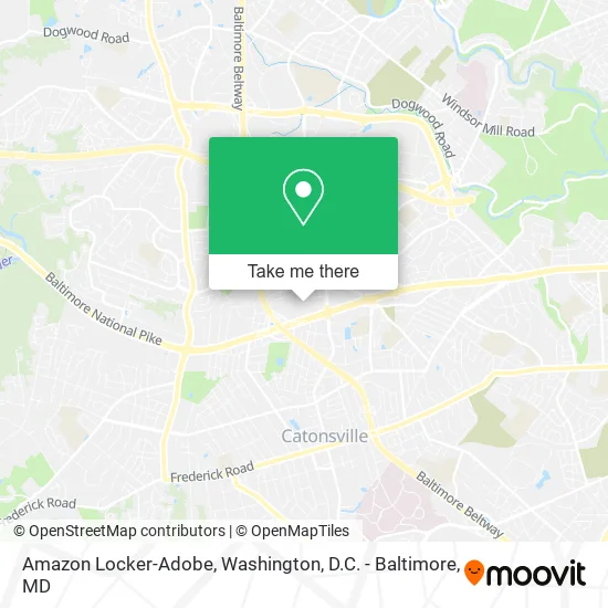
See Amazon Locker-Adobe, Baltimore County, on the map
Public Transit to Amazon Locker-Adobe in Baltimore County
Wondering how to get to Amazon Locker-Adobe in Baltimore County? Moovit helps you find the best way to get to Amazon Locker-Adobe with step-by-step directions from the nearest public transit station.
Moovit provides free maps and live directions to help you navigate through your city. View schedules, routes, timetables, and find out how long does it take to get to Amazon Locker-Adobe in real time.
Looking for the nearest stop or station to Amazon Locker-Adobe? Check out this list of stops closest to your destination: Craigmont Rd & Westview Mall Eb; Baltimore National Pike & Ingleside Ave FS Wb.
Bus: 34, 78, 37, 150.
Want to see if there’s another route that gets you there at an earlier time? Moovit helps you find alternative routes or times. Get directions from and directions to Amazon Locker-Adobe easily from the Moovit App or Website.
We make riding to Amazon Locker-Adobe easy, which is why over 1.5 million users, including users in Baltimore County, trust Moovit as the best app for public transit. You don’t need to download an individual bus app or train app, Moovit is your all-in-one transit app that helps you find the best bus time or train time available.
For information on prices of bus, costs and ride fares to Amazon Locker-Adobe, please check the Moovit app.
Use the app to navigate to popular places including to the airport, hospital, stadium, grocery store, mall, coffee shop, school, college, and university.
Amazon Locker-Adobe Address: Catonsville, MD 21228 street in Baltimore County
- Ross Dress for Less,
- Safeway Food & Drug,
- Ross,
- Ashley Stewart,
- Kay’S Beauty,
- Madrag,
- Chiropractors Applied Kinesiology,
- Conway,
- Marshalls,
- Staff Max Corp,
- Snipes 2124,
- Little India Plus Supermarket,
- Catonsville Lockout Plus,
- Addy's Barbeque,
- Infinite Liquors,
- Sleepy's,
- General Nutrition GNC,
- Addy's Barbeque,
- Equity One Inc,
- Accent Remodeling
Places Near Amazon Locker-Adobe (Baltimore County)
- National Museum of African American History and Culture, Washington,
- M&T Bank Stadium, Baltimore,
- Capital One Arena, Washington,
- National Zoo, Washington,
- Marriott Marquis Washington, DC, Washington,
- Rock Creek Tennis Center, Washington,
- National Mall, Washington,
- Pennsylvania Ave NW (3rd st and pennsylvania), Washington,
- Basilica of the National Shrine, Washington,
- Washington DC VA Medical Center, Washington,
- Georgetown, Washington,
- Camden Yards, Baltimore,
- Warner Theatre, Washington,
- Museum Of The Bible, Washington,
- Sibley Memorial Hospital, Washington,
- Washington National Cathedral, Washington,
- Amazon Hq2, Arlington County,
- The Anthem, Washington,
- PG Mall, Prince George's County,
- Westfield Montgomery Mall, Montgomery County
How to get to popular places in Washington, D.C. - Baltimore, MD with public transit
Get around Baltimore County by public transit!
Traveling around Baltimore County has never been so easy. See step by step directions as you travel to any attraction, street or major public transit station. View bus and train schedules, arrival times, service alerts and detailed routes on a map, so you know exactly how to get to anywhere in Baltimore County.
When traveling to any destination around Baltimore County use Moovit's Live Directions with Get Off Notifications to know exactly where and how far to walk, how long to wait for your line, and how many stops are left. Moovit will alert you when it's time to get off — no need to constantly re-check whether yours is the next stop.
Wondering how to use public transit in Baltimore County or how to pay for public transit in Baltimore County? Moovit public transit app can help you navigate your way with public transit easily, and at minimum cost. It includes public transit fees, ticket prices, and costs. Looking for a map of Baltimore County public transit lines? Moovit public transit app shows all public transit maps in Baltimore County with all Bus, Train, Metro, Light Rail and Ferry routes and stops on an interactive map.
Washington, D.C. - Baltimore, MD has 5 transit type(s), including: Bus, Train, Metro, Light Rail and Ferry, operated by several transit agencies, including WMATA, Montgomery County Ride On, Fairfax Connector, TheBus, PRTC, DASH - Alexandria, Arlington Transit (ART), RTA of Central Maryland, MDOT MTA, MDOT MTA Light RailLink, MDOT MTA Commuter Bus, MDOT MTA Local Bus, FXBGO!, Virginia Railway Express (VRE) and MARC