How to get to Amazon Locker-Anubis by bus?
Click on the bus route to see step by step directions with maps, line arrival times and updated time schedules.
From Bois du Marin, Allonnes
45 minFrom Aigné, Aigné
61 minFrom L'Allée des Prix, Allonnes
42 minFrom Bureau Vallée, Ruaudin
61 minFrom Optimhome Brochard Sophie Mandataire Indépendant, Mulsanne
60 minFrom Gemo, La Chapelle-Saint-Aubin
50 minFrom Flora, Mulsanne
65 minFrom Arrêt Bourdonnière [8,20], Saint-Saturnin
54 minFrom Mulsanne, Mulsanne
56 minFrom Rue des Coccinelles, Mulsanne
59 min
Bus stops near Amazon Locker-Anubis in Le Mans
Light Rail stations near Amazon Locker-Anubis in Le Mans
- Leclerc-Fleurus, 10 min walk,VIEW
Bus lines to Amazon Locker-Anubis in Le Mans
- 35, Sécurité Sociale,VIEW
- 5, Gazonfier,VIEW
- 6, République,VIEW
- 23, Chanzy Bollee,VIEW
- 25, Champagne,VIEW
- 25EX, La Baronniere,VIEW
- 15, Guetteloup,VIEW
- 31, Ehpad,VIEW
- 4, St-Georges / St-Joseph – Bellevue-Hauts de C.,VIEW
- 7, Éperon par Auchan,VIEW
- 11, Le Cadran / St-Aubin - Closerie,VIEW
- 14, Parc Manceau - St-Martin,VIEW
- 16, Lafayette - Californie,VIEW
- 17, Gallière - Eperon,VIEW
- 20, Éperon - Aigné,VIEW
- 110, Sainte Hélène,VIEW
What are the closest stations to Amazon Locker-Anubis?
The closest stations to Amazon Locker-Anubis are:
- Maupertuis is 168 meters away, 3 min walk.
- Mazagran is 453 meters away, 6 min walk.
- Bollée is 460 meters away, 7 min walk.
- Malpalu is 560 meters away, 8 min walk.
- Leclerc-Fleurus is 712 meters away, 10 min walk.
- Lafayette is 768 meters away, 11 min walk.
- St-Exupéry is 788 meters away, 11 min walk.
Which bus lines stop near Amazon Locker-Anubis?
These bus lines stop near Amazon Locker-Anubis: 23, 35, 5, 6.
What’s the nearest light rail station to Amazon Locker-Anubis in Le Mans?
The nearest light rail station to Amazon Locker-Anubis in Le Mans is Leclerc-Fleurus. It’s a 10 min walk away.
What’s the nearest bus station to Amazon Locker-Anubis in Le Mans?
The nearest bus station to Amazon Locker-Anubis in Le Mans is Maupertuis. It’s a 3 min walk away.
What time is the first light rail to Amazon Locker-Anubis in Le Mans?
The T2 is the first light rail that goes to Amazon Locker-Anubis in Le Mans. It stops nearby at 5:10 AM.
What time is the last light rail to Amazon Locker-Anubis in Le Mans?
The T1 is the last light rail that goes to Amazon Locker-Anubis in Le Mans. It stops nearby at 1:12 AM.
What time is the first bus to Amazon Locker-Anubis in Le Mans?
The 25 is the first bus that goes to Amazon Locker-Anubis in Le Mans. It stops nearby at 5:28 AM.
What time is the last bus to Amazon Locker-Anubis in Le Mans?
The 5 is the last bus that goes to Amazon Locker-Anubis in Le Mans. It stops nearby at 11:54 PM.
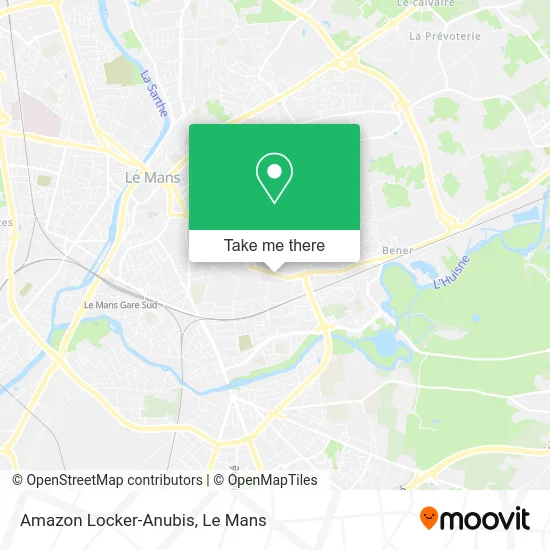
See Amazon Locker-Anubis, Le Mans, on the map
Public Transit to Amazon Locker-Anubis in Le Mans
Wondering how to get to Amazon Locker-Anubis in Le Mans? Moovit helps you find the best way to get to Amazon Locker-Anubis with step-by-step directions from the nearest public transit station.
Moovit provides free maps and live directions to help you navigate through your city. View schedules, routes, timetables, and find out how long does it take to get to Amazon Locker-Anubis in real time.
Looking for the nearest stop or station to Amazon Locker-Anubis? Check out this list of stops closest to your destination: Maupertuis; Mazagran; Bollée; Malpalu; Leclerc-Fleurus; Lafayette; St-Exupéry.
Bus: 23, 35, 5, 6, 25, 25EX, 15, 31, 110, 4, 7, 11, 14, 16.
Want to see if there’s another route that gets you there at an earlier time? Moovit helps you find alternative routes or times. Get directions from and directions to Amazon Locker-Anubis easily from the Moovit App or Website.
We make riding to Amazon Locker-Anubis easy, which is why over 1.5 million users, including users in Le Mans, trust Moovit as the best app for public transit. You don’t need to download an individual bus app or train app, Moovit is your all-in-one transit app that helps you find the best bus time or train time available.
For information on prices of bus and light rail, costs and ride fares to Amazon Locker-Anubis, please check the Moovit app.
Use the app to navigate to popular places including to the airport, hospital, stadium, grocery store, mall, coffee shop, school, college, and university.
Amazon Locker-Anubis Address: 162 Avenue Bollée 72000 Le Mans street in Le Mans
- Wash,
- Avenue Bollée,
- Auto École Artaud,
- Rue de Montheard 37,
- Lna Santé Résidence le Monthéard,
- E.H.P.A.D. le Montheard,
- CAF-CPAM du Mans,
- Ehpad Le Monthéard,
- Sécurité Sociale Et Caisse D'Allocations Familiales (Caf) Du Mans,
- Avenue Bollée 178,
- L'Escale Restaurant,
- C.A.F de la Sarthe Caisse Allocations Familiales,
- Institut Inter Régional Pour la Santé Irsa,
- Anne Et Stan,
- Annat Osteopath,
- Restaurant Inter Entreprises la Poste,
- Assoc Terrariophile,
- École Primaire René Descartes,
- Racois Valérie,
- Geiq Btp 72
Places Near Amazon Locker-Anubis (Le Mans)
- Pôle Santé Sud-Elsan, Le Mans,
- E.Leclerc, Le Mans,
- Family Village, Ruaudin,
- Hôpital, Le Mans,
- Place des Jacobins (le Mans), Le Mans,
- Avenue Bollée, Le Mans,
- Circuit des 24 Heures du Mans, Le Mans,
- Saint-Saturnin, Saint-Saturnin,
- Camp du 2e RIMa, Champagné,
- Changé, Changé,
- Clinique Du Pré, Le Mans,
- Coulaines, Coulaines,
- Auchan le Mans, La Chapelle-Saint-Aubin,
- La Chapelle-Saint-Aubin, La Chapelle-Saint-Aubin,
- Clinique Pôle Santé Sud, Le Mans,
- Université, Le Mans,
- Maison D'Arrêt Le Mans - Les Croisettes, Coulaines,
- Gare SNCF du Mans, Le Mans,
- Centre Hospitalier Du Mans, Le Mans,
- Parc Des Expositions, Le Mans
How to get to popular places in Le Mans with public transit
Get around Le Mans by public transit!
Traveling around Le Mans has never been so easy. See step by step directions as you travel to any attraction, street or major public transit station. View bus and train schedules, arrival times, service alerts and detailed routes on a map, so you know exactly how to get to anywhere in Le Mans.
When traveling to any destination around Le Mans use Moovit's Live Directions with Get Off Notifications to know exactly where and how far to walk, how long to wait for your line, and how many stops are left. Moovit will alert you when it's time to get off — no need to constantly re-check whether yours is the next stop.
Wondering how to use public transit in Le Mans or how to pay for public transit in Le Mans? Moovit public transit app can help you navigate your way with public transit easily, and at minimum cost. It includes public transit fees, ticket prices, and costs. Looking for a map of Le Mans public transit lines? Moovit public transit app shows all public transit maps in Le Mans with all Bus and Light Rail routes and stops on an interactive map.
Le Mans has 2 transit type(s), including: Bus and Light Rail, operated by several transit agencies, including SETRAM