How to get to Amazon Locker-Buggy by bus?
Click on the bus route to see step by step directions with maps, line arrival times and updated time schedules.
From I-695 @ Exit 27 (Dulaney Valley Road/MD 146), Baltimore County
50 minFrom I-695 @ Exit 26 (York Rd/MD 45), Baltimore County
46 minFrom Eastern Ave (eastern avenue and dundalk av), Baltimore
55 minFrom Loyola University Maryland, Baltimore
41 minFrom Medstar Union Memorial Hospital, Baltimore
52 minFrom Johns Hopkins Mountcastle Auditorium, Baltimore
38 minFrom Morgan State University, Baltimore
46 minFrom Towson, MD, Baltimore County
54 minFrom Johns Hopkins University, Baltimore
53 minFrom I-695 Exit 29 (Loch Raven Blvd (MD 542)/Cromwell Bridge Rd), Baltimore County
44 min
Bus stop near Amazon Locker-Buggy in Baltimore County
- Belair Rd & Rossville Blvd Nb, 4 min walk,VIEW
Bus lines to Amazon Locker-Buggy in Baltimore County
What are the closest stations to Amazon Locker-Buggy?
The closest stations to Amazon Locker-Buggy are:
- Belair Rd & Rossville Blvd Nb is 264 yards away, 4 min walk.
Which bus line stops near Amazon Locker-Buggy?
33 (Mt Washington Station - White Marsh)
What’s the nearest bus station to Amazon Locker-Buggy in Baltimore County?
The nearest bus station to Amazon Locker-Buggy in Baltimore County is Belair Rd & Rossville Blvd Nb. It’s a 4 min walk away.
What time is the first bus to Amazon Locker-Buggy in Baltimore County?
The 33 is the first bus that goes to Amazon Locker-Buggy in Baltimore County. It stops nearby at 5:28 AM.
What time is the last bus to Amazon Locker-Buggy in Baltimore County?
The 33 is the last bus that goes to Amazon Locker-Buggy in Baltimore County. It stops nearby at 12:16 AM.
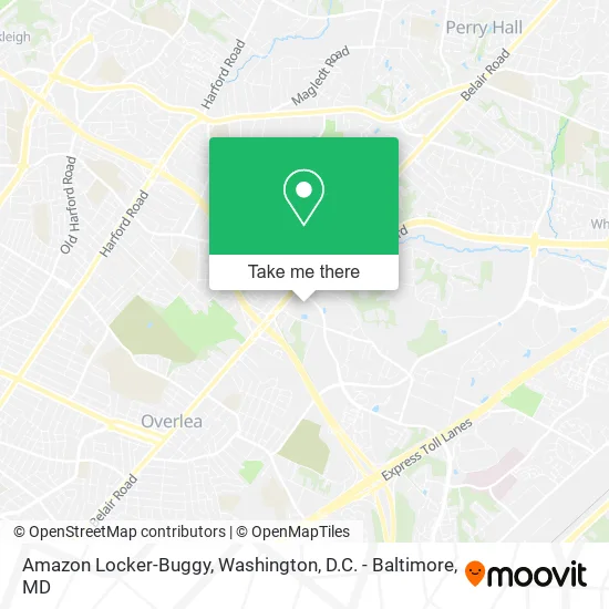
See Amazon Locker-Buggy, Baltimore County, on the map
Public Transit to Amazon Locker-Buggy in Baltimore County
Wondering how to get to Amazon Locker-Buggy in Baltimore County? Moovit helps you find the best way to get to Amazon Locker-Buggy with step-by-step directions from the nearest public transit station.
Moovit provides free maps and live directions to help you navigate through your city. View schedules, routes, timetables, and find out how long does it take to get to Amazon Locker-Buggy in real time.
Looking for the nearest stop or station to Amazon Locker-Buggy? Check out this list of stops closest to your destination: Belair Rd & Rossville Blvd Nb.
Bus: 33, 115.
Want to see if there’s another route that gets you there at an earlier time? Moovit helps you find alternative routes or times. Get directions from and directions to Amazon Locker-Buggy easily from the Moovit App or Website.
We make riding to Amazon Locker-Buggy easy, which is why over 1.5 million users, including users in Baltimore County, trust Moovit as the best app for public transit. You don’t need to download an individual bus app or train app, Moovit is your all-in-one transit app that helps you find the best bus time or train time available.
For information on prices of bus, costs and ride fares to Amazon Locker-Buggy, please check the Moovit app.
Use the app to navigate to popular places including to the airport, hospital, stadium, grocery store, mall, coffee shop, school, college, and university.
Amazon Locker-Buggy Address: Nottingham, MD 21236 street in Baltimore County
- Sally Beauty,
- 24 Hour Locksmith In Nottingham,
- Rock & Toss Crab House,
- Minute Key,
- Golden Corral Buffet and Grill,
- Lucas Pizzeria & Cafe,
- Dream Nails & Spa,
- Gold Rush Baltimore,
- Truist,
- Nihan,
- La Nails 2,
- Boost Mobile,
- Village Crossroads Senior Housing,
- Belair Road & Rossville Boulevard Far-Side Southbound,
- Rossville Blvd Belair Rd,
- Metro Prosthetics,
- Next Play Sports & Training,
- ChargePoint,
- Merchant's Tire & Auto,
- First Financial FCU of Maryland - Fullerton Branch
Places Near Amazon Locker-Buggy (Baltimore County)
- Pennsylvania Ave NW (3rd st and pennsylvania), Washington,
- Basilica of the National Shrine, Washington,
- Museum Of The Bible, Washington,
- Rock Creek Tennis Center, Washington,
- Washington National Cathedral, Washington,
- Georgetown, Washington,
- Marriott Marquis Washington, DC, Washington,
- Warner Theatre, Washington,
- Washington DC VA Medical Center, Washington,
- PG Mall, Prince George's County,
- Amazon Hq2, Arlington County,
- National Museum of African American History and Culture, Washington,
- National Mall, Washington,
- M&T Bank Stadium, Baltimore,
- National Zoo, Washington,
- Sibley Memorial Hospital, Washington,
- Camden Yards, Baltimore,
- Westfield Montgomery Mall, Montgomery County,
- The Anthem, Washington,
- Capital One Arena, Washington
How to get to popular places in Washington, D.C. - Baltimore, MD with public transit
Get around Baltimore County by public transit!
Traveling around Baltimore County has never been so easy. See step by step directions as you travel to any attraction, street or major public transit station. View bus and train schedules, arrival times, service alerts and detailed routes on a map, so you know exactly how to get to anywhere in Baltimore County.
When traveling to any destination around Baltimore County use Moovit's Live Directions with Get Off Notifications to know exactly where and how far to walk, how long to wait for your line, and how many stops are left. Moovit will alert you when it's time to get off — no need to constantly re-check whether yours is the next stop.
Wondering how to use public transit in Baltimore County or how to pay for public transit in Baltimore County? Moovit public transit app can help you navigate your way with public transit easily, and at minimum cost. It includes public transit fees, ticket prices, and costs. Looking for a map of Baltimore County public transit lines? Moovit public transit app shows all public transit maps in Baltimore County with all Bus, Train, Metro, Light Rail and Ferry routes and stops on an interactive map.
Washington, D.C. - Baltimore, MD has 5 transit type(s), including: Bus, Train, Metro, Light Rail and Ferry, operated by several transit agencies, including WMATA, Montgomery County Ride On, Fairfax Connector, TheBus, PRTC, DASH - Alexandria, Arlington Transit (ART), RTA of Central Maryland, MDOT MTA, MDOT MTA Light RailLink, MDOT MTA Commuter Bus, MDOT MTA Local Bus, FXBGO!, Virginia Railway Express (VRE) and MARC