How to get to Amazon Locker-CATS by bus?
Click on the bus route to see step by step directions with maps, line arrival times and updated time schedules.
From Congress/45th Street, West Palm Beach
46 minFrom Lake Worth, FL, Lake Worth
57 minFrom Palm Beach State College, Lake Worth
58 minFrom Singer Island Pump House, Riviera Beach
84 minFrom Downtown West Palm Beach, West Palm Beach
36 minFrom Brightline West Palm Beach Parking Garage, West Palm Beach
31 minFrom The Mall at Wellington Green, Sunshine Parkway
45 minFrom Rosemary Square, West Palm Beach
38 minFrom Saint Marys Hospital, West Palm Beach
48 minFrom Lake Worth Tri Rail Station, Lake Worth
60 min
Bus stops near Amazon Locker-CATS in West Palm Beach
Bus lines to Amazon Locker-CATS in West Palm Beach
What are the closest stations to Amazon Locker-CATS?
The closest stations to Amazon Locker-CATS are:
- WESTGATE AVE at MILITARY TRL is 229 yards away, 4 min walk.
- MILITARY TRL at WESTGATE AVE is 278 yards away, 4 min walk.
- OKEECHOBEE BLVD at MILITARY TRL is 435 yards away, 6 min walk.
Which bus lines stop near Amazon Locker-CATS?
These bus lines stop near Amazon Locker-CATS: 3, 33, 43.
What’s the nearest bus station to Amazon Locker-CATS in West Palm Beach?
The nearest bus stations to Amazon Locker-CATS in West Palm Beach are WESTGATE AVE at MILITARY TRL and MILITARY TRL at WESTGATE AVE. The closest one is a 4 min walk away.
What time is the first bus to Amazon Locker-CATS in West Palm Beach?
The 43 is the first bus that goes to Amazon Locker-CATS in West Palm Beach. It stops nearby at 5:19 AM.
What time is the last bus to Amazon Locker-CATS in West Palm Beach?
The 43 is the last bus that goes to Amazon Locker-CATS in West Palm Beach. It stops nearby at 10:32 PM.
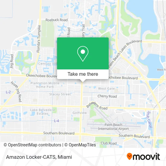
See Amazon Locker-CATS, West Palm Beach, on the map
Public Transit to Amazon Locker-CATS in West Palm Beach
Wondering how to get to Amazon Locker-CATS in West Palm Beach? Moovit helps you find the best way to get to Amazon Locker-CATS with step-by-step directions from the nearest public transit station.
Moovit provides free maps and live directions to help you navigate through your city. View schedules, routes, timetables, and find out how long does it take to get to Amazon Locker-CATS in real time.
Looking for the nearest stop or station to Amazon Locker-CATS? Check out this list of stops closest to your destination: WESTGATE AVE at MILITARY TRL; MILITARY TRL at WESTGATE AVE; OKEECHOBEE BLVD at MILITARY TRL.
Bus: 3, 33, 43, 40.
Want to see if there’s another route that gets you there at an earlier time? Moovit helps you find alternative routes or times. Get directions from and directions to Amazon Locker-CATS easily from the Moovit App or Website.
We make riding to Amazon Locker-CATS easy, which is why over 1.5 million users, including users in West Palm Beach, trust Moovit as the best app for public transit. You don’t need to download an individual bus app or train app, Moovit is your all-in-one transit app that helps you find the best bus time or train time available.
For information on prices of bus and train, costs and ride fares to Amazon Locker-CATS, please check the Moovit app.
Use the app to navigate to popular places including to the airport, hospital, stadium, grocery store, mall, coffee shop, school, college, and university.
Amazon Locker-CATS Address: 4370 Okeechobee Blvd West Palm Beach, FL 33409 street in West Palm Beach
- Ihop,
- Bees Knees Diner,
- USPS Collection Box - Blue Box,
- Arona Home Essentials West Palm Beach,
- Goodwill,
- Atlantic Broadband,
- Ty Global Consulting Inc,
- Vitalurgent,
- D D's,
- Amazon Locker-Marshmallows,
- K & G Fashion Superstore,
- Jo-Ann Fabric and Craft Stores,
- BOSCH Car Service,
- DUNKIN',
- Renaissance Family Worship Center,
- Yf W PB Okeechob,
- Florida 809 & Okeechobee Boulevard,
- British Swim School at la Fitness - West Palm Beach,
- King Super Buffet ,
- Makeb's Homemade Bangles & Deli
Places Near Amazon Locker-CATS (West Palm Beach)
- Miami VA Hospital, Miami,
- Sawgrass mall ( FL ), Miami Beach,
- Little Havana, Miami,
- Aventura Mall, Miami Beach,
- Keiser University Flagship Campus, West Palm Beach,
- Zoo Miami, Miami,
- Miami Freedom Park, Miami,
- Dolphin Mall, Miami,
- Miami Design District, Miami,
- Richard E. Gerstein Justice Building, Miami,
- Brickell City Centre, Miami,
- Marlins Park, Miami,
- Miami-Dade County Courthouse, Miami,
- Sawgrass Mall, Miami,
- Dolphin Mall Bus, Miami,
- Port of Miami Cruise Terminal, Miami,
- Bayside Marketplace, Miami,
- Aventura Mall, Miami,
- Hard Rock Stadium, Miami Gardens,
- Wynwood, Miami
How to get to popular places in Miami with public transit
Get around West Palm Beach by public transit!
Traveling around West Palm Beach has never been so easy. See step by step directions as you travel to any attraction, street or major public transit station. View bus and train schedules, arrival times, service alerts and detailed routes on a map, so you know exactly how to get to anywhere in West Palm Beach.
When traveling to any destination around West Palm Beach use Moovit's Live Directions with Get Off Notifications to know exactly where and how far to walk, how long to wait for your line, and how many stops are left. Moovit will alert you when it's time to get off — no need to constantly re-check whether yours is the next stop.
Wondering how to use public transit in West Palm Beach or how to pay for public transit in West Palm Beach? Moovit public transit app can help you navigate your way with public transit easily, and at minimum cost. It includes public transit fees, ticket prices, and costs. Looking for a map of West Palm Beach public transit lines? Moovit public transit app shows all public transit maps in West Palm Beach with all Bus, Train, Light Rail and Ferry routes and stops on an interactive map.
Miami has 4 transit type(s), including: Bus, Train, Light Rail and Ferry, operated by several transit agencies, including Broward County Transit, Miami-Dade Transit, Metrorail, Palm Tran, Tri-Rail, Brightline, MARTY, City of Homestead Trolley, Key West Transit, Treasure Coast Connector, GoLine IRT, Amtrak, Greyhound-us, FlixBus-us and Aventura Express Shuttle Bus