How to get to Amazon Locker-Cirse by bus?
Click on the bus route to see step by step directions with maps, line arrival times and updated time schedules.
From Herblay, Herblay
89 minFrom Orgeval, Orgeval
330 minFrom Franconville, Franconville
75 minFrom IKEA, Franconville
66 minFrom L'Isle-Adam, L'Isle-Adam
97 minFrom Hôpital de Poissy, Poissy
128 minFrom Fête des Loges, Saint-Germain-En-Laye
307 minFrom Hôpital Simone Veil, Eaubonne
415 minFrom Montesson, Montesson
313 minFrom Chambourcy, Chambourcy
143 min
How to get to Amazon Locker-Cirse by train?
Click on the train route to see step by step directions with maps, line arrival times and updated time schedules.
Bus stops near Amazon Locker-Cirse in Cergy
RER station near Amazon Locker-Cirse in Cergy
- Cergy Saint-Christophe, 16 min walk,VIEW
Train station near Amazon Locker-Cirse in Cergy
- Osny, 25 min walk,VIEW
Bus lines to Amazon Locker-Cirse in Cergy
What are the closest stations to Amazon Locker-Cirse?
The closest stations to Amazon Locker-Cirse are:
- Plaine Des Sports is 177 meters away, 3 min walk.
- Place Gisèle Halimi is 297 meters away, 4 min walk.
- Cergy Saint-Christophe is 1193 meters away, 16 min walk.
- Osny is 1937 meters away, 25 min walk.
Which train line stops near Amazon Locker-Cirse?
J (Paris-Saint-Lazare)
Which RER line stops near Amazon Locker-Cirse?
A (Marne la Vallée Chessy / Boissy Saint-Léger)
Which bus lines stop near Amazon Locker-Cirse?
These bus lines stop near Amazon Locker-Cirse: 1201, 1206, 1224, 1235, N150, N152.
What’s the nearest train station to Amazon Locker-Cirse in Cergy?
The nearest train station to Amazon Locker-Cirse in Cergy is Osny. It’s a 25 min walk away.
What’s the nearest bus station to Amazon Locker-Cirse in Cergy?
The nearest bus station to Amazon Locker-Cirse in Cergy is Plaine Des Sports. It’s a 3 min walk away.
What’s the nearest RER station to Amazon Locker-Cirse in Cergy?
The nearest RER station to Amazon Locker-Cirse in Cergy is Cergy Saint-Christophe. It’s a 16 min walk away.
What time is the first train to Amazon Locker-Cirse in Cergy?
The J is the first train that goes to Amazon Locker-Cirse in Cergy. It stops nearby at 7:03 AM.
What time is the last train to Amazon Locker-Cirse in Cergy?
The J is the last train that goes to Amazon Locker-Cirse in Cergy. It stops nearby at 11:08 PM.
What time is the first bus to Amazon Locker-Cirse in Cergy?
The 1206 is the first bus that goes to Amazon Locker-Cirse in Cergy. It stops nearby at 6:55 AM.
What time is the last bus to Amazon Locker-Cirse in Cergy?
The 1201 is the last bus that goes to Amazon Locker-Cirse in Cergy. It stops nearby at 10:31 PM.
What time is the first RER to Amazon Locker-Cirse in Cergy?
The A is the first RER that goes to Amazon Locker-Cirse in Cergy. It stops nearby at 4:44 AM.
What time is the last RER to Amazon Locker-Cirse in Cergy?
The A is the last RER that goes to Amazon Locker-Cirse in Cergy. It stops nearby at 1:37 AM.
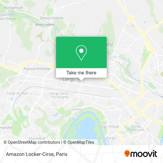
See Amazon Locker-Cirse, Cergy, on the map
Public Transit to Amazon Locker-Cirse in Cergy
Wondering how to get to Amazon Locker-Cirse in Cergy? Moovit helps you find the best way to get to Amazon Locker-Cirse with step-by-step directions from the nearest public transit station.
Moovit provides free maps and live directions to help you navigate through your city. View schedules, routes, timetables, and find out how long does it take to get to Amazon Locker-Cirse in real time.
Looking for the nearest stop or station to Amazon Locker-Cirse? Check out this list of stops closest to your destination: Plaine Des Sports; Place Gisèle Halimi; Cergy Saint-Christophe; Osny.
Train: J.RER: A, L.Bus: 1201, 1206, 1224, 1235, N150, N152.
Want to see if there’s another route that gets you there at an earlier time? Moovit helps you find alternative routes or times. Get directions from and directions to Amazon Locker-Cirse easily from the Moovit App or Website.
We make riding to Amazon Locker-Cirse easy, which is why over 1.5 million users, including users in Cergy, trust Moovit as the best app for public transit. You don’t need to download an individual bus app or train app, Moovit is your all-in-one transit app that helps you find the best bus time or train time available.
For information on prices of bus, RER and train, costs and ride fares to Amazon Locker-Cirse, please check the Moovit app.
Use the app to navigate to popular places including to the airport, hospital, stadium, grocery store, mall, coffee shop, school, college, and university.
Amazon Locker-Cirse Address: 95800 Cergy street in Cergy
- ibis budget Cergy Saint Christophe,
- Basic-Fit Cergy Avenue de La Plaine des Sports,
- Bleu Libellule,
- Aren'Ice,
- Petit Albi,
- Cergy Pontoise Football Club,
- B&B Hotel,
- E.Leclerc Traiteur Cergy,
- ZAC des Linandes,
- Cergy Pontoise Football Club Stade Salif Keita,
- B&B Hotel Cergy Saint Christophe,
- Stade Salif Keita,
- Amazon Logistics,
- Association te,
- Gymspa,
- Bm Osny,
- Decathlon,
- Decathlon Cergy-Pontoise Osny,
- Le Comptoir des Gourmets,
- Square de la Belle Épine
Places Near Amazon Locker-Cirse (Cergy)
- Hopital Foch, Suresnes,
- Hôpital Necker, Paris,
- Galeries Lafayette, Paris,
- Beaugrenelle, Paris,
- Galeries Lafayette Haussmann, Paris,
- Hôpital Cochin, Paris,
- Marché Saint-Pierre, Paris,
- Hôpital Saint-Joseph, Paris,
- Théâtre Mogador, Paris,
- Hôpital Henri Mondor, Creteil,
- Hopital Lariboisière, Paris,
- Hôpital Beaujon, Clichy,
- Fondation Louis Vuitton, Paris,
- Centre Hospitalier des 15/20, Paris,
- Atelier Des Lumieres, Paris,
- 29 Rue Manin, Paris,
- Hôpital Pitié Salpêtrière, Paris,
- Créteil Soleil, Creteil,
- Gare Routière Flixbus, Paris,
- Hôpital de la Pitié-Salpêtrière, Paris
How to get to popular places in Paris with public transit
Get around Cergy by public transit!
Traveling around Cergy has never been so easy. See step by step directions as you travel to any attraction, street or major public transit station. View bus and train schedules, arrival times, service alerts and detailed routes on a map, so you know exactly how to get to anywhere in Cergy.
When traveling to any destination around Cergy use Moovit's Live Directions with Get Off Notifications to know exactly where and how far to walk, how long to wait for your line, and how many stops are left. Moovit will alert you when it's time to get off — no need to constantly re-check whether yours is the next stop.
Wondering how to use public transit in Cergy or how to pay for public transit in Cergy? Moovit public transit app can help you navigate your way with public transit easily, and at minimum cost. It includes public transit fees, ticket prices, and costs. Looking for a map of Cergy public transit lines? Moovit public transit app shows all public transit maps in Cergy with all Bus, Train, Metro, Light Rail, RER, Funicular and Gondola routes and stops on an interactive map.
Paris has 7 transit type(s), including: Bus, Train, Metro, Light Rail, RER, Funicular and Gondola, operated by several transit agencies, including RATP, RER, RER Bus de remplacement, Train, Train Bus de remplacement, Tramway Bus de remplacement, TER, ADP, Magical Shuttle, Argenteuil - Boucles de Seine, Autocars Dominique, Bièvre, Brie et 2 Morin, Le Bus - C.C. du Clermontois and Cœur d’Essonne