Directions to Amazon Locker-Council (Stafford County) with public transportation
The following transit lines have routes that pass near Amazon Locker-Council
 Bus: ROUTE 20.
- Train: FREDERICKSBURG LINE.
How to get to Amazon Locker-Council by bus?
Click on the bus route to see step by step directions with maps, line arrival times and updated time schedules.
From Department of State SA 34, Fairfax County
214 minFrom Lorton, VA - Amtrak Auto Train Station (LOR), Fairfax County
201 minFrom Lorton, VA, Fairfax County
196 minFrom Potomac Mills Mall, Prince William County
186 minFrom Rose Gaming Resort, Prince William County
211 minFrom Woodbridge, VA, Prince William County
131 min
How to get to Amazon Locker-Council by train?
Click on the train route to see step by step directions with maps, line arrival times and updated time schedules.
Bus stop near Amazon Locker-Council in Stafford County
- 436 - Deacon Rd. (Woodlawn Shopping Center), 1 min walk,VIEW
Train station near Amazon Locker-Council in Stafford County
- Leeland Road, 63 min walk,VIEW
Bus lines to Amazon Locker-Council in Stafford County
- ROUTE 20, Outbound,VIEW
What are the closest stations to Amazon Locker-Council?
The closest stations to Amazon Locker-Council are:
- 436 - Deacon Rd. (Woodlawn Shopping Center) is 56 yards away, 1 min walk.
- Leeland Road is 5442 yards away, 63 min walk.
Which bus line stops near Amazon Locker-Council?
ROUTE 20 (Outbound)
Which train line stops near Amazon Locker-Council?
FREDERICKSBURG LINE (Spotsylvania)
What’s the nearest bus station to Amazon Locker-Council in Stafford County?
The nearest bus station to Amazon Locker-Council in Stafford County is 436 - Deacon Rd. (Woodlawn Shopping Center). It’s a 1 min walk away.
What time is the first train to Amazon Locker-Council in Stafford County?
The FREDERICKSBURG LINE is the first train that goes to Amazon Locker-Council in Stafford County. It stops nearby at 5:10 AM.
What time is the last train to Amazon Locker-Council in Stafford County?
The FREDERICKSBURG LINE is the last train that goes to Amazon Locker-Council in Stafford County. It stops nearby at 8:18 PM.
What time is the first bus to Amazon Locker-Council in Stafford County?
The ROUTE 20 is the first bus that goes to Amazon Locker-Council in Stafford County. It stops nearby at 8:34 AM.
What time is the last bus to Amazon Locker-Council in Stafford County?
The ROUTE 20 is the last bus that goes to Amazon Locker-Council in Stafford County. It stops nearby at 4:36 PM.
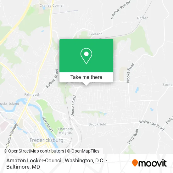
See Amazon Locker-Council, Stafford County, on the map
Public Transit to Amazon Locker-Council in Stafford County
Wondering how to get to Amazon Locker-Council in Stafford County? Moovit helps you find the best way to get to Amazon Locker-Council with step-by-step directions from the nearest public transit station.
Moovit provides free maps and live directions to help you navigate through your city. View schedules, routes, timetables, and find out how long does it take to get to Amazon Locker-Council in real time.
Looking for the nearest stop or station to Amazon Locker-Council? Check out this list of stops closest to your destination: 436 - Deacon Rd. (Woodlawn Shopping Center); Leeland Road.
Bus: ROUTE 20.Train: FREDERICKSBURG LINE.
Want to see if there’s another route that gets you there at an earlier time? Moovit helps you find alternative routes or times. Get directions from and directions to Amazon Locker-Council easily from the Moovit App or Website.
We make riding to Amazon Locker-Council easy, which is why over 1.5 million users, including users in Stafford County, trust Moovit as the best app for public transit. You don’t need to download an individual bus app or train app, Moovit is your all-in-one transit app that helps you find the best bus time or train time available.
For information on prices of bus and train, costs and ride fares to Amazon Locker-Council, please check the Moovit app.
Use the app to navigate to popular places including to the airport, hospital, stadium, grocery store, mall, coffee shop, school, college, and university.
Amazon Locker-Council Address: Fredericksburg, VA 22405 street in Stafford County
- Studio 17,
- KG Cleaners,
- Soon Barber Shop,
- Stafford Food Security,
- Concerted Care Group - Coming Soon,
- O'Reilly Auto Parts,
- Professional Business Services of VA,
- DTN Construction,
- Vdot Fredericksburg District Planning Office,
- Friendship Baptist Church,
- Sherwood Rogers St,
- Jostens Robertie 5677,
- Megasolar,
- Calvary Chapel Stafford,
- Perry's Painting Service,
- Patawomeck Indians of Virginia,
- Five Star Used Auto Sales & Service,
- Karb Kings VA,
- Dwayne E Loving,
- Strokers Unlimited
Places Near Amazon Locker-Council (Stafford County)
- Georgetown, Washington,
- Marriott Marquis Washington, DC, Washington,
- M&T Bank Stadium, Baltimore,
- Pennsylvania Ave NW (3rd st and pennsylvania), Washington,
- Westfield Montgomery Mall, Montgomery County,
- Warner Theatre, Washington,
- Sibley Memorial Hospital, Washington,
- National Museum of African American History and Culture, Washington,
- Washington National Cathedral, Washington,
- Rock Creek Tennis Center, Washington,
- Museum Of The Bible, Washington,
- PG Mall, Prince George's County,
- The Anthem, Washington,
- National Zoo, Washington,
- Capital One Arena, Washington,
- National Mall, Washington,
- Camden Yards, Baltimore,
- Washington DC VA Medical Center, Washington,
- Amazon Hq2, Arlington County,
- Basilica of the National Shrine, Washington
How to get to popular places in Washington, D.C. - Baltimore, MD with public transit
Get around Stafford County by public transit!
Traveling around Stafford County has never been so easy. See step by step directions as you travel to any attraction, street or major public transit station. View bus and train schedules, arrival times, service alerts and detailed routes on a map, so you know exactly how to get to anywhere in Stafford County.
When traveling to any destination around Stafford County use Moovit's Live Directions with Get Off Notifications to know exactly where and how far to walk, how long to wait for your line, and how many stops are left. Moovit will alert you when it's time to get off — no need to constantly re-check whether yours is the next stop.
Wondering how to use public transit in Stafford County or how to pay for public transit in Stafford County? Moovit public transit app can help you navigate your way with public transit easily, and at minimum cost. It includes public transit fees, ticket prices, and costs. Looking for a map of Stafford County public transit lines? Moovit public transit app shows all public transit maps in Stafford County with all Bus, Train, Metro, Light Rail and Ferry routes and stops on an interactive map.
Washington, D.C. - Baltimore, MD has 5 transit type(s), including: Bus, Train, Metro, Light Rail and Ferry, operated by several transit agencies, including WMATA, Montgomery County Ride On, Fairfax Connector, TheBus, PRTC, DASH - Alexandria, Arlington Transit (ART), RTA of Central Maryland, MDOT MTA, MDOT MTA Light RailLink, MDOT MTA Commuter Bus, MDOT MTA Local Bus, FXBGO!, Virginia Railway Express (VRE) and MARC