How to get to Amazon Locker-Emine by bus?
Click on the bus route to see step by step directions with maps, line arrival times and updated time schedules.
From Seminole Hard Rock Hotel & Casino Hollywood, Davie
49 minFrom Cam Transfer, Coral Springs-Margate
56 minFrom Las Olas Beach, Fort Lauderdale
86 minFrom Broward College-Central, Davie
55 minFrom Fort Lauderdale Tri-Rail Station, Hollywood
82 minFrom Sawgrass Recreation Park, Fort Lauderdale
56 minFrom Broward College Central Campus, Davie
57 minFrom Hotel Soap, Fort Lauderdale
69 minFrom Fort Lauderdale Airport, Hollywood
83 minFrom Tri-Rail Shuttle To FLL Airport, Hollywood
84 min
Bus stops near Amazon Locker-Emine in Plantation
Bus lines to Amazon Locker-Emine in Plantation
What are the closest stations to Amazon Locker-Emine?
The closest stations to Amazon Locker-Emine are:
- Sunset Strip/Northwest 12th Court is 62 yards away, 1 min walk.
- Sunrise Boulevard/Sunset Strip is 466 yards away, 6 min walk.
Which bus lines stop near Amazon Locker-Emine?
These bus lines stop near Amazon Locker-Emine: 36, 81.
What’s the nearest bus station to Amazon Locker-Emine in Plantation?
The nearest bus station to Amazon Locker-Emine in Plantation is Sunset Strip/Northwest 12th Court. It’s a 1 min walk away.
What time is the first bus to Amazon Locker-Emine in Plantation?
The 81 is the first bus that goes to Amazon Locker-Emine in Plantation. It stops nearby at 4:42 AM.
What time is the last bus to Amazon Locker-Emine in Plantation?
The 81 is the last bus that goes to Amazon Locker-Emine in Plantation. It stops nearby at 12:22 AM.
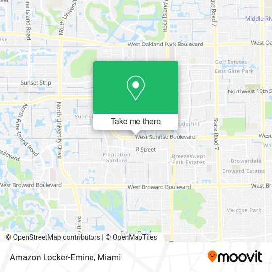
See Amazon Locker-Emine, Plantation, on the map
Public Transit to Amazon Locker-Emine in Plantation
Wondering how to get to Amazon Locker-Emine in Plantation? Moovit helps you find the best way to get to Amazon Locker-Emine with step-by-step directions from the nearest public transit station.
Moovit provides free maps and live directions to help you navigate through your city. View schedules, routes, timetables, and find out how long does it take to get to Amazon Locker-Emine in real time.
Looking for the nearest stop or station to Amazon Locker-Emine? Check out this list of stops closest to your destination: Sunset Strip/Northwest 12th Court; Sunrise Boulevard/Sunset Strip.
Bus: 36, 81.
Want to see if there’s another route that gets you there at an earlier time? Moovit helps you find alternative routes or times. Get directions from and directions to Amazon Locker-Emine easily from the Moovit App or Website.
We make riding to Amazon Locker-Emine easy, which is why over 1.5 million users, including users in Plantation, trust Moovit as the best app for public transit. You don’t need to download an individual bus app or train app, Moovit is your all-in-one transit app that helps you find the best bus time or train time available.
For information on prices of bus, costs and ride fares to Amazon Locker-Emine, please check the Moovit app.
Use the app to navigate to popular places including to the airport, hospital, stadium, grocery store, mall, coffee shop, school, college, and university.
Amazon Locker-Emine Address: 6041 W Sunrise Blvd Fort Lauderdale, FL 33313 street in Plantation
- Coin Cloud DCM,
- Twin Smokin Inc-Sunris,
- Petra Connect,
- Amazon Counter-Unity Pro Services LLC,
- El Projimo Medical Center,
- Esthetic Fit,
- Nevaeh Multi-Services,
- Camp Wannado,
- Assurance of Hope Institute,
- Staar Technologies,
- Iglesia Amor de Cristo NC,
- Professional Association for Childbirth Education,
- High Roll Smoke Shop,
- Jean Arts Graphic de,
- Fresh Fits Sneakers Club,
- Tasty's,
- smart Response,
- Merida's Healthy Hair Care,
- K&K - Krisp&Klean Barbershop,
- M.E.I. & Company
Places Near Amazon Locker-Emine (Plantation)
- Dolphin Mall, Miami,
- Marlins Park, Miami,
- Miami-Dade County Courthouse, Miami,
- Dolphin Mall Bus, Miami,
- Port of Miami Cruise Terminal, Miami,
- Little Havana, Miami,
- Miami Freedom Park, Miami,
- Wynwood, Miami,
- Aventura Mall, Miami,
- Sawgrass mall ( FL ), Miami Beach,
- Hard Rock Stadium, Miami Gardens,
- Aventura Mall, Miami Beach,
- Richard E. Gerstein Justice Building, Miami,
- Miami VA Hospital, Miami,
- Keiser University Flagship Campus, West Palm Beach,
- Brickell City Centre, Miami,
- Miami Design District, Miami,
- Sawgrass Mall, Miami,
- Zoo Miami, Miami,
- Bayside Marketplace, Miami
How to get to popular places in Miami with public transit
Get around Plantation by public transit!
Traveling around Plantation has never been so easy. See step by step directions as you travel to any attraction, street or major public transit station. View bus and train schedules, arrival times, service alerts and detailed routes on a map, so you know exactly how to get to anywhere in Plantation.
When traveling to any destination around Plantation use Moovit's Live Directions with Get Off Notifications to know exactly where and how far to walk, how long to wait for your line, and how many stops are left. Moovit will alert you when it's time to get off — no need to constantly re-check whether yours is the next stop.
Wondering how to use public transit in Plantation or how to pay for public transit in Plantation? Moovit public transit app can help you navigate your way with public transit easily, and at minimum cost. It includes public transit fees, ticket prices, and costs. Looking for a map of Plantation public transit lines? Moovit public transit app shows all public transit maps in Plantation with all Bus, Train, Light Rail and Ferry routes and stops on an interactive map.
Miami has 4 transit type(s), including: Bus, Train, Light Rail and Ferry, operated by several transit agencies, including Broward County Transit, Miami-Dade Transit, Metrorail, Palm Tran, Tri-Rail, Brightline, MARTY, City of Homestead Trolley, Key West Transit, Treasure Coast Connector, GoLine IRT, Amtrak, Greyhound-us, FlixBus-us and Aventura Express Shuttle Bus