How to get to Amazon Locker - Examiner by bus?
Click on the bus route to see step by step directions with maps, line arrival times and updated time schedules.
From Frick Collection, Manhattan
57 minFrom New Jersey/New York border - Lincoln Tunnel crossing, Manhattan
83 minFrom Co-Op City, Bronx
97 minFrom Ross Dress For Less, Manhattan
75 minFrom Hobby Lobby, Queens
102 minFrom 68th St and York York Ave, Manhattan
70 minFrom Rikers Island, Bronx
96 minFrom W 45th St / 6th Ave, Manhattan
81 minFrom 63rd & Lexington, Manhattan
64 minFrom Walmart Supercenter, Secaucus
109 min
How to get to Amazon Locker - Examiner by train?
Click on the train route to see step by step directions with maps, line arrival times and updated time schedules.
How to get to Amazon Locker - Examiner by subway?
Click on the subway route to see step by step directions with maps, line arrival times and updated time schedules.
From Frick Collection, Manhattan
40 minFrom New Jersey/New York border - Lincoln Tunnel crossing, Manhattan
57 minFrom Co-Op City, Bronx
65 minFrom Ross Dress For Less, Manhattan
30 minFrom Hobby Lobby, Queens
52 minFrom 68th St and York York Ave, Manhattan
48 minFrom W 45th St / 6th Ave, Manhattan
30 minFrom 63rd & Lexington, Manhattan
35 min
Bus stops near Amazon Locker - Examiner in Manhattan
Subway stations near Amazon Locker - Examiner in Manhattan
Train station near Amazon Locker - Examiner in Manhattan
- Highbridge Yard, 36 min walk,VIEW
Bus lines to Amazon Locker - Examiner in Manhattan
What are the closest stations to Amazon Locker - Examiner?
The closest stations to Amazon Locker - Examiner are:
- Frederick Douglass Blvd/W 158 St is 342 yards away, 5 min walk.
- 155 St is 471 yards away, 6 min walk.
- 163 St-Amsterdam Av is 509 yards away, 7 min walk.
- 157 St is 769 yards away, 10 min walk.
- Edgecombe Av/W 158 St is 1335 yards away, 16 min walk.
- Amsterdam Av/W 158 St is 1539 yards away, 19 min walk.
- Amsterdam Av/W 161 St is 1713 yards away, 21 min walk.
- Highbridge Yard is 3033 yards away, 36 min walk.
Which bus lines stop near Amazon Locker - Examiner?
These bus lines stop near Amazon Locker - Examiner: M10, M2.
Which train line stops near Amazon Locker - Examiner?
1 (717#| Croton-Harmon)
Which subway lines stop near Amazon Locker - Examiner?
These subway lines stop near Amazon Locker - Examiner: B, D, M.
What’s the nearest subway station to Amazon Locker - Examiner in Manhattan?
The nearest subway station to Amazon Locker - Examiner in Manhattan is 155 St. It’s a 6 min walk away.
What’s the nearest bus station to Amazon Locker - Examiner in Manhattan?
The nearest bus station to Amazon Locker - Examiner in Manhattan is Frederick Douglass Blvd/W 158 St. It’s a 5 min walk away.
What time is the first subway to Amazon Locker - Examiner in Manhattan?
The A is the first subway that goes to Amazon Locker - Examiner in Manhattan. It stops nearby at 3:00 AM.
What time is the last subway to Amazon Locker - Examiner in Manhattan?
The A is the last subway that goes to Amazon Locker - Examiner in Manhattan. It stops nearby at 4:21 AM.
What time is the first train to Amazon Locker - Examiner in Manhattan?
The 1 is the first train that goes to Amazon Locker - Examiner in Manhattan. It stops nearby at 5:28 AM.
What time is the last train to Amazon Locker - Examiner in Manhattan?
The 1 is the last train that goes to Amazon Locker - Examiner in Manhattan. It stops nearby at 12:39 AM.
What time is the first bus to Amazon Locker - Examiner in Manhattan?
The M2 is the first bus that goes to Amazon Locker - Examiner in Manhattan. It stops nearby at 3:00 AM.
What time is the last bus to Amazon Locker - Examiner in Manhattan?
The M101 is the last bus that goes to Amazon Locker - Examiner in Manhattan. It stops nearby at 3:19 AM.
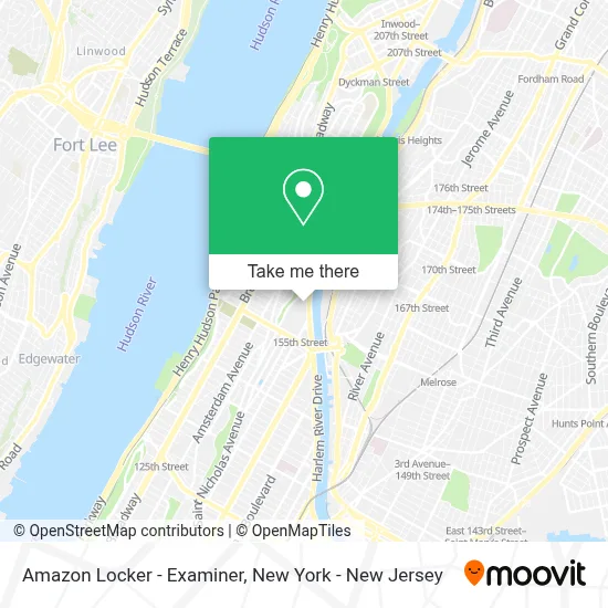
See Amazon Locker - Examiner, Manhattan, on the map
Public Transit to Amazon Locker - Examiner in Manhattan
Wondering how to get to Amazon Locker - Examiner in Manhattan? Moovit helps you find the best way to get to Amazon Locker - Examiner with step-by-step directions from the nearest public transit station.
Moovit provides free maps and live directions to help you navigate through your city. View schedules, routes, timetables, and find out how long does it take to get to Amazon Locker - Examiner in real time.
Looking for the nearest stop or station to Amazon Locker - Examiner? Check out this list of stops closest to your destination: Frederick Douglass Blvd/W 158 St; 155 St; 163 St-Amsterdam Av; 157 St; Edgecombe Av/W 158 St; Amsterdam Av/W 158 St; Amsterdam Av/W 161 St; Highbridge Yard.
Bus: M10, M2.Train: 1.Subway: B, D, M, A, C, 1.
Want to see if there’s another route that gets you there at an earlier time? Moovit helps you find alternative routes or times. Get directions from and directions to Amazon Locker - Examiner easily from the Moovit App or Website.
We make riding to Amazon Locker - Examiner easy, which is why over 1.5 million users, including users in Manhattan, trust Moovit as the best app for public transit. You don’t need to download an individual bus app or train app, Moovit is your all-in-one transit app that helps you find the best bus time or train time available.
For information on prices of subway, bus and train, costs and ride fares to Amazon Locker - Examiner, please check the Moovit app.
Use the app to navigate to popular places including to the airport, hospital, stadium, grocery store, mall, coffee shop, school, college, and university.
Amazon Locker - Examiner Address: RANGEL - 159-44 HARLEM RIVER DRIVE, 159-44 HARLEM RIVER DRIVE street in Manhattan
- Prince Hall Colonial Park Care,
- Eye See You Too Llc.,
- Amazon Locker - Longmont,
- Amazon Locker - Maitland,
- Amazon Locker - Lounge,
- Amazon Locker - Saddle,
- Nycha - Rangel Houses,
- Take Over Pest Control Inc,
- Ralph J Rangel Houses,
- Harlem River Greenway / Bike Path,
- Cuddlebugs Early Learning Center,
- NYCHA - Rangel Houses,
- Harlem River Drive North Bound,
- Putnam Bridge,
- Amazon Locker - Maki,
- Flower Of Life Ayurveda,
- Ps 046 Arthur Tappan School,
- Riseevencredito,
- Amazon Locker - Jetsum,
- 2999 8th Ave
Places Near Amazon Locker - Examiner (Manhattan)
- San Gennaro Feast, Manhattan,
- Chinatown, Manhattan,
- 1 Police Plaza, Manhattan,
- 376 Hudson Street, Manhattan,
- Queens Center Mall, Queens,
- 3 Stone St, Manhattan,
- Wall Street, Manhattan,
- qqqq, Manhattan,
- 911 Memorial, Manhattan,
- Pier 83, Manhattan,
- Hudson Yards, Manhattan,
- SoHo, Manhattan,
- 66 John Street, Manhattan,
- Times Square, Manhattan,
- Rockefeller Center, Manhattan,
- 111 Centre New York City Supreme Court, Manhattan,
- 26 Federal Plaza, Manhattan,
- Mountainside Hospital, Glen Ridge,
- Katz's Deli, Manhattan,
- Bellevue Hospital, Manhattan
How to get to popular places in New York - New Jersey with public transit
Get around Manhattan by public transit!
Traveling around Manhattan has never been so easy. See step by step directions as you travel to any attraction, street or major public transit station. View bus and train schedules, arrival times, service alerts and detailed routes on a map, so you know exactly how to get to anywhere in Manhattan.
When traveling to any destination around Manhattan use Moovit's Live Directions with Get Off Notifications to know exactly where and how far to walk, how long to wait for your line, and how many stops are left. Moovit will alert you when it's time to get off — no need to constantly re-check whether yours is the next stop.
Wondering how to use public transit in Manhattan or how to pay for public transit in Manhattan? Moovit public transit app can help you navigate your way with public transit easily, and at minimum cost. It includes public transit fees, ticket prices, and costs. Looking for a map of Manhattan public transit lines? Moovit public transit app shows all public transit maps in Manhattan with all Bus, Train, Subway, Light Rail, Ferry and Cable Car routes and stops on an interactive map.
New York - New Jersey has 6 transit type(s), including: Bus, Train, Subway, Light Rail, Ferry and Cable Car, operated by several transit agencies, including MTA Subway, Metro-North Railroad, LIRR, PATH, MTA New York City Transit - Express routes, MTA Bus, NJ Transit, NYC Ferry, NICE bus, Bee-Line Bus, NJ Transit Rail, Norwalk Transit District, Hartford Line, River Valley Transit and HART