Directions to Amazon Locker - Forebear (Queens) with public transportation
The following transit lines have routes that pass near Amazon Locker - Forebear
 Bus: Q111, Q114, Q115, Q51, Q6.
- Train: LONG BEACH BRANCH, FAR ROCKAWAY BRANCH, BABYLON BRANCH, WEST HEMPSTEAD BRANCH, HEMPSTEAD BRANCH.
- Subway: E, J, Z.
How to get to Amazon Locker - Forebear by bus?
Click on the bus route to see step by step directions with maps, line arrival times and updated time schedules.
From Mall del Sol Guayaquil,Ecuador, Queens
79 minFrom Ridgewood, NY, Queens
73 minFrom Fresh Meadows, Queens
43 minFrom 30-56 Whitestone Expwy, Queens
65 minFrom Shea Stadium, Queens
70 minFrom Citi Field, Queens
67 minFrom Resorts World Shuttle Bus, Queens
65 minFrom Elmhurst, NY, Queens
64 minFrom President's Gate - US Open, Queens
75 minFrom Louis Armstrong Stadium, Queens
71 min
How to get to Amazon Locker - Forebear by train?
Click on the train route to see step by step directions with maps, line arrival times and updated time schedules.
How to get to Amazon Locker - Forebear by subway?
Click on the subway route to see step by step directions with maps, line arrival times and updated time schedules.
From Mall del Sol Guayaquil,Ecuador, Queens
70 minFrom Ridgewood, NY, Queens
82 minFrom 30-56 Whitestone Expwy, Queens
97 minFrom Shea Stadium, Queens
75 minFrom Citi Field, Queens
72 minFrom Resorts World Shuttle Bus, Queens
62 minFrom Elmhurst, NY, Queens
64 minFrom President's Gate - US Open, Queens
79 minFrom Louis Armstrong Stadium, Queens
76 min
Bus stops near Amazon Locker - Forebear in Queens
Train stations near Amazon Locker - Forebear in Queens
Subway station near Amazon Locker - Forebear in Queens
- Jamaica Center-Parsons/Archer, 16 min walk,VIEW
Bus lines to Amazon Locker - Forebear in Queens
- Q115, Springfield Gardens Via Brewer Bl,VIEW
- QM21, Midtown 57 St Via Madison Av,VIEW
- QM65, Laurelton,VIEW
- Q111, Rush Cedarhurst Peninsula Bl Via Brewer Bl Via 147 Av,VIEW
- Q113, Limited Jamaica Parsons-Hillside Via Nassau Exy Via Brewer Bl,VIEW
- Q114, Rush Far Rockaway Seagirt Bl Via Brewer Bl,VIEW
- QM63, Rosedale,VIEW
- Q51, Limited Cambria Heights,VIEW
- Q5, Green Acres Via Merrick Bl,VIEW
What are the closest stations to Amazon Locker - Forebear?
The closest stations to Amazon Locker - Forebear are:
- Guy R Brewer Blvd/116 Av is 130 yards away, 2 min walk.
- Guy R Brewer Blvd/Foch Blvd is 233 yards away, 3 min walk.
- Locust Manor is 370 yards away, 5 min walk.
- Linden Blvd/Guy R Brewer Bl is 522 yards away, 7 min walk.
- Linden Blvd/Guy R Brewer Blvd is 526 yards away, 7 min walk.
- Merrick Bl/116 Av is 1087 yards away, 14 min walk.
- Jamaica Center-Parsons/Archer is 1257 yards away, 16 min walk.
- St.Albans is 2679 yards away, 32 min walk.
- Hillside Facility is 3944 yards away, 47 min walk.
Which bus lines stop near Amazon Locker - Forebear?
These bus lines stop near Amazon Locker - Forebear: Q111, Q114, Q115, Q51, Q6.
Which train line stops near Amazon Locker - Forebear?
LONG BEACH BRANCH (Long Beach)
Which subway lines stop near Amazon Locker - Forebear?
These subway lines stop near Amazon Locker - Forebear: E, J.
What’s the nearest subway station to Amazon Locker - Forebear in Queens?
The nearest subway station to Amazon Locker - Forebear in Queens is Jamaica Center-Parsons/Archer. It’s a 16 min walk away.
What’s the nearest train station to Amazon Locker - Forebear in Queens?
The nearest train station to Amazon Locker - Forebear in Queens is Locust Manor. It’s a 5 min walk away.
What’s the nearest bus station to Amazon Locker - Forebear in Queens?
The nearest bus station to Amazon Locker - Forebear in Queens is Guy R Brewer Blvd/116 Av. It’s a 2 min walk away.
What time is the first subway to Amazon Locker - Forebear in Queens?
The E is the first subway that goes to Amazon Locker - Forebear in Queens. It stops nearby at 3:06 AM.
What time is the last subway to Amazon Locker - Forebear in Queens?
The J is the last subway that goes to Amazon Locker - Forebear in Queens. It stops nearby at 3:49 AM.
What time is the first train to Amazon Locker - Forebear in Queens?
The FAR ROCKAWAY BRANCH is the first train that goes to Amazon Locker - Forebear in Queens. It stops nearby at 3:30 AM.
What time is the last train to Amazon Locker - Forebear in Queens?
The FAR ROCKAWAY BRANCH is the last train that goes to Amazon Locker - Forebear in Queens. It stops nearby at 2:50 AM.
What time is the first bus to Amazon Locker - Forebear in Queens?
The Q114 is the first bus that goes to Amazon Locker - Forebear in Queens. It stops nearby at 3:04 AM.
What time is the last bus to Amazon Locker - Forebear in Queens?
The Q114 is the last bus that goes to Amazon Locker - Forebear in Queens. It stops nearby at 3:06 AM.
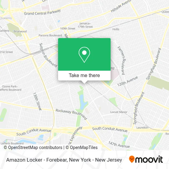
See Amazon Locker - Forebear, Queens, on the map
Public Transit to Amazon Locker - Forebear in Queens
Wondering how to get to Amazon Locker - Forebear in Queens? Moovit helps you find the best way to get to Amazon Locker - Forebear with step-by-step directions from the nearest public transit station.
Moovit provides free maps and live directions to help you navigate through your city. View schedules, routes, timetables, and find out how long does it take to get to Amazon Locker - Forebear in real time.
Looking for the nearest stop or station to Amazon Locker - Forebear? Check out this list of stops closest to your destination: Guy R Brewer Blvd/116 Av; Guy R Brewer Blvd/Foch Blvd; Locust Manor; Linden Blvd/Guy R Brewer Bl; Linden Blvd/Guy R Brewer Blvd; Merrick Bl/116 Av; Jamaica Center-Parsons/Archer; St.Albans; Hillside Facility.
Bus: Q111, Q114, Q115, Q51, Q6, QM21, QM65, Q113.Train: LONG BEACH BRANCH, FAR ROCKAWAY BRANCH, BABYLON BRANCH, WEST HEMPSTEAD BRANCH, HEMPSTEAD BRANCH, MONTAUK BRANCH, PORT JEFFERSON BRANCH, RONKONKOMA BRANCH.Subway: E, J, Z.
Want to see if there’s another route that gets you there at an earlier time? Moovit helps you find alternative routes or times. Get directions from and directions to Amazon Locker - Forebear easily from the Moovit App or Website.
We make riding to Amazon Locker - Forebear easy, which is why over 1.5 million users, including users in Queens, trust Moovit as the best app for public transit. You don’t need to download an individual bus app or train app, Moovit is your all-in-one transit app that helps you find the best bus time or train time available.
For information on prices of bus, subway and train, costs and ride fares to Amazon Locker - Forebear, please check the Moovit app.
Use the app to navigate to popular places including to the airport, hospital, stadium, grocery store, mall, coffee shop, school, college, and university.
Amazon Locker - Forebear Address: BAISLEY PARK - 116-40 GUY BREWER BLVD, 116-40 GUY BREWER BLVD street in Queens
- Amazon Locker - Ruthie,
- Police Athletic League Edward Byrne Center,
- Amazon Locker - Lauderdale,
- Hsleaps,
- 116-25 Guy R Brewer Boulevard,
- Baisley Park South Side Queens,
- Baisley Projects,
- The Most Affordable Chimney Cleaning Corp,
- Amazon Locker - Johns,
- NYCHA - Baisley Park Houses,
- Amazon Locker - Recorder,
- Guy R Brewer Blvd,
- Guy R Brewer Boulevard & Foch Boulevard,
- Guy R Brewer Blvd,
- Al Ansar Inc.,
- Amazon Locker - Bellows,
- Tax Plus,
- Baisley Park,
- Creation,
- Sundae Sauuce
Places Near Amazon Locker - Forebear (Queens)
- 911 Memorial, Manhattan,
- Times Square, Manhattan,
- San Gennaro Feast, Manhattan,
- qqqq, Manhattan,
- Pier 83, Manhattan,
- Bellevue Hospital, Manhattan,
- 26 Federal Plaza, Manhattan,
- Katz's Deli, Manhattan,
- Mountainside Hospital, Glen Ridge,
- 111 Centre New York City Supreme Court, Manhattan,
- Rockefeller Center, Manhattan,
- Wall Street, Manhattan,
- 376 Hudson Street, Manhattan,
- 1 Police Plaza, Manhattan,
- Chinatown, Manhattan,
- Hudson Yards, Manhattan,
- SoHo, Manhattan,
- 3 Stone St, Manhattan,
- 66 John Street, Manhattan,
- Queens Center Mall, Queens
How to get to popular places in New York - New Jersey with public transit
Get around Queens by public transit!
Traveling around Queens has never been so easy. See step by step directions as you travel to any attraction, street or major public transit station. View bus and train schedules, arrival times, service alerts and detailed routes on a map, so you know exactly how to get to anywhere in Queens.
When traveling to any destination around Queens use Moovit's Live Directions with Get Off Notifications to know exactly where and how far to walk, how long to wait for your line, and how many stops are left. Moovit will alert you when it's time to get off — no need to constantly re-check whether yours is the next stop.
Wondering how to use public transit in Queens or how to pay for public transit in Queens? Moovit public transit app can help you navigate your way with public transit easily, and at minimum cost. It includes public transit fees, ticket prices, and costs. Looking for a map of Queens public transit lines? Moovit public transit app shows all public transit maps in Queens with all Bus, Train, Subway, Light Rail, Ferry and Cable Car routes and stops on an interactive map.
New York - New Jersey has 6 transit type(s), including: Bus, Train, Subway, Light Rail, Ferry and Cable Car, operated by several transit agencies, including MTA Subway, Metro-North Railroad, LIRR, PATH, MTA New York City Transit - Express routes, MTA Bus, NJ Transit, NYC Ferry, NICE bus, Bee-Line Bus, NJ Transit Rail, Norwalk Transit District, Hartford Line, River Valley Transit and HART