How to get to Amazon Locker-Lung by bus?
Click on the bus route to see step by step directions with maps, line arrival times and updated time schedules.
From US Marine Corps War Memorial (Iwo Jima), Arlington County
49 minFrom Shirlington, Arlington County
47 minFrom Pentagon North Parking Lot, Arlington County
40 minFrom U.S. Department of State SA-28, Fairfax County
83 minFrom Inova Mount Vernon Hospital, Fairfax County
83 minFrom Crowne Plaza Hotel-Crystal City Washington, D.c., Arlington County
54 minFrom Costco, Arlington County
54 minFrom Arlington County Courthouse, Arlington County
55 minFrom Gravelly Point Park, Arlington County
58 minFrom Tomb of the Unknown Soldier, Arlington County
56 min
How to get to Amazon Locker-Lung by metro?
Click on the metro route to see step by step directions with maps, line arrival times and updated time schedules.
From US Marine Corps War Memorial (Iwo Jima), Arlington County
81 minFrom Crowne Plaza Hotel-Crystal City Washington, D.c., Arlington County
69 minFrom Costco, Arlington County
82 minFrom Arlington County Courthouse, Arlington County
81 minFrom Gravelly Point Park, Arlington County
79 minFrom Tomb of the Unknown Soldier, Arlington County
58 min
Bus stop near Amazon Locker-Lung in Fairfax County
- Rt 236 Little River Tpke & Oasis Dr, 4 min walk,VIEW
Metro station near Amazon Locker-Lung in Fairfax County
- Van Dorn Street Metro Station, 56 min walk,VIEW
Bus lines to Amazon Locker-Lung in Fairfax County
- 306, METRO PENTAGON BAY L4 - UNIVERSITY DR @ GEORGE MASON BLVD,VIEW
- 834, METRO PENTAGON BAY L4 - NVCC ON LAKE DR,VIEW
- 35, Pentagon Transit Center (Bay U7) - Van Dorn Street Station (Bay C),VIEW
- F23, Little River Tpk-George Mason,VIEW
- F24, Little River Tpk-Vienna,VIEW
- F29, Braddock Rd,VIEW
- F85, Little River Tpk-Pentagon,VIEW
What are the closest stations to Amazon Locker-Lung?
The closest stations to Amazon Locker-Lung are:
- Rt 236 Little River Tpke & Oasis Dr is 269 yards away, 4 min walk.
- Van Dorn Street Metro Station is 4760 yards away, 56 min walk.
Which bus lines stop near Amazon Locker-Lung?
These bus lines stop near Amazon Locker-Lung: 306, 35, F24, F85.
Which metro line stops near Amazon Locker-Lung?
BLUE (Franconia-Springfield)
What’s the nearest bus station to Amazon Locker-Lung in Fairfax County?
The nearest bus station to Amazon Locker-Lung in Fairfax County is Rt 236 Little River Tpke & Oasis Dr. It’s a 4 min walk away.
What time is the first metro to Amazon Locker-Lung in Fairfax County?
The BLUE is the first metro that goes to Amazon Locker-Lung in Fairfax County. It stops nearby at 5:05 AM.
What time is the last metro to Amazon Locker-Lung in Fairfax County?
The BLUE is the last metro that goes to Amazon Locker-Lung in Fairfax County. It stops nearby at 12:39 AM.
What time is the first bus to Amazon Locker-Lung in Fairfax County?
The 35 is the first bus that goes to Amazon Locker-Lung in Fairfax County. It stops nearby at 4:36 AM.
What time is the last bus to Amazon Locker-Lung in Fairfax County?
The 35 is the last bus that goes to Amazon Locker-Lung in Fairfax County. It stops nearby at 2:46 AM.
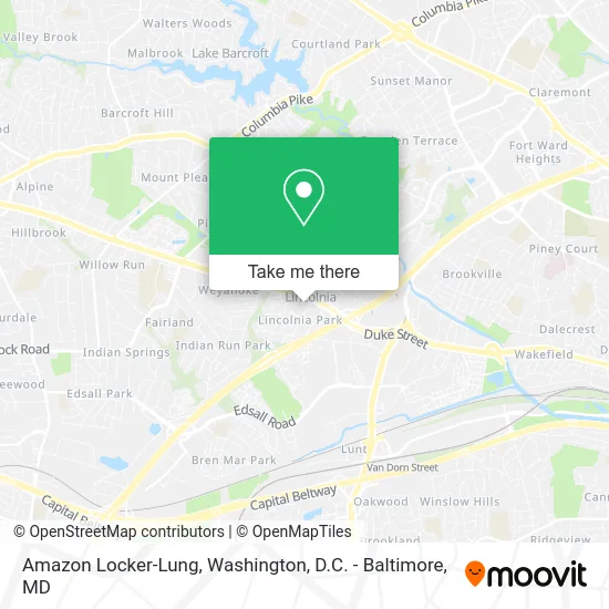
See Amazon Locker-Lung, Fairfax County, on the map
Public Transit to Amazon Locker-Lung in Fairfax County
Wondering how to get to Amazon Locker-Lung in Fairfax County? Moovit helps you find the best way to get to Amazon Locker-Lung with step-by-step directions from the nearest public transit station.
Moovit provides free maps and live directions to help you navigate through your city. View schedules, routes, timetables, and find out how long does it take to get to Amazon Locker-Lung in real time.
Looking for the nearest stop or station to Amazon Locker-Lung? Check out this list of stops closest to your destination: Rt 236 Little River Tpke & Oasis Dr; Van Dorn Street Metro Station.
Bus: 306, 35, F24, F85, 834, F23.Metro: BLUE.
Want to see if there’s another route that gets you there at an earlier time? Moovit helps you find alternative routes or times. Get directions from and directions to Amazon Locker-Lung easily from the Moovit App or Website.
We make riding to Amazon Locker-Lung easy, which is why over 1.5 million users, including users in Fairfax County, trust Moovit as the best app for public transit. You don’t need to download an individual bus app or train app, Moovit is your all-in-one transit app that helps you find the best bus time or train time available.
For information on prices of bus and metro, costs and ride fares to Amazon Locker-Lung, please check the Moovit app.
Use the app to navigate to popular places including to the airport, hospital, stadium, grocery store, mall, coffee shop, school, college, and university.
Amazon Locker-Lung Address: Alexandria, VA 22312 street in Fairfax County
- Long Brian P MD - Long, Brian P MD,
- Repair Goodman Central Air Conditioners Hvac,
- Global Eye Physicians and Surgeons,
- Little Dental Studio,
- Sunrise Hair Braiding Studio,
- Office of the Surgeon Gen,
- Brotha's N Sistah's Salon,
- Mobius,
- Supreme Solutions Inc,
- Taco Bamba,
- Lempira Fashion,
- Clearvue Cleaning,
- Roofing Company Roofing,
- Getcoins,
- Chiropractors Near Me,
- Steamer Carpet Cleaning,
- Gogi Friends,
- Sudsmore Laundromat,
- smart Air Mark 華府冷暖,
- Upholstery Cleaning
Places Near Amazon Locker-Lung (Fairfax County)
- Museum Of The Bible, Washington,
- Pennsylvania Ave NW (3rd st and pennsylvania), Washington,
- Capital One Arena, Washington,
- Westfield Montgomery Mall, Montgomery County,
- M&T Bank Stadium, Baltimore,
- National Zoo, Washington,
- Georgetown, Washington,
- PG Mall, Prince George's County,
- National Mall, Washington,
- Washington National Cathedral, Washington,
- Rock Creek Tennis Center, Washington,
- National Museum of African American History and Culture, Washington,
- Sibley Memorial Hospital, Washington,
- Marriott Marquis Washington, DC, Washington,
- Amazon Hq2, Arlington County,
- Warner Theatre, Washington,
- Basilica of the National Shrine, Washington,
- Washington DC VA Medical Center, Washington,
- Camden Yards, Baltimore,
- The Anthem, Washington
How to get to popular places in Washington, D.C. - Baltimore, MD with public transit
Get around Fairfax County by public transit!
Traveling around Fairfax County has never been so easy. See step by step directions as you travel to any attraction, street or major public transit station. View bus and train schedules, arrival times, service alerts and detailed routes on a map, so you know exactly how to get to anywhere in Fairfax County.
When traveling to any destination around Fairfax County use Moovit's Live Directions with Get Off Notifications to know exactly where and how far to walk, how long to wait for your line, and how many stops are left. Moovit will alert you when it's time to get off — no need to constantly re-check whether yours is the next stop.
Wondering how to use public transit in Fairfax County or how to pay for public transit in Fairfax County? Moovit public transit app can help you navigate your way with public transit easily, and at minimum cost. It includes public transit fees, ticket prices, and costs. Looking for a map of Fairfax County public transit lines? Moovit public transit app shows all public transit maps in Fairfax County with all Bus, Train, Metro, Light Rail and Ferry routes and stops on an interactive map.
Washington, D.C. - Baltimore, MD has 5 transit type(s), including: Bus, Train, Metro, Light Rail and Ferry, operated by several transit agencies, including WMATA, Montgomery County Ride On, Fairfax Connector, TheBus, PRTC, DASH - Alexandria, Arlington Transit (ART), RTA of Central Maryland, MDOT MTA, MDOT MTA Light RailLink, MDOT MTA Commuter Bus, MDOT MTA Local Bus, FXBGO!, Virginia Railway Express (VRE) and MARC