Directions to Amazon Locker-Mian (Princeton-Goulds) with public transportation
The following transit lines have routes that pass near Amazon Locker-Mian
 Bus: 602.
How to get to Amazon Locker-Mian by bus?
Click on the bus route to see step by step directions with maps, line arrival times and updated time schedules.
From SW 144th Street & US1, Kendall-Palmetto Bay
33 minFrom Coral Reef Senior High School, Kendall-Palmetto Bay
37 minFrom Cutler Bay, FL, Princeton-Goulds
58 minFrom Eureka Drive & U.S. 1, Kendall-Palmetto Bay
22 minFrom Baptist homestead hospital, Homestead
46 minFrom Martinez Distributors, Kendale Lakes-Tamiami
91 minFrom Falls (Mall), Kendall-Palmetto Bay
36 minFrom The Falls, Kendall-Palmetto Bay
40 minFrom Colombian Massage And Food, Kendall-Palmetto Bay
32 minFrom Madalon Law, Kendall-Palmetto Bay
37 min
Bus stop near Amazon Locker-Mian in Princeton-Goulds
- Transitway & Sw 232 St, 3 min walk,VIEW
Bus lines to Amazon Locker-Mian in Princeton-Goulds
- 602, Transitway Local Dadeland South Station,VIEW
What are the closest stations to Amazon Locker-Mian?
The closest stations to Amazon Locker-Mian are:
- Transitway & Sw 232 St is 171 yards away, 3 min walk.
Which bus line stops near Amazon Locker-Mian?
602 (Transitway Local FL City SW 344 St P&R)
What’s the nearest bus station to Amazon Locker-Mian in Princeton-Goulds?
The nearest bus station to Amazon Locker-Mian in Princeton-Goulds is Transitway & Sw 232 St. It’s a 3 min walk away.
What time is the first bus to Amazon Locker-Mian in Princeton-Goulds?
The 602 is the first bus that goes to Amazon Locker-Mian in Princeton-Goulds. It stops nearby at 3:07 AM.
What time is the last bus to Amazon Locker-Mian in Princeton-Goulds?
The 602 is the last bus that goes to Amazon Locker-Mian in Princeton-Goulds. It stops nearby at 3:06 AM.
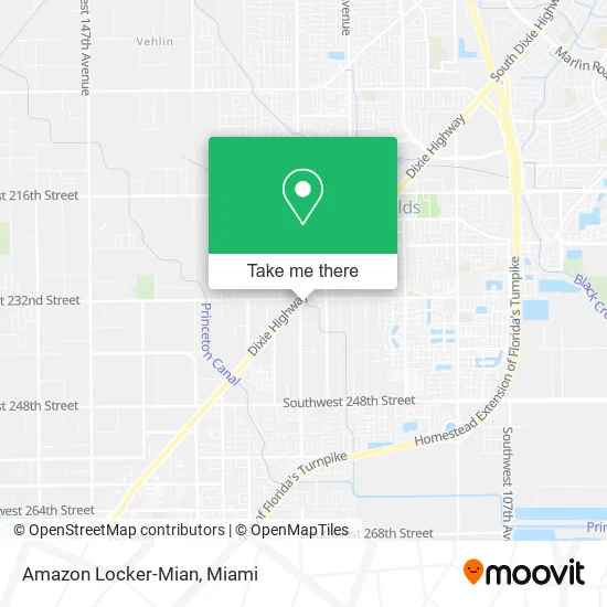
See Amazon Locker-Mian, Princeton-Goulds, on the map
Public Transit to Amazon Locker-Mian in Princeton-Goulds
Wondering how to get to Amazon Locker-Mian in Princeton-Goulds? Moovit helps you find the best way to get to Amazon Locker-Mian with step-by-step directions from the nearest public transit station.
Moovit provides free maps and live directions to help you navigate through your city. View schedules, routes, timetables, and find out how long does it take to get to Amazon Locker-Mian in real time.
Looking for the nearest stop or station to Amazon Locker-Mian? Check out this list of stops closest to your destination: Transitway & Sw 232 St.
Bus: 602.
Want to see if there’s another route that gets you there at an earlier time? Moovit helps you find alternative routes or times. Get directions from and directions to Amazon Locker-Mian easily from the Moovit App or Website.
We make riding to Amazon Locker-Mian easy, which is why over 1.5 million users, including users in Princeton-Goulds, trust Moovit as the best app for public transit. You don’t need to download an individual bus app or train app, Moovit is your all-in-one transit app that helps you find the best bus time or train time available.
For information on prices of bus, costs and ride fares to Amazon Locker-Mian, please check the Moovit app.
Use the app to navigate to popular places including to the airport, hospital, stadium, grocery store, mall, coffee shop, school, college, and university.
Amazon Locker-Mian Address: 23215 S Dixie Hwy Homestead, FL 33032 street in Princeton-Goulds
- Play Pen South,
- Troops 78 Scouts,
- Eastern Medical Courier,
- Children's Rainbow Day School DSL Line,
- Spectrum Group Insurance,
- Penske Auto Center,
- Quillami Fast Food,
- Prestige Car Group Cor,
- High Impact Auto Bdy & CLLSN SPCLST,
- Presto Building Design,
- Andrew Palmer,
- All Star Insurance,
- Rta International,
- El Compy Tires,
- Luxury Auto Mall,
- A A Autos,
- La Motors,
- J and G Auto City,
- Rent A Cow,
- Beacon Building Products
Places Near Amazon Locker-Mian (Princeton-Goulds)
- Miami Design District, Miami,
- Bayside Marketplace, Miami,
- Sawgrass mall ( FL ), Miami Beach,
- Brickell City Centre, Miami,
- Dolphin Mall, Miami,
- Richard E. Gerstein Justice Building, Miami,
- Wynwood, Miami,
- Aventura Mall, Miami Beach,
- Miami-Dade County Courthouse, Miami,
- Little Havana, Miami,
- Hard Rock Stadium, Miami Gardens,
- Marlins Park, Miami,
- Zoo Miami, Miami,
- Dolphin Mall Bus, Miami,
- Keiser University Flagship Campus, West Palm Beach,
- Port of Miami Cruise Terminal, Miami,
- Miami VA Hospital, Miami,
- Sawgrass Mall, Miami,
- Aventura Mall, Miami,
- Miami Freedom Park, Miami
How to get to popular places in Miami with public transit
Get around Princeton-Goulds by public transit!
Traveling around Princeton-Goulds has never been so easy. See step by step directions as you travel to any attraction, street or major public transit station. View bus and train schedules, arrival times, service alerts and detailed routes on a map, so you know exactly how to get to anywhere in Princeton-Goulds.
When traveling to any destination around Princeton-Goulds use Moovit's Live Directions with Get Off Notifications to know exactly where and how far to walk, how long to wait for your line, and how many stops are left. Moovit will alert you when it's time to get off — no need to constantly re-check whether yours is the next stop.
Wondering how to use public transit in Princeton-Goulds or how to pay for public transit in Princeton-Goulds? Moovit public transit app can help you navigate your way with public transit easily, and at minimum cost. It includes public transit fees, ticket prices, and costs. Looking for a map of Princeton-Goulds public transit lines? Moovit public transit app shows all public transit maps in Princeton-Goulds with all Bus, Train, Light Rail and Ferry routes and stops on an interactive map.
Miami has 4 transit type(s), including: Bus, Train, Light Rail and Ferry, operated by several transit agencies, including Broward County Transit, Miami-Dade Transit, Metrorail, Palm Tran, Tri-Rail, Brightline, MARTY, City of Homestead Trolley, Key West Transit, Treasure Coast Connector, GoLine IRT, Amtrak, Greyhound-us, FlixBus-us and Aventura Express Shuttle Bus