How to get to Amazon Locker-Mikel by bus?
Click on the bus route to see step by step directions with maps, line arrival times and updated time schedules.
From University of Alberta, Edmonton
64 minFrom Tunis E W Professional, Edmonton
74 minFrom Blue Quill Pharmacy, Edmonton
76 minFrom College Plaza Professional Building, Edmonton
68 minFrom Victoria Park, Edmonton
83 minFrom Midway, Edmonton
78 minFrom St Thomas More Catholic Church, Edmonton
48 minFrom Edmonton Valley Zoo, Edmonton
77 minFrom Midway Music Hall, Edmonton
78 minFrom Whyte Avenue, Edmonton
72 min
Bus stops near Amazon Locker-Mikel in Edmonton
Bus lines to Amazon Locker-Mikel in Edmonton
What are the closest stations to Amazon Locker-Mikel?
The closest stations to Amazon Locker-Mikel are:
- 188 Street & Callingwood Road is 32 meters away, 1 min walk.
- 188 Street & Ormsby Road West is 77 meters away, 2 min walk.
- 188a Street & 57 Avenue is 1299 meters away, 17 min walk.
Which bus lines stop near Amazon Locker-Mikel?
These bus lines stop near Amazon Locker-Mikel: 916, 917.
What’s the nearest bus station to Amazon Locker-Mikel in Edmonton?
The nearest bus station to Amazon Locker-Mikel in Edmonton is 188 Street & Callingwood Road. It’s a 1 min walk away.
What time is the first bus to Amazon Locker-Mikel in Edmonton?
The 917 is the first bus that goes to Amazon Locker-Mikel in Edmonton. It stops nearby at 6:00 AM.
What time is the last bus to Amazon Locker-Mikel in Edmonton?
The 916 is the last bus that goes to Amazon Locker-Mikel in Edmonton. It stops nearby at 11:50 PM.
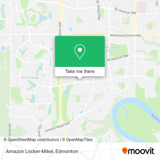
See Amazon Locker-Mikel, Edmonton, on the map
Public Transit to Amazon Locker-Mikel in Edmonton
Wondering how to get to Amazon Locker-Mikel in Edmonton? Moovit helps you find the best way to get to Amazon Locker-Mikel with step-by-step directions from the nearest public transit station.
Moovit provides free maps and live directions to help you navigate through your city. View schedules, routes, timetables, and find out how long does it take to get to Amazon Locker-Mikel in real time.
Looking for the nearest stop or station to Amazon Locker-Mikel? Check out this list of stops closest to your destination: 188 Street & Callingwood Road; 188 Street & Ormsby Road West; 188a Street & 57 Avenue.
Bus: 916, 917, 910X, 913.
Want to see if there’s another route that gets you there at an earlier time? Moovit helps you find alternative routes or times. Get directions from and directions to Amazon Locker-Mikel easily from the Moovit App or Website.
We make riding to Amazon Locker-Mikel easy, which is why over 1.5 million users, including users in Edmonton, trust Moovit as the best app for public transit. You don’t need to download an individual bus app or train app, Moovit is your all-in-one transit app that helps you find the best bus time or train time available.
For information on prices of bus, costs and ride fares to Amazon Locker-Mikel, please check the Moovit app.
Use the app to navigate to popular places including to the airport, hospital, stadium, grocery store, mall, coffee shop, school, college, and university.
Amazon Locker-Mikel Address: 6211 188 St NW Edmonton, AB T5T street in Edmonton
- Logic Realty,
- Ladybug Playschool,
- Sam Nike Enterprises,
- Doggo Treadmi,
- T'NT Work & Rescue,
- Rekt Services,
- Micro Eats,
- International Waste Management Inc,
- Shampooches Spa and SE,
- Ormsby Place,
- Good Shepherd Catholic Church,
- Sell My Stuff Canada E,
- Silver Apron,
- Good Shepherd Church,
- Milestone Christian Church,
- Coinamatic,
- Sunnyside Before & After School Care,
- Overcomers Pentecostal Church,
- Maven Beauty Lounge,
- Ormsby School
Places Near Amazon Locker-Mikel (Edmonton)
- Alberta Legislature Building, Edmonton,
- Londonderry Mall, Edmonton,
- Rogers Place, Edmonton,
- Cross Cancer Institute, Edmonton,
- West Edmonton Mall, Edmonton,
- Northgate Centre, Edmonton,
- University of Alberta, Edmonton,
- Royal Alexandra Hospital, Edmonton,
- Edmonton Commonwealth Stadium, Edmonton,
- Edmonton Valley Zoo, Edmonton,
- Kingsway Mall, Edmonton,
- Edmonton EXPO Centre, Edmonton,
- Edmonton VIA Rail Station, Edmonton,
- Borden Park, Edmonton,
- Kaye Edmonton Clinic, Edmonton,
- Fort Edmonton Park, Edmonton,
- Grey Nuns Community Hospital, Edmonton,
- Canada Place Service Canada Centre, Edmonton,
- Whyte Avenue, Edmonton,
- MacEwan University, Edmonton
How to get to popular places in Edmonton with public transit
Get around Edmonton by public transit!
Traveling around Edmonton has never been so easy. See step by step directions as you travel to any attraction, street or major public transit station. View bus and train schedules, arrival times, service alerts and detailed routes on a map, so you know exactly how to get to anywhere in Edmonton.
When traveling to any destination around Edmonton use Moovit's Live Directions with Get Off Notifications to know exactly where and how far to walk, how long to wait for your line, and how many stops are left. Moovit will alert you when it's time to get off — no need to constantly re-check whether yours is the next stop.
Wondering how to use public transit in Edmonton or how to pay for public transit in Edmonton? Moovit public transit app can help you navigate your way with public transit easily, and at minimum cost. It includes public transit fees, ticket prices, and costs. Looking for a map of Edmonton public transit lines? Moovit public transit app shows all public transit maps in Edmonton with all Bus and Light Rail routes and stops on an interactive map.
Edmonton has 2 transit type(s), including: Bus and Light Rail, operated by several transit agencies, including ETS LRT, ETS, Strathcona County Transit, St. Albert Transit, Spruce Grove Transit, Fort Saskatchewan Transit, Beaumont Transit and Leduc Transit