How to get to Amazon Locker - Power by bus?
Click on the bus route to see step by step directions with maps, line arrival times and updated time schedules.
From Calvary Hospital, Bronx
59 minFrom 165-08 88th Avenue, Queens
47 minFrom Roy Wilkins Park, Queens
64 minFrom The Shops At Atlas Park, Queens
45 minFrom Lincoln Hospital, Bronx
94 minFrom 125, Manhattan
54 minFrom Hobby Lobby, Queens
53 minFrom Queens Criminal Court, Queens
42 minFrom Crotona Park, Bronx
68 minFrom Fulton Ave, Bronx
81 min
How to get to Amazon Locker - Power by train?
Click on the train route to see step by step directions with maps, line arrival times and updated time schedules.
How to get to Amazon Locker - Power by subway?
Click on the subway route to see step by step directions with maps, line arrival times and updated time schedules.
Bus stops near Amazon Locker - Power in Queens
Train station near Amazon Locker - Power in Queens
- Flushing - Main Street, 2 min walk,VIEW
Subway station near Amazon Locker - Power in Queens
- Flushing-Main St, 4 min walk,VIEW
Bus lines to Amazon Locker - Power in Queens
- Q90, Limited Flushing,VIEW
- Q27, Flushing Main St Station,VIEW
- Q19, Flushing,VIEW
- Q63, Rush Court Square Via Northern Bl,VIEW
- Q66, Flushing Via Northern Bl,VIEW
- Q50, Limited Flushing,VIEW
- Q25, College Point 5 Av,VIEW
- Q26, Fresh Meadows,VIEW
- Q65, Jamaica LIRR Via 164 St,VIEW
- Q58, Ridgewood Terminal Via Corona Av,VIEW
- Q98, Limited Ridgewood,VIEW
What are the closest stations to Amazon Locker - Power?
The closest stations to Amazon Locker - Power are:
- Roosevelt Av/Prince St is 50 yards away, 1 min walk.
- Flushing - Main Street is 138 yards away, 2 min walk.
- 39 Av/Main St is 152 yards away, 2 min walk.
- Roosevelt Av/Main St is 163 yards away, 3 min walk.
- Main St/40 Rd is 242 yards away, 4 min walk.
- Main St/Roosevelt Av is 271 yards away, 4 min walk.
- Flushing-Main St is 302 yards away, 4 min walk.
- 41 Rd/College Point Blvd is 360 yards away, 5 min walk.
- College Point Blvd/Sanford Av is 427 yards away, 6 min walk.
Which bus lines stop near Amazon Locker - Power?
These bus lines stop near Amazon Locker - Power: Q19, Q25, Q44-SBS, Q50, Q65, Q98.
Which train line stops near Amazon Locker - Power?
PORT WASHINGTON BRANCH (Port Washington)
Which subway line stops near Amazon Locker - Power?
7 (Queens)
What’s the nearest subway station to Amazon Locker - Power in Queens?
The nearest subway station to Amazon Locker - Power in Queens is Flushing-Main St. It’s a 4 min walk away.
What’s the nearest train station to Amazon Locker - Power in Queens?
The nearest train station to Amazon Locker - Power in Queens is Flushing - Main Street. It’s a 2 min walk away.
What’s the nearest bus station to Amazon Locker - Power in Queens?
The nearest bus station to Amazon Locker - Power in Queens is Roosevelt Av/Prince St. It’s a 1 min walk away.
What time is the first subway to Amazon Locker - Power in Queens?
The 7 is the first subway that goes to Amazon Locker - Power in Queens. It stops nearby at 3:00 AM.
What time is the last subway to Amazon Locker - Power in Queens?
The 7 is the last subway that goes to Amazon Locker - Power in Queens. It stops nearby at 3:31 AM.
What time is the first train to Amazon Locker - Power in Queens?
The PORT WASHINGTON BRANCH is the first train that goes to Amazon Locker - Power in Queens. It stops nearby at 3:35 AM.
What time is the last train to Amazon Locker - Power in Queens?
The PORT WASHINGTON BRANCH is the last train that goes to Amazon Locker - Power in Queens. It stops nearby at 2:39 AM.
What time is the first bus to Amazon Locker - Power in Queens?
The Q66 is the first bus that goes to Amazon Locker - Power in Queens. It stops nearby at 3:00 AM.
What time is the last bus to Amazon Locker - Power in Queens?
The Q27 is the last bus that goes to Amazon Locker - Power in Queens. It stops nearby at 3:34 AM.
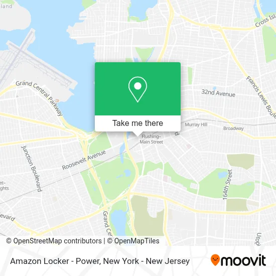
See Amazon Locker - Power, Queens, on the map
Public Transit to Amazon Locker - Power in Queens
Wondering how to get to Amazon Locker - Power in Queens? Moovit helps you find the best way to get to Amazon Locker - Power with step-by-step directions from the nearest public transit station.
Moovit provides free maps and live directions to help you navigate through your city. View schedules, routes, timetables, and find out how long does it take to get to Amazon Locker - Power in real time.
Looking for the nearest stop or station to Amazon Locker - Power? Check out this list of stops closest to your destination: Roosevelt Av/Prince St; Flushing - Main Street; 39 Av/Main St; Roosevelt Av/Main St; Main St/40 Rd; Main St/Roosevelt Av; Flushing-Main St; 41 Rd/College Point Blvd; College Point Blvd/Sanford Av.
Bus: Q19, Q25, Q44-SBS, Q50, Q65, Q98, Q90, Q27, Q63, Q66.Train: PORT WASHINGTON BRANCH.Subway: 7, 7X.
Want to see if there’s another route that gets you there at an earlier time? Moovit helps you find alternative routes or times. Get directions from and directions to Amazon Locker - Power easily from the Moovit App or Website.
We make riding to Amazon Locker - Power easy, which is why over 1.7 million users, including users in Queens, trust Moovit as the best app for public transit. You don’t need to download an individual bus app or train app, Moovit is your all-in-one transit app that helps you find the best bus time or train time available.
For information on prices of bus, subway and train, costs and ride fares to Amazon Locker - Power, please check the Moovit app.
Use the app to navigate to popular places including to the airport, hospital, stadium, grocery store, mall, coffee shop, school, college, and university.
Amazon Locker - Power Address: 40-24 College Point Blvd street in Queens
- Skyview Parc Residential Condo,
- Flushing / Coming Soon (The Shops at Skyview),
- Amazon Locker - Shimon,
- New York - Skyview Center,
- Target,
- Nike Clearance Store,
- Republic Of Couture - Queens,
- Chick-Fil-A,
- Daiso,
- The Shops at SkyView Center,
- Bath & Body Works,
- Auntie Anne's Sky View Center - Flushing,
- Mart World,
- Queens Flushing Mall,
- College Point Roosevelt Ave,
- Lily Tung Psychiatry 精神科護理醫師,
- T-Mobile Authorized Retailer,
- The Grand at Skyview Parc,
- Adidas outlet Store,
- 皇室美容Royal Beauty
Places Near Amazon Locker - Power (Queens)
- 1 Police Plaza, Manhattan,
- Katz's Deli, Manhattan,
- Rockefeller Center, Manhattan,
- Chinatown, Manhattan,
- 376 Hudson Street, Manhattan,
- Pier 83, Manhattan,
- 26 Federal Plaza, Manhattan,
- 66 John Street, Manhattan,
- Bellevue Hospital, Manhattan,
- Mountainside Hospital, Glen Ridge,
- Wall Street, Manhattan,
- San Gennaro Feast, Manhattan,
- 911 Memorial, Manhattan,
- 3 Stone St, Manhattan,
- Queens Center Mall, Queens,
- Hudson Yards, Manhattan,
- qqqq, Manhattan,
- 111 Centre New York City Supreme Court, Manhattan,
- SoHo, Manhattan,
- Times Square, Manhattan
How to get to popular places in New York - New Jersey with public transit
Get around Queens by public transit!
Traveling around Queens has never been so easy. See step by step directions as you travel to any attraction, street or major public transit station. View bus and train schedules, arrival times, service alerts and detailed routes on a map, so you know exactly how to get to anywhere in Queens.
When traveling to any destination around Queens use Moovit's Live Directions with Get Off Notifications to know exactly where and how far to walk, how long to wait for your line, and how many stops are left. Moovit will alert you when it's time to get off — no need to constantly re-check whether yours is the next stop.
Wondering how to use public transit in Queens or how to pay for public transit in Queens? Moovit public transit app can help you navigate your way with public transit easily, and at minimum cost. It includes public transit fees, ticket prices, and costs. Looking for a map of Queens public transit lines? Moovit public transit app shows all public transit maps in Queens with all Bus, Train, Subway, Light Rail, Ferry and Cable Car routes and stops on an interactive map.
New York - New Jersey has 6 transit type(s), including: Bus, Train, Subway, Light Rail, Ferry and Cable Car, operated by several transit agencies, including MTA Subway, Metro-North Railroad, LIRR, PATH, MTA New York City Transit - Express routes, MTA Bus, NJ Transit, NYC Ferry, NICE bus, Bee-Line Bus, NJ Transit Rail, Norwalk Transit District, Hartford Line, River Valley Transit and HART