Directions to Amazon Locker-Rafela (Baltimore) with public transportation
The following transit lines have routes that pass near Amazon Locker-Rafela
 Bus: CITYLINK BROWN, 115, 33, 36.
How to get to Amazon Locker-Rafela by bus?
Click on the bus route to see step by step directions with maps, line arrival times and updated time schedules.
From Hilton Baltimore, Baltimore
34 minFrom The Maryland Zoo In Baltimore, Baltimore
57 minFrom Renaissance Baltimore Harborplace Hotel, Baltimore
31 minFrom University Of Maryland Medical Center, Baltimore
35 minFrom Baltimore VA Medical Center, Baltimore
38 minFrom Inner Harbor, Baltimore
31 minFrom Camden Yards, Baltimore
34 minFrom CFG Bank Arena, Baltimore
35 minFrom I-83 Exit 5 (Maryland Ave/Charles St), Baltimore
36 minFrom Megabus Stop - White Marsh Park & Ride, Baltimore County
28 min
Bus stops near Amazon Locker-Rafela in Baltimore
Bus lines to Amazon Locker-Rafela in Baltimore
What are the closest stations to Amazon Locker-Rafela?
The closest stations to Amazon Locker-Rafela are:
- Belair Rd & Raspe Ave Nb is 2 yards away, 1 min walk.
- Belair Rd & Parkmont Ave Nb is 285 yards away, 4 min walk.
- Fleetwood Ave & Cedonia Ave Eb is 1047 yards away, 13 min walk.
Which bus line stops near Amazon Locker-Rafela?
CITYLINK BROWN (Overlea)
What’s the nearest bus station to Amazon Locker-Rafela in Baltimore?
The nearest bus station to Amazon Locker-Rafela in Baltimore is Belair Rd & Raspe Ave Nb. It’s a 1 min walk away.
What time is the first bus to Amazon Locker-Rafela in Baltimore?
The CITYLINK BROWN is the first bus that goes to Amazon Locker-Rafela in Baltimore. It stops nearby at 4:11 AM.
What time is the last bus to Amazon Locker-Rafela in Baltimore?
The CITYLINK BROWN is the last bus that goes to Amazon Locker-Rafela in Baltimore. It stops nearby at 3:12 AM.
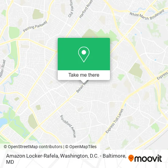
See Amazon Locker-Rafela, Baltimore, on the map
Public Transit to Amazon Locker-Rafela in Baltimore
Wondering how to get to Amazon Locker-Rafela in Baltimore? Moovit helps you find the best way to get to Amazon Locker-Rafela with step-by-step directions from the nearest public transit station.
Moovit provides free maps and live directions to help you navigate through your city. View schedules, routes, timetables, and find out how long does it take to get to Amazon Locker-Rafela in real time.
Looking for the nearest stop or station to Amazon Locker-Rafela? Check out this list of stops closest to your destination: Belair Rd & Raspe Ave Nb; Belair Rd & Parkmont Ave Nb; Fleetwood Ave & Cedonia Ave Eb.
Bus: CITYLINK BROWN, 115, 33, 36.
Want to see if there’s another route that gets you there at an earlier time? Moovit helps you find alternative routes or times. Get directions from and directions to Amazon Locker-Rafela easily from the Moovit App or Website.
We make riding to Amazon Locker-Rafela easy, which is why over 1.5 million users, including users in Baltimore, trust Moovit as the best app for public transit. You don’t need to download an individual bus app or train app, Moovit is your all-in-one transit app that helps you find the best bus time or train time available.
For information on prices of bus and metro, costs and ride fares to Amazon Locker-Rafela, please check the Moovit app.
Use the app to navigate to popular places including to the airport, hospital, stadium, grocery store, mall, coffee shop, school, college, and university.
Amazon Locker-Rafela Address: 6109 Belair Rd Baltimore, MD 21206 street in Baltimore
- Getcoins,
- Tiger Mart,
- Auto Repair Check Engine Light,
- F.O.E Variety Thrift Store,
- Liquor Store,
- 7 Days Cars,
- Global Automotors,
- Two Brothers Carryout,
- Hey Daddys Grille,
- Automotive Solutions,
- Matheo New&Used.Tire Express,
- Credit Union 1,
- Malone Children Memorial Playground,
- Appliance Repair Emergency Services,
- City of Hope Missionary Baptist Church,
- DUNKIN',
- Maryland Recovery Homes,
- Starbuds,
- Crown Motors - Dr. Koons Used Cars,
- Ironclad Medical Staffing Agency
Places Near Amazon Locker-Rafela (Baltimore)
- Georgetown, Washington,
- National Mall, Washington,
- Westfield Montgomery Mall, Montgomery County,
- Camden Yards, Baltimore,
- Washington National Cathedral, Washington,
- Rock Creek Tennis Center, Washington,
- Pennsylvania Ave NW (3rd st and pennsylvania), Washington,
- National Zoo, Washington,
- Washington DC VA Medical Center, Washington,
- National Museum of African American History and Culture, Washington,
- Amazon Hq2, Arlington County,
- Marriott Marquis Washington, DC, Washington,
- M&T Bank Stadium, Baltimore,
- Sibley Memorial Hospital, Washington,
- Warner Theatre, Washington,
- The Anthem, Washington,
- PG Mall, Prince George's County,
- Capital One Arena, Washington,
- Basilica of the National Shrine, Washington,
- Museum Of The Bible, Washington
How to get to popular places in Washington, D.C. - Baltimore, MD with public transit
Get around Baltimore by public transit!
Traveling around Baltimore has never been so easy. See step by step directions as you travel to any attraction, street or major public transit station. View bus and train schedules, arrival times, service alerts and detailed routes on a map, so you know exactly how to get to anywhere in Baltimore.
When traveling to any destination around Baltimore use Moovit's Live Directions with Get Off Notifications to know exactly where and how far to walk, how long to wait for your line, and how many stops are left. Moovit will alert you when it's time to get off — no need to constantly re-check whether yours is the next stop.
Wondering how to use public transit in Baltimore or how to pay for public transit in Baltimore? Moovit public transit app can help you navigate your way with public transit easily, and at minimum cost. It includes public transit fees, ticket prices, and costs. Looking for a map of Baltimore public transit lines? Moovit public transit app shows all public transit maps in Baltimore with all Bus, Train, Metro, Light Rail and Ferry routes and stops on an interactive map.
Washington, D.C. - Baltimore, MD has 5 transit type(s), including: Bus, Train, Metro, Light Rail and Ferry, operated by several transit agencies, including WMATA, Montgomery County Ride On, Fairfax Connector, TheBus, PRTC, DASH - Alexandria, Arlington Transit (ART), RTA of Central Maryland, MDOT MTA, MDOT MTA Light RailLink, MDOT MTA Commuter Bus, MDOT MTA Local Bus, FXBGO!, Virginia Railway Express (VRE) and MARC