How to get to Amazon Locker-Thomai by bus?
Click on the bus route to see step by step directions with maps, line arrival times and updated time schedules.
How to get to Amazon Locker-Thomai by train?
Click on the train route to see step by step directions with maps, line arrival times and updated time schedules.
From TUI Blue Montafon, Gemeinde Tschagguns
141 minFrom Landeskrankenhaus Feldkirch-Notaufnahme, Stadt Feldkirch
109 minFrom Wildpark Feldkirch, Stadt Feldkirch
93 minFrom LKH Rankweil Valduna, Marktgemeinde Rankweil
89 minFrom Bergbahnen Rosshütte, Gemeinde Seefeld In Tirol
276 minFrom Mooserwirt, Gemeinde Sankt Anton am Arlberg
146 minFrom Xxxlutz Restaurant, Stadt Feldkirch
112 min
Bus stops near Amazon Locker-Thomai in Marktgemeinde Wolfurt
Train stations near Amazon Locker-Thomai in Marktgemeinde Wolfurt
Bus lines to Amazon Locker-Thomai in Marktgemeinde Wolfurt
- 151, Bregenz Bahnhof,VIEW
- 148, Hard-Fussach Bahnhof,VIEW
- 131, Bregenz-Kennelbach-Wolfurt-Dornbirn,VIEW
- 830, Bregenz-Alberschwende-Egg-Schwarzenberg-Bezau,VIEW
- SK, Bregenz Bahnhof,VIEW
- 118, Bregenz Bahnhof,VIEW
- 820, Sulzberg Fahl,VIEW
- 821, Scheidegg Bahnhofstraße,VIEW
- 8F2, Egg Zentrum,VIEW
- 8N2, Krumbach Dorf,VIEW
What are the closest stations to Amazon Locker-Thomai?
The closest stations to Amazon Locker-Thomai are:
- Wolfurt Ach is 33 meters away, 1 min walk.
- Wolfurt Inselstraße is 515 meters away, 7 min walk.
- Lauterach Bahnhof is 1240 meters away, 17 min walk.
- Bregenz Riedenburg Bahnhof is 1345 meters away, 18 min walk.
- Kennelbach Kustersberg is 2151 meters away, 28 min walk.
Which bus lines stop near Amazon Locker-Thomai?
These bus lines stop near Amazon Locker-Thomai: 131, 148, 151.
Which train line stops near Amazon Locker-Thomai?
S1 (Bregenz Hafen Bahnhof)
What’s the nearest train station to Amazon Locker-Thomai in Marktgemeinde Wolfurt?
The nearest train station to Amazon Locker-Thomai in Marktgemeinde Wolfurt is Lauterach Bahnhof. It’s a 17 min walk away.
What’s the nearest bus station to Amazon Locker-Thomai in Marktgemeinde Wolfurt?
The nearest bus station to Amazon Locker-Thomai in Marktgemeinde Wolfurt is Wolfurt Ach. It’s a 1 min walk away.
What time is the first train to Amazon Locker-Thomai in Marktgemeinde Wolfurt?
The S1 is the first train that goes to Amazon Locker-Thomai in Marktgemeinde Wolfurt. It stops nearby at 4:16 AM.
What time is the last train to Amazon Locker-Thomai in Marktgemeinde Wolfurt?
The S1 is the last train that goes to Amazon Locker-Thomai in Marktgemeinde Wolfurt. It stops nearby at 1:41 AM.
What time is the first bus to Amazon Locker-Thomai in Marktgemeinde Wolfurt?
The 151 is the first bus that goes to Amazon Locker-Thomai in Marktgemeinde Wolfurt. It stops nearby at 4:42 AM.
What time is the last bus to Amazon Locker-Thomai in Marktgemeinde Wolfurt?
The 151 is the last bus that goes to Amazon Locker-Thomai in Marktgemeinde Wolfurt. It stops nearby at 11:34 PM.
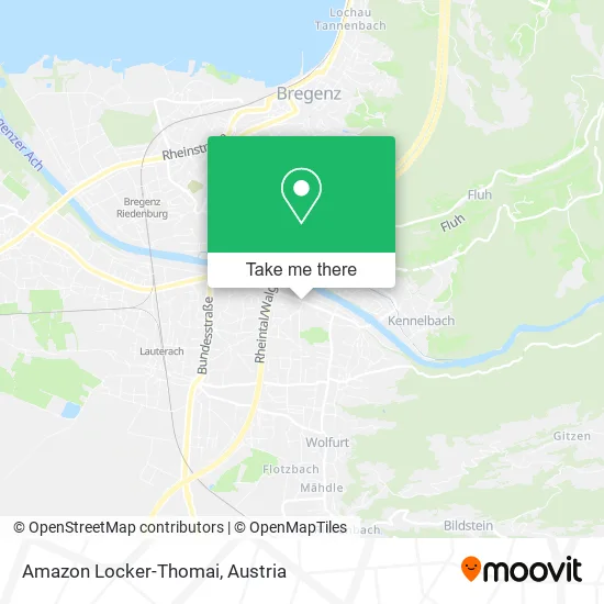
See Amazon Locker-Thomai, Marktgemeinde Wolfurt, on the map
Public Transit to Amazon Locker-Thomai in Marktgemeinde Wolfurt
Wondering how to get to Amazon Locker-Thomai in Marktgemeinde Wolfurt? Moovit helps you find the best way to get to Amazon Locker-Thomai with step-by-step directions from the nearest public transit station.
Moovit provides free maps and live directions to help you navigate through your city. View schedules, routes, timetables, and find out how long does it take to get to Amazon Locker-Thomai in real time.
Looking for the nearest stop or station to Amazon Locker-Thomai? Check out this list of stops closest to your destination: Wolfurt Ach; Wolfurt Inselstraße; Lauterach Bahnhof; Bregenz Riedenburg Bahnhof; Kennelbach Kustersberg.
Bus: 131, 148, 151, 830, SK.Train: S1, 1, R5, R1, A3, A3, REX1, S3, 402-V.
Want to see if there’s another route that gets you there at an earlier time? Moovit helps you find alternative routes or times. Get directions from and directions to Amazon Locker-Thomai easily from the Moovit App or Website.
We make riding to Amazon Locker-Thomai easy, which is why over 1.5 million users, including users in Marktgemeinde Wolfurt, trust Moovit as the best app for public transit. You don’t need to download an individual bus app or train app, Moovit is your all-in-one transit app that helps you find the best bus time or train time available.
For information on prices of train and bus, costs and ride fares to Amazon Locker-Thomai, please check the Moovit app.
Use the app to navigate to popular places including to the airport, hospital, stadium, grocery store, mall, coffee shop, school, college, and university.
Amazon Locker-Thomai Address: Achstraße 6922 Wolfurt street in Marktgemeinde Wolfurt
- Wörz Gabriela - Tabaktrafik,
- Eni Café,
- Eni Shop,
- eni,
- Erhard Wolff,
- Ächler Brotlädele,
- Schwanenbaeckerei,
- Pawag Verpackungen,
- Dun Huang,
- HELIOS Feuerwerke,
- Rohner Thomas Zeltverleih GmbH,
- Best of Golf & Ski Verlagsgmbh International,
- Mäser Werbung Druck,
- Marketing-Consulting,
- Hartmuth Erwin Lohs,
- Wolfurt Trophy Beach Volleyball,
- Dr. Roland Gmeiner,
- Matthias Gmeiner - Grafikdesign & Marktkommunikation,
- Mähr Walter Finanzierungen-,
- SC Kennelbach Josef Kalb
Places Near Amazon Locker-Thomai (Marktgemeinde Wolfurt)
- Strandbad Gänsehäufel, Donaustadt,
- Auhof-Center, Penzing,
- Feuerhalle Simmering, Simmering,
- Lugner City, Rudolfsheim-Fünfhaus,
- Klinik Floridsdorf (Krankenhaus Nord), Floridsdorf,
- Ronacher, 1., Innere Stadt,
- Leopoldauer Alm, Floridsdorf,
- Kabarett Simpl, 1., Innere Stadt,
- Ghegastraße 3, Landstraße,
- Schiffsanleger Wien-Nussdorf, Döbling,
- Donauzentrum, Donaustadt,
- Setagayapark, Döbling,
- Thomas-Klestil-Platz, Landstraße,
- Wien Rennbahn Freudenau, Leopoldstadt,
- Schweizerhaus (Karl Kolariks Schweizerhaus), Leopoldstadt,
- Zentralfriedhof Halle 3, Simmering,
- Türkenschanzpark, Währing,
- Mariahilfer Strasse, Mariahilf,
- 10er Marie, Ottakring,
- Raimund-Theater, Mariahilf
How to get to popular places in Austria with public transit
Get around Marktgemeinde Wolfurt by public transit!
Traveling around Marktgemeinde Wolfurt has never been so easy. See step by step directions as you travel to any attraction, street or major public transit station. View bus and train schedules, arrival times, service alerts and detailed routes on a map, so you know exactly how to get to anywhere in Marktgemeinde Wolfurt.
When traveling to any destination around Marktgemeinde Wolfurt use Moovit's Live Directions with Get Off Notifications to know exactly where and how far to walk, how long to wait for your line, and how many stops are left. Moovit will alert you when it's time to get off — no need to constantly re-check whether yours is the next stop.
Wondering how to use public transit in Marktgemeinde Wolfurt or how to pay for public transit in Marktgemeinde Wolfurt? Moovit public transit app can help you navigate your way with public transit easily, and at minimum cost. It includes public transit fees, ticket prices, and costs. Looking for a map of Marktgemeinde Wolfurt public transit lines? Moovit public transit app shows all public transit maps in Marktgemeinde Wolfurt with all Bus, Train, Subway, Light Rail, Ferry and Funicular routes and stops on an interactive map.
Austria has 6 transit type(s), including: Bus, Train, Subway, Light Rail, Ferry and Funicular, operated by several transit agencies, including Wiener Linien GmbH & Co KG, Vienna Airport Lines, OEBB Personenverkehr AG Kundenservice, Wiener Lokalbahnen GmbH, City Air Terminal Betriebsgesellschaft m.b.H., CAT, Österreichische Postbus AG, VOR GmbH, Graz Linien, Graz-Köflacher Bahn und Busbetrieb GmbH, Steiermarkbahn und Bus GmbH, Linz Linien GmbH, Salzburg AG (Salzburger Lokalbahn), Salzburg AG (OBus) and KMG Klagenfurt Mobil GmbH