How to get to Amazon Locker-Vampire by bus?
Click on the bus route to see step by step directions with maps, line arrival times and updated time schedules.
From Lexington Market, Baltimore
46 minFrom University Of Maryland Baltimore (Umbc), Baltimore County
60 minFrom Johns Hopkins Mountcastle Auditorium, Baltimore
70 minFrom Baltimore Greyhound Station, Baltimore
46 minFrom National Aquarium, Baltimore
53 minFrom I-70 at Security Blvd Baltimore City Lot Park & Ride, Baltimore
41 minFrom Harford Road, Baltimore
48 minFrom Renaissance Baltimore Harborplace Hotel, Baltimore
48 minFrom Hanover, Baltimore
67 minFrom Federal Hill, Baltimore
65 min
How to get to Amazon Locker-Vampire by metro?
Click on the metro route to see step by step directions with maps, line arrival times and updated time schedules.
Bus stops near Amazon Locker-Vampire in Baltimore
- Reisterstown Rd & Rogers Ave Nb, 2 min walk,VIEW
- Reisterstown Rd & Rogers Ave Sb, 2 min walk,VIEW
- Reisterstown Rd & Northern Pkwy Nb, 4 min walk,VIEW
- Rogers Ave Metro Station Bay 5, 8 min walk,VIEW
- Rogers Ave Station, 8 min walk,VIEW
- Rogers Ave Metro Station Bay 2, 9 min walk,VIEW
- Rogers Ave Metro Station Bay 1, 9 min walk,VIEW
Metro station near Amazon Locker-Vampire in Baltimore
- Reisterstown Plaza Metro, 19 min walk,VIEW
Light Rail stations near Amazon Locker-Vampire in Baltimore
- Cold Spring Lane, 32 min walk,VIEW
Bus lines to Amazon Locker-Vampire in Baltimore
What are the closest stations to Amazon Locker-Vampire?
The closest stations to Amazon Locker-Vampire are:
- Reisterstown Rd & Rogers Ave Nb is 110 yards away, 2 min walk.
- Reisterstown Rd & Rogers Ave Sb is 131 yards away, 2 min walk.
- Reisterstown Rd & Northern Pkwy Nb is 293 yards away, 4 min walk.
- Rogers Ave Metro Station Bay 5 is 617 yards away, 8 min walk.
- Rogers Ave Station is 650 yards away, 8 min walk.
- Rogers Ave Metro Station Bay 2 is 665 yards away, 9 min walk.
- Rogers Ave Metro Station Bay 1 is 693 yards away, 9 min walk.
- Reisterstown Plaza Metro is 1626 yards away, 19 min walk.
- Cold Spring Lane is 2719 yards away, 32 min walk.
Which bus lines stop near Amazon Locker-Vampire?
These bus lines stop near Amazon Locker-Vampire: 30, 34, 80, 83.
Which metro line stops near Amazon Locker-Vampire?
METRO (Towards Owing Mills)
What’s the nearest metro station to Amazon Locker-Vampire in Baltimore?
The nearest metro station to Amazon Locker-Vampire in Baltimore is Reisterstown Plaza Metro. It’s a 19 min walk away.
What’s the nearest bus station to Amazon Locker-Vampire in Baltimore?
The nearest bus stations to Amazon Locker-Vampire in Baltimore are Reisterstown Rd & Rogers Ave Nb and Reisterstown Rd & Rogers Ave Sb. The closest one is a 2 min walk away.
What time is the first light rail to Amazon Locker-Vampire in Baltimore?
The LIGHT RAILLINK is the first light rail that goes to Amazon Locker-Vampire in Baltimore. It stops nearby at 4:28 AM.
What time is the last light rail to Amazon Locker-Vampire in Baltimore?
The LIGHT RAILLINK is the last light rail that goes to Amazon Locker-Vampire in Baltimore. It stops nearby at 12:45 AM.
What time is the first metro to Amazon Locker-Vampire in Baltimore?
The METRO is the first metro that goes to Amazon Locker-Vampire in Baltimore. It stops nearby at 3:45 AM.
What time is the last metro to Amazon Locker-Vampire in Baltimore?
The METRO is the last metro that goes to Amazon Locker-Vampire in Baltimore. It stops nearby at 12:23 AM.
What time is the first bus to Amazon Locker-Vampire in Baltimore?
The 80 is the first bus that goes to Amazon Locker-Vampire in Baltimore. It stops nearby at 3:00 AM.
What time is the last bus to Amazon Locker-Vampire in Baltimore?
The 80 is the last bus that goes to Amazon Locker-Vampire in Baltimore. It stops nearby at 3:22 AM.
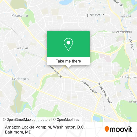
See Amazon Locker-Vampire, Baltimore, on the map
Public Transit to Amazon Locker-Vampire in Baltimore
Wondering how to get to Amazon Locker-Vampire in Baltimore? Moovit helps you find the best way to get to Amazon Locker-Vampire with step-by-step directions from the nearest public transit station.
Moovit provides free maps and live directions to help you navigate through your city. View schedules, routes, timetables, and find out how long does it take to get to Amazon Locker-Vampire in real time.
Looking for the nearest stop or station to Amazon Locker-Vampire? Check out this list of stops closest to your destination: Reisterstown Rd & Rogers Ave Nb; Reisterstown Rd & Rogers Ave Sb; Reisterstown Rd & Northern Pkwy Nb; Rogers Ave Metro Station Bay 5; Rogers Ave Station; Rogers Ave Metro Station Bay 2; Rogers Ave Metro Station Bay 1; Reisterstown Plaza Metro; Cold Spring Lane.
Bus: 30, 34, 80, 83, 89, 82, 94.Metro: METRO.
Want to see if there’s another route that gets you there at an earlier time? Moovit helps you find alternative routes or times. Get directions from and directions to Amazon Locker-Vampire easily from the Moovit App or Website.
We make riding to Amazon Locker-Vampire easy, which is why over 1.5 million users, including users in Baltimore, trust Moovit as the best app for public transit. You don’t need to download an individual bus app or train app, Moovit is your all-in-one transit app that helps you find the best bus time or train time available.
For information on prices of bus and metro, costs and ride fares to Amazon Locker-Vampire, please check the Moovit app.
Use the app to navigate to popular places including to the airport, hospital, stadium, grocery store, mall, coffee shop, school, college, and university.
Amazon Locker-Vampire Address: Baltimore, MD 21215 street in Baltimore
- PNC Mortgage,
- Hilltop Shopping Center,
- District Tobacco,
- Baltimore File Cabinet & Desk Locks,
- Pizza Hut,
- Western Union,
- Shear Images,
- Maryland Motor Vehicle Administration (MVA),
- Mva,
- Qa Testing,
- 202,
- Forever Wireless,
- Queen Anne Driving School,
- Dare It Auto Center LL,
- Success Auto Sales and Repairs,
- Reisterstown and Rogers,
- Elite Tags,
- Sha's Place Salon,
- Mold and Water Damage Pros,
- Billennial Foundation
Places Near Amazon Locker-Vampire (Baltimore)
- National Museum of African American History and Culture, Washington,
- Museum Of The Bible, Washington,
- Camden Yards, Baltimore,
- Washington DC VA Medical Center, Washington,
- The Anthem, Washington,
- Pennsylvania Ave NW (3rd st and pennsylvania), Washington,
- Sibley Memorial Hospital, Washington,
- Warner Theatre, Washington,
- Westfield Montgomery Mall, Montgomery County,
- Capital One Arena, Washington,
- M&T Bank Stadium, Baltimore,
- Marriott Marquis Washington, DC, Washington,
- National Zoo, Washington,
- PG Mall, Prince George's County,
- Washington National Cathedral, Washington,
- Amazon Hq2, Arlington County,
- National Mall, Washington,
- Rock Creek Tennis Center, Washington,
- Basilica of the National Shrine, Washington,
- Georgetown, Washington
How to get to popular places in Washington, D.C. - Baltimore, MD with public transit
Get around Baltimore by public transit!
Traveling around Baltimore has never been so easy. See step by step directions as you travel to any attraction, street or major public transit station. View bus and train schedules, arrival times, service alerts and detailed routes on a map, so you know exactly how to get to anywhere in Baltimore.
When traveling to any destination around Baltimore use Moovit's Live Directions with Get Off Notifications to know exactly where and how far to walk, how long to wait for your line, and how many stops are left. Moovit will alert you when it's time to get off — no need to constantly re-check whether yours is the next stop.
Wondering how to use public transit in Baltimore or how to pay for public transit in Baltimore? Moovit public transit app can help you navigate your way with public transit easily, and at minimum cost. It includes public transit fees, ticket prices, and costs. Looking for a map of Baltimore public transit lines? Moovit public transit app shows all public transit maps in Baltimore with all Bus, Train, Metro, Light Rail and Ferry routes and stops on an interactive map.
Washington, D.C. - Baltimore, MD has 5 transit type(s), including: Bus, Train, Metro, Light Rail and Ferry, operated by several transit agencies, including WMATA, Montgomery County Ride On, Fairfax Connector, TheBus, PRTC, DASH - Alexandria, Arlington Transit (ART), RTA of Central Maryland, MDOT MTA, MDOT MTA Light RailLink, MDOT MTA Commuter Bus, MDOT MTA Local Bus, FXBGO!, Virginia Railway Express (VRE) and MARC