Directions to Amazon Locker-al (Baltimore) with public transportation
The following transit lines have routes that pass near Amazon Locker-al
 Bus: CITYLINK RED, 52, LAKE AVE, 30, 33.
How to get to Amazon Locker-al by bus?
Click on the bus route to see step by step directions with maps, line arrival times and updated time schedules.
From I-83 Exit 5 (Maryland Ave/Charles St), Baltimore
36 minFrom Federal Hill, Baltimore
46 minFrom Camden Yards, Baltimore
44 minFrom M&T Bank Stadium, Baltimore
57 minFrom Druid Hill Park, Baltimore
53 minFrom Power Plant Live, Baltimore
37 minFrom Ravens Walk @ M&T Bank Stadium, Baltimore
51 minFrom Johns Hopkins Bayview Medical Center, Baltimore
66 minFrom I-83 Exit 16 (Timonium Road), Baltimore County
38 minFrom Pigtown / Washington Village, Baltimore
50 min
Bus stops near Amazon Locker-al in Baltimore
Light Rail stations near Amazon Locker-al in Baltimore
- Falls Road, 39 min walk,VIEW
Bus lines to Amazon Locker-al in Baltimore
What are the closest stations to Amazon Locker-al?
The closest stations to Amazon Locker-al are:
- York Rd & Gittings Ave Sb is 59 yards away, 1 min walk.
- York Rd & Walker Ave Nb is 100 yards away, 2 min walk.
- Northern Pkwy & York Rd FS Wb is 759 yards away, 10 min walk.
- Falls Road is 3313 yards away, 39 min walk.
Which bus line stops near Amazon Locker-al?
CITYLINK RED (Towson Town Center)
What’s the nearest bus station to Amazon Locker-al in Baltimore?
The nearest bus station to Amazon Locker-al in Baltimore is York Rd & Gittings Ave Sb. It’s a 1 min walk away.
What time is the first light rail to Amazon Locker-al in Baltimore?
The LIGHT RAILLINK is the first light rail that goes to Amazon Locker-al in Baltimore. It stops nearby at 4:32 AM.
What time is the last light rail to Amazon Locker-al in Baltimore?
The LIGHT RAILLINK is the last light rail that goes to Amazon Locker-al in Baltimore. It stops nearby at 1:09 AM.
What time is the first bus to Amazon Locker-al in Baltimore?
The CITYLINK RED is the first bus that goes to Amazon Locker-al in Baltimore. It stops nearby at 3:00 AM.
What time is the last bus to Amazon Locker-al in Baltimore?
The CITYLINK RED is the last bus that goes to Amazon Locker-al in Baltimore. It stops nearby at 3:05 AM.
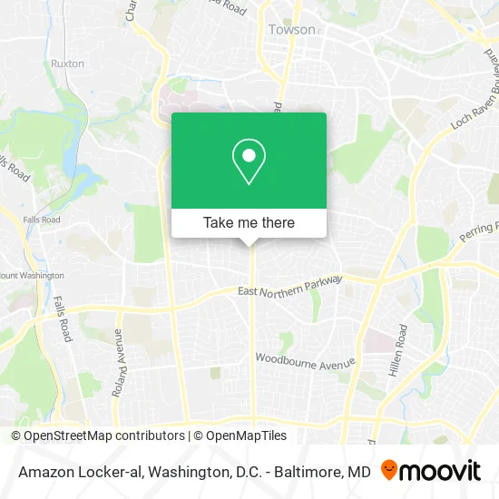
See Amazon Locker-al, Baltimore, on the map
Public Transit to Amazon Locker-al in Baltimore
Wondering how to get to Amazon Locker-al in Baltimore? Moovit helps you find the best way to get to Amazon Locker-al with step-by-step directions from the nearest public transit station.
Moovit provides free maps and live directions to help you navigate through your city. View schedules, routes, timetables, and find out how long does it take to get to Amazon Locker-al in real time.
Looking for the nearest stop or station to Amazon Locker-al? Check out this list of stops closest to your destination: York Rd & Gittings Ave Sb; York Rd & Walker Ave Nb; Northern Pkwy & York Rd FS Wb; Falls Road.
Bus: CITYLINK RED, 52, LAKE AVE, 30, 33.
Want to see if there’s another route that gets you there at an earlier time? Moovit helps you find alternative routes or times. Get directions from and directions to Amazon Locker-al easily from the Moovit App or Website.
We make riding to Amazon Locker-al easy, which is why over 1.5 million users, including users in Baltimore, trust Moovit as the best app for public transit. You don’t need to download an individual bus app or train app, Moovit is your all-in-one transit app that helps you find the best bus time or train time available.
For information on prices of bus and light rail, costs and ride fares to Amazon Locker-al, please check the Moovit app.
Use the app to navigate to popular places including to the airport, hospital, stadium, grocery store, mall, coffee shop, school, college, and university.
Amazon Locker-al Address: Baltimore, MD 21212 street in Baltimore
- Habtemariam, Zemen A,
- Quickway Japanese Hibachi,
- Wells Fargo,
- Score! Educational Ctr,
- Diamond Carpet Cleaning Carpet Cleaning,
- First National Bank ATM,
- PNC Mortgage,
- Vera Zejmis, Pharmd,
- Always Green Carpet Cleaning Carpet Cleaning,
- 6401 York Rd Bus Stop,
- Martinizing Dry Cleaning,
- Hibachi Express Japanese Grill,
- Drumcastle Center,
- Joint Chiropractic,
- 6401 York Road,
- Baltimore County Department of Health and Human Services,
- Orkin Pest & Termite Control,
- WESTERN UNION,
- Appliances Plumbing,
- 3 Ring Theater
Places Near Amazon Locker-al (Baltimore)
- Amazon Hq2, Arlington County,
- National Museum of African American History and Culture, Washington,
- Georgetown, Washington,
- M&T Bank Stadium, Baltimore,
- National Zoo, Washington,
- The Anthem, Washington,
- Washington DC VA Medical Center, Washington,
- Washington National Cathedral, Washington,
- Rock Creek Tennis Center, Washington,
- Marriott Marquis Washington, DC, Washington,
- Basilica of the National Shrine, Washington,
- Warner Theatre, Washington,
- Museum Of The Bible, Washington,
- PG Mall, Prince George's County,
- Westfield Montgomery Mall, Montgomery County,
- Sibley Memorial Hospital, Washington,
- Camden Yards, Baltimore,
- National Mall, Washington,
- Capital One Arena, Washington,
- Pennsylvania Ave NW (3rd st and pennsylvania), Washington
How to get to popular places in Washington, D.C. - Baltimore, MD with public transit
Get around Baltimore by public transit!
Traveling around Baltimore has never been so easy. See step by step directions as you travel to any attraction, street or major public transit station. View bus and train schedules, arrival times, service alerts and detailed routes on a map, so you know exactly how to get to anywhere in Baltimore.
When traveling to any destination around Baltimore use Moovit's Live Directions with Get Off Notifications to know exactly where and how far to walk, how long to wait for your line, and how many stops are left. Moovit will alert you when it's time to get off — no need to constantly re-check whether yours is the next stop.
Wondering how to use public transit in Baltimore or how to pay for public transit in Baltimore? Moovit public transit app can help you navigate your way with public transit easily, and at minimum cost. It includes public transit fees, ticket prices, and costs. Looking for a map of Baltimore public transit lines? Moovit public transit app shows all public transit maps in Baltimore with all Bus, Train, Metro, Light Rail and Ferry routes and stops on an interactive map.
Washington, D.C. - Baltimore, MD has 5 transit type(s), including: Bus, Train, Metro, Light Rail and Ferry, operated by several transit agencies, including WMATA, Montgomery County Ride On, Fairfax Connector, TheBus, PRTC, DASH - Alexandria, Arlington Transit (ART), RTA of Central Maryland, MDOT MTA, MDOT MTA Light RailLink, MDOT MTA Commuter Bus, MDOT MTA Local Bus, FXBGO!, Virginia Railway Express (VRE) and MARC