Directions to Ambep (Angra Dos Reis) with public transportation
The following transit lines have routes that pass near Ambep
 Bus: 102, 104, 106, 230, B220.
- Ferry: ANGRA DOS REIS - ILHA GRANDE, ANGRA DOS REIS - ILHA GRANDE.
How to get to Ambep by bus?
Click on the bus route to see step by step directions with maps, line arrival times and updated time schedules.
From Praça da Monsuaba, Jacuecanga
59 minFrom Rua Doce Angra 735, Jacuecanga
40 minFrom Condominio Retiro Dos Ubás, Cunhambebe
53 minFrom Estrada da Caputera, Jacuecanga
51 minFrom Climarine, Jacuecanga
39 minFrom Pousada do Engenho de Bracuhy, Cunhambebe
83 minFrom Praia Das Araras, Jacuecanga
80 minFrom Rua Bahia - Bracuí, Cunhambebe
75 minFrom Posto de Gasolina Marina Parque Verolme Ltda, Jacuecanga
41 minFrom Instituto Médico Legal - Angra dos Reis, Cunhambebe
75 min
Bus stops near Ambep in Angra Dos Reis
- Rua Coronel Carvalho, 230a, 3 min walk,VIEW
- Ponto De Embarque 04 - Praça Do Porto, 3 min walk,VIEW
- Centro / Praça Do Porto, 4 min walk,VIEW
- Ponto De Embarque 06 - Praça Do Porto, 4 min walk,VIEW
- Ponto De Embarque 07 - Praça Do Porto, 4 min walk,VIEW
- Centro / Largo Da Lapa, 5 min walk,VIEW
- Centro / Santa Luzia, 5 min walk,VIEW
- Centro / Largo Da Lapa II, 5 min walk,VIEW
- Ponto De Embarque 10 - Lapa, 5 min walk,VIEW
- Ponto 01 - Santa Luzia, 5 min walk,VIEW
- Ponto De Embarque 11 - Lapa, 5 min walk,VIEW
Ferry station near Ambep in Angra Dos Reis
- Estação Santa Luzia (Angra Dos Reis) ⛴, 28 min walk,VIEW
Bus lines to Ambep in Angra Dos Reis
- C05, Retiro,VIEW
- T11, Ponta Leste (via Jacuecanga),VIEW
- B106, Jacuecanga (via Morro da Cruz),VIEW
- 206, Banqueta,VIEW
- 207, Japuíba (via Morro da Cruz - Circular),VIEW
- B207, Japuíba (via Rio-Santos / Circular),VIEW
- 224, Vila Nova,VIEW
- 225, Campo Belo,VIEW
- C05B, Centro (via Balneário),VIEW
- 205, Areal,VIEW
- B203, Serra D'Agua (Túnel),VIEW
- 208, Belém (Circular),VIEW
- A220, Japuíba (Via Gamboa - Circular),VIEW
- B220, Japuíba (Via Balneário / Ribeira - Circular),VIEW
- 221, Nova Angra,VIEW
- B221, Nova Angra (via Gamboa / Ribeira),VIEW
- 203, Serra D'Água (Via Zungu),VIEW
- 204, Centro,VIEW
- B206, Centro (via Balneário),VIEW
- C206, Centro (Saída Vale da Banqueta),VIEW
What are the closest stations to Ambep?
The closest stations to Ambep are:
- Rua Coronel Carvalho, 230a is 194 meters away, 3 min walk.
- Ponto De Embarque 04 - Praça Do Porto is 220 meters away, 3 min walk.
- Centro / Praça Do Porto is 232 meters away, 4 min walk.
- Ponto De Embarque 06 - Praça Do Porto is 247 meters away, 4 min walk.
- Ponto De Embarque 07 - Praça Do Porto is 251 meters away, 4 min walk.
- Centro / Largo Da Lapa is 309 meters away, 5 min walk.
- Centro / Santa Luzia is 337 meters away, 5 min walk.
- Centro / Largo Da Lapa II is 345 meters away, 5 min walk.
- Ponto De Embarque 10 - Lapa is 353 meters away, 5 min walk.
- Ponto 01 - Santa Luzia is 356 meters away, 5 min walk.
- Ponto De Embarque 11 - Lapa is 365 meters away, 5 min walk.
- Estação Santa Luzia (Angra Dos Reis) ⛴ is 2095 meters away, 28 min walk.
Which bus lines stop near Ambep?
These bus lines stop near Ambep: 102, 104, 106, 230, B220, T11.
What’s the nearest bus station to Ambep in Angra Dos Reis?
The nearest bus stations to Ambep in Angra Dos Reis are Rua Coronel Carvalho, 230a and Ponto De Embarque 04 - Praça Do Porto. The closest one is a 3 min walk away.
What’s the nearest ferry station to Ambep in Angra Dos Reis?
The nearest ferry station to Ambep in Angra Dos Reis is Estação Santa Luzia (Angra Dos Reis) ⛴. It’s a 28 min walk away.
What time is the first bus to Ambep in Angra Dos Reis?
The T20 is the first bus that goes to Ambep in Angra Dos Reis. It stops nearby at 4:50 AM.
What time is the last bus to Ambep in Angra Dos Reis?
The T11 is the last bus that goes to Ambep in Angra Dos Reis. It stops nearby at 2:01 AM.
What time is the first ferry to Ambep in Angra Dos Reis?
The ANGRA DOS REIS - ILHA GRANDE is the first ferry that goes to Ambep in Angra Dos Reis. It stops nearby at 8:35 AM.
What time is the last ferry to Ambep in Angra Dos Reis?
The ANGRA DOS REIS - ILHA GRANDE is the last ferry that goes to Ambep in Angra Dos Reis. It stops nearby at 6:30 PM.
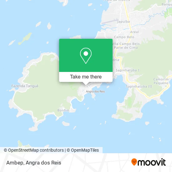
See Ambep, Angra Dos Reis, on the map
Public Transit to Ambep in Angra Dos Reis
Wondering how to get to Ambep in Angra Dos Reis? Moovit helps you find the best way to get to Ambep with step-by-step directions from the nearest public transit station.
Moovit provides free maps and live directions to help you navigate through your city. View schedules, routes, timetables, and find out how long does it take to get to Ambep in real time.
Looking for the nearest stop or station to Ambep? Check out this list of stops closest to your destination: Rua Coronel Carvalho; Ponto De Embarque 04 - Praça Do Porto; Centro / Praça Do Porto; Ponto De Embarque 06 - Praça Do Porto; Ponto De Embarque 07 - Praça Do Porto; Centro / Largo Da Lapa; Centro / Santa Luzia; Centro / Largo Da Lapa II; Ponto De Embarque 10 - Lapa; Ponto 01 - Santa Luzia; Ponto De Embarque 11 - Lapa; Estação Santa Luzia (Angra Dos Reis) ⛴.
Bus: 102, 104, 106, 230, B220, T11, C05, B106, 206, 207, C05B, 205, B203, 208, A220, 221, B221, 203, 204, B206, C206.Ferry: ANGRA DOS REIS - ILHA GRANDE, ANGRA DOS REIS - ILHA GRANDE.
Want to see if there’s another route that gets you there at an earlier time? Moovit helps you find alternative routes or times. Get directions from and directions to Ambep easily from the Moovit App or Website.
We make riding to Ambep easy, which is why over 1.5 million users, including users in Angra Dos Reis, trust Moovit as the best app for public transit. You don’t need to download an individual bus app or train app, Moovit is your all-in-one transit app that helps you find the best bus time or train time available.
For information on prices of bus, costs and ride fares to Ambep, please check the Moovit app.
Use the app to navigate to popular places including to the airport, hospital, stadium, grocery store, mall, coffee shop, school, college, and university.
Ambep Address: Rua Coronel Carvalho, 539 Centro Angra dos Reis-RJ 23900-315 street in Angra Dos Reis
- R. Castro Cardiologistas,
- Casa Mineira Produtos de Minas,
- Platta Angra dos Reis,
- Samara Vieira de Medei,
- Alergotop,
- Clínica de Imagem Winston de Andrade,
- Andréa de Brito,
- Karina,
- Lapis de Cor,
- Kings Coast,
- S Koracakis Agência Navios Estiva,
- Studio Ester Rosa,
- Patricia's Hair,
- Radiologia Odontológica,
- Ultra-Sonografia Misto Winfpon Marques de Andrade,
- Ultra Sonogr Winston M de Andrade,
- Centro Especializado Em Rpg,
- Ninina Kids,
- Angra Cad,
- Galpao03
Places Near Ambep (Angra Dos Reis)
- Rua Prefeito João Gregório Galindo 2487, Angra Dos Reis,
- Alambique Engenho D'Ouro, Parati,
- Rua Cônegos Bittencourt, Angra Dos Reis,
- BR 101, Km 508 s/n, Cunhambebe,
- Centro Histórico de Paraty, Parati,
- Rua Prefeito João Gregório Galindo, Cunhambebe,
- Praia do Laboratório, Angra Dos Reis,
- Avenida Antônio Bertholdo da Silva Jordão 7346, Jacuecanga,
- Avenida Almirante Jair Carneiro Toscano de Brito 110, Angra Dos Reis,
- Rodovia Procurador Haroldo Fernandes Duarte, Km 513,5 s / n, Cunhambebe,
- Garatucaia, Angra Dos Reis,
- Praia de Paraty Mirim, Parati,
- Condominio Laranjeiras, Parati Mirim,
- Vila Residencial De Mambucaba, Mambucaba,
- Verolme, Jacuecanga,
- Rodovia BR 101, Km 533 s/n, Mambucaba,
- Mambucaba, Mambucaba,
- Cachoeira do Tobogã, Parati,
- praia jabaquara - parati, Parati,
- Vila Galé Eco Resort De Angra, Angra Dos Reis
How to get to popular places in Angra dos Reis with public transit
Get around Angra Dos Reis by public transit!
Traveling around Angra Dos Reis has never been so easy. See step by step directions as you travel to any attraction, street or major public transit station. View bus and train schedules, arrival times, service alerts and detailed routes on a map, so you know exactly how to get to anywhere in Angra Dos Reis.
When traveling to any destination around Angra Dos Reis use Moovit's Live Directions with Get Off Notifications to know exactly where and how far to walk, how long to wait for your line, and how many stops are left. Moovit will alert you when it's time to get off — no need to constantly re-check whether yours is the next stop.
Wondering how to use public transit in Angra Dos Reis or how to pay for public transit in Angra Dos Reis? Moovit public transit app can help you navigate your way with public transit easily, and at minimum cost. It includes public transit fees, ticket prices, and costs. Looking for a map of Angra Dos Reis public transit lines? Moovit public transit app shows all public transit maps in Angra Dos Reis with all Bus and Ferry routes and stops on an interactive map.
Angra dos Reis has 2 transit type(s), including: Bus and Ferry, operated by several transit agencies, including Viação Senhor do Bonfim, Colitur Transportes Rodoviários, Cooparatyense (Vans), Costa Verde Transportes, Barcas Rio, Objetiva Tour, Vilanova Tour, Rodoviário Oceano, BusUFF and Colitur (Tarifa Zero - Paraty)