How to get to Amber Communications Lab by bus?
Click on the bus route to see step by step directions with maps, line arrival times and updated time schedules.
From BPCL Refinery Plant, Chembur, Chembur
67 minFrom Wadala Truck Terminal, Sion Koliwada
58 minFrom Candies in Pali Hill-Bandra West, Vandre West
52 minFrom Pratiksha Nagar, Sion Koliwada
52 minFrom Mahim Dargah, Mahim
41 minFrom Sri Shanmukhananda, Sion Koliwada
44 minFrom Mahim Church Signal, Mahim
37 min
How to get to Amber Communications Lab by train?
Click on the train route to see step by step directions with maps, line arrival times and updated time schedules.
How to get to Amber Communications Lab by metro?
Click on the metro route to see step by step directions with maps, line arrival times and updated time schedules.
Bus stops near Amber Communications Lab in Malabar Hill
Train stations near Amber Communications Lab in Malabar Hill
Metro station near Amber Communications Lab in Malabar Hill
- Grant Road Metro, 23 min walk,VIEW
Bus lines to Amber Communications Lab in Malabar Hill
- A-37, Kurla Station (W),VIEW
- A-63, Byculla Station (W),VIEW
- A-76, Byculla Station (W) ,VIEW
- A-78, Dr.Shyamaprasad Mukherjee Chowk (Museum),VIEW
- A-132, Colaba Bus Station,VIEW
- 151, J.Mehta Marg (Napean Sea Road),VIEW
- A-77, Godrej Chowk (Kemps Corner),VIEW
- 28, JVPD Bus Station - Chhatrapati Shivaji Maharaj Terminus,VIEW
- 57, Prabodhankar Thackeray Udyan Bus Station (Sewree) - Walkeshwar,VIEW
- A-62, Vidyavihar Bus Station - Pandit Paluskar Chowk (Opera House),VIEW
- 83, Santacruz Depot - Pandit Paluskar Chowk (Opera House),VIEW
- 83, Santacruz Depot - Colaba Bus Station,VIEW
- C-86, Backbay Depot - Bandra (W) Bus Station,VIEW
- 88, Pratiksha Nagar Depot - Mantralaya,VIEW
- A-89, Worli Depot - Mantralaya,VIEW
- A-155, Grant Road Station (W) - Cumbala Hill Post Office,VIEW
- C-305, Backbay Depot - Dharavi Depot,VIEW
- A-84, Dr.Shyamaprasad Mukherjee Chowk (Museum),VIEW
What are the closest stations to Amber Communications Lab?
The closest stations to Amber Communications Lab are:
- Breach Candy Hospital is 125 meters away, 2 min walk.
- Mafatlal Park is 256 meters away, 4 min walk.
- Cumbala Hill Post Office is 580 meters away, 8 min walk.
- Grant Road is 1468 meters away, 20 min walk.
- Mahalaxmi is 1576 meters away, 21 min walk.
- Grant Road Metro is 1726 meters away, 23 min walk.
- Mumbai Central is 2065 meters away, 27 min walk.
- Mahalaxmi Temple (Coastal Road) is 4125 meters away, 53 min walk.
Which bus lines stop near Amber Communications Lab?
These bus lines stop near Amber Communications Lab: 151, A-37, A-63, A-77, A-78.
Which train lines stop near Amber Communications Lab?
These train lines stop near Amber Communications Lab: WR, WR-LDS.
Which metro line stops near Amber Communications Lab?
LINE 3 (Aarey JVLR)
What’s the nearest metro station to Amber Communications Lab in Malabar Hill?
The nearest metro station to Amber Communications Lab in Malabar Hill is Grant Road Metro. It’s a 23 min walk away.
What’s the nearest train station to Amber Communications Lab in Malabar Hill?
The nearest train station to Amber Communications Lab in Malabar Hill is Grant Road. It’s a 20 min walk away.
What’s the nearest bus station to Amber Communications Lab in Malabar Hill?
The nearest bus station to Amber Communications Lab in Malabar Hill is Breach Candy Hospital. It’s a 2 min walk away.
What time is the first metro to Amber Communications Lab in Malabar Hill?
The LINE 3 is the first metro that goes to Amber Communications Lab in Malabar Hill. It stops nearby at 6:07 AM.
What time is the last metro to Amber Communications Lab in Malabar Hill?
The LINE 3 is the last metro that goes to Amber Communications Lab in Malabar Hill. It stops nearby at 11:10 PM.
What time is the first train to Amber Communications Lab in Malabar Hill?
The WR is the first train that goes to Amber Communications Lab in Malabar Hill. It stops nearby at 4:23 AM.
What time is the last train to Amber Communications Lab in Malabar Hill?
The WR is the last train that goes to Amber Communications Lab in Malabar Hill. It stops nearby at 1:41 AM.
What time is the first bus to Amber Communications Lab in Malabar Hill?
The A-132 is the first bus that goes to Amber Communications Lab in Malabar Hill. It stops nearby at 5:57 AM.
What time is the last bus to Amber Communications Lab in Malabar Hill?
The C-86 is the last bus that goes to Amber Communications Lab in Malabar Hill. It stops nearby at 1:21 AM.
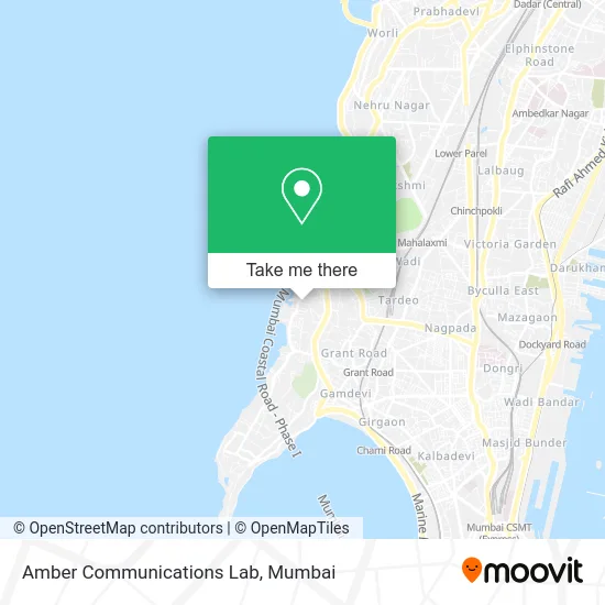
See Amber Communications Lab, Malabar Hill, on the map
Public Transit to Amber Communications Lab in Malabar Hill
Wondering how to get to Amber Communications Lab in Malabar Hill? Moovit helps you find the best way to get to Amber Communications Lab with step-by-step directions from the nearest public transit station.
Moovit provides free maps and live directions to help you navigate through your city. View schedules, routes, timetables, and find out how long does it take to get to Amber Communications Lab in real time.
Looking for the nearest stop or station to Amber Communications Lab? Check out this list of stops closest to your destination: Breach Candy Hospital; Mafatlal Park; Cumbala Hill Post Office; Grant Road; Mahalaxmi; Grant Road Metro; Mumbai Central; Mahalaxmi Temple (Coastal Road).
Bus: 151, A-37, A-63, A-77, A-78, A-76, A-132.Train: WR, WR-LDS, CGDR, WR-AC, WR-AC, WR-AC, WR-AC, WR-AC, WR-AC, WR-AC.Metro: LINE 3.
Want to see if there’s another route that gets you there at an earlier time? Moovit helps you find alternative routes or times. Get directions from and directions to Amber Communications Lab easily from the Moovit App or Website.
We make riding to Amber Communications Lab easy, which is why over 1.5 million users, including users in Malabar Hill, trust Moovit as the best app for public transit. You don’t need to download an individual bus app or train app, Moovit is your all-in-one transit app that helps you find the best bus time or train time available.
For information on prices of bus, train and metro, costs and ride fares to Amber Communications Lab, please check the Moovit app.
Use the app to navigate to popular places including to the airport, hospital, stadium, grocery store, mall, coffee shop, school, college, and university.
Amber Communications Lab Address: Sophia College Lane Mumbai 400026 MH street in Malabar Hill
- Cumballa Hill,
- El Florista Neha Gupta,
- Shankar Sagar Gate 2,
- Swami Anna Idli,
- Bishops Gate,
- LOTUS Placement,
- JK House,
- Physiques by Vinay,
- Ankita Evershine Laundry,
- The Bombay Cartel,
- Enriched Research International LLP,
- Aromathai,
- Shivansh Enterprises,
- SUBWAY,
- Raymond Tower,
- Good Fettle-Healthy Ice Creams,
- Sarnath Gate 1,
- Mazda Mansion,
- Mason Home,
- Amarson Garden in Breach Candy
Places Near Amber Communications Lab (Malabar Hill)
- TCS Olympus, Thane,
- NESCO, Goregaon,
- Hinduja Hospital, Mahim,
- Gateway Of India,
- Juhu Beach,
- Bhaucha Dhakka,
- J. J. Hospital, Byculla,
- R CITY MALL, Ghatkopar East,
- Malabar Hill, Malabar Hill,
- Worli Sea Face,
- Govardhan Ecovillage, Palghar (St),
- Ikea, Worli,
- Dome @ Nsci - Svp Stadium Mumbai, Worli,
- INFINITI Mall (Infinity Mall, andheri), Versova,
- Oberoi Mall, Dindoshi,
- Rani Baug, Byculla,
- Mumbai University, Kalina,
- Oberoi Sky City, Borivali East,
- Inorbit Mall, Malad West,
- Bombay Exhibition Center, Goregaon
How to get to popular places in Mumbai with public transit
Get around Malabar Hill by public transit!
Traveling around Malabar Hill has never been so easy. See step by step directions as you travel to any attraction, street or major public transit station. View bus and train schedules, arrival times, service alerts and detailed routes on a map, so you know exactly how to get to anywhere in Malabar Hill.
When traveling to any destination around Malabar Hill use Moovit's Live Directions with Get Off Notifications to know exactly where and how far to walk, how long to wait for your line, and how many stops are left. Moovit will alert you when it's time to get off — no need to constantly re-check whether yours is the next stop.
Wondering how to use public transit in Malabar Hill or how to pay for public transit in Malabar Hill? Moovit public transit app can help you navigate your way with public transit easily, and at minimum cost. It includes public transit fees, ticket prices, and costs. Looking for a map of Malabar Hill public transit lines? Moovit public transit app shows all public transit maps in Malabar Hill with all Bus, Train, Metro and Ferry routes and stops on an interactive map.
Mumbai has 4 transit type(s), including: Bus, Train, Metro and Ferry, operated by several transit agencies, including MMMOCL (Maha Mumbai Metro Operation Corporation Ltd.), NMM CIDCO (Navi Mumbai Metro Maha Metro), Reliance Mumbai Metro, MMRCL (Mumbai Metro Rail Corporation Ltd), BEST (Brihanmumbai Electricity Supply & Transport), BEST AC Services, A.C.Trains (Air-Conditioning Trains), W.R. (Western Railways), C.R. (Central Railways), C.R.MEMU (Central Railways Shuttle MEMU Trains), H.R. (Harbour Railways), T.R.(Trans Harbour Railways), U.R.(Uran-Ulwe Railways), I.R.(Indian Railways) and TMT (Thane Municipal Transport)