How to get to Ambolten by bus?
Click on the bus route to see step by step directions with maps, line arrival times and updated time schedules.
Bus stops near Ambolten in Norway
Bus lines to Ambolten in Norway
- 48, Kongstun Via Ålgård Skole,VIEW
- SK2203, Indra Sikvaland Via Holmaholen,VIEW
- E90, Sandnes,VIEW
- 92, Sandnes Via Tengesdal,VIEW
- VY190, Ørsta,VIEW
- 23, Fiskebekk Via Ålgård,VIEW
- X39, Ålgård Via Uis-Forus,VIEW
- N95, Sandnes Via Ålgård,VIEW
- SK2100, Bryne Via Kvernaland,VIEW
- SK2201, Kongstun Via Gjesdal Ungdomsskole,VIEW
- SK2202, Kongstun Via Ålgård Skole,VIEW
- SK2102, Undheim Skule,VIEW
What are the closest stations to Ambolten?
The closest stations to Ambolten are:
- Kongstun is 682 meters away, 9 min walk.
- Ole Nielsens Vei is 800 meters away, 11 min walk.
- Kongeparken is 805 meters away, 11 min walk.
- Opstad Kongeparken is 932 meters away, 13 min walk.
- Stasjonen Ålgård is 1345 meters away, 18 min walk.
Which bus lines stop near Ambolten?
These bus lines stop near Ambolten: 23, VY190.
What’s the nearest bus station to Ambolten in Norway?
The nearest bus station to Ambolten in Norway is Kongstun. It’s a 9 min walk away.
What time is the first bus to Ambolten in Norway?
The 23 is the first bus that goes to Ambolten in Norway. It stops nearby at 6:24 AM.
What time is the last bus to Ambolten in Norway?
The 23 is the last bus that goes to Ambolten in Norway. It stops nearby at 12:02 AM.
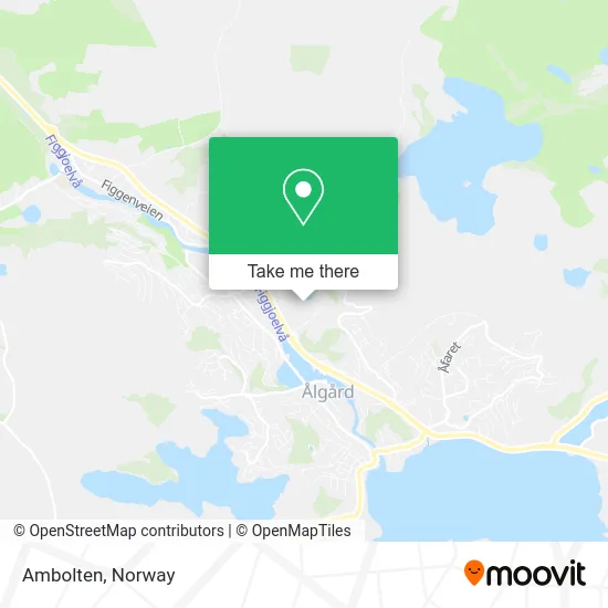
See Ambolten, Norway, on the map
Public Transit to Ambolten in Norway
Wondering how to get to Ambolten in Norway? Moovit helps you find the best way to get to Ambolten with step-by-step directions from the nearest public transit station.
Moovit provides free maps and live directions to help you navigate through your city. View schedules, routes, timetables, and find out how long does it take to get to Ambolten in real time.
Looking for the nearest stop or station to Ambolten? Check out this list of stops closest to your destination: Kongstun; Ole Nielsens Vei; Kongeparken; Opstad Kongeparken; Stasjonen Ålgård.
Bus: 23, VY190, 48, SK2203, E90, 92, X39, N95, SK2100, SK2201, SK2102.
Want to see if there’s another route that gets you there at an earlier time? Moovit helps you find alternative routes or times. Get directions from and directions to Ambolten easily from the Moovit App or Website.
We make riding to Ambolten easy, which is why over 1.5 million users, including users in Norway, trust Moovit as the best app for public transit. You don’t need to download an individual bus app or train app, Moovit is your all-in-one transit app that helps you find the best bus time or train time available.
For information on prices of bus, costs and ride fares to Ambolten, please check the Moovit app.
Use the app to navigate to popular places including to the airport, hospital, stadium, grocery store, mall, coffee shop, school, college, and university.
Location: Norway
- Kongeparken Camping,
- Kongeparken,
- Sviland Bistro,
- Sandnesveien,
- Landstreffet,
- Apcoa Parking,
- Tegl & Betong,
- Kristian Apeland,
- Byggmester Tore Ravndal,
- Circle K,
- Farstad Glass & Aluminium As,
- Sinus Elektro Avd Ålgård,
- Poppy Tornes,
- Tower AS,
- Ålgård Fotostudio,
- Gjesdal Apotek,
- Fr Company AS,
- Gjestehuset Ålgård AS,
- Lonestar,
- Dolly Dimple's Ålgård
Places Near Ambolten (Norway)
- Ulriken, Bergen,
- Quality Hotel Edvard Grieg, Bergen,
- Voldsløkka, Oslo,
- Ullevål Stadion (T), Oslo,
- Radiumhospitalet, Oslo,
- Nylandsbrua, Oslo,
- Tyholttårnet, Trondheim,
- Drammen Sykehus, Drammen,
- Vestby Outlet Store, Vestby,
- Oslo S spor 19 (Trelastgata), Oslo,
- IKEA, Bergen,
- DFDS Seaways, Oslo,
- Rikshospitalet (trikk), Oslo,
- Haukeland Universitetssjukehus, Bergen,
- Color Line Terminal, Oslo,
- Jekta Storsenter, Tromsø,
- Ikea Leangen, Trondheim,
- Bjerke Travbane, Oslo,
- Lovisenberg Diakonale Sykehus, Oslo,
- IKEA, Oslo
How to get to popular places in Norway with public transit
Get around Norway by public transit!
Traveling around Norway has never been so easy. See step by step directions as you travel to any attraction, street or major public transit station. View bus and train schedules, arrival times, service alerts and detailed routes on a map, so you know exactly how to get to anywhere in Norway.
When traveling to any destination around Norway use Moovit's Live Directions with Get Off Notifications to know exactly where and how far to walk, how long to wait for your line, and how many stops are left. Moovit will alert you when it's time to get off — no need to constantly re-check whether yours is the next stop.
Wondering how to use public transit in Norway or how to pay for public transit in Norway? Moovit public transit app can help you navigate your way with public transit easily, and at minimum cost. It includes public transit fees, ticket prices, and costs. Looking for a map of Norway public transit lines? Moovit public transit app shows all public transit maps in Norway with all Bus, Train, Subway, Light Rail, Ferry and Cable Car routes and stops on an interactive map.
Norway has 6 transit type(s), including: Bus, Train, Subway, Light Rail, Ferry and Cable Car, operated by several transit agencies, including Ruter, Skyss, AtB, Flytoget, Vy Tåg, SJ, Go-Ahead Norge AS, SJ Nord, Vestfold Kollektivtrafikk as, Snelandia, Innlandstrafikk, FRAM, FlixBus, Kolumbus and Brakar