Directions to American Lock & Key (Manhattan) with public transportation
The following transit lines have routes that pass near American Lock & Key
 Bus: BXM10, BXM8, M15-SBS, M42, QM34.
- Train: 2, BABYLON BRANCH, YEL, CITY TERMINAL ZONE, FAR ROCKAWAY BRANCH.
- Subway: 4, 5, 6X, S, 6.
How to get to American Lock & Key by bus?
Click on the bus route to see step by step directions with maps, line arrival times and updated time schedules.
From Franklin Ave, Bronx
93 minFrom Four Points by Sheraton New York Downtown, Manhattan
40 minFrom 1231 Lafayette Avenue, Bronx
88 minFrom Elmhurst, NY, Queens
36 minFrom The Shops At Atlas Park, Queens
40 minFrom South Street Seaport, Manhattan
40 minFrom South Ferry, Manhattan
42 minFrom Cipriani Wall Street, Manhattan
41 minFrom American Dream, East Rutherford
55 min
How to get to American Lock & Key by train?
Click on the train route to see step by step directions with maps, line arrival times and updated time schedules.
How to get to American Lock & Key by subway?
Click on the subway route to see step by step directions with maps, line arrival times and updated time schedules.
Bus stops near American Lock & Key in Manhattan
Train stations near American Lock & Key in Manhattan
Subway stations near American Lock & Key in Manhattan
Bus lines to American Lock & Key in Manhattan
- M101, Ft George Via 3 Av Via Amsterdam Av,VIEW
- M102, East Village 6 St Via Lex Av,VIEW
- M103, City Hall Via Lex Av,VIEW
- SIM6, Eltvlle Trans Ctr Via F Cap Bl Via Gfrds,VIEW
- SIM11, New Dorp Via Hylan Bl,VIEW
- SIM22, Eltingville Via Ar Kill Rd Via Richmond,VIEW
- SIM26, Tottenville Via Blmingdale Rd Via Amboy,VIEW
- BXM1, East Midtown 34 St Via Lex Av,VIEW
- M42, East Side U N-1 Av Crosstown,VIEW
- 42ND ST, E 42nd St & 3rd Ave,VIEW
- QM32, Bay Terrace - Midtown Express,VIEW
- QM34, Glendale - Midtown Express,VIEW
- QM40, Lefrak City - Midtown Express,VIEW
- QM42, Forest Hills - Midtown Express,VIEW
- HAMPTON JITNEY MONTAUK, Manhattan,VIEW
- SUBURBAN TRANSIT, Twin Rivers,VIEW
- SUBURBAN TRANSIT, Hillsborough,VIEW
- SUBURBAN TRANSIT, New York,VIEW
- HAMPTON JITNEY NORTH FORK, Orient Point,VIEW
What are the closest stations to American Lock & Key?
The closest stations to American Lock & Key are:
- Lexington Av/E 45 St is 119 yards away, 2 min walk.
- Lexington Av/E 42 St is 136 yards away, 2 min walk.
- E 42 St/Lexington Av is 153 yards away, 2 min walk.
- E 42nd St & 3rd Ave is 178 yards away, 3 min walk.
- 3 Av/E 43 St is 189 yards away, 3 min walk.
- 3 Av/E 42 St is 196 yards away, 3 min walk.
- 44th Street is 244 yards away, 3 min walk.
- Grand Central Madison is 358 yards away, 5 min walk.
- Grand Central-42 St is 423 yards away, 6 min walk.
- 42 St-Bryant Pk is 561 yards away, 7 min walk.
- Grand Central is 576 yards away, 7 min walk.
Which bus lines stop near American Lock & Key?
These bus lines stop near American Lock & Key: BXM10, BXM8, M15-SBS, M42, QM34, QM42.
Which train lines stop near American Lock & Key?
These train lines stop near American Lock & Key: 2, BABYLON BRANCH, YEL.
Which subway lines stop near American Lock & Key?
These subway lines stop near American Lock & Key: 4, 5, 6X, S.
What’s the nearest subway station to American Lock & Key in Manhattan?
The nearest subway station to American Lock & Key in Manhattan is Grand Central-42 St. It’s a 6 min walk away.
What’s the nearest train station to American Lock & Key in Manhattan?
The nearest train station to American Lock & Key in Manhattan is Grand Central Madison. It’s a 5 min walk away.
What’s the nearest bus station to American Lock & Key in Manhattan?
The nearest bus stations to American Lock & Key in Manhattan are Lexington Av/E 45 St, Lexington Av/E 42 St and E 42 St/Lexington Av. The closest one is a 2 min walk away.
What time is the first subway to American Lock & Key in Manhattan?
The 6X is the first subway that goes to American Lock & Key in Manhattan. It stops nearby at 3:02 AM.
What time is the last subway to American Lock & Key in Manhattan?
The D is the last subway that goes to American Lock & Key in Manhattan. It stops nearby at 3:52 AM.
What time is the first train to American Lock & Key in Manhattan?
The CITY TERMINAL ZONE is the first train that goes to American Lock & Key in Manhattan. It stops nearby at 5:28 AM.
What time is the last train to American Lock & Key in Manhattan?
The 1 is the last train that goes to American Lock & Key in Manhattan. It stops nearby at 2:12 AM.
What time is the first bus to American Lock & Key in Manhattan?
The M103 is the first bus that goes to American Lock & Key in Manhattan. It stops nearby at 3:01 AM.
What time is the last bus to American Lock & Key in Manhattan?
The M103 is the last bus that goes to American Lock & Key in Manhattan. It stops nearby at 3:15 AM.
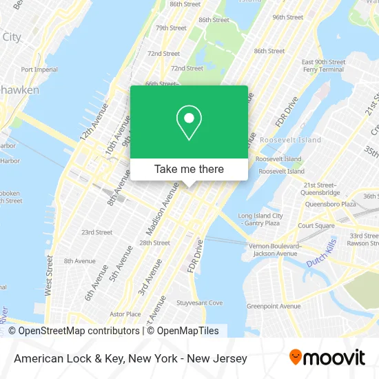
See American Lock & Key, Manhattan, on the map
Public Transit to American Lock & Key in Manhattan
Wondering how to get to American Lock & Key in Manhattan? Moovit helps you find the best way to get to American Lock & Key with step-by-step directions from the nearest public transit station.
Moovit provides free maps and live directions to help you navigate through your city. View schedules, routes, timetables, and find out how long does it take to get to American Lock & Key in real time.
Looking for the nearest stop or station to American Lock & Key? Check out this list of stops closest to your destination: Lexington Av/E 45 St; Lexington Av/E 42 St; E 42 St/Lexington Av; E 42nd St & 3rd Ave; 3 Av/E 43 St; 3 Av/E 42 St; 44th Street; Grand Central Madison; Grand Central-42 St; 42 St-Bryant Pk; Grand Central.
Bus: BXM10, BXM8, M15-SBS, M42, QM34, QM42, BXM1.Train: 2, BABYLON BRANCH, YEL, CITY TERMINAL ZONE, FAR ROCKAWAY BRANCH, HEMPSTEAD BRANCH, LONG BEACH BRANCH, 1, 3, 4, 5.Subway: 4, 5, 6X, S, 6, B, D, F, FX, M.
Want to see if there’s another route that gets you there at an earlier time? Moovit helps you find alternative routes or times. Get directions from and directions to American Lock & Key easily from the Moovit App or Website.
We make riding to American Lock & Key easy, which is why over 1.5 million users, including users in Manhattan, trust Moovit as the best app for public transit. You don’t need to download an individual bus app or train app, Moovit is your all-in-one transit app that helps you find the best bus time or train time available.
For information on prices of subway, bus and train, costs and ride fares to American Lock & Key, please check the Moovit app.
Use the app to navigate to popular places including to the airport, hospital, stadium, grocery store, mall, coffee shop, school, college, and university.
American Lock & Key Address: 405 Lexington Ave street in Manhattan
- Lexpath Technologies,
- 237,
- Iggi App. Incorporated,
- The Chrysler Building From Parasite Eve,
- Valencag,
- Law Offices Of Ronald I. Paltrowitz,
- Arvex Ai,
- Reynolds Russell Associates,
- Fmc Training & Conferences,
- Maersk,
- Lollitune,
- Miracle on 34,
- Quantum Tech Hd,
- Templo Espiritual Amor Y Esperanza,
- Hudson Atlantic Land Company,
- Ceriello,
- Watchhouse,
- Blaxxun Tdcs,
- Dr Kenn Kakosian Dds,
- Rlm Pr
Places Near American Lock & Key (Manhattan)
- 911 Memorial, Manhattan,
- Katz's Deli, Manhattan,
- 3 Stone St, Manhattan,
- Pier 83, Manhattan,
- Times Square, Manhattan,
- 111 Centre New York City Supreme Court, Manhattan,
- Chinatown, Manhattan,
- qqqq, Manhattan,
- San Gennaro Feast, Manhattan,
- 1 Police Plaza, Manhattan,
- Wall Street, Manhattan,
- 66 John Street, Manhattan,
- Bellevue Hospital, Manhattan,
- Hudson Yards, Manhattan,
- 376 Hudson Street, Manhattan,
- SoHo, Manhattan,
- Rockefeller Center, Manhattan,
- Queens Center Mall, Queens,
- Mountainside Hospital, Glen Ridge,
- 26 Federal Plaza, Manhattan
How to get to popular places in New York - New Jersey with public transit
Get around Manhattan by public transit!
Traveling around Manhattan has never been so easy. See step by step directions as you travel to any attraction, street or major public transit station. View bus and train schedules, arrival times, service alerts and detailed routes on a map, so you know exactly how to get to anywhere in Manhattan.
When traveling to any destination around Manhattan use Moovit's Live Directions with Get Off Notifications to know exactly where and how far to walk, how long to wait for your line, and how many stops are left. Moovit will alert you when it's time to get off — no need to constantly re-check whether yours is the next stop.
Wondering how to use public transit in Manhattan or how to pay for public transit in Manhattan? Moovit public transit app can help you navigate your way with public transit easily, and at minimum cost. It includes public transit fees, ticket prices, and costs. Looking for a map of Manhattan public transit lines? Moovit public transit app shows all public transit maps in Manhattan with all Bus, Train, Subway, Light Rail, Ferry and Cable Car routes and stops on an interactive map.
New York - New Jersey has 6 transit type(s), including: Bus, Train, Subway, Light Rail, Ferry and Cable Car, operated by several transit agencies, including MTA Subway, Metro-North Railroad, LIRR, PATH, MTA New York City Transit - Express routes, MTA Bus, NJ Transit, NYC Ferry, NICE bus, Bee-Line Bus, NJ Transit Rail, Norwalk Transit District, Hartford Line, River Valley Transit and HART