How to get to American Lock & Key by bus?
Click on the bus route to see step by step directions with maps, line arrival times and updated time schedules.
From Rockville, MD, Montgomery County
28 minFrom Comet Ping Pong, Washington
56 minFrom Wheaton Mall, Montgomery County
39 minFrom Carderock Division of the Naval Surface Warfare Center, Montgomery County
49 minFrom Montgomery College-Takoma Park/Silver Spring, Montgomery County
61 minFrom St John's College High School, Washington
55 minFrom The Cheesecake Factory, Washington
46 minFrom Politics and Prose, Washington
58 minFrom Knollwood, Washington
65 minFrom Holy Cross Hospital, Montgomery County
41 min
How to get to American Lock & Key by train?
Click on the train route to see step by step directions with maps, line arrival times and updated time schedules.
How to get to American Lock & Key by metro?
Click on the metro route to see step by step directions with maps, line arrival times and updated time schedules.
From Rockville, MD, Montgomery County
19 minFrom Comet Ping Pong, Washington
39 minFrom Wheaton Mall, Montgomery County
69 minFrom Montgomery College-Takoma Park/Silver Spring, Montgomery County
62 minFrom The Cheesecake Factory, Washington
20 minFrom Politics and Prose, Washington
41 minFrom Holy Cross Hospital, Montgomery County
63 min
Bus stops near American Lock & Key in Montgomery County
Train station near American Lock & Key in Montgomery County
- Kensington Marc Eb, 30 min walk,VIEW
Bus lines to American Lock & Key in Montgomery County
What are the closest stations to American Lock & Key?
The closest stations to American Lock & Key are:
- Rockville Pike & Executive Blvd is 74 yards away, 1 min walk.
- Rockville Pike & Security Ln is 237 yards away, 3 min walk.
- Nicholson La & Rockville Pi is 414 yards away, 6 min walk.
- North Bethesda Station & Bay C is 647 yards away, 8 min walk.
- Kensington Marc Eb is 2516 yards away, 30 min walk.
Which bus lines stop near American Lock & Key?
These bus lines stop near American Lock & Key: 46, 5.
Which train line stops near American Lock & Key?
MARC (Outbound - Washington)
Which metro line stops near American Lock & Key?
RED (Shady Grove)
What’s the nearest train station to American Lock & Key in Montgomery County?
The nearest train station to American Lock & Key in Montgomery County is Kensington Marc Eb. It’s a 30 min walk away.
What’s the nearest bus station to American Lock & Key in Montgomery County?
The nearest bus station to American Lock & Key in Montgomery County is Rockville Pike & Executive Blvd. It’s a 1 min walk away.
What time is the first metro to American Lock & Key in Montgomery County?
The RED is the first metro that goes to American Lock & Key in Montgomery County. It stops nearby at 5:07 AM.
What time is the last metro to American Lock & Key in Montgomery County?
The RED is the last metro that goes to American Lock & Key in Montgomery County. It stops nearby at 12:35 AM.
What time is the first train to American Lock & Key in Montgomery County?
The MARC is the first train that goes to American Lock & Key in Montgomery County. It stops nearby at 5:45 AM.
What time is the last train to American Lock & Key in Montgomery County?
The MARC is the last train that goes to American Lock & Key in Montgomery County. It stops nearby at 7:45 PM.
What time is the first bus to American Lock & Key in Montgomery County?
The M42 is the first bus that goes to American Lock & Key in Montgomery County. It stops nearby at 5:00 AM.
What time is the last bus to American Lock & Key in Montgomery County?
The 5 is the last bus that goes to American Lock & Key in Montgomery County. It stops nearby at 1:46 AM.
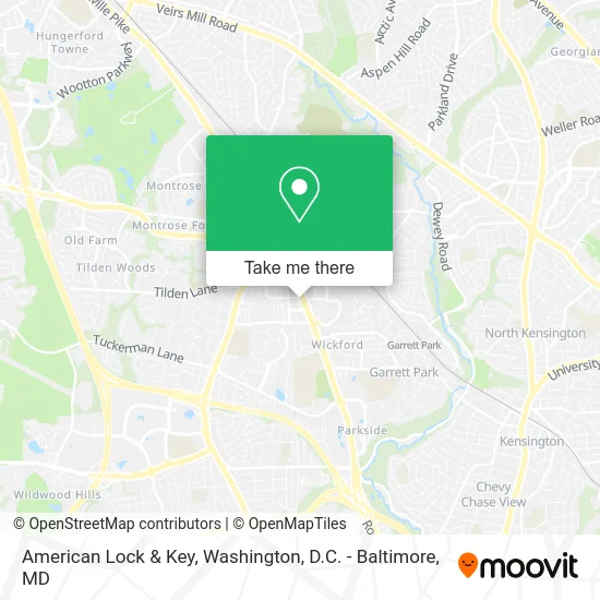
See American Lock & Key, Montgomery County, on the map
Public Transit to American Lock & Key in Montgomery County
Wondering how to get to American Lock & Key in Montgomery County? Moovit helps you find the best way to get to American Lock & Key with step-by-step directions from the nearest public transit station.
Moovit provides free maps and live directions to help you navigate through your city. View schedules, routes, timetables, and find out how long does it take to get to American Lock & Key in real time.
Looking for the nearest stop or station to American Lock & Key? Check out this list of stops closest to your destination: Rockville Pike & Executive Blvd; Rockville Pike & Security Ln; Nicholson La & Rockville Pi; North Bethesda Station & Bay C; Kensington Marc Eb.
Bus: 46, 5, 101, 38, M42, M44, 26, 81.Train: MARC.Metro: RED.
Want to see if there’s another route that gets you there at an earlier time? Moovit helps you find alternative routes or times. Get directions from and directions to American Lock & Key easily from the Moovit App or Website.
We make riding to American Lock & Key easy, which is why over 1.5 million users, including users in Montgomery County, trust Moovit as the best app for public transit. You don’t need to download an individual bus app or train app, Moovit is your all-in-one transit app that helps you find the best bus time or train time available.
For information on prices of bus, metro and train, costs and ride fares to American Lock & Key, please check the Moovit app.
Use the app to navigate to popular places including to the airport, hospital, stadium, grocery store, mall, coffee shop, school, college, and university.
American Lock & Key Address: 11416 Rockville Pike Rockville, MD 20852 street in Montgomery County
- United Healthcare,
- Eatopian Eats,
- Potomac Geophysical Society,
- Asg Nobe N Bethesda Mr,
- Piedmont Locksmith,
- Seasons 52 - North Bethesda,
- Seasons 52,
- FDA,
- Lot 104 - Nobe,
- Lao Sze Chuan,
- JBS International, Inc.,
- Kantakevich Joseph J DDS,
- Asam Criteria,
- Maryland Radiology Associates,
- Pike District Smiles,
- Whole Foods Market,
- Dcmetroliving,
- Louis Penda of Century 21 Trademark,
- Lot 616,
- Roof Installed & Repair
Places Near American Lock & Key (Montgomery County)
- Amazon Hq2, Arlington County,
- Museum Of The Bible, Washington,
- National Zoo, Washington,
- Washington DC VA Medical Center, Washington,
- Rock Creek Tennis Center, Washington,
- Marriott Marquis Washington, DC, Washington,
- Camden Yards, Baltimore,
- Westfield Montgomery Mall, Montgomery County,
- M&T Bank Stadium, Baltimore,
- Washington National Cathedral, Washington,
- Capital One Arena, Washington,
- Warner Theatre, Washington,
- Pennsylvania Ave NW (3rd st and pennsylvania), Washington,
- Basilica of the National Shrine, Washington,
- National Museum of African American History and Culture, Washington,
- National Theatre, Washington,
- PG Mall, Prince George's County,
- Sibley Memorial Hospital, Washington,
- The Anthem, Washington,
- Georgetown, Washington
How to get to popular places in Washington, D.C. - Baltimore, MD with public transit
Get around Montgomery County by public transit!
Traveling around Montgomery County has never been so easy. See step by step directions as you travel to any attraction, street or major public transit station. View bus and train schedules, arrival times, service alerts and detailed routes on a map, so you know exactly how to get to anywhere in Montgomery County.
When traveling to any destination around Montgomery County use Moovit's Live Directions with Get Off Notifications to know exactly where and how far to walk, how long to wait for your line, and how many stops are left. Moovit will alert you when it's time to get off — no need to constantly re-check whether yours is the next stop.
Wondering how to use public transit in Montgomery County or how to pay for public transit in Montgomery County? Moovit public transit app can help you navigate your way with public transit easily, and at minimum cost. It includes public transit fees, ticket prices, and costs. Looking for a map of Montgomery County public transit lines? Moovit public transit app shows all public transit maps in Montgomery County with all Bus, Train, Metro, Light Rail and Ferry routes and stops on an interactive map.
Washington, D.C. - Baltimore, MD has 5 transit type(s), including: Bus, Train, Metro, Light Rail and Ferry, operated by several transit agencies, including WMATA, Montgomery County Ride On, Fairfax Connector, TheBus, PRTC, DASH - Alexandria, Arlington Transit (ART), RTA of Central Maryland, MDOT MTA, MDOT MTA Light RailLink, MDOT MTA Commuter Bus, MDOT MTA Local Bus, FXBGO!, Virginia Railway Express (VRE) and MARC