How to get to American Lock & Key by bus?
Click on the bus route to see step by step directions with maps, line arrival times and updated time schedules.
From Bethesda North Marriott Hotel & Conference Center, Montgomery County
44 minFrom The Fillmore Silver Spring, Montgomery County
47 minFrom Ellsworth Place, Montgomery County
49 minFrom Pike & Rose (Pike and Rose), Montgomery County
36 minFrom Montgomery College-Rockville, Montgomery County
39 minFrom Regal Majestic Stadium 20 and IMAX, Montgomery County
48 minFrom Montgomery Blair High School, Montgomery County
47 minFrom Adventist HealthCare Shady Grove Medical Center, Montgomery County
49 minFrom Silver Spring Civic Building (Silver Spring Civic Center), Montgomery County
49 minFrom Rockville, MD, Montgomery County
31 min
How to get to American Lock & Key by metro?
Click on the metro route to see step by step directions with maps, line arrival times and updated time schedules.
From Bethesda North Marriott Hotel & Conference Center, Montgomery County
95 minFrom The Fillmore Silver Spring, Montgomery County
55 minFrom Ellsworth Place, Montgomery County
56 minFrom Pike & Rose (Pike and Rose), Montgomery County
101 minFrom Montgomery College-Rockville, Montgomery County
124 minFrom Regal Majestic Stadium 20 and IMAX, Montgomery County
57 minFrom Silver Spring Civic Building (Silver Spring Civic Center), Montgomery County
59 minFrom Rockville, MD, Montgomery County
103 min
Bus stops near American Lock & Key in Montgomery County
Metro station near American Lock & Key in Montgomery County
- Glenmont, 33 min walk,VIEW
Bus lines to American Lock & Key in Montgomery County
What are the closest stations to American Lock & Key?
The closest stations to American Lock & Key are:
- Georgia Av+Connecticut Av is 167 yards away, 3 min walk.
- Connecticut Ave & Georgia Ave is 266 yards away, 4 min walk.
- Glenmont is 2756 yards away, 33 min walk.
Which bus lines stop near American Lock & Key?
These bus lines stop near American Lock & Key: 26, M20, M22.
Which metro line stops near American Lock & Key?
RED (Glenmont)
What’s the nearest bus station to American Lock & Key in Montgomery County?
The nearest bus station to American Lock & Key in Montgomery County is Georgia Av+Connecticut Av. It’s a 3 min walk away.
What time is the first metro to American Lock & Key in Montgomery County?
The RED is the first metro that goes to American Lock & Key in Montgomery County. It stops nearby at 5:00 AM.
What time is the last metro to American Lock & Key in Montgomery County?
The RED is the last metro that goes to American Lock & Key in Montgomery County. It stops nearby at 12:37 AM.
What time is the first bus to American Lock & Key in Montgomery County?
The M20 is the first bus that goes to American Lock & Key in Montgomery County. It stops nearby at 4:30 AM.
What time is the last bus to American Lock & Key in Montgomery County?
The M22 is the last bus that goes to American Lock & Key in Montgomery County. It stops nearby at 2:29 AM.
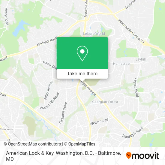
See American Lock & Key, Montgomery County, on the map
Public Transit to American Lock & Key in Montgomery County
Wondering how to get to American Lock & Key in Montgomery County? Moovit helps you find the best way to get to American Lock & Key with step-by-step directions from the nearest public transit station.
Moovit provides free maps and live directions to help you navigate through your city. View schedules, routes, timetables, and find out how long does it take to get to American Lock & Key in real time.
Looking for the nearest stop or station to American Lock & Key? Check out this list of stops closest to your destination: Georgia Av+Connecticut Av; Connecticut Ave & Georgia Ave; Glenmont.
Bus: 26, M20, M22, 41.Metro: RED.
Want to see if there’s another route that gets you there at an earlier time? Moovit helps you find alternative routes or times. Get directions from and directions to American Lock & Key easily from the Moovit App or Website.
We make riding to American Lock & Key easy, which is why over 1.5 million users, including users in Montgomery County, trust Moovit as the best app for public transit. You don’t need to download an individual bus app or train app, Moovit is your all-in-one transit app that helps you find the best bus time or train time available.
For information on prices of bus and metro, costs and ride fares to American Lock & Key, please check the Moovit app.
Use the app to navigate to popular places including to the airport, hospital, stadium, grocery store, mall, coffee shop, school, college, and university.
American Lock & Key Address: 13870 Georgia Ave Silver Spring, MD 20906 street in Montgomery County
- FM Beauty,
- TACO BELL,
- Credit Union 1,
- DUNKIN',
- Montgomery County Stroke Association - McSa,
- Hearusa,
- smart Communications,
- Salon,
- Holy Cross Hospital,
- Fantasy Nails & Spa Silver Spring,
- C & E Cleaning Service,
- Geo Cleaning Services,
- Sephora at Kohl's,
- Kohl's,
- CUBESMART,
- Aspen Hill Life Insurance Brokers,
- Georgia Ave & Connecticut Ave,
- United Pentecostal Church,
- Catholic Cemeteries of the Archdiocese of Washington,
- Volta
Places Near American Lock & Key (Montgomery County)
- Marriott Marquis Washington, DC, Washington,
- Rock Creek Tennis Center, Washington,
- Pennsylvania Ave NW (3rd st and pennsylvania), Washington,
- Basilica of the National Shrine, Washington,
- Amazon Hq2, Arlington County,
- National Theatre, Washington,
- Georgetown, Washington,
- Washington DC VA Medical Center, Washington,
- Sibley Memorial Hospital, Washington,
- Capital One Arena, Washington,
- Washington National Cathedral, Washington,
- Museum Of The Bible, Washington,
- PG Mall, Prince George's County,
- M&T Bank Stadium, Baltimore,
- Westfield Montgomery Mall, Montgomery County,
- Warner Theatre, Washington,
- National Zoo, Washington,
- The Anthem, Washington,
- Camden Yards, Baltimore,
- National Museum of African American History and Culture, Washington
How to get to popular places in Washington, D.C. - Baltimore, MD with public transit
Get around Montgomery County by public transit!
Traveling around Montgomery County has never been so easy. See step by step directions as you travel to any attraction, street or major public transit station. View bus and train schedules, arrival times, service alerts and detailed routes on a map, so you know exactly how to get to anywhere in Montgomery County.
When traveling to any destination around Montgomery County use Moovit's Live Directions with Get Off Notifications to know exactly where and how far to walk, how long to wait for your line, and how many stops are left. Moovit will alert you when it's time to get off — no need to constantly re-check whether yours is the next stop.
Wondering how to use public transit in Montgomery County or how to pay for public transit in Montgomery County? Moovit public transit app can help you navigate your way with public transit easily, and at minimum cost. It includes public transit fees, ticket prices, and costs. Looking for a map of Montgomery County public transit lines? Moovit public transit app shows all public transit maps in Montgomery County with all Bus, Train, Metro, Light Rail and Ferry routes and stops on an interactive map.
Washington, D.C. - Baltimore, MD has 5 transit type(s), including: Bus, Train, Metro, Light Rail and Ferry, operated by several transit agencies, including WMATA, Montgomery County Ride On, Fairfax Connector, TheBus, PRTC, DASH - Alexandria, Arlington Transit (ART), RTA of Central Maryland, MDOT MTA, MDOT MTA Light RailLink, MDOT MTA Commuter Bus, MDOT MTA Local Bus, FXBGO!, Virginia Railway Express (VRE) and MARC