How to get to Americlean by bus?
Click on the bus route to see step by step directions with maps, line arrival times and updated time schedules.
From Wilton Manors, Fort Lauderdale
69 minFrom Banco Davivienda sa Miami Internatl Branch, Fort Lauderdale
78 minFrom Cam Transfer, Coral Springs-Margate
48 minFrom Margate, FL, Coral Springs-Margate
55 minFrom Galleria at Fort Lauderdale (Galleria Mall At Fort Lauderdale), Fort Lauderdale
46 minFrom Galleria Mall, Fort Lauderdale
44 minFrom Hotel Soap, Fort Lauderdale
57 minFrom Coral Ridge Mall, Fort Lauderdale
26 minFrom Alligator Alley, Fort Lauderdale
38 minFrom Xtreme Action Park, Fort Lauderdale
53 min
Bus stops near Americlean in Pompano Beach
Bus lines to Americlean in Pompano Beach
What are the closest stations to Americlean?
The closest stations to Americlean are:
- Atlantic Boulevard/Southeast 25th Avenue is 22 yards away, 1 min walk.
- US 1/Atlantic Boulevard is 516 yards away, 7 min walk.
Which bus lines stop near Americlean?
These bus lines stop near Americlean: 10, 42.
What’s the nearest bus station to Americlean in Pompano Beach?
The nearest bus station to Americlean in Pompano Beach is Atlantic Boulevard/Southeast 25th Avenue. It’s a 1 min walk away.
What time is the first bus to Americlean in Pompano Beach?
The 10 is the first bus that goes to Americlean in Pompano Beach. It stops nearby at 5:14 AM.
What time is the last bus to Americlean in Pompano Beach?
The 10 is the last bus that goes to Americlean in Pompano Beach. It stops nearby at 11:48 PM.
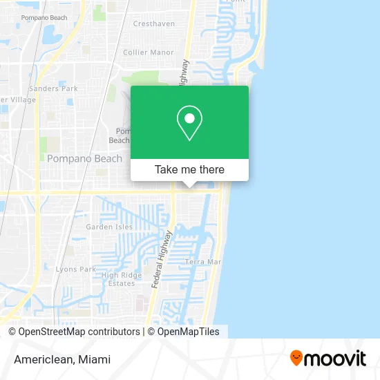
See Americlean, Pompano Beach, on the map
Public Transit to Americlean in Pompano Beach
Wondering how to get to Americlean in Pompano Beach? Moovit helps you find the best way to get to Americlean with step-by-step directions from the nearest public transit station.
Moovit provides free maps and live directions to help you navigate through your city. View schedules, routes, timetables, and find out how long does it take to get to Americlean in real time.
Looking for the nearest stop or station to Americlean? Check out this list of stops closest to your destination: Atlantic Boulevard/Southeast 25th Avenue; US 1/Atlantic Boulevard.
Bus: 10, 42.
Want to see if there’s another route that gets you there at an earlier time? Moovit helps you find alternative routes or times. Get directions from and directions to Americlean easily from the Moovit App or Website.
We make riding to Americlean easy, which is why over 1.5 million users, including users in Pompano Beach, trust Moovit as the best app for public transit. You don’t need to download an individual bus app or train app, Moovit is your all-in-one transit app that helps you find the best bus time or train time available.
For information on prices of bus, costs and ride fares to Americlean, please check the Moovit app.
Use the app to navigate to popular places including to the airport, hospital, stadium, grocery store, mall, coffee shop, school, college, and university.
Americlean Address: 2535 E Atlantic Blvd Pompano Beach, FL 33062 street in Pompano Beach
- Talay Thai,
- Warner Locksmith,
- Aviation Seo,
- Link Builder Seo,
- Divas Drink U.S. Inc.,
- Remote Accountant,
- Precesio Designs,
- Low Cost Cigarettes,
- Contech Systems,
- Ocean Drive Plastic Surgery,
- Dgx,
- A1 Excursions,
- Slip Safe Floors,
- the American Psychological Association,
- Caring Dental Services Pompano,
- Real Brands Inc.,
- Dorma Locksmith Company,
- Atlantic Eye Care & Spa,
- Difo Law Firm PLLC,
- Ameridream Funding
Places Near Americlean (Pompano Beach)
- Aventura Mall, Miami,
- Hard Rock Stadium, Miami Gardens,
- Port of Miami Cruise Terminal, Miami,
- Bayside Marketplace, Miami,
- Marlins Park, Miami,
- Sawgrass mall ( FL ), Miami Beach,
- Keiser University Flagship Campus, West Palm Beach,
- Miami Freedom Park, Miami,
- Dolphin Mall, Miami,
- Richard E. Gerstein Justice Building, Miami,
- Wynwood, Miami,
- Aventura Mall, Miami Beach,
- Zoo Miami, Miami,
- Miami-Dade County Courthouse, Miami,
- Little Havana, Miami,
- Dolphin Mall Bus, Miami,
- Sawgrass Mall, Miami,
- Brickell City Centre, Miami,
- Miami Design District, Miami,
- 1351 NW 12th St, Miami
How to get to popular places in Miami with public transit
Get around Pompano Beach by public transit!
Traveling around Pompano Beach has never been so easy. See step by step directions as you travel to any attraction, street or major public transit station. View bus and train schedules, arrival times, service alerts and detailed routes on a map, so you know exactly how to get to anywhere in Pompano Beach.
When traveling to any destination around Pompano Beach use Moovit's Live Directions with Get Off Notifications to know exactly where and how far to walk, how long to wait for your line, and how many stops are left. Moovit will alert you when it's time to get off — no need to constantly re-check whether yours is the next stop.
Wondering how to use public transit in Pompano Beach or how to pay for public transit in Pompano Beach? Moovit public transit app can help you navigate your way with public transit easily, and at minimum cost. It includes public transit fees, ticket prices, and costs. Looking for a map of Pompano Beach public transit lines? Moovit public transit app shows all public transit maps in Pompano Beach with all Bus, Train, Light Rail and Ferry routes and stops on an interactive map.
Miami has 4 transit type(s), including: Bus, Train, Light Rail and Ferry, operated by several transit agencies, including Broward County Transit, Miami-Dade Transit, Metrorail, Palm Tran, Tri-Rail, Brightline, MARTY, City of Homestead Trolley, Key West Transit, Treasure Coast Connector, GoLine IRT, Amtrak, Greyhound-us, FlixBus-us and Aventura Express Shuttle Bus