How to get to Amgen by bus?
Click on the bus route to see step by step directions with maps, line arrival times and updated time schedules.
From Defense Intelligence Agency Headquarters, Washington
88 minFrom Knollwood, Washington
65 minFrom Alexandria, VA, Alexandria
40 minFrom Holiday Inn National Airport/Crystal City, Arlington County
61 minFrom U.S. Census Bureau, Prince George's County
72 minFrom Silver Spring, Maryland, Montgomery County
54 minFrom St John's College High School, Washington
47 minFrom Hyattsville District Court, Prince George's County
53 minFrom Baileys Crossroads, Fairfax County
52 minFrom Consulado General de El Salvador en El Dmv, Montgomery County
55 min
How to get to Amgen by train?
Click on the train route to see step by step directions with maps, line arrival times and updated time schedules.
How to get to Amgen by metro?
Click on the metro route to see step by step directions with maps, line arrival times and updated time schedules.
Bus stops near Amgen in Washington
- 13 St Nw+F St NW, 2 min walk,VIEW
- 13 St Nw+G St NW, 2 min walk,VIEW
- 13 St Nw+H St NW, 3 min walk,VIEW
- Nw 11th St & Nw H St, 3 min walk,VIEW
- F St Nw+12 St NW, 3 min walk,VIEW
- 13th St & H St NW Sb, 3 min walk,VIEW
- Metro Center, 4 min walk,VIEW
- 11th St NW @ F St NW, 4 min walk,VIEW
- Nw H St & Nw 11th St, 4 min walk,VIEW
- 12th St & G St NW Nb, 4 min walk,VIEW
Metro stations near Amgen in Washington
Bus lines to Amgen in Washington
- D10, West To Foggy Bottom,VIEW
- D34, North To W Hyattsville,VIEW
- A29, South To Van Dorn Street,VIEW
- A49, East To Metro Center,VIEW
- D20, West To Farragut Sq,VIEW
- D36, South To Franklin Sq,VIEW
- D5X, North To Takoma,VIEW
- 315, 315/1 Washington Dc,VIEW
- 325, 325/2 Washington Dc / Metro Center,VIEW
- DC, Front Royal,VIEW
- 943, 543 - L'Enfant Plaza - Washington, Dc,VIEW
- 953, L'Enfant Plaza / Washington Dc,VIEW
- D94, East To Gallery Place,VIEW
- 610, 610/4 Washington Dc,VIEW
- 620, 620/6 Washington Dc,VIEW
- 640, 640/5 Washington Dc,VIEW
- 650, 650/2 Washington Dc,VIEW
- 705, 705/9 Washington Dc,VIEW
- 715, 715/5 Washington Dc,VIEW
- 725, 725/2 Washington Dc,VIEW
What are the closest stations to Amgen?
The closest stations to Amgen are:
- 13 St Nw+F St NW is 98 yards away, 2 min walk.
- 13 St Nw+G St NW is 142 yards away, 2 min walk.
- 13 St Nw+H St NW is 185 yards away, 3 min walk.
- Nw 11th St & Nw H St is 211 yards away, 3 min walk.
- F St Nw+12 St NW is 218 yards away, 3 min walk.
- 13th St & H St NW Sb is 223 yards away, 3 min walk.
- Metro Center is 256 yards away, 4 min walk.
- 11th St NW @ F St NW is 256 yards away, 4 min walk.
- Nw H St & Nw 11th St is 259 yards away, 4 min walk.
- Entrance B - 11th And G Sts. is 291 yards away, 4 min walk.
- 12th St & G St NW Nb is 322 yards away, 4 min walk.
- Archives-Navy Memorial-Penn Quarter Metro Station is 982 yards away, 12 min walk.
Which bus lines stop near Amgen?
These bus lines stop near Amgen: A29, D10, D32, D5X, D60, D6X, F19.
Which train lines stop near Amgen?
These train lines stop near Amgen: MARC, NORTHEAST REGIONAL.
Which metro lines stop near Amgen?
These metro lines stop near Amgen: BLUE, ORANGE, RED.
What’s the nearest metro station to Amgen in Washington?
The nearest metro station to Amgen in Washington is Entrance B - 11th And G Sts.. It’s a 4 min walk away.
What’s the nearest bus station to Amgen in Washington?
The nearest bus stations to Amgen in Washington are 13 St Nw+F St NW and 13 St Nw+G St NW. The closest one is a 2 min walk away.
What time is the first metro to Amgen in Washington?
The BLUE is the first metro that goes to Amgen in Washington. It stops nearby at 5:20 AM.
What time is the last metro to Amgen in Washington?
The GREEN is the last metro that goes to Amgen in Washington. It stops nearby at 12:17 AM.
What time is the first bus to Amgen in Washington?
The D20 is the first bus that goes to Amgen in Washington. It stops nearby at 3:01 AM.
What time is the last bus to Amgen in Washington?
The D10 is the last bus that goes to Amgen in Washington. It stops nearby at 3:11 AM.
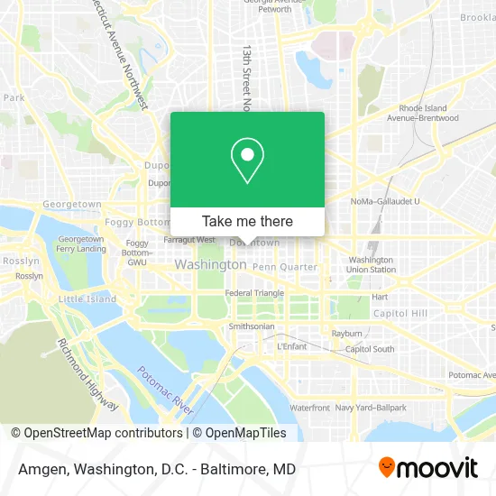
See Amgen, Washington, on the map
Public Transit to Amgen in Washington
Wondering how to get to Amgen in Washington? Moovit helps you find the best way to get to Amgen with step-by-step directions from the nearest public transit station.
Moovit provides free maps and live directions to help you navigate through your city. View schedules, routes, timetables, and find out how long does it take to get to Amgen in real time.
Looking for the nearest stop or station to Amgen? Check out this list of stops closest to your destination: 13 St Nw+F St NW; 13 St Nw+G St NW; 13 St Nw+H St NW; Nw 11th St & Nw H St; F St Nw+12 St NW; 13th St & H St NW Sb; Metro Center; 11th St NW @ F St NW; Nw H St & Nw 11th St; Entrance B - 11th And G Sts.; 12th St & G St NW Nb; Archives-Navy Memorial-Penn Quarter Metro Station.
Bus: A29, D10, D32, D5X, D60, D6X, F19, D34, A49, D20, D36.Train: MARC, NORTHEAST REGIONAL.Metro: BLUE, ORANGE, RED, SILVER, GREEN, YELLOW.
Want to see if there’s another route that gets you there at an earlier time? Moovit helps you find alternative routes or times. Get directions from and directions to Amgen easily from the Moovit App or Website.
We make riding to Amgen easy, which is why over 1.7 million users, including users in Washington, trust Moovit as the best app for public transit. You don’t need to download an individual bus app or train app, Moovit is your all-in-one transit app that helps you find the best bus time or train time available.
For information on prices of bus, metro and train, costs and ride fares to Amgen, please check the Moovit app.
Use the app to navigate to popular places including to the airport, hospital, stadium, grocery store, mall, coffee shop, school, college, and university.
Amgen Address: 601 13th St NW street in Washington
- 13th St NW (g street and 13th),
- Macy's,
- Macy's (STORY at Macy's Metro DC),
- The Homer Building (Homer Building (Atlantic Services Location 135)),
- Astro Doughnuts & Fried Chicken,
- Episcopal Church of the Epiphany,
- National Cherry Blossom Festival,
- PNC Bank (PNC ATM),
- Staples,
- Metro Center Metro Station,
- 12th St NW (12th and g street northwest),
- Metro Center Station,
- Washington Marriott at Metro Center,
- PwC,
- Laz Parking (Laz PKG 570186cloverfl),
- IDB,
- The Oceanaire Seafood Room,
- Mastro's Steakhouse,
- 13th St NW (h st @ 13th),
- H St and 13th St NW
Places Near Amgen (Washington)
- The Anthem, Washington,
- Basilica of the National Shrine, Washington,
- Amazon Hq2, Arlington County,
- Pennsylvania Ave NW (3rd st and pennsylvania), Washington,
- Warner Theatre, Washington,
- Washington DC VA Medical Center, Washington,
- M&T Bank Stadium, Baltimore,
- Capital One Arena, Washington,
- Sibley Memorial Hospital, Washington,
- PG Mall, Prince George's County,
- Washington National Cathedral, Washington,
- Westfield Montgomery Mall, Montgomery County,
- Museum Of The Bible, Washington,
- Camden Yards, Baltimore,
- National Zoo, Washington,
- Georgetown, Washington,
- National Museum of African American History and Culture, Washington,
- Rock Creek Tennis Center, Washington,
- National Theatre, Washington,
- Marriott Marquis Washington, DC, Washington
How to get to popular places in Washington, D.C. - Baltimore, MD with public transit
Get around Washington by public transit!
Traveling around Washington has never been so easy. See step by step directions as you travel to any attraction, street or major public transit station. View bus and train schedules, arrival times, service alerts and detailed routes on a map, so you know exactly how to get to anywhere in Washington.
When traveling to any destination around Washington use Moovit's Live Directions with Get Off Notifications to know exactly where and how far to walk, how long to wait for your line, and how many stops are left. Moovit will alert you when it's time to get off — no need to constantly re-check whether yours is the next stop.
Wondering how to use public transit in Washington or how to pay for public transit in Washington? Moovit public transit app can help you navigate your way with public transit easily, and at minimum cost. It includes public transit fees, ticket prices, and costs. Looking for a map of Washington public transit lines? Moovit public transit app shows all public transit maps in Washington with all Bus, Train, Metro, Light Rail and Ferry routes and stops on an interactive map.
Washington, D.C. - Baltimore, MD has 5 transit type(s), including: Bus, Train, Metro, Light Rail and Ferry, operated by several transit agencies, including WMATA, Montgomery County Ride On, Fairfax Connector, TheBus, PRTC, DASH - Alexandria, Arlington Transit (ART), RTA of Central Maryland, MDOT MTA, MDOT MTA Light RailLink, MDOT MTA Commuter Bus, MDOT MTA Local Bus, FXBGO!, Virginia Railway Express (VRE) and MARC