How to get to Amway Aguascalientes by bus?
Click on the bus route to see step by step directions with maps, line arrival times and updated time schedules.
From Fraccionamiento Camino Real
58 minFrom Avenida Constitución
51 minFrom Mirador de las Culturas II
66 minFrom Cinepolis Aguascalientes
33 minFrom Avenida Arroyo el Molino
53 minFrom Fraccionamiento Ojocaliente 2
45 minFrom Municipio Libre
47 minFrom Anexo Palomino
53 minFrom Fraccionamiento Asturias
79 minFrom El Sabinal
69 min
Bus stops near Amway Aguascalientes
Bus lines to Amway Aguascalientes
- RUTA 05, Vicente Guerrero - La Ribera,VIEW
- RUTA 12, Vicente Guerrero - Lunaria,VIEW
- RUTA 14, Lunaria - Vicente Guerrero,VIEW
- RUTA 30, Villa Montaña - Martínez Dóminguez,VIEW
- RUTA 09, Cumbres III - Mahatma Gandhi,VIEW
- RUTA 09, Mahatma Gandhi - Los Laureles,VIEW
- RUTA 10, UAA Sur - Paseos de Aguascalientes,VIEW
- RUTA 11, Mahatma Gandhi - Chichimeco,VIEW
- RUTA 27, Vicente Guerrero - Valle de los Cactus,VIEW
What are the closest stations to Amway Aguascalientes?
The closest stations to Amway Aguascalientes are:
- Ricardo García Mendoza, 301 is 220 meters away, 3 min walk.
- Avenida De Los Maestros, 2615 is 249 meters away, 4 min walk.
Which bus lines stop near Amway Aguascalientes?
These bus lines stop near Amway Aguascalientes: RUTA 05, RUTA 09, RUTA 10, RUTA 30.
What’s the nearest bus station to Amway Aguascalientes?
The nearest bus station to Amway Aguascalientes is Ricardo García Mendoza, 301. It’s a 3 min walk away.
What time is the first bus to Amway Aguascalientes?
The RUTA 14 is the first bus that goes to Amway Aguascalientes. It stops nearby at 5:51 AM.
What time is the last bus to Amway Aguascalientes?
The RUTA 30 is the last bus that goes to Amway Aguascalientes. It stops nearby at 10:19 PM.
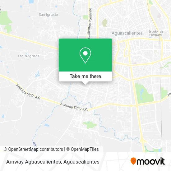
See Amway Aguascalientes on the map
Public Transportation to Amway Aguascalientes
Wondering how to get to Amway Aguascalientes? Moovit helps you find the best way to get to Amway Aguascalientes with step-by-step directions from the nearest public transit station.
Moovit provides free maps and live directions to help you navigate through your city. View schedules, routes, timetables, and find out how long does it take to get to Amway Aguascalientes in real time.
Looking for the nearest stop or station to Amway Aguascalientes? Check out this list of stops closest to your destination: Ricardo García Mendoza; Avenida De Los Maestros.
Bus: RUTA 05, RUTA 09, RUTA 10, RUTA 30, RUTA 12, RUTA 14, RUTA 11, RUTA 27.
Want to see if there’s another route that gets you there at an earlier time? Moovit helps you find alternative routes or times. Get directions from and directions to Amway Aguascalientes easily from the Moovit App or Website.
We make riding to Amway Aguascalientes easy, which is why over 1.5 million users, including users in Aguascalientes, trust Moovit as the best app for public transit. You don’t need to download an individual bus app or train app, Moovit is your all-in-one transit app that helps you find the best bus time or train time available.
For information on prices of bus, costs and ride fares to Amway Aguascalientes, please check the Moovit app.
Use the app to navigate to popular places including to the airport, hospital, stadium, grocery store, mall, coffee shop, school, college, and university.
Amway Aguascalientes Address: Amway Aguascalientes, Calle Rosalía Monroy 125, Fracc Lic José López Portillo, 20206 Aguascalientes street in Aguascalientes
- Novedades Interbal,
- Clínica y Maternidad Santa Fe,
- Granjas Fatima,
- Jet Studio,
- Cocina Economica El Sazon de la Abuela,
- Clínica Santa Fe,
- Estetica,
- Dominio Cel Accesorios y Reparacion de Celulares,
- Fraccionamiento Educación Álamos,
- Gorditas Ducasa,
- Tortilleria El Charrito 2,
- Salones y Clinicas de Belleza y Peluquerias,
- Centro de Salud Jose Lopez Portillo,
- Esmelu Nails,
- Transporte Colectivo Foraneo de Pasajeros,
- Cremeria San Juan,
- Trendy,
- Gasol Astra,
- Bk Aguascalientes,
- Club de Nutricion
Places Near Amway Aguascalientes
- Isla San Marcos, Aguascalientes,
- Universidad Autónoma de Aguascalientes, Aguascalientes,
- Hospital Imss No. 3, Aguascalientes,
- Jesús María, Aguascalientes,
- La Isla San Marcos, Aguascalientes,
- Parque Las Tres Centurias, Aguascalientes,
- clinica 3 uaa, Aguascalientes,
- Imss Clinica 1, Aguascalientes,
- Terminal De Combis, Aguascalientes,
- Villas de Nuestra Señora de la Asunción, Aguascalientes,
- Ciudad industrial, Aguascalientes,
- Blvd. Luis Donaldo Colosio, Aguascalientes,
- Agropecuario, Aguascalientes,
- ESPACIOS, Aguascalientes,
- Aeropuerto de Aguascalientes S.A. de C.V., Aguascalientes,
- Nuevo Hospital Hidalgo, Aguascalientes,
- Central De Autobuses, Aguascalientes,
- Centro, Aguascalientes,
- Villasuncion, Aguascalientes,
- Centro Comercial Altaria, Aguascalientes
How to get to popular places in Aguascalientes with public transit
Get around Aguascalientes by public transit!
Traveling around Aguascalientes has never been so easy. See step by step directions as you travel to any attraction, street or major public transit station. View bus and train schedules, arrival times, service alerts and detailed routes on a map, so you know exactly how to get to anywhere in Aguascalientes.
When traveling to any destination around Aguascalientes use Moovit's Live Directions with Get Off Notifications to know exactly where and how far to walk, how long to wait for your line, and how many stops are left. Moovit will alert you when it's time to get off — no need to constantly re-check whether yours is the next stop.
Wondering how to use public transit in Aguascalientes or how to pay for public transit in Aguascalientes? Moovit public transit app can help you navigate your way with public transit easily, and at minimum cost. It includes public transit fees, ticket prices, and costs. Looking for a map of Aguascalientes public transit lines? Moovit public transit app shows all public transit maps in Aguascalientes with all bus routes and stops on an interactive map.
Aguascalientes has 1 transit type(s), including: bus, operated by several transit agencies, including Coordinación General de Movilidad