Directions to Anakin's Moda Infantil (Santa Cândida) with public transportation
The following transit lines have routes that pass near Anakin's Moda Infantil
How to get to Anakin's Moda Infantil by bus?
Click on the bus route to see step by step directions with maps, line arrival times and updated time schedules.
From Rua XV de Novembro, Colombo
39 minFrom Rua Imaculada Conceicao, Prado Velho
51 minFrom Parque Barigui, Bigorrilho
60 minFrom Avenida Victor Ferreira do Amaral, Tarumã
37 minFrom Seminário, Seminário
50 minFrom Rua Engenheiros Rebouças, Rebouças
44 minFrom UPA 24h - Unidade de Pronto Atendimento Cajuru, Cajuru
69 minFrom Rua Padre Ladislau Kula, Santo Inácio
62 minFrom Gerar, Centro
39 minFrom Água Verde, Água Verde
52 min
Bus stops near Anakin's Moda Infantil in Santa Cândida
Bus lines to Anakin's Moda Infantil in Santa Cândida
- 224 CASSIOPÉIA, Terminal Boa Vista ↺ Cassiopéia (Circular),VIEW
- 280 NOSSA SENHORA DE NAZARÉ, Nossa Senhora de Nazaré → Praça Tiradentes,VIEW
- S01 ROÇA GRANDE / GUADALUPE (VIA SANTA CÂNDIDA), ROÇA GRANDE / GUADALUPE (VIA SANTA CÂNDIDA),VIEW
- B72 COLOMBO / GUADALUPE (VIA T. ROÇA GRANDE), COLOMBO / GUADALUPE (via T. ROÇA GRANDE),VIEW
- B73 JARDIM OSASCO / GUADALUPE, JARDIM OSASCO / GUADALUPE,VIEW
- B76 SÃO SEBASTIÃO / GUADALUPE, SÃO SEBASTIÃO / GUADALUPE,VIEW
- B78 SÃO GABRIEL / GUADALUPE, SÃO GABRIEL / GUADALUPE,VIEW
- S89 SÃO SEBASTIÃO / GUADALUPE (VIA SÃO GABRIEL), SÃO SEBASTIÃO / GUADALUPE (via SÃO GABRIEL),VIEW
- 209 MAD. SANTA CÂNDIDA / CAPÃO RASO, Terminal Santa Cândida → Terminal Capão Raso (via Praça Rui Barbosa),VIEW
- 203 SANTA CÂNDIDA / CAPÃO RASO, Terminal Santa Cândida → Terminal Capão Raso,VIEW
What are the closest stations to Anakin's Moda Infantil?
The closest stations to Anakin's Moda Infantil are:
- Rua Maria Geronasso Do Rosário, 89-343 is 236 meters away, 4 min walk.
- R. João Reboli, 309 is 367 meters away, 5 min walk.
- R. João Gbur, 200 is 398 meters away, 6 min walk.
- Av. Paraná, 2533 is 538 meters away, 7 min walk.
- Fernando de Noronha is 540 meters away, 7 min walk.
Which bus lines stop near Anakin's Moda Infantil?
These bus lines stop near Anakin's Moda Infantil: 203 SANTA CÂNDIDA / CAPÃO RASO, 280 NOSSA SENHORA DE NAZARÉ, B72 COLOMBO / GUADALUPE (VIA T. ROÇA GRANDE).
What’s the nearest bus station to Anakin's Moda Infantil in Santa Cândida?
The nearest bus station to Anakin's Moda Infantil in Santa Cândida is Rua Maria Geronasso Do Rosário, 89-343. It’s a 4 min walk away.
What time is the first bus to Anakin's Moda Infantil in Santa Cândida?
The 209 MAD. SANTA CÂNDIDA / CAPÃO RASO is the first bus that goes to Anakin's Moda Infantil in Santa Cândida. It stops nearby at 3:09 AM.
What time is the last bus to Anakin's Moda Infantil in Santa Cândida?
The 209 MAD. SANTA CÂNDIDA / CAPÃO RASO is the last bus that goes to Anakin's Moda Infantil in Santa Cândida. It stops nearby at 3:09 AM.
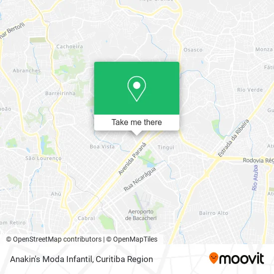
See Anakin's Moda Infantil, Santa Cândida, on the map
Public Transit to Anakin's Moda Infantil in Santa Cândida
Wondering how to get to Anakin's Moda Infantil in Santa Cândida? Moovit helps you find the best way to get to Anakin's Moda Infantil with step-by-step directions from the nearest public transit station.
Moovit provides free maps and live directions to help you navigate through your city. View schedules, routes, timetables, and find out how long does it take to get to Anakin's Moda Infantil in real time.
Looking for the nearest stop or station to Anakin's Moda Infantil? Check out this list of stops closest to your destination: Rua Maria Geronasso Do Rosário; R. João Reboli; R. João Gbur; Av. Paraná; Fernando de Noronha.
Bus: 203 SANTA CÂNDIDA / CAPÃO RASO, 280 NOSSA SENHORA DE NAZARÉ, B72 COLOMBO / GUADALUPE (VIA T. ROÇA GRANDE), 224 CASSIOPÉIA, S01 ROÇA GRANDE / GUADALUPE (VIA SANTA CÂNDIDA), B73 JARDIM OSASCO / GUADALUPE, B76 SÃO SEBASTIÃO / GUADALUPE, B78 SÃO GABRIEL / GUADALUPE, 209 MAD. SANTA CÂNDIDA / CAPÃO RASO.
Want to see if there’s another route that gets you there at an earlier time? Moovit helps you find alternative routes or times. Get directions from and directions to Anakin's Moda Infantil easily from the Moovit App or Website.
We make riding to Anakin's Moda Infantil easy, which is why over 1.5 million users, including users in Santa Cândida, trust Moovit as the best app for public transit. You don’t need to download an individual bus app or train app, Moovit is your all-in-one transit app that helps you find the best bus time or train time available.
For information on prices of bus, costs and ride fares to Anakin's Moda Infantil, please check the Moovit app.
Use the app to navigate to popular places including to the airport, hospital, stadium, grocery store, mall, coffee shop, school, college, and university.
Anakin's Moda Infantil Address: Rua Francisco Zanicotti Sobrinho, 110 Santa Cândida Curitiba-PR 82640-220 street in Santa Cândida
- Baunilha Cakes Cwb,
- Thaisbraz,
- Condominio Residencial Guimaraes,
- A and S Automacao e Servicos,
- Ciassist,
- Conesul Cargas Aereas,
- Kauan Portes Maia,
- Franco Morais,
- Leone Rações,
- Bar Gabriel Tavares,
- Valeria Oliveira,
- Jan Jan Confeccoes,
- Noronha Veiculos,
- Rosangela Nady,
- Academia de Cientistas,
- Brittes Tecnologia,
- Anna Coutinho Producoes Didaticas,
- Condominio Residencial Alpendre,
- Fabiola Teixeira,
- Vanessa Comex
Places Near Anakin's Moda Infantil (Santa Cândida)
- Jardim Botânico de Curitiba PR, Centro,
- Rua Martim Afonso 558, Mercês,
- Hospital do Rocio, Campo,
- Hospital Angelina Caron, Campina Grande Do Sul,
- Campo Largo, Campo,
- Hhhhh, Fazendinha,
- Rua General Mário Tourinho, Campina Do Siqueira,
- Hospital Universitário Evangélico de Curitiba, Bigorrilho,
- Hospital Da Cruz Vermelha, Batel,
- Shopping Estação, Rebouças,
- Hospital Nossa Senhora Das Graças, Mercês,
- Hospital Erasto Gaertner, Jardim Das Américas,
- Shopping Palladium, Portão,
- Hospital Madalena Sofia, Bairro Alto,
- Hospital de Clínicas (HC - UFPR), Centro,
- Park Shopping Barigüi, Mossunguê,
- Parque Barigui, Mercês,
- Pontifícia Universidade Católica do Paraná (PUCPR), Prado Velho,
- Arena Da Baixada - Curitiba,
- Jockey Plaza Shopping Center, Tarumã
How to get to popular places in Curitiba Region with public transit
Get around Santa Cândida by public transit!
Traveling around Santa Cândida has never been so easy. See step by step directions as you travel to any attraction, street or major public transit station. View bus and train schedules, arrival times, service alerts and detailed routes on a map, so you know exactly how to get to anywhere in Santa Cândida.
When traveling to any destination around Santa Cândida use Moovit's Live Directions with Get Off Notifications to know exactly where and how far to walk, how long to wait for your line, and how many stops are left. Moovit will alert you when it's time to get off — no need to constantly re-check whether yours is the next stop.
Wondering how to use public transit in Santa Cândida or how to pay for public transit in Santa Cândida? Moovit public transit app can help you navigate your way with public transit easily, and at minimum cost. It includes public transit fees, ticket prices, and costs. Looking for a map of Santa Cândida public transit lines? Moovit public transit app shows all public transit maps in Santa Cândida with all Bus and Cable Car routes and stops on an interactive map.
Curitiba Region has 2 transit type(s), including: Bus and Cable Car, operated by several transit agencies, including Sistema Integrado de Mobilidade (URBS), Sistema Integrado de Mobilidade (AMEP), URBS (Cartões bancários e Dinheiro), URBS (Cartões bancários / Cartão URBS), AMEP (Cartões bancários / Cartão MetroCard), AMEP (Cartões bancários / Cartão MetroCard / Dinheiro), Viação Colombo (Dinheiro), TRIAR (Cartão TRIAR / Dinheiro), Empresa Curitiba Cerro Azul (Dinheiro), Expresso Nossa Senhora da Penha (Dinheiro), Empresa Campo Alto Tijucas (Dinheiro), Auto Viação São José (Cartão VEM / Dinheiro), BRT S/A (Cartão VEM / Dinheiro), TransPiedade (Cartão Cidadão / Dinheiro) and Oceânica Sul (Cartão Transporte / Dinheiro)
Public transit lines with stations closest to Anakin's Moda Infantil in Santa Cândida
Bus lines with stations closest to Anakin's Moda Infantil in Santa Cândida
Rua Maria Geronasso Do Rosário, 89-343
R. João Gbur, 200
 S01 ROÇA GRANDE / GUADALUPE (VIA SANTA CÂNDIDA)ROÇA GRANDE / GUADALUPE (VIA SANTA CÂNDIDA)
- B72 COLOMBO / GUADALUPE (VIA T. ROÇA GRANDE)COLOMBO / GUADALUPE (via T. ROÇA GRANDE)
- B73 JARDIM OSASCO / GUADALUPEJARDIM OSASCO / GUADALUPE
- B76 SÃO SEBASTIÃO / GUADALUPESÃO SEBASTIÃO / GUADALUPE
- B78 SÃO GABRIEL / GUADALUPESÃO GABRIEL / GUADALUPE