How to get to Angamos by bus?
Click on the bus route to see step by step directions with maps, line arrival times and updated time schedules.
From Cieneguilla, Cieneguill
167 minFrom Centro Comercial Real Plaza Santa Clara, Ate
71 minFrom Universidad Peruana Unión - UPeU, Lurigancho
60 minFrom Chaclacayo, Chaclacayo
47 minFrom Santa Eulalia, Santa Eula
34 minFrom Carapongo, Lurigancho
76 minFrom Entrada A Huaycan, Ate
52 minFrom Ñaña, Chaclacayo
54 minFrom Huachipa, Ate
61 minFrom Cevicheria El Rico Piura, Ate
74 min
Bus stop near Angamos in Lurigancho
- Navidad, 6 min walk,VIEW
Bus lines to Angamos in Lurigancho
What are the closest stations to Angamos?
The closest stations to Angamos are:
- Navidad is 456 meters away, 6 min walk.
Which bus lines stop near Angamos?
These bus lines stop near Angamos: 1069, 1085, 1218, 1319, 1480.
What’s the nearest bus station to Angamos in Lurigancho?
The nearest bus station to Angamos in Lurigancho is Navidad. It’s a 6 min walk away.
What time is the first bus to Angamos in Lurigancho?
The 1319 is the first bus that goes to Angamos in Lurigancho. It stops nearby at 3:00 AM.
What time is the last bus to Angamos in Lurigancho?
The 1319 is the last bus that goes to Angamos in Lurigancho. It stops nearby at 4:31 AM.
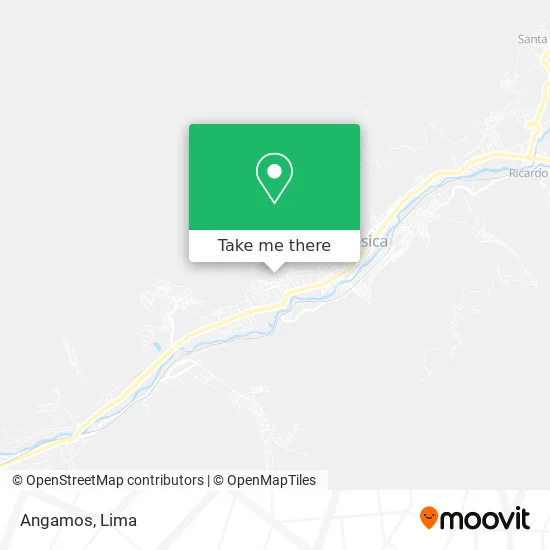
See Angamos, Lurigancho, on the map
Public Transit to Angamos in Lurigancho
Wondering how to get to Angamos in Lurigancho? Moovit helps you find the best way to get to Angamos with step-by-step directions from the nearest public transit station.
Moovit provides free maps and live directions to help you navigate through your city. View schedules, routes, timetables, and find out how long does it take to get to Angamos in real time.
Looking for the nearest stop or station to Angamos? Check out this list of stops closest to your destination: Navidad.
Bus: 1069, 1085, 1218, 1319, 1480, 1354.
Want to see if there’s another route that gets you there at an earlier time? Moovit helps you find alternative routes or times. Get directions from and directions to Angamos easily from the Moovit App or Website.
We make riding to Angamos easy, which is why over 1.5 million users, including users in Lurigancho, trust Moovit as the best app for public transit. You don’t need to download an individual bus app or train app, Moovit is your all-in-one transit app that helps you find the best bus time or train time available.
For information on prices of bus, costs and ride fares to Angamos, please check the Moovit app.
Use the app to navigate to popular places including to the airport, hospital, stadium, grocery store, mall, coffee shop, school, college, and university.
Angamos Address: Angamos, Chosica, Perú street in Lurigancho
- Parroquia San Nicolás De Tolentino,
- Institución Educativa 0055 Manuel Gonzales Prada,
- Ravichagua,
- Deylu,
- Chosica - Paradero Tarazona,
- Sierra Limeña,
- Colegio Nicolas de Pierola Ie 1197,
- Colectivo Estudiantil Clasista,
- La Casona de Pompeya,
- Viñas de Media Luna,
- Institución Educativa 1197 Nicolas De Pierola,
- Colegio Deuni,
- Institución Educativa Deuni,
- Pequeños Nadadores La Moza,
- Las Laderas de Chaclacayo,
- Institución Educativa Deuni Kinder Kids,
- Pasaje Santa Isabel 211 Chosica,
- Av Lima Sur,
- Market,
- Pasaje Solea altura del kilometro 32 de la Carretera Central ( Templo hare Krishna)
Places Near Angamos (Lurigancho)
- Av. Abancay, Lima,
- av arequipa, Lima,
- Av. Salaverry, Jesus Mari,
- Parque de las Leyendas, San Miguel,
- Parque Kennedy, Miraflores,
- Hospital Edgardo Rebagliati Martins, Jesus Mari,
- Av. La Marina, San Miguel,
- Pontificia Universidad Católica del Perú - PUCP, San Miguel,
- Mall Del Sur,
- Plaza San Miguel, San Miguel,
- Aeropuerto Internacional Jorge Chávez, Ventanilla,
- Jockey Plaza, Santiago D,
- Barranco, Barranco,
- Miraflores, Miraflores,
- Real Plaza Puruchuco, Ate,
- Gamarra,
- Larcomar, Miraflores,
- Paradero Av.Brasil,
- Centro Comercial Plaza Norte, Independen,
- Circuito Mágico Del Agua, Lima
How to get to popular places in Lima with public transit
Get around Lurigancho by public transit!
Traveling around Lurigancho has never been so easy. See step by step directions as you travel to any attraction, street or major public transit station. View bus and train schedules, arrival times, service alerts and detailed routes on a map, so you know exactly how to get to anywhere in Lurigancho.
When traveling to any destination around Lurigancho use Moovit's Live Directions with Get Off Notifications to know exactly where and how far to walk, how long to wait for your line, and how many stops are left. Moovit will alert you when it's time to get off — no need to constantly re-check whether yours is the next stop.
Wondering how to use public transit in Lurigancho or how to pay for public transit in Lurigancho? Moovit public transit app can help you navigate your way with public transit easily, and at minimum cost. It includes public transit fees, ticket prices, and costs. Looking for a map of Lurigancho public transit lines? Moovit public transit app shows all public transit maps in Lurigancho with all Bus, Metro and Ferry routes and stops on an interactive map.
Lima has 3 transit type(s), including: Bus, Metro and Ferry, operated by several transit agencies, including Metro de Lima Línea 2 , Metro de Lima, Corredor Rojo, Metropolitano, Metropolitano - Alimentadores, Corredor Morado, Corredor Azul, Rutas Tradicionales, Transportes y Servicios La Esperanza S.A., Las Flores S.A., Virgen de la Asunción S.A., Consorcio HAM, Transportes y Service Canadá S.A., ETUL4SA and ETUCHISA