How to get to Angela's Whimsy by bus?
Click on the bus route to see step by step directions with maps, line arrival times and updated time schedules.
From 30-56 Whitestone Expwy, Queens
66 minFrom Glendale, NY, Queens
77 minFrom Broadway–Lafayette Street, Manhattan
38 minFrom 66 John Street, Manhattan
65 minFrom West Broadway Soho, Manhattan
46 minFrom 1 Police Plaza, Manhattan
60 minFrom Pier 40 - Hudson River Park, Manhattan
49 minFrom 1910 Monterey Avenue, Bronx
74 minFrom American Dream, East Rutherford
79 min
How to get to Angela's Whimsy by train?
Click on the train route to see step by step directions with maps, line arrival times and updated time schedules.
How to get to Angela's Whimsy by subway?
Click on the subway route to see step by step directions with maps, line arrival times and updated time schedules.
From 30-56 Whitestone Expwy, Queens
77 minFrom Glendale, NY, Queens
83 minFrom Broadway–Lafayette Street, Manhattan
27 minFrom 66 John Street, Manhattan
29 minFrom West Broadway Soho, Manhattan
31 minFrom 1 Police Plaza, Manhattan
34 minFrom Pier 40 - Hudson River Park, Manhattan
38 minFrom 1910 Monterey Avenue, Bronx
52 min
Subway stations near Angela's Whimsy in Manhattan
Bus stops near Angela's Whimsy in Manhattan
Bus lines to Angela's Whimsy in Manhattan
- M101, Ft George Via 3 Av Via Amsterdam Av,VIEW
- M102, East Village 6 St Via Lex Av,VIEW
- M103, City Hall Via Lex Av,VIEW
- HAMPTON JITNEY MONTAUK, Manhattan,VIEW
- M98, Limited Midtown Lex Av-68 St,VIEW
- M72, East Side York Av Crosstown,VIEW
- SHORTLINE HUDSON, Montgomery,VIEW
- HAMPTON JITNEY NORTH FORK, Greenport-Manhattan,VIEW
- SHORTLINE HUDSON, New York,VIEW
- M15, Pike St -Via 2 Av,VIEW
What are the closest stations to Angela's Whimsy?
The closest stations to Angela's Whimsy are:
- Lexington Av/63 St is 38 yards away, 1 min walk.
- Lexington Av/E 74 St is 108 yards away, 2 min walk.
- 3 Av/E 72 St is 241 yards away, 3 min walk.
- E 72 St/Lexington Av is 253 yards away, 3 min walk.
- 3rd Ave & E 72nd St is 257 yards away, 3 min walk.
- 3rd Ave & 72nd St is 301 yards away, 4 min walk.
- Lexington Ave & East 72nd St is 314 yards away, 4 min walk.
- 77 St is 319 yards away, 4 min walk.
- 2 Av/E 73 St is 367 yards away, 5 min walk.
Which bus lines stop near Angela's Whimsy?
These bus lines stop near Angela's Whimsy: M101, M103, M15, M98.
Which train lines stop near Angela's Whimsy?
These train lines stop near Angela's Whimsy: 2, 3, PORT WASHINGTON BRANCH.
Which subway lines stop near Angela's Whimsy?
These subway lines stop near Angela's Whimsy: 6, 6X, Q.
What’s the nearest subway station to Angela's Whimsy in Manhattan?
The nearest subway station to Angela's Whimsy in Manhattan is Lexington Av/63 St. It’s a 1 min walk away.
What’s the nearest bus station to Angela's Whimsy in Manhattan?
The nearest bus station to Angela's Whimsy in Manhattan is Lexington Av/E 74 St. It’s a 2 min walk away.
What time is the first subway to Angela's Whimsy in Manhattan?
The Q is the first subway that goes to Angela's Whimsy in Manhattan. It stops nearby at 3:01 AM.
What time is the last subway to Angela's Whimsy in Manhattan?
The 4 is the last subway that goes to Angela's Whimsy in Manhattan. It stops nearby at 3:46 AM.
What time is the first bus to Angela's Whimsy in Manhattan?
The M103 is the first bus that goes to Angela's Whimsy in Manhattan. It stops nearby at 3:06 AM.
What time is the last bus to Angela's Whimsy in Manhattan?
The M103 is the last bus that goes to Angela's Whimsy in Manhattan. It stops nearby at 3:08 AM.
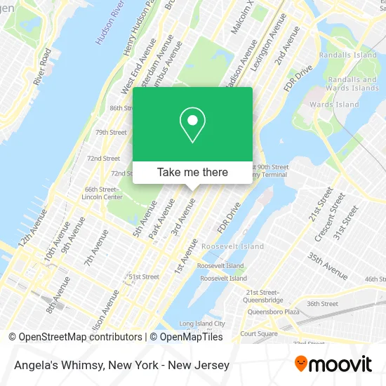
See Angela's Whimsy, Manhattan, on the map
Public Transit to Angela's Whimsy in Manhattan
Wondering how to get to Angela's Whimsy in Manhattan? Moovit helps you find the best way to get to Angela's Whimsy with step-by-step directions from the nearest public transit station.
Moovit provides free maps and live directions to help you navigate through your city. View schedules, routes, timetables, and find out how long does it take to get to Angela's Whimsy in real time.
Looking for the nearest stop or station to Angela's Whimsy? Check out this list of stops closest to your destination: Lexington Av/63 St; Lexington Av/E 74 St; 3 Av/E 72 St; E 72 St/Lexington Av; 3rd Ave & E 72nd St; 3rd Ave & 72nd St; Lexington Ave & East 72nd St; 77 St; 2 Av/E 73 St.
Bus: M101, M103, M15, M98, M102, HAMPTON JITNEY MONTAUK, SHORTLINE HUDSON, M72.Train: 2, 3, PORT WASHINGTON BRANCH.Subway: 6, 6X, Q, F, M, N, R, 4, 5.
Want to see if there’s another route that gets you there at an earlier time? Moovit helps you find alternative routes or times. Get directions from and directions to Angela's Whimsy easily from the Moovit App or Website.
We make riding to Angela's Whimsy easy, which is why over 1.5 million users, including users in Manhattan, trust Moovit as the best app for public transit. You don’t need to download an individual bus app or train app, Moovit is your all-in-one transit app that helps you find the best bus time or train time available.
For information on prices of bus, subway, train and ferry, costs and ride fares to Angela's Whimsy, please check the Moovit app.
Use the app to navigate to popular places including to the airport, hospital, stadium, grocery store, mall, coffee shop, school, college, and university.
Angela's Whimsy Address: 174 E 74th St street in Manhattan
- Kingdom Revival Nyc,
- Jam Paper & Envelope,
- Blank Street,
- Blank Street Coffee,
- [Ph7],
- Nuts Factory,
- Bcbg Max Azria,
- Remorca Wellness Upper East Side,
- 168 East,
- Phit Well,
- Amy Gossels Casting,
- Tbar,
- Dr Elise Mccrea Fischbacher Phd,
- Breads Bakery,
- E 74th St (74th and 3rd ave),
- J.G. Melon,
- Gerard Sager,
- Neurotherapeutix Medical Services,
- New York Hvac Choice,
- Seamore's Upper East Side
Places Near Angela's Whimsy (Manhattan)
- Wall Street, Manhattan,
- 111 Centre New York City Supreme Court, Manhattan,
- Pier 83, Manhattan,
- 1 Police Plaza, Manhattan,
- Bellevue Hospital, Manhattan,
- Queens Center Mall, Queens,
- Mountainside Hospital, Glen Ridge,
- Rockefeller Center, Manhattan,
- San Gennaro Feast, Manhattan,
- 26 Federal Plaza, Manhattan,
- Katz's Deli, Manhattan,
- 911 Memorial, Manhattan,
- Hudson Yards, Manhattan,
- qqqq, Manhattan,
- Chinatown, Manhattan,
- 3 Stone St, Manhattan,
- 376 Hudson Street, Manhattan,
- 66 John Street, Manhattan,
- SoHo, Manhattan,
- Times Square, Manhattan
How to get to popular places in New York - New Jersey with public transit
Get around Manhattan by public transit!
Traveling around Manhattan has never been so easy. See step by step directions as you travel to any attraction, street or major public transit station. View bus and train schedules, arrival times, service alerts and detailed routes on a map, so you know exactly how to get to anywhere in Manhattan.
When traveling to any destination around Manhattan use Moovit's Live Directions with Get Off Notifications to know exactly where and how far to walk, how long to wait for your line, and how many stops are left. Moovit will alert you when it's time to get off — no need to constantly re-check whether yours is the next stop.
Wondering how to use public transit in Manhattan or how to pay for public transit in Manhattan? Moovit public transit app can help you navigate your way with public transit easily, and at minimum cost. It includes public transit fees, ticket prices, and costs. Looking for a map of Manhattan public transit lines? Moovit public transit app shows all public transit maps in Manhattan with all Bus, Train, Subway, Light Rail, Ferry and Cable Car routes and stops on an interactive map.
New York - New Jersey has 6 transit type(s), including: Bus, Train, Subway, Light Rail, Ferry and Cable Car, operated by several transit agencies, including MTA Subway, Metro-North Railroad, LIRR, PATH, MTA New York City Transit - Express routes, MTA Bus, NJ Transit, NYC Ferry, NICE bus, Bee-Line Bus, NJ Transit Rail, Norwalk Transit District, Hartford Line, River Valley Transit and HART