Directions to Anglerteich (Saalbach-Hinterglemm) with public transportation
The following transit lines have routes that pass near Anglerteich
 Bus: 680.
How to get to Anglerteich by bus?
Click on the bus route to see step by step directions with maps, line arrival times and updated time schedules.
From P7 Parkplatz Tennisstadion, Stadt Kitzbühel
170 minFrom Kitzlochklamm, Taxenbach
130 minFrom McKinsey Alpine University - Grand Hotel Kitzbühel, Stadt Kitzbühel
158 minFrom Gartenhotel Daxer, Zell am See
59 minFrom Kitzbüheler Hornbahn, Stadt Kitzbühel
178 minFrom Sportcamp Woferlgut, Bruck An Der Großglocknerstraße
88 minFrom Tauernklinikum, Zell am See
65 min
Bus stop near Anglerteich in Saalbach-Hinterglemm
- Saalbach Steinachbrücke, 6 min walk,VIEW
Bus lines to Anglerteich in Saalbach-Hinterglemm
- 680, Schüttdorf Gym/Hak Via Saalbach - Maishofen,VIEW
What are the closest stations to Anglerteich?
The closest stations to Anglerteich are:
- Saalbach Steinachbrücke is 402 meters away, 6 min walk.
Which bus line stops near Anglerteich?
680 (Hinterglemm Mitterlengau Via Maishofen - Saalbach)
What’s the nearest bus station to Anglerteich in Saalbach-Hinterglemm?
The nearest bus station to Anglerteich in Saalbach-Hinterglemm is Saalbach Steinachbrücke. It’s a 6 min walk away.
What time is the first bus to Anglerteich in Saalbach-Hinterglemm?
The 680 is the first bus that goes to Anglerteich in Saalbach-Hinterglemm. It stops nearby at 6:06 AM.
What time is the last bus to Anglerteich in Saalbach-Hinterglemm?
The 680 is the last bus that goes to Anglerteich in Saalbach-Hinterglemm. It stops nearby at 8:00 PM.
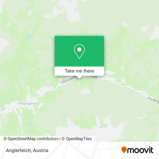
See Anglerteich, Saalbach-Hinterglemm, on the map
Public Transit to Anglerteich in Saalbach-Hinterglemm
Wondering how to get to Anglerteich in Saalbach-Hinterglemm? Moovit helps you find the best way to get to Anglerteich with step-by-step directions from the nearest public transit station.
Moovit provides free maps and live directions to help you navigate through your city. View schedules, routes, timetables, and find out how long does it take to get to Anglerteich in real time.
Looking for the nearest stop or station to Anglerteich? Check out this list of stops closest to your destination: Saalbach Steinachbrücke.
Bus: 680.
Want to see if there’s another route that gets you there at an earlier time? Moovit helps you find alternative routes or times. Get directions from and directions to Anglerteich easily from the Moovit App or Website.
We make riding to Anglerteich easy, which is why over 1.5 million users, including users in Saalbach-Hinterglemm, trust Moovit as the best app for public transit. You don’t need to download an individual bus app or train app, Moovit is your all-in-one transit app that helps you find the best bus time or train time available.
For information on prices of bus and train, costs and ride fares to Anglerteich, please check the Moovit app.
Use the app to navigate to popular places including to the airport, hospital, stadium, grocery store, mall, coffee shop, school, college, and university.
Anglerteich Address: Bärenbachweg 5753 Saalbach-Hinterglemm street in Saalbach-Hinterglemm
- Glemmtaler Landesstraße 447 Parking,
- Royal Taxi,
- Appartement Riverside by Easy Holiday Appartements,
- Kurt Schwarzenbacher,
- Philson Apartm,
- Bike Fuerst,
- Hüttl Relax-Ambiente,
- Hotel Bärenbachhof,
- Hotel Garni Markus,
- Hotel Mulk,
- Hotel Panther,
- Pension Sigmundshof,
- Christa Gschoßmann,
- General-Weitlaner-Weg Parking,
- Antonia Feiersinger,
- Landhaus Eichenhof,
- Wasserfallhütte Saalbach,
- Erlebnisbad Käpt'n Hook,
- Wasserfallhütte Saalbach,
- Manuel Unterberger
Places Near Anglerteich (Saalbach-Hinterglemm)
- Leopoldauer Alm, Floridsdorf,
- Donauzentrum, Donaustadt,
- Feuerhalle Simmering, Simmering,
- Wien Rennbahn Freudenau, Leopoldstadt,
- Ronacher, 1., Innere Stadt,
- Schiffsanleger Wien-Nussdorf, Döbling,
- Kabarett Simpl, 1., Innere Stadt,
- Klinik Floridsdorf (Krankenhaus Nord), Floridsdorf,
- Setagayapark, Döbling,
- Türkenschanzpark, Währing,
- Raimund-Theater, Mariahilf,
- Ghegastraße 3, Landstraße,
- Lugner City, Rudolfsheim-Fünfhaus,
- 10er Marie, Ottakring,
- Strandbad Gänsehäufel, Donaustadt,
- Mariahilfer Strasse, Mariahilf,
- Schweizerhaus (Karl Kolariks Schweizerhaus), Leopoldstadt,
- Zentralfriedhof Halle 3, Simmering,
- Thomas-Klestil-Platz, Landstraße,
- Auhof-Center, Penzing
How to get to popular places in Austria with public transit
Get around Saalbach-Hinterglemm by public transit!
Traveling around Saalbach-Hinterglemm has never been so easy. See step by step directions as you travel to any attraction, street or major public transit station. View bus and train schedules, arrival times, service alerts and detailed routes on a map, so you know exactly how to get to anywhere in Saalbach-Hinterglemm.
When traveling to any destination around Saalbach-Hinterglemm use Moovit's Live Directions with Get Off Notifications to know exactly where and how far to walk, how long to wait for your line, and how many stops are left. Moovit will alert you when it's time to get off — no need to constantly re-check whether yours is the next stop.
Wondering how to use public transit in Saalbach-Hinterglemm or how to pay for public transit in Saalbach-Hinterglemm? Moovit public transit app can help you navigate your way with public transit easily, and at minimum cost. It includes public transit fees, ticket prices, and costs. Looking for a map of Saalbach-Hinterglemm public transit lines? Moovit public transit app shows all public transit maps in Saalbach-Hinterglemm with all Bus, Train, Subway, Light Rail, Ferry and Funicular routes and stops on an interactive map.
Austria has 6 transit type(s), including: Bus, Train, Subway, Light Rail, Ferry and Funicular, operated by several transit agencies, including Wiener Linien GmbH & Co KG, Vienna Airport Lines, OEBB Personenverkehr AG Kundenservice, Wiener Lokalbahnen GmbH, City Air Terminal Betriebsgesellschaft m.b.H., CAT, Österreichische Postbus AG, VOR GmbH, Graz Linien, Graz-Köflacher Bahn und Busbetrieb GmbH, Steiermarkbahn und Bus GmbH, Linz Linien GmbH, Salzburg AG (Salzburger Lokalbahn), Salzburg AG (OBus) and KMG Klagenfurt Mobil GmbH