How to get to Angola II by bus?
Click on the bus route to see step by step directions with maps, line arrival times and updated time schedules.
From Walmart, Arlington County
66 minFrom United States Patent & Trademark Office (USPTO), Alexandria
50 minFrom Hyattsville, MD, Prince George's County
69 minFrom Baileys Crossroads, Fairfax County
51 minFrom The Westin Alexandria Old Town, Alexandria
56 minFrom Kreeger Museum, Washington
67 minFrom Shirlington, Arlington County
31 minFrom Basilica of the National Shrine, Washington
42 minFrom Courtyard Alexandria Pentagon South, Alexandria
35 minFrom St. Albans School, Washington
53 min
How to get to Angola II by train?
Click on the train route to see step by step directions with maps, line arrival times and updated time schedules.
How to get to Angola II by metro?
Click on the metro route to see step by step directions with maps, line arrival times and updated time schedules.
From Walmart, Arlington County
30 minFrom United States Patent & Trademark Office (USPTO), Alexandria
33 minFrom Hyattsville, MD, Prince George's County
53 minFrom The Westin Alexandria Old Town, Alexandria
35 minFrom Basilica of the National Shrine, Washington
34 minFrom St. Albans School, Washington
43 min
Bus stops near Angola II in Washington
- 7th St @ Jefferson Dr SW, 3 min walk,VIEW
- 7 St Sw+Jefferson Dr SW, 3 min walk,VIEW
- Independence & 9th St, 4 min walk,VIEW
- Independence Ave & 9th St SW Eb, 4 min walk,VIEW
- 7th St & Independence Ave SW Nb, 4 min walk,VIEW
- Independence St Ave & Lenfant Plaza, 5 min walk,VIEW
- 7th St & Maryland & Independence Aves. SW Nb, 5 min walk,VIEW
- 7th St. & Maryland Ave. SW (L'Enfant Plaza) Nb, 7 min walk,VIEW
- L'Enfant Plaza, 7 min walk,VIEW
- 7th St @ C St SW, 7 min walk,VIEW
Metro stations near Angola II in Washington
Bus lines to Angola II in Washington
- 943, 543 - L'Enfant Plaza - Washington, Dc,VIEW
- 953, 234 Lot / Montclair,VIEW
- D1X, Pennsylvania Av Limited,VIEW
- D30, N Capitol St,VIEW
- D40, 7 St-Georgia Av,VIEW
- D60, 16 St,VIEW
- 281, H ST & 4TH ST - Stone Ridge II,VIEW
- 481, H ST & 4TH ST - Leesburg P&R,VIEW
- 483, H ST & 4TH ST - Harmony Park and Ride,VIEW
- 484, H ST & 4TH ST - Harmony Park and Ride,VIEW
- 486, H ST & 4TH ST - Loudoun Gateway Metro Station,VIEW
- 230, 230/9 Annapolis,VIEW
- 250, 250/1 Washington Dc,VIEW
- 630, 630/10 La Plata,VIEW
- 725, 725/1 Washington Dc,VIEW
- 305, 305/3 Washington Dc,VIEW
- 315, 315/2 Washington Dc,VIEW
- 325, 325/6 Columbia,VIEW
- 335, 335/3 Washington Dc,VIEW
- 345, 345/2 Washington Dc,VIEW
What are the closest stations to Angola II?
The closest stations to Angola II are:
- 7th St @ Jefferson Dr SW is 190 yards away, 3 min walk.
- 7 St Sw+Jefferson Dr SW is 242 yards away, 3 min walk.
- Independence & 9th St is 249 yards away, 4 min walk.
- Independence Ave & 9th St SW Eb is 262 yards away, 4 min walk.
- 7th St & Independence Ave SW Nb is 287 yards away, 4 min walk.
- Independence St Ave & Lenfant Plaza is 349 yards away, 5 min walk.
- 7th St & Maryland & Independence Aves. SW Nb is 394 yards away, 5 min walk.
- Smithsonian Metrorail is 479 yards away, 6 min walk.
- 7th St. & Maryland Ave. SW (L'Enfant Plaza) Nb is 496 yards away, 7 min walk.
- L'Enfant Plaza is 505 yards away, 7 min walk.
- 7th St @ C St SW is 506 yards away, 7 min walk.
Which bus lines stop near Angola II?
These bus lines stop near Angola II: 612-WAR, 923, A29, D10, D32, D44, D4X, F19.
Which train lines stop near Angola II?
These train lines stop near Angola II: MANASSAS LINE, MARC.
Which metro lines stop near Angola II?
These metro lines stop near Angola II: BLUE, GREEN, ORANGE, SILVER, YELLOW.
What’s the nearest metro station to Angola II in Washington?
The nearest metro station to Angola II in Washington is Smithsonian Metrorail. It’s a 6 min walk away.
What’s the nearest bus station to Angola II in Washington?
The nearest bus stations to Angola II in Washington are 7th St @ Jefferson Dr SW and 7 St Sw+Jefferson Dr SW. The closest one is a 3 min walk away.
What time is the first metro to Angola II in Washington?
The BLUE is the first metro that goes to Angola II in Washington. It stops nearby at 5:16 AM.
What time is the last metro to Angola II in Washington?
The GREEN is the last metro that goes to Angola II in Washington. It stops nearby at 12:16 AM.
What time is the first train to Angola II in Washington?
The FREDERICKSBURG LINE is the first train that goes to Angola II in Washington. It stops nearby at 6:22 AM.
What time is the last train to Angola II in Washington?
The MANASSAS LINE is the last train that goes to Angola II in Washington. It stops nearby at 6:08 PM.
What time is the first bus to Angola II in Washington?
The D40 is the first bus that goes to Angola II in Washington. It stops nearby at 3:03 AM.
What time is the last bus to Angola II in Washington?
The D40 is the last bus that goes to Angola II in Washington. It stops nearby at 3:23 AM.
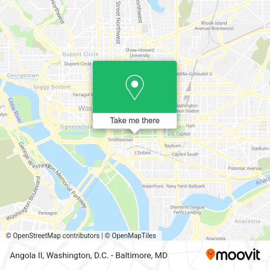
See Angola II, Washington, on the map
Public Transit to Angola II in Washington
Wondering how to get to Angola II in Washington? Moovit helps you find the best way to get to Angola II with step-by-step directions from the nearest public transit station.
Moovit provides free maps and live directions to help you navigate through your city. View schedules, routes, timetables, and find out how long does it take to get to Angola II in real time.
Looking for the nearest stop or station to Angola II? Check out this list of stops closest to your destination: 7th St @ Jefferson Dr SW; 7 St Sw+Jefferson Dr SW; Independence & 9th St; Independence Ave & 9th St SW Eb; 7th St & Independence Ave SW Nb; Independence St Ave & Lenfant Plaza; 7th St & Maryland & Independence Aves. SW Nb; Smithsonian Metrorail; 7th St. & Maryland Ave. SW (L'Enfant Plaza) Nb; L'Enfant Plaza; 7th St @ C St SW.
Bus: 612-WAR, 923, A29, D10, D32, D44, D4X, F19, 943, 953, D1X, D30, D40, D60, 281, 481, 483, 484, 486, 230, 250, 630, 725.Train: MANASSAS LINE, MARC.Metro: BLUE, GREEN, ORANGE, SILVER, YELLOW, FREDERICKSBURG LINE, MANASSAS LINE.
Want to see if there’s another route that gets you there at an earlier time? Moovit helps you find alternative routes or times. Get directions from and directions to Angola II easily from the Moovit App or Website.
We make riding to Angola II easy, which is why over 1.5 million users, including users in Washington, trust Moovit as the best app for public transit. You don’t need to download an individual bus app or train app, Moovit is your all-in-one transit app that helps you find the best bus time or train time available.
For information on prices of bus, metro and train, costs and ride fares to Angola II, please check the Moovit app.
Use the app to navigate to popular places including to the airport, hospital, stadium, grocery store, mall, coffee shop, school, college, and university.
Angola II Address: Jefferson Drive Southwest street in Washington
- Arts and Industries Building,
- National Gallery Of Art,
- Natural Museum Of History,
- National Museum Of American History,
- National Zoological Park,
- National Air And Space Museum,
- Arthur M.Sackler Gallery,
- Smithsonian Institution,
- Hirshhorn Museum,
- Yayoi Kusama: Infinity Mirrors,
- National Mall,
- Carousel on the National Mall,
- Hirshhorn Museum and Sculpture Garden,
- The National Mall ,
- INDEPENDENCE AVE 9TH ST SW eb,
- Federal Aviation Administration,
- American Art Museum,
- National Museum of African Art,
- Smithsonian Institution Building (The Castle),
- Enid A. Haupt Garden
Places Near Angola II (Washington)
- Capital One Arena, Washington,
- The Anthem, Washington,
- Westfield Montgomery Mall, Montgomery County,
- Basilica of the National Shrine, Washington,
- Museum Of The Bible, Washington,
- Georgetown, Washington,
- PG Mall, Prince George's County,
- Sibley Memorial Hospital, Washington,
- Camden Yards, Baltimore,
- National Museum of African American History and Culture, Washington,
- Pennsylvania Ave NW (3rd st and pennsylvania), Washington,
- Amazon Hq2, Arlington County,
- Rock Creek Tennis Center, Washington,
- Washington DC VA Medical Center, Washington,
- Washington National Cathedral, Washington,
- Warner Theatre, Washington,
- Marriott Marquis Washington, DC, Washington,
- M&T Bank Stadium, Baltimore,
- National Mall, Washington,
- National Zoo, Washington
How to get to popular places in Washington, D.C. - Baltimore, MD with public transit
Get around Washington by public transit!
Traveling around Washington has never been so easy. See step by step directions as you travel to any attraction, street or major public transit station. View bus and train schedules, arrival times, service alerts and detailed routes on a map, so you know exactly how to get to anywhere in Washington.
When traveling to any destination around Washington use Moovit's Live Directions with Get Off Notifications to know exactly where and how far to walk, how long to wait for your line, and how many stops are left. Moovit will alert you when it's time to get off — no need to constantly re-check whether yours is the next stop.
Wondering how to use public transit in Washington or how to pay for public transit in Washington? Moovit public transit app can help you navigate your way with public transit easily, and at minimum cost. It includes public transit fees, ticket prices, and costs. Looking for a map of Washington public transit lines? Moovit public transit app shows all public transit maps in Washington with all Bus, Train, Metro, Light Rail and Ferry routes and stops on an interactive map.
Washington, D.C. - Baltimore, MD has 5 transit type(s), including: Bus, Train, Metro, Light Rail and Ferry, operated by several transit agencies, including WMATA, Montgomery County Ride On, Fairfax Connector, TheBus, PRTC, DASH - Alexandria, Arlington Transit (ART), RTA of Central Maryland, MDOT MTA, MDOT MTA Light RailLink, MDOT MTA Commuter Bus, MDOT MTA Local Bus, FXBGO!, Virginia Railway Express (VRE) and MARC