Directions to Angracell (Angra Dos Reis) with public transportation
The following transit lines have routes that pass near Angracell
 Bus: 104, 230, B207, T10, T11.
- Ferry: ANGRA DOS REIS - ILHA GRANDE, ANGRA DOS REIS - ILHA GRANDE.
How to get to Angracell by bus?
Click on the bus route to see step by step directions with maps, line arrival times and updated time schedules.
From Camping Cristina, Cunhambebe
82 minFrom Caputera, Jacuecanga
43 minFrom Samba Angra dos Reis, Cunhambebe
82 minFrom Monsuaba, Jacuecanga
60 minFrom Rod. Governador Mário Covas, Km 115 s/n, Cunhambebe
82 minFrom Vila Da Petrobras, Jacuecanga
49 minFrom Jussaral, Cunhambebe
69 minFrom Praia do Sol- Monsuaba, Jacuecanga
60 minFrom Escolinha da Brasfels (Brasfels), Jacuecanga
36 min
Bus stops near Angracell in Angra Dos Reis
- Ponto De Embarque 07 - Praça Do Porto, 2 min walk,VIEW
- Centro / Largo Da Lapa, 2 min walk,VIEW
- Ponto De Embarque 06 - Praça Do Porto, 3 min walk,VIEW
- Desembarque Centro / Largo Da Lapa, 3 min walk,VIEW
- Ponto De Embarque 11 - Lapa, 3 min walk,VIEW
- Ponto 01 - Santa Luzia, 5 min walk,VIEW
- Avenida Júlio Maria, 289-385, 6 min walk,VIEW
Ferry station near Angracell in Angra Dos Reis
- Estação Santa Luzia (Angra Dos Reis) ⛴, 6 min walk,VIEW
Bus lines to Angracell in Angra Dos Reis
- 203, Serra D'Água (Via Zungu),VIEW
- B203, Serra D'Agua (Túnel),VIEW
- 204, Centro,VIEW
- B206, Centro (via Balneário),VIEW
- C206, Centro (Saída Vale da Banqueta),VIEW
- C01, Centro (Circular),VIEW
- C01B, Circular (via Pestalozzi),VIEW
- C03, Marinas,VIEW
- C03B, Marinas (via Balneário),VIEW
- C04, Vila Velha,VIEW
- 207, Centro (Via Morro Da Cruz),VIEW
- B207, Japuíba (via Rio-Santos),VIEW
- 221, Nova Angra,VIEW
- B221, Nova Angra (via Gamboa / Ribeira),VIEW
- C05, Retiro,VIEW
- C05B, Retiro (via Balneário),VIEW
- T10, Divisa Mangaratiba,VIEW
- T11, Ponta Leste (via Jacuecanga),VIEW
- T20, Parque Mambucaba (via Praia Brava / Vila Histórica),VIEW
- T21, Frade,VIEW
What are the closest stations to Angracell?
The closest stations to Angracell are:
- Ponto De Embarque 07 - Praça Do Porto is 136 meters away, 2 min walk.
- Centro / Largo Da Lapa is 140 meters away, 2 min walk.
- Ponto De Embarque 06 - Praça Do Porto is 148 meters away, 3 min walk.
- Desembarque Centro / Largo Da Lapa is 149 meters away, 3 min walk.
- Ponto De Embarque 11 - Lapa is 196 meters away, 3 min walk.
- Ponto 01 - Santa Luzia is 360 meters away, 5 min walk.
- Avenida Júlio Maria, 289-385 is 403 meters away, 6 min walk.
- Estação Santa Luzia (Angra Dos Reis) ⛴ is 420 meters away, 6 min walk.
Which bus lines stop near Angracell?
These bus lines stop near Angracell: 104, 230, B207, T10, T11.
What’s the nearest bus station to Angracell in Angra Dos Reis?
The nearest bus stations to Angracell in Angra Dos Reis are Ponto De Embarque 07 - Praça Do Porto and Centro / Largo Da Lapa. The closest one is a 2 min walk away.
What’s the nearest ferry station to Angracell in Angra Dos Reis?
The nearest ferry station to Angracell in Angra Dos Reis is Estação Santa Luzia (Angra Dos Reis) ⛴. It’s a 6 min walk away.
What time is the first bus to Angracell in Angra Dos Reis?
The T11 is the first bus that goes to Angracell in Angra Dos Reis. It stops nearby at 4:50 AM.
What time is the last bus to Angracell in Angra Dos Reis?
The T11 is the last bus that goes to Angracell in Angra Dos Reis. It stops nearby at 2:01 AM.
What time is the first ferry to Angracell in Angra Dos Reis?
The ANGRA DOS REIS - ILHA GRANDE is the first ferry that goes to Angracell in Angra Dos Reis. It stops nearby at 8:35 AM.
What time is the last ferry to Angracell in Angra Dos Reis?
The ANGRA DOS REIS - ILHA GRANDE is the last ferry that goes to Angracell in Angra Dos Reis. It stops nearby at 6:30 PM.
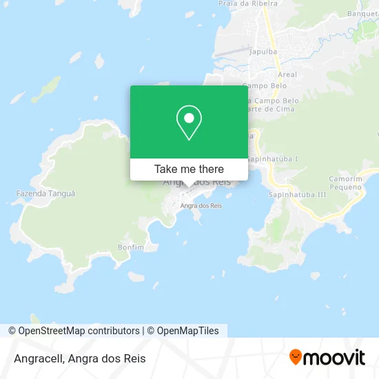
See Angracell, Angra Dos Reis, on the map
Public Transit to Angracell in Angra Dos Reis
Wondering how to get to Angracell in Angra Dos Reis? Moovit helps you find the best way to get to Angracell with step-by-step directions from the nearest public transit station.
Moovit provides free maps and live directions to help you navigate through your city. View schedules, routes, timetables, and find out how long does it take to get to Angracell in real time.
Looking for the nearest stop or station to Angracell? Check out this list of stops closest to your destination: Ponto De Embarque 07 - Praça Do Porto; Centro / Largo Da Lapa; Ponto De Embarque 06 - Praça Do Porto; Desembarque Centro / Largo Da Lapa; Ponto De Embarque 11 - Lapa; Ponto 01 - Santa Luzia; Avenida Júlio Maria; Estação Santa Luzia (Angra Dos Reis) ⛴.
Bus: 104, 230, B207, T10, T11, 203, B203, 204, B206, C206, C01, C01B, C03, C03B, C04, 207, 221, B221, C05, C05B, T20, C04B.Ferry: ANGRA DOS REIS - ILHA GRANDE, ANGRA DOS REIS - ILHA GRANDE.
Want to see if there’s another route that gets you there at an earlier time? Moovit helps you find alternative routes or times. Get directions from and directions to Angracell easily from the Moovit App or Website.
We make riding to Angracell easy, which is why over 1.5 million users, including users in Angra Dos Reis, trust Moovit as the best app for public transit. You don’t need to download an individual bus app or train app, Moovit is your all-in-one transit app that helps you find the best bus time or train time available.
For information on prices of bus, costs and ride fares to Angracell, please check the Moovit app.
Use the app to navigate to popular places including to the airport, hospital, stadium, grocery store, mall, coffee shop, school, college, and university.
Angracell Address: Rua Coronel Carvalho, 275 Centro Angra dos Reis-RJ 23900-315 street in Angra Dos Reis
- K S Modas,
- M S Comercio de Roupas e Acessorios,
- Dermoclin Clinica Dermatologia e Estética,
- Sindhoteis,
- Itaú Unibanco S/A.,
- Patas and Penas Racoes e Medicamentos,
- Funerária Real Pax Costa Verde,
- Submarino Lanches,
- Bicemello Comercio de Roupas,
- Clinica De Dermatologia E Estetica Dermoclin,
- Isabella Gaver,
- Cassino Praia Hotel,
- Banco Itaú,
- Auto Escola 2m,
- Lets Burger,
- Otica Bela Angra,
- Bar e Lanchonete Tatiana de Angra,
- Hotel Restaurante Zibamba,
- Ccaa Angra,
- Loterica Angra dos Rei
Places Near Angracell (Angra Dos Reis)
- Cachoeira do Tobogã, Parati,
- praia jabaquara - parati, Parati,
- Rua Cônegos Bittencourt, Angra Dos Reis,
- Rodovia BR 101, Km 533 s/n, Mambucaba,
- Garatucaia, Angra Dos Reis,
- Centro Histórico de Paraty, Parati,
- Rua Prefeito João Gregório Galindo 2487, Angra Dos Reis,
- Praia do Laboratório, Angra Dos Reis,
- Verolme, Jacuecanga,
- Alambique Engenho D'Ouro, Parati,
- Rodovia Procurador Haroldo Fernandes Duarte, Km 513,5 s / n, Cunhambebe,
- Mambucaba, Mambucaba,
- Avenida Antônio Bertholdo da Silva Jordão 7346, Jacuecanga,
- BR 101, Km 508 s/n, Cunhambebe,
- Praia de Paraty Mirim, Parati,
- Avenida Almirante Jair Carneiro Toscano de Brito 110, Angra Dos Reis,
- Vila Galé Eco Resort De Angra, Angra Dos Reis,
- Condominio Laranjeiras, Parati Mirim,
- Vila Residencial De Mambucaba, Mambucaba,
- Rua Prefeito João Gregório Galindo, Cunhambebe
How to get to popular places in Angra dos Reis with public transit
Get around Angra Dos Reis by public transit!
Traveling around Angra Dos Reis has never been so easy. See step by step directions as you travel to any attraction, street or major public transit station. View bus and train schedules, arrival times, service alerts and detailed routes on a map, so you know exactly how to get to anywhere in Angra Dos Reis.
When traveling to any destination around Angra Dos Reis use Moovit's Live Directions with Get Off Notifications to know exactly where and how far to walk, how long to wait for your line, and how many stops are left. Moovit will alert you when it's time to get off — no need to constantly re-check whether yours is the next stop.
Wondering how to use public transit in Angra Dos Reis or how to pay for public transit in Angra Dos Reis? Moovit public transit app can help you navigate your way with public transit easily, and at minimum cost. It includes public transit fees, ticket prices, and costs. Looking for a map of Angra Dos Reis public transit lines? Moovit public transit app shows all public transit maps in Angra Dos Reis with all Bus and Ferry routes and stops on an interactive map.
Angra dos Reis has 2 transit type(s), including: Bus and Ferry, operated by several transit agencies, including Viação Senhor do Bonfim, Colitur Transportes Rodoviários, Cooparatyense (Vans), Costa Verde Transportes, Barcas Rio, Objetiva Tour, Vilanova Tour, Rodoviário Oceano, BusUFF and Colitur (Tarifa Zero - Paraty)