How to get to Anita Harding by bus?
Click on the bus route to see step by step directions with maps, line arrival times and updated time schedules.
From S Yukon Ave W, Tulsa
76 minFrom Amazon Counter-AAA Tulsa, Tulsa
54 minFrom Nathan Hale High School, Tulsa
79 minFrom Tacos, Tulsa
49 minFrom Hilldale, Oklahoma, Tulsa
72 minFrom CarHop Auto Sales & Finance, Tulsa
74 minFrom Red Fork Distillery, Tulsa
64 minFrom Dove Science Academy Tulsa, Tulsa
71 minFrom Dr Harry Ma Doctor of Medicine, Tulsa
60 min
Bus stops near Anita Harding in Tulsa
What are the closest stations to Anita Harding?
The closest stations to Anita Harding are:
- (8406) Hartford Ave & Virgin St Nb is 457 yards away, 6 min walk.
- (0141) M.L.K. Jr Blvd & Ute Nb is 927 yards away, 12 min walk.
Which bus lines stop near Anita Harding?
These bus lines stop near Anita Harding: 110, 201, 320.
What’s the nearest bus station to Anita Harding in Tulsa?
The nearest bus station to Anita Harding in Tulsa is (8406) Hartford Ave & Virgin St Nb. It’s a 6 min walk away.
What time is the first bus to Anita Harding in Tulsa?
The 110 is the first bus that goes to Anita Harding in Tulsa. It stops nearby at 5:39 AM.
What time is the last bus to Anita Harding in Tulsa?
The 320 is the last bus that goes to Anita Harding in Tulsa. It stops nearby at 7:02 PM.
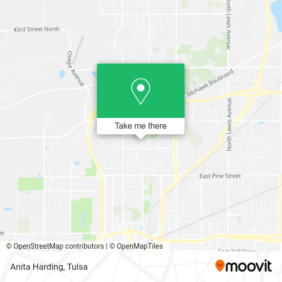
See Anita Harding, Tulsa, on the map
Public Transit to Anita Harding in Tulsa
Wondering how to get to Anita Harding in Tulsa? Moovit helps you find the best way to get to Anita Harding with step-by-step directions from the nearest public transit station.
Moovit provides free maps and live directions to help you navigate through your city. View schedules, routes, timetables, and find out how long does it take to get to Anita Harding in real time.
Looking for the nearest stop or station to Anita Harding? Check out this list of stops closest to your destination: (8406) Hartford Ave & Virgin St Nb; (0141) M.L.K. Jr Blvd & Ute Nb.
Bus: 110, 201, 320.
Want to see if there’s another route that gets you there at an earlier time? Moovit helps you find alternative routes or times. Get directions from and directions to Anita Harding easily from the Moovit App or Website.
We make riding to Anita Harding easy, which is why over 1.5 million users, including users in Tulsa, trust Moovit as the best app for public transit. You don’t need to download an individual bus app or train app, Moovit is your all-in-one transit app that helps you find the best bus time or train time available.
For information on prices of bus, costs and ride fares to Anita Harding, please check the Moovit app.
Use the app to navigate to popular places including to the airport, hospital, stadium, grocery store, mall, coffee shop, school, college, and university.
Anita Harding Address: 535 E Woodrow Pl Tulsa, OK 74106 street in Tulsa
- Jimbo's Smokn Grill,
- Dittus Company, LLC,
- Place of Worship,
- Love Your Decor,
- New Beginnings Ministry,
- Apache & Lewis,
- Water Damage Repair and Restoration,
- John 3:16 Mission,
- Home Heating & Cooling Repair,
- John 3:16 Children's Office,
- Loving Arms,
- Sunday Dinner by Janet,
- John 3:16 Fyc,
- Premier Paint & Design,
- Sanctuary Evangelistic Church,
- Antioch Baptist Church,
- DC Phillips Law Firm,
- Jaoz House Cleaning,
- Sisters Cleaning,
- SFC Cleaning
Places Near Anita Harding (Tulsa)
- Woodland Hills Mall, Tulsa,
- Amazon Fulfillment Center-TUL2, Tulsa,
- Tulsa Zoo, Tulsa,
- St. Francis Hospital Outpatient Infusion, Tulsa,
- S Garnett Rd / E 21st St, Tulsa,
- Tulsa Ok, Tulsa,
- Fallout Shelter, Tulsa,
- Zavala Plus, Tulsa,
- Broken Arrow, OK, Broken Arrow,
- Osage Casino, Tulsa,
- Bixby, OK, Bixby,
- Plaza Santa Cecilia, Tulsa,
- Hard Rock Casino, Tulsa,
- Alagon Spa (Olympus Spa), Tulsa,
- 71st & Memorial, Tulsa,
- Tulsa State Fair, Tulsa,
- River Spirit Casino, Tulsa,
- St Francis South Cardinal Building, Tulsa,
- Walmart, Tulsa,
- Saint Francis Hospital, Tulsa
How to get to popular places in Tulsa with public transit
Get around Tulsa by public transit!
Traveling around Tulsa has never been so easy. See step by step directions as you travel to any attraction, street or major public transit station. View bus and train schedules, arrival times, service alerts and detailed routes on a map, so you know exactly how to get to anywhere in Tulsa.
When traveling to any destination around Tulsa use Moovit's Live Directions with Get Off Notifications to know exactly where and how far to walk, how long to wait for your line, and how many stops are left. Moovit will alert you when it's time to get off — no need to constantly re-check whether yours is the next stop.
Wondering how to use public transit in Tulsa or how to pay for public transit in Tulsa? Moovit public transit app can help you navigate your way with public transit easily, and at minimum cost. It includes public transit fees, ticket prices, and costs. Looking for a map of Tulsa public transit lines? Moovit public transit app shows all public transit maps in Tulsa with all bus routes and stops on an interactive map.
Tulsa has 1 transit type(s), including: bus, operated by several transit agencies, including MetroLink Tulsa and Greyhound-us