How to get to Ap2c by bus?
Click on the bus route to see step by step directions with maps, line arrival times and updated time schedules.
From Musée des Arts Decoratifs, Paris
58 minFrom Rue la Vacquerie, Paris
65 minFrom Rue Sedaine, Paris
64 minFrom Rue de Lille, Paris
52 minFrom Centre Hospitalier Sainte-Anne, Paris
71 minFrom Rue du Faubourg Saint-Honoré & Rue Saint Honoré, Paris
43 minFrom Hôpital de la Salpêtrière, Paris
74 minFrom Disneyland, Paris
69 minFrom Gare d'Austerlitz, Paris
78 minFrom Lycée Louis le Grand, Paris
65 min
How to get to Ap2c by train?
Click on the train route to see step by step directions with maps, line arrival times and updated time schedules.
How to get to Ap2c by metro?
Click on the metro route to see step by step directions with maps, line arrival times and updated time schedules.
From Musée des Arts Decoratifs, Paris
45 minFrom Rue la Vacquerie, Paris
56 minFrom Rue Sedaine, Paris
56 minFrom Rue de Lille, Paris
47 minFrom Centre Hospitalier Sainte-Anne, Paris
72 minFrom Rue du Faubourg Saint-Honoré & Rue Saint Honoré, Paris
45 minFrom Hôpital de la Salpêtrière, Paris
62 minFrom Disneyland, Paris
68 minFrom Gare d'Austerlitz, Paris
54 minFrom Lycée Louis le Grand, Paris
61 min
Bus stops near Ap2c in Courbevoie
Train station near Ap2c in Courbevoie
- Gare D'Asnieres, 12 min walk,VIEW
Metro station near Ap2c in Courbevoie
- Pont de Levallois - Bécon, 22 min walk,VIEW
Bus lines to Ap2c in Courbevoie
- 167, Piscine - Patinoire,VIEW
- 278, Les Bruyères - La Défense (voie Perronet Sud),VIEW
- 363, Nanterre - Préfecture Rer - Les Bruyères,VIEW
- N52, Gare Saint-Lazare,VIEW
- 178, La Défense (Voie Perronet Nord),VIEW
- 275, La Défense (Voie Perronet Nord),VIEW
- A, Gare Saint-Lazare,VIEW
- L, Place de Belgique / Bécon Les Bruyères,VIEW
- J, Gare Saint-Lazare,VIEW
- 175, Les Bruyères,VIEW
What are the closest stations to Ap2c?
The closest stations to Ap2c are:
- Michel Ricard is 186 meters away, 3 min walk.
- Les Bruyères is 207 meters away, 3 min walk.
- Chevreul is 421 meters away, 6 min walk.
- Place de Belgique / Bécon Les Bruyères is 566 meters away, 8 min walk.
- Gare D'Asnieres is 912 meters away, 12 min walk.
- Pont de Levallois - Bécon is 1668 meters away, 22 min walk.
Which train line stops near Ap2c?
L (Paris-Saint-Lazare)
Which metro line stops near Ap2c?
3 (Gallieni)
Which bus lines stop near Ap2c?
These bus lines stop near Ap2c: 163, 164, 167, 275.
What’s the nearest metro station to Ap2c in Courbevoie?
The nearest metro station to Ap2c in Courbevoie is Pont de Levallois - Bécon. It’s a 22 min walk away.
What’s the nearest train station to Ap2c in Courbevoie?
The nearest train station to Ap2c in Courbevoie is Gare D'Asnieres. It’s a 12 min walk away.
What’s the nearest bus station to Ap2c in Courbevoie?
The nearest bus stations to Ap2c in Courbevoie are Michel Ricard and Les Bruyères. The closest one is a 3 min walk away.
What time is the first metro to Ap2c in Courbevoie?
The 3 is the first metro that goes to Ap2c in Courbevoie. It stops nearby at 5:30 AM.
What time is the last metro to Ap2c in Courbevoie?
The 3 is the last metro that goes to Ap2c in Courbevoie. It stops nearby at 1:15 AM.
What time is the first train to Ap2c in Courbevoie?
The J is the first train that goes to Ap2c in Courbevoie. It stops nearby at 4:59 AM.
What time is the last train to Ap2c in Courbevoie?
The J is the last train that goes to Ap2c in Courbevoie. It stops nearby at 1:10 AM.
What time is the first bus to Ap2c in Courbevoie?
The N52 is the first bus that goes to Ap2c in Courbevoie. It stops nearby at 3:07 AM.
What time is the last bus to Ap2c in Courbevoie?
The N52 is the last bus that goes to Ap2c in Courbevoie. It stops nearby at 3:25 AM.
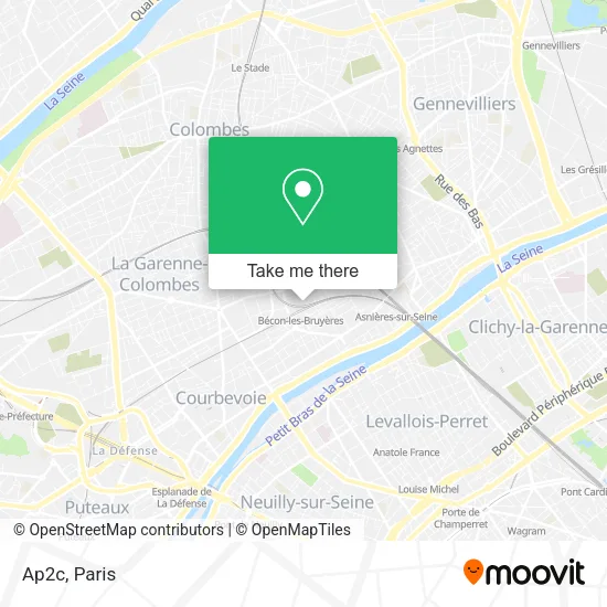
See Ap2c, Courbevoie, on the map
Public Transit to Ap2c in Courbevoie
Wondering how to get to Ap2c in Courbevoie? Moovit helps you find the best way to get to Ap2c with step-by-step directions from the nearest public transit station.
Moovit provides free maps and live directions to help you navigate through your city. View schedules, routes, timetables, and find out how long does it take to get to Ap2c in real time.
Looking for the nearest stop or station to Ap2c? Check out this list of stops closest to your destination: Michel Ricard; Les Bruyères; Chevreul; Place de Belgique / Bécon Les Bruyères; Gare D'Asnieres; Pont de Levallois - Bécon.
Train: L, J.Metro: 3.Bus: 163, 164, 167, 275, 278, 363, N52, 178.
Want to see if there’s another route that gets you there at an earlier time? Moovit helps you find alternative routes or times. Get directions from and directions to Ap2c easily from the Moovit App or Website.
We make riding to Ap2c easy, which is why over 1.5 million users, including users in Courbevoie, trust Moovit as the best app for public transit. You don’t need to download an individual bus app or train app, Moovit is your all-in-one transit app that helps you find the best bus time or train time available.
For information on prices of metro, bus, train and RER, costs and ride fares to Ap2c, please check the Moovit app.
Use the app to navigate to popular places including to the airport, hospital, stadium, grocery store, mall, coffee shop, school, college, and university.
Ap2c Address: 2 Rue Madiraa 92400 Courbevoie street in Courbevoie
- Agence des Bruyères,
- Dr. Belzgaou Pascal,
- Sarl Dannepond,
- Cabinet du Tintoret,
- 64 Rue de la Sablière,
- SNCF-Bécon-les Bruyères,
- Look Becon,
- Dr Lahana,
- Quai des Vaps,
- Flovir,
- Beniikiker Négoce,
- Épicerie,
- Aurélien Cohen Pâtisserie,
- Le Goff Laurent,
- Pharmacie Sebag Charles,
- Comfort Hotel,
- Nadji - Mazouni,
- Boulangerie de la Gare,
- Gare SNCF de Bécon-les-Bruyères,
- Napoli Eat
Places Near Ap2c (Courbevoie)
- Fondation Louis Vuitton, Paris,
- Hôpital Beaujon, Clichy,
- Galeries Lafayette Haussmann, Paris,
- Gare Routière Flixbus, Paris,
- Centre Hospitalier des 15/20, Paris,
- Créteil Soleil, Creteil,
- Hopital Lariboisière, Paris,
- Hôpital Saint-Joseph, Paris,
- Marché Saint-Pierre, Paris,
- Atelier Des Lumieres, Paris,
- 29 Rue Manin, Paris,
- Hôpital de la Pitié-Salpêtrière, Paris,
- Théâtre Mogador, Paris,
- Hôpital Cochin, Paris,
- Hôpital Necker, Paris,
- Hôpital Henri Mondor, Creteil,
- Beaugrenelle, Paris,
- Galeries Lafayette, Paris,
- Hopital Foch, Suresnes,
- Hôpital Pitié Salpêtrière, Paris
How to get to popular places in Paris with public transit
Get around Courbevoie by public transit!
Traveling around Courbevoie has never been so easy. See step by step directions as you travel to any attraction, street or major public transit station. View bus and train schedules, arrival times, service alerts and detailed routes on a map, so you know exactly how to get to anywhere in Courbevoie.
When traveling to any destination around Courbevoie use Moovit's Live Directions with Get Off Notifications to know exactly where and how far to walk, how long to wait for your line, and how many stops are left. Moovit will alert you when it's time to get off — no need to constantly re-check whether yours is the next stop.
Wondering how to use public transit in Courbevoie or how to pay for public transit in Courbevoie? Moovit public transit app can help you navigate your way with public transit easily, and at minimum cost. It includes public transit fees, ticket prices, and costs. Looking for a map of Courbevoie public transit lines? Moovit public transit app shows all public transit maps in Courbevoie with all Bus, Train, Metro, Light Rail, RER, Funicular and Gondola routes and stops on an interactive map.
Paris has 7 transit type(s), including: Bus, Train, Metro, Light Rail, RER, Funicular and Gondola, operated by several transit agencies, including RATP, RER, RER Bus de remplacement, Train, Train Bus de remplacement, Tramway Bus de remplacement, TER, ADP, Magical Shuttle, Argenteuil - Boucles de Seine, Autocars Dominique, Bièvre, Brie et 2 Morin, Le Bus - C.C. du Clermontois and Cœur d’Essonne