Directions to Apac - Auto (Anne Arundel County) with public transportation
The following transit lines have routes that pass near Apac - Auto
 Bus: 75.
- Light Rail: LIGHT RAILLINK.
How to get to Apac - Auto by bus?
Click on the bus route to see step by step directions with maps, line arrival times and updated time schedules.
From Saint Agnes Hospital, Baltimore
41 minFrom National Aquarium-Baltimore, Baltimore
52 minFrom Hanover, Baltimore
49 minFrom Baltimore Soundstage, Baltimore
48 minFrom Mondawmin Mall, Baltimore
61 minFrom Walmart, Baltimore County
92 minFrom Druid Hill Park, Baltimore
82 minFrom Bwi2 Employee Shuttles, Baltimore
100 minFrom The Maryland Zoo In Baltimore, Baltimore
69 minFrom CFG Bank Arena, Baltimore
45 min
Bus stop near Apac - Auto in Anne Arundel County
- Nursery Rd & Barkwood Ct Wb, 4 min walk,VIEW
Light Rail stations near Apac - Auto in Anne Arundel County
- Nursery Road, 20 min walk,VIEW
Bus lines to Apac - Auto in Anne Arundel County
- 75, Arundel Mills Shopping Center,VIEW
What are the closest stations to Apac - Auto?
The closest stations to Apac - Auto are:
- Nursery Rd & Barkwood Ct Wb is 307 yards away, 4 min walk.
- Nursery Road is 1615 yards away, 20 min walk.
Which bus line stops near Apac - Auto?
75 (Arundel Mills Shopping Center)
Which light rail line stops near Apac - Auto?
LIGHT RAILLINK (Soutbound)
What’s the nearest light rail station to Apac - Auto in Anne Arundel County?
The nearest light rail station to Apac - Auto in Anne Arundel County is Nursery Road. It’s a 20 min walk away.
What’s the nearest bus station to Apac - Auto in Anne Arundel County?
The nearest bus station to Apac - Auto in Anne Arundel County is Nursery Rd & Barkwood Ct Wb. It’s a 4 min walk away.
What time is the first light rail to Apac - Auto in Anne Arundel County?
The LIGHT RAILLINK is the first light rail that goes to Apac - Auto in Anne Arundel County. It stops nearby at 4:28 AM.
What time is the last light rail to Apac - Auto in Anne Arundel County?
The LIGHT RAILLINK is the last light rail that goes to Apac - Auto in Anne Arundel County. It stops nearby at 12:55 AM.
What time is the first bus to Apac - Auto in Anne Arundel County?
The 75 is the first bus that goes to Apac - Auto in Anne Arundel County. It stops nearby at 4:41 AM.
What time is the last bus to Apac - Auto in Anne Arundel County?
The 75 is the last bus that goes to Apac - Auto in Anne Arundel County. It stops nearby at 12:27 AM.
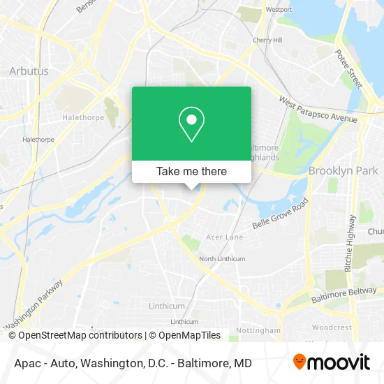
See Apac - Auto, Anne Arundel County, on the map
Public Transit to Apac - Auto in Anne Arundel County
Wondering how to get to Apac - Auto in Anne Arundel County? Moovit helps you find the best way to get to Apac - Auto with step-by-step directions from the nearest public transit station.
Moovit provides free maps and live directions to help you navigate through your city. View schedules, routes, timetables, and find out how long does it take to get to Apac - Auto in real time.
Looking for the nearest stop or station to Apac - Auto? Check out this list of stops closest to your destination: Nursery Rd & Barkwood Ct Wb; Nursery Road.
Bus: 75.Light Rail: LIGHT RAILLINK.
Want to see if there’s another route that gets you there at an earlier time? Moovit helps you find alternative routes or times. Get directions from and directions to Apac - Auto easily from the Moovit App or Website.
We make riding to Apac - Auto easy, which is why over 1.5 million users, including users in Anne Arundel County, trust Moovit as the best app for public transit. You don’t need to download an individual bus app or train app, Moovit is your all-in-one transit app that helps you find the best bus time or train time available.
For information on prices of bus, light rail and metro, costs and ride fares to Apac - Auto, please check the Moovit app.
Use the app to navigate to popular places including to the airport, hospital, stadium, grocery store, mall, coffee shop, school, college, and university.
Apac - Auto Address: 806 Barkwood Ct Linthicum Heights, MD 21090 street in Anne Arundel County
- Wanna Pizza This,
- Capitol Response,
- Kolb Electric,
- Progressive Systems,
- Cell-Tek Geosynthetics,
- JJ Wanlong,
- West Shore Home,
- Doug Andersen - M&T Bank,
- Andrew Baker - M&T Bank,
- Carleton Dunn - M&T Bank,
- Matt Saros - M&T Bank,
- National Cardiac,
- MD Medical Supply,
- North Linthicum, Maryland,
- Pain Management Physical Therapy,
- Big Fish,
- Heights Disount Locksmiths,
- Pdi Sheetz Construction Corporation,
- Hongyu Spa,
- Asian Massage
Places Near Apac - Auto (Anne Arundel County)
- Amazon Hq2, Arlington County,
- National Mall, Washington,
- National Zoo, Washington,
- Washington National Cathedral, Washington,
- Pennsylvania Ave NW (3rd st and pennsylvania), Washington,
- Georgetown, Washington,
- PG Mall, Prince George's County,
- Washington DC VA Medical Center, Washington,
- Museum Of The Bible, Washington,
- Basilica of the National Shrine, Washington,
- National Museum of African American History and Culture, Washington,
- Marriott Marquis Washington, DC, Washington,
- Rock Creek Tennis Center, Washington,
- Westfield Montgomery Mall, Montgomery County,
- Capital One Arena, Washington,
- The Anthem, Washington,
- Warner Theatre, Washington,
- Sibley Memorial Hospital, Washington,
- Camden Yards, Baltimore,
- M&T Bank Stadium, Baltimore
How to get to popular places in Washington, D.C. - Baltimore, MD with public transit
Get around Anne Arundel County by public transit!
Traveling around Anne Arundel County has never been so easy. See step by step directions as you travel to any attraction, street or major public transit station. View bus and train schedules, arrival times, service alerts and detailed routes on a map, so you know exactly how to get to anywhere in Anne Arundel County.
When traveling to any destination around Anne Arundel County use Moovit's Live Directions with Get Off Notifications to know exactly where and how far to walk, how long to wait for your line, and how many stops are left. Moovit will alert you when it's time to get off — no need to constantly re-check whether yours is the next stop.
Wondering how to use public transit in Anne Arundel County or how to pay for public transit in Anne Arundel County? Moovit public transit app can help you navigate your way with public transit easily, and at minimum cost. It includes public transit fees, ticket prices, and costs. Looking for a map of Anne Arundel County public transit lines? Moovit public transit app shows all public transit maps in Anne Arundel County with all Bus, Train, Metro, Light Rail and Ferry routes and stops on an interactive map.
Washington, D.C. - Baltimore, MD has 5 transit type(s), including: Bus, Train, Metro, Light Rail and Ferry, operated by several transit agencies, including WMATA, Montgomery County Ride On, Fairfax Connector, TheBus, PRTC, DASH - Alexandria, Arlington Transit (ART), RTA of Central Maryland, MDOT MTA, MDOT MTA Light RailLink, MDOT MTA Commuter Bus, MDOT MTA Local Bus, FXBGO!, Virginia Railway Express (VRE) and MARC