How to get to Apb by bus?
Click on the bus route to see step by step directions with maps, line arrival times and updated time schedules.
From La Plaine Saint-Denis, Saint-Denis
79 minFrom Accor Arena, Paris
59 minFrom Avenue de Flandre, Paris
76 minFrom Cirque Pinder, Paris
76 minFrom Père-Lachaise, Paris
69 minFrom Avenue de l'Opéra, Paris
33 minFrom EDF Cap Ampère, Saint-Denis
110 minFrom Consulado Geral de Portugal, Paris
36 minFrom Studio 217, Aubervilliers
88 minFrom Foire du Trône, Paris
76 min
How to get to Apb by metro?
Click on the metro route to see step by step directions with maps, line arrival times and updated time schedules.
From La Plaine Saint-Denis, Saint-Denis
58 minFrom Accor Arena, Paris
44 minFrom Avenue de Flandre, Paris
47 minFrom Cirque Pinder, Paris
55 minFrom Père-Lachaise, Paris
50 minFrom Avenue de l'Opéra, Paris
31 minFrom EDF Cap Ampère, Saint-Denis
57 minFrom Consulado Geral de Portugal, Paris
38 minFrom Studio 217, Aubervilliers
52 minFrom Foire du Trône, Paris
57 min
Bus stops near Apb in Paris
Metro station near Apb in Paris
- Église D'Auteuil, 2 min walk,VIEW
RER station near Apb in Paris
- Pont du Garigliano - Hôpital Européen G. Pompidou, 11 min walk,VIEW
Bus lines to Apb in Paris
- 22, Gare Saint-Lazare,VIEW
- 72, Parc de Saint-Cloud,VIEW
- N12, Porte Des Lilas,VIEW
- N61, Gare Montparnasse,VIEW
- 62, Porte de Saint-Cloud,VIEW
- 88, Montsouris - Tombe Issoire,VIEW
- 42, Cours de L'Ile Seguin,VIEW
- N160, Gare Montparnasse,VIEW
- 30, Pigalle - Hôpital Européen Georges Pompidou,VIEW
- 169, Hôpital Européen Georges Pompidou - Pont De Sèvres,VIEW
What are the closest stations to Apb?
The closest stations to Apb are:
- Victorien Sardou is 6 meters away, 1 min walk.
- Église D'Auteuil is 99 meters away, 2 min walk.
- Wilhem - Versailles is 219 meters away, 3 min walk.
- Versailles - Exelmans is 418 meters away, 6 min walk.
- Hôpital Européen Georges Pompidou is 671 meters away, 9 min walk.
- Pont du Garigliano is 795 meters away, 11 min walk.
- Pont du Garigliano - Hôpital Européen G. Pompidou is 796 meters away, 11 min walk.
Which metro line stops near Apb?
10 (Gare D'Austerlitz)
Which bus lines stop near Apb?
These bus lines stop near Apb: 72, PC.
What’s the nearest metro station to Apb in Paris?
The nearest metro station to Apb in Paris is Église D'Auteuil. It’s a 2 min walk away.
What’s the nearest bus station to Apb in Paris?
The nearest bus station to Apb in Paris is Victorien Sardou. It’s a 1 min walk away.
What’s the nearest RER station to Apb in Paris?
The nearest RER station to Apb in Paris is Pont du Garigliano - Hôpital Européen G. Pompidou. It’s a 11 min walk away.
What time is the first light rail to Apb in Paris?
The T3A is the first light rail that goes to Apb in Paris. It stops nearby at 5:15 AM.
What time is the last light rail to Apb in Paris?
The T3A is the last light rail that goes to Apb in Paris. It stops nearby at 1:47 AM.
What time is the first metro to Apb in Paris?
The 10 is the first metro that goes to Apb in Paris. It stops nearby at 5:31 AM.
What time is the last metro to Apb in Paris?
The 9 is the last metro that goes to Apb in Paris. It stops nearby at 1:12 AM.
What time is the first bus to Apb in Paris?
The N12 is the first bus that goes to Apb in Paris. It stops nearby at 3:11 AM.
What time is the last bus to Apb in Paris?
The N160 is the last bus that goes to Apb in Paris. It stops nearby at 3:49 AM.
What time is the first RER to Apb in Paris?
The C is the first RER that goes to Apb in Paris. It stops nearby at 5:17 AM.
What time is the last RER to Apb in Paris?
The C is the last RER that goes to Apb in Paris. It stops nearby at 11:14 PM.
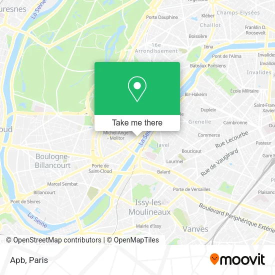
See Apb, Paris, on the map
Public Transit to Apb in Paris
Wondering how to get to Apb in Paris? Moovit helps you find the best way to get to Apb with step-by-step directions from the nearest public transit station.
Moovit provides free maps and live directions to help you navigate through your city. View schedules, routes, timetables, and find out how long does it take to get to Apb in real time.
Looking for the nearest stop or station to Apb? Check out this list of stops closest to your destination: Victorien Sardou; Église D'Auteuil; Wilhem - Versailles; Versailles - Exelmans; Hôpital Européen Georges Pompidou; Pont du Garigliano; Pont du Garigliano - Hôpital Européen G. Pompidou.
RER: C, T3A.Metro: 10.Bus: 72, PC, 22, N12, N61, 62, 88, 42.
Want to see if there’s another route that gets you there at an earlier time? Moovit helps you find alternative routes or times. Get directions from and directions to Apb easily from the Moovit App or Website.
We make riding to Apb easy, which is why over 1.5 million users, including users in Paris, trust Moovit as the best app for public transit. You don’t need to download an individual bus app or train app, Moovit is your all-in-one transit app that helps you find the best bus time or train time available.
For information on prices of metro and bus, costs and ride fares to Apb, please check the Moovit app.
Use the app to navigate to popular places including to the airport, hospital, stadium, grocery store, mall, coffee shop, school, college, and university.
Apb Address: Avenue de Versailles street in Paris
- 130 Quai Louis Blériot,
- Société Générale,
- Quai Saint Exupery,
- Avenue de Versailles,
- IUT Paris Descartes,
- 143 Avenue de Versailles,
- Parc Sainte-Périne,
- Astor,
- L'Atelier,
- Shangri-la HQ,
- Hôpital Sainte Perine,
- Clinique Jouvenet,
- Port de Javel Bas,
- La Javelle - Guinguette Effervescente,
- Service Culturel de l'Ambassade de Chine,
- La Javelle,
- Péniche Le Fleuron,
- 11 Rue Chardon Lagache,
- Arrêt Chardon-Lagache - Molitor [22,62],
- 8 Rue Chapu
Places Near Apb (Paris)
- Gare Routière Flixbus, Paris,
- Hôpital Pitié Salpêtrière, Paris,
- Hôpital de la Pitié-Salpêtrière, Paris,
- Créteil Soleil, Creteil,
- Hôpital Henri Mondor, Creteil,
- Hopital Foch, Suresnes,
- Hôpital Beaujon, Clichy,
- Centre Hospitalier des 15/20, Paris,
- Marché Saint-Pierre, Paris,
- Galeries Lafayette Haussmann, Paris,
- 29 Rue Manin, Paris,
- Hopital Lariboisière, Paris,
- Hôpital Saint-Joseph, Paris,
- Hôpital Cochin, Paris,
- Atelier Des Lumieres, Paris,
- Hôpital Necker, Paris,
- Galeries Lafayette, Paris,
- Beaugrenelle, Paris,
- Fondation Louis Vuitton, Paris,
- Théâtre Mogador, Paris
How to get to popular places in Paris with public transit
Get around Paris by public transit!
Traveling around Paris has never been so easy. See step by step directions as you travel to any attraction, street or major public transit station. View bus and train schedules, arrival times, service alerts and detailed routes on a map, so you know exactly how to get to anywhere in Paris.
When traveling to any destination around Paris use Moovit's Live Directions with Get Off Notifications to know exactly where and how far to walk, how long to wait for your line, and how many stops are left. Moovit will alert you when it's time to get off — no need to constantly re-check whether yours is the next stop.
Wondering how to use public transit in Paris or how to pay for public transit in Paris? Moovit public transit app can help you navigate your way with public transit easily, and at minimum cost. It includes public transit fees, ticket prices, and costs. Looking for a map of Paris public transit lines? Moovit public transit app shows all public transit maps in Paris with all Bus, Train, Metro, Light Rail, RER, Funicular and Gondola routes and stops on an interactive map.
Paris has 7 transit type(s), including: Bus, Train, Metro, Light Rail, RER, Funicular and Gondola, operated by several transit agencies, including RATP, RER, RER Bus de remplacement, Train, Train Bus de remplacement, Tramway Bus de remplacement, TER, ADP, Magical Shuttle, Argenteuil - Boucles de Seine, Autocars Dominique, Bièvre, Brie et 2 Morin, Le Bus - C.C. du Clermontois and Cœur d’Essonne