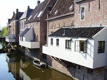
Appingedam station - Sunday schedule
| Line | Direction | Time |
|---|---|---|
| STOPTREIN RS6 | Delfzijl | 7:20 AM |
| STOPTREIN RS6 | Winschoten | 7:37 AM |
| STOPTREIN RS6 | Delfzijl | 8:20 AM |
| STOPTREIN RS6 | Winschoten | 8:37 AM |
| STOPTREIN RS6 | Delfzijl | 9:20 AM |
| STOPTREIN RS6 | Winschoten | 9:37 AM |
| STOPTREIN RS6 | Delfzijl | 10:20 AM |
| STOPTREIN RS6 | Winschoten | 10:37 AM |
| STOPTREIN RS6 | Delfzijl | 11:20 AM |
| STOPTREIN RS6 | Winschoten | 11:37 AM |
| STOPTREIN RS6 | Delfzijl | 12:20 PM |
| STOPTREIN RS6 | Winschoten | 12:37 PM |
| STOPTREIN RS6 | Delfzijl | 1:20 PM |
| STOPTREIN RS6 | Winschoten | 1:37 PM |
| STOPTREIN RS6 | Delfzijl | 2:20 PM |
| STOPTREIN RS6 | Winschoten | 2:37 PM |
| STOPTREIN RS6 | Delfzijl | 3:20 PM |
| STOPTREIN RS6 | Winschoten | 3:37 PM |
| STOPTREIN RS6 | Delfzijl | 4:20 PM |
| STOPTREIN RS6 | Winschoten | 4:37 PM |
| STOPTREIN RS6 | Delfzijl | 5:20 PM |
| STOPTREIN RS6 | Winschoten | 5:37 PM |
| STOPTREIN RS6 | Delfzijl | 6:20 PM |
| STOPTREIN RS6 | Winschoten | 6:37 PM |
| STOPTREIN RS6 | Delfzijl | 7:20 PM |
Directions to Appingedam station with public transit
The following transit lines have routes that pass near Appingedam
 Bus: 6, 41, 549, 564, 178.
- Train: STOPTREIN RS6, STOPTREIN RS5.
How to get to Appingedam station by bus?
Click on the bus route to see step by step directions with maps, line arrival times and updated time schedules.
How to get to Appingedam station by train?
Click on the train route to see step by step directions with maps, line arrival times and updated time schedules.
Bus stops near Appingedam stop
- Appingedam, Busstation (Perron D), 9 min walk,
- Appingedam, Busstation (Perron E), 9 min walk,
- Appingedam, Busstation, 9 min walk,
Train stations near Appingedam station
- Delfzijl West, 53 min walk,
Bus lines to Appingedam station
- 41, Appingedam,
- 549, Appingedam,
- 564, Winsum,
- 6, Delfzijl Via Umcg,
- 178, Groningen,
- 406, Groningen Centrum,
What are the closest stations to Appingedam?
The closest stations to Appingedam are:
- Appingedam, Busstation (Perron D) stop is 661 meters away, 9 min walk.
- Appingedam, Busstation (Perron E) stop is 661 meters away, 9 min walk.
- Appingedam, Busstation stop is 678 meters away, 9 min walk.
- Delfzijl West station is 4213 meters away, 53 min walk.
Which bus line stops near Appingedam?
6 (Delfzijl Via Umcg)
Which train line stops near Appingedam?
STOPTREIN RS6 (Winschoten)
What’s the nearest bus station to Appingedam?
The nearest bus stations to Appingedam are Appingedam, Busstation (Perron D), Appingedam, Busstation (Perron E) and Appingedam, Busstation. The closest one is a 9 min walk away.
What time is the first train to Appingedam?
The STOPTREIN RS6 is the first train that goes to Appingedam. It stops nearby at 7:23 AM.
What time is the last train to Appingedam?
The STOPTREIN RS6 is the last train that goes to Appingedam. It stops nearby at 1:03 AM.
What time is the first bus to Appingedam?
The 406 is the first bus that goes to Appingedam. It stops nearby at 3:37 AM.
What time is the last bus to Appingedam?
The 6 is the last bus that goes to Appingedam. It stops nearby at 1:19 AM.
See Appingedam station on the map
Public transit to Appingedam station
Looking for directions to Appingedam in Appingedam, Netherlands?
Download the Moovit App to find the current schedule and step-by-step directions for Bus or Train routes that pass through Appingedam.
Looking for the nearest stops closest to Appingedam ? Check out this list of closest stops to your destination: Appingedam, Busstation (Perron D); Appingedam, Busstation (Perron E); Appingedam, Busstation; Delfzijl West.
Bus: 6, 41, 549, 564, 178, 406.Train: STOPTREIN RS6, STOPTREIN RS5.
We make riding on public transit to Appingedam easy, which is why over 1.7 billion users, including users in Appingedam trust Moovit as the best app for public transit.
Use the app to navigate to popular places including to the airport, hospital, stadium, grocery store, mall, coffee shop, school, college, and university.
The station has the following entrances: Stationsweg
The first line to this station is STOPTREIN RS6, at 7:20 AM, and the last line is STOPTREIN RS6 at 1:07 AM.
2 Spoorbaan, Appingedam, Netherlands
This station serves Arriva’s lines
- Appingedam, Busstation (Perron D),
- Appingedam, Busstation (Perron E),
- Appingedam, Busstation
Bus stops near Appingedam stop
- Delfzijl West
Train station near Appingedam station
- Bakkerswaal,
- Kreekhuizenlaan,
- Hoofddorp, Kalorama,
- Raamsdonksveer, Kerklaan,
- Paasweide,
- Roosendaal, Jan Vermeerlaan,
- De Tempel,
- Meersel Dreef, Nieuw Dreef,
- Sonneburgh,
- Arnhem, Beethovenlaan,
- Varenhof,
- Zevenaar,
- Tilburg, Korvelplein,
- De Lugt,
- Baarle-Nassau, Venweg,
- Slinge Metro,
- Roelantweg,
- Veldhoven, Huize Sele,
- 'S-Hertogenbosch (Den Bosch), Het Sterrenbeeld,
- Halsteren, Steenspil
Popular public transit stations in Appingedam
Get around Appingedam by public transit!
Traveling around Appingedam has never been so easy. See step by step directions as you travel to any attraction, street or major public transit station. View bus and train schedules, arrival times, service alerts and detailed routes on a map, so you know exactly how to get to anywhere in Appingedam.
When traveling to any destination around Appingedam use Moovit's Live Directions with Get Off Notifications to know exactly where and how far to walk, how long to wait for your line, and how many stops are left. Moovit will alert you when it's time to get off — no need to constantly re-check whether yours is the next stop.
Wondering how to use public transit in Appingedam or how to pay for public transit in Appingedam? Moovit public transit app can help you navigate your way with public transit easily, and at minimum cost. It includes public transit fees, ticket prices, and costs. Looking for a map of Appingedam public transit lines? Moovit public transit app shows all public transit maps in Appingedam with all Bus, Train, Metro, Light Rail and Ferry routes and stops on an interactive map.
Netherlands has 5 transit type(s), including: Bus, Train, Metro, Light Rail and Ferry, operated by several transit agencies, including NS, GVB, U-OV, HTM, RET, De Lijn, Connexxion, Arriva, Breng, EBS, Bravo (Hermes), Hermes, Qbuzz, Bravo (Arriva) and allGo