Directions to Araruama with public transportation
The following transit lines have routes that pass near Araruama
 Bus: B105, B147 ARARUAMA / CABO FRIO, BARRA DA TIJUCA - ARRAIAL DO CABO (VIA ARARUAMA / CABO FRIO), EXECUTIVO, NITERÓI - CABO FRIO.
- Ferry: ARARUAMA - PRAIA SECA.
How to get to Araruama by bus?
Click on the bus route to see step by step directions with maps, line arrival times and updated time schedules.
Bus stops near Araruama
- Rua Francisco Andrade 448 Araruama - Rio De Janeiro 28970 Brasil, 1 min walk,
- Rodoviária De Araruama - Rua Com. A. Carvalho, 3 min walk,
- Ar G 01 - Sentido Ida, 4 min walk,
- Avenida Presidente Getulio Vargas, 250, 5 min walk,
- Ar G 02 - Sentido Ida, 5 min walk,
- Avenida Getúlio Vargas 774 Araruama - Rio De Janeiro 28970 Brasil, 6 min walk,
- Rua Major Felix Moreira, 117, 6 min walk,
- Ar B 97 - Sentido Araruama, 6 min walk,
- Avenida Araruama, 345, 8 min walk,
Ferry station near Araruama
- Ferry Boat - Píer De Araruama, 27 min walk,
Bus lines to Araruama
- B105, Araruama,
- BARRA DA TIJUCA - ARRAIAL DO CABO (VIA ARARUAMA / CABO FRIO), Barra da Tijuca - Arraial do Cabo (Via Araruama / Cabo Frio),
- EXECUTIVO, Araruama - Niterói (Via Alameda),
- MARICÁ - CABO FRIO, Maricá - Cabo Frio,
- NITERÓI - ARRAIAL DO CABO, Niterói - Arraial do Cabo,
- NITERÓI - CABO FRIO, Niterói - Cabo Frio,
- NOVA IGUAÇU - CABO FRIO, Nova Iguaçu - Cabo Frio,
- PETRÓPOLIS - CABO FRIO, Petrópolis - Cabo Frio,
- RIO DE JANEIRO - ARARUAMA, Rio de Janeiro - Araruama,
- RIO DE JANEIRO - ARRAIAL DO CABO, Rio de Janeiro - Arraial do Cabo,
- RIO DE JANEIRO - CABO FRIO, Rio de Janeiro - Cabo Frio,
- RIO DE JANEIRO - SÃO PEDRO DA ALDEIA, Rio de Janeiro - São Pedro da Aldeia,
- MB26, Araruama - Niterói (Via Alameda),
- 206 CIRCULAR CENTRO (VIA XV DE NOVEMBRO), 206 Circular Centro (via XV de Novembro),
- 216 ARARUAMA / REGAMÉ, 216 Araruama / Regamé,
- 242 CIRCULAR CENTRO (VIA RIO DO LIMÃO), 242 Circular Centro (via Rio do Limão),
- 248 RODOVIÁRIA / PARATI, 248 Rodoviária / Parati,
- B180 ARARUAMA / SILVA JARDIM, B180 Araruama / Silva Jardim,
- 203 ARARUAMA / ITATIQUARA, 203 Araruama / Itatiquara,
- 205 CIRCULAR MORRO GRANDE (VIA PRAÇA DA BANDEIRA), 205 Circular Morro Grande (via Praça da Bandeira),
What are the closest stations to Araruama?
The closest stations to Araruama are:
- Rua Francisco Andrade 448 Araruama - Rio De Janeiro 28970 Brasil stop is 12 meters away, 1 min walk.
- Rodoviária De Araruama - Rua Com. A. Carvalho stop is 173 meters away, 3 min walk.
- Ar G 01 - Sentido Ida stop is 247 meters away, 4 min walk.
- Avenida Presidente Getulio Vargas, 250 stop is 322 meters away, 5 min walk.
- Ar G 02 - Sentido Ida stop is 368 meters away, 5 min walk.
- Avenida Getúlio Vargas 774 Araruama - Rio De Janeiro 28970 Brasil stop is 395 meters away, 6 min walk.
- Rua Major Felix Moreira, 117 stop is 419 meters away, 6 min walk.
- Ar B 97 - Sentido Araruama stop is 432 meters away, 6 min walk.
- Avenida Araruama, 345 stop is 560 meters away, 8 min walk.
- Ferry Boat - Píer De Araruama station is 2046 meters away, 27 min walk.
Which bus lines stop near Araruama?
These bus lines stop near Araruama: B105, B147 ARARUAMA / CABO FRIO, BARRA DA TIJUCA - ARRAIAL DO CABO (VIA ARARUAMA / CABO FRIO), EXECUTIVO, NITERÓI - CABO FRIO.
What’s the nearest bus station to Araruama?
The nearest bus station to Araruama is Rua Francisco Andrade 448 Araruama - Rio De Janeiro 28970 Brasil. It’s a 1 min walk away.
What’s the nearest ferry station to Araruama?
The nearest ferry station to Araruama is Ferry Boat - Píer De Araruama. It’s a 27 min walk away.
What time is the first bus to Araruama?
The B147 ARARUAMA / CABO FRIO is the first bus that goes to Araruama. It stops nearby at 3:32 AM.
What time is the last bus to Araruama?
The B147 ARARUAMA / CABO FRIO is the last bus that goes to Araruama. It stops nearby at 3:59 AM.
What time is the first ferry to Araruama?
The ARARUAMA - PRAIA SECA is the first ferry that goes to Araruama. It stops nearby at 8:30 AM.
What time is the last ferry to Araruama?
The ARARUAMA - PRAIA SECA is the last ferry that goes to Araruama. It stops nearby at 5:50 PM.
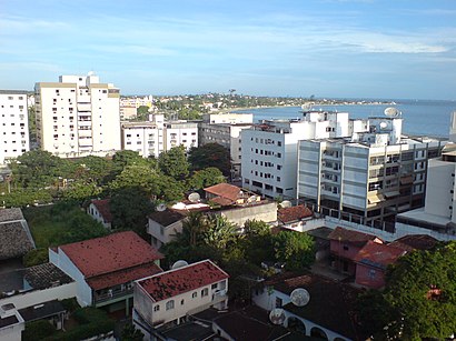
See Araruama on the map
Public Transportation to Araruama
Wondering how to get to Araruama? Moovit helps you find the best way to get to Araruama with step-by-step directions from the nearest public transit station.
Moovit provides free maps and live directions to help you navigate through your city. View schedules, routes, timetables, and find out how long does it take to get to Araruama in real time.
Looking for the nearest stop or station to Araruama? Check out this list of stops closest to your destination: Rua Francisco Andrade 448 Araruama - Rio De Janeiro 28970 Brasil; Rodoviária De Araruama - Rua Com. A. Carvalho; Ar G 01 - Sentido Ida; Avenida Presidente Getulio Vargas; Ar G 02 - Sentido Ida; Avenida Getúlio Vargas 774 Araruama - Rio De Janeiro 28970 Brasil; Rua Major Felix Moreira; Ar B 97 - Sentido Araruama; Avenida Araruama; Ferry Boat - Píer De Araruama.
Bus: B105, B147 ARARUAMA / CABO FRIO, BARRA DA TIJUCA - ARRAIAL DO CABO (VIA ARARUAMA / CABO FRIO), EXECUTIVO, NITERÓI - CABO FRIO, MARICÁ - CABO FRIO, MARICÁ - CABO FRIO, NITERÓI - ARRAIAL DO CABO, 206 CIRCULAR CENTRO (VIA XV DE NOVEMBRO), 216 ARARUAMA / REGAMÉ, 242 CIRCULAR CENTRO (VIA RIO DO LIMÃO), 248 RODOVIÁRIA / PARATI, B180 ARARUAMA / SILVA JARDIM, 203 ARARUAMA / ITATIQUARA, 205 CIRCULAR MORRO GRANDE (VIA PRAÇA DA BANDEIRA), 207 ARARUAMA / SÃO VICENTE (VIA MORRO GRANDE), 208 ARARUAMA / PONTE DOS LEITES (VIA PRAIA DO HOSPÍCIO}, 243 ARARUAMA / PONTE DOS LEITES (VIA PRAÇA DA BANDEIRA).Ferry: ARARUAMA - PRAIA SECA.
Want to see if there’s another route that gets you there at an earlier time? Moovit helps you find alternative routes or times. Get directions from and directions to Araruama easily from the Moovit App or Website.
We make riding to Araruama easy, which is why over 1.7 billion users, including users in Rio de Janeiro Region, trust Moovit as the best app for public transit. You don’t need to download an individual bus app or train app, Moovit is your all-in-one transit app that helps you find the best bus time or train time available.
For information on prices of bus, costs and ride fares to Araruama, please check the Moovit app.
Use the app to navigate to popular places including to the airport, hospital, stadium, grocery store, mall, coffee shop, school, college, and university.
Location: Rio de Janeiro Region
Popular routes to Araruama
Popular routes from Araruama
- Iguaba Grande,
- Saquarema,
- São Pedro Da Aldeia,
- Silva Jardim,
- Arraial Do Cabo,
- Cabo Frio,
- Rio Bonito,
- Armação Dos Búzios,
- Tanguá,
- Maricá,
- Casimiro De Abreu,
- Rio Das Ostras,
- Cachoeiras De Macacu,
- Itaboraí,
- Nova Friburgo,
- São Gonçalo,
- Trajano De Moraes,
- Magé,
- Guapimirim,
- Macaé
Places Near Araruama
- Avenida Rio Branco, Centro,
- Shopping Rio Sul, Botafogo,
- Museu Do Amanhã, Centro,
- Hospital Federal Cardoso Fontes, Jacarepaguá,
- Shopping RioSul, Botafogo,
- West Shopping, Campo Grande,
- Shopping Downtown, Barra Da Tijuca,
- Hospital Federal Do Andaraí, Andaraí,
- Norte Shopping, Cachambi,
- Niterói, Niterói,
- Hospital Municipal Ronaldo Gazolla, Acari,
- Feirão De Malhas, Duque De Caxias,
- Shopping Nova América, Del Castilho,
- Rodoviária Novo Rio (Rodoviária do Rio de Janeiro), Santo Cristo,
- Praia do Arpoador, Ipanema,
- Avenida Venezuela 134, Saúde,
- Feira Livre da Gloria, Glória,
- Rua Licínio Cardoso, São Francisco Xavier,
- Hospital Pedro Ernesto, Vila Isabel,
- Rio De Janeiro
How to get to popular places in Rio de Janeiro Region with public transit
Get around Rio de Janeiro Region by public transit!
Traveling around Rio de Janeiro Region has never been so easy. See step by step directions as you travel to any attraction, street or major public transit station. View bus and train schedules, arrival times, service alerts and detailed routes on a map, so you know exactly how to get to anywhere in Rio de Janeiro Region.
When traveling to any destination around Rio de Janeiro Region use Moovit's Live Directions with Get Off Notifications to know exactly where and how far to walk, how long to wait for your line, and how many stops are left. Moovit will alert you when it's time to get off — no need to constantly re-check whether yours is the next stop.
Wondering how to use public transit in Rio de Janeiro Region or how to pay for public transit in Rio de Janeiro Region? Moovit public transit app can help you navigate your way with public transit easily, and at minimum cost. It includes public transit fees, ticket prices, and costs. Looking for a map of Rio de Janeiro Region public transit lines? Moovit public transit app shows all public transit maps in Rio de Janeiro Region with all Bus, Train, Metro, Light Rail, Ferry, Cable Car, Gondola and Funicular routes and stops on an interactive map.
Rio de Janeiro Region has 8 transit type(s), including: Bus, Train, Metro, Light Rail, Ferry, Cable Car, Gondola and Funicular, operated by several transit agencies, including TrensRJ, Metrô Rio, VLT Carioca, Barcas Rio, BRT MOBI-Rio, Auto Viação Alpha, Auto Viação Tijuca, Gire Transportes, Transurb, Viação Nossa Senhora das Graças, Consórcio INTERSUL, Braso Lisboa, Caprichosa Auto Ônibus, Auto Viação Três Amigos and Rodoviária Âncora Matias