Directions to Arlington Locks & Keys with public transportation
The following transit lines have routes that pass near Arlington Locks & Keys
 Bus: 350, 77, 80, 87.
- Train: FITCHBURG, LOWELL.
- Subway: RED LINE, GREEN LINE B, GREEN LINE C, GREEN LINE E.
How to get to Arlington Locks & Keys by bus?
Click on the bus route to see step by step directions with maps, line arrival times and updated time schedules.
From Rose Kennedy Greenway
73 minFrom Boston Harbor
74 minFrom 88 Broad Street
73 minFrom Boston Long Wharf Ferry Terminal
74 minFrom CambridgeSide (Cambridgeside Galleria)
45 minFrom Mission Hill
68 minFrom Reggie Lewis Athletic Center
75 minFrom Wyndham Boston Beacon Hill
61 minFrom Stone Zoo
83 minFrom Courtyard by Marriott Brookline
61 min
How to get to Arlington Locks & Keys by train?
Click on the train route to see step by step directions with maps, line arrival times and updated time schedules.
How to get to Arlington Locks & Keys by subway?
Click on the subway route to see step by step directions with maps, line arrival times and updated time schedules.
From Rose Kennedy Greenway
63 minFrom Boston Harbor
66 minFrom 88 Broad Street
61 minFrom Boston Long Wharf Ferry Terminal
66 minFrom CambridgeSide (Cambridgeside Galleria)
61 minFrom Mission Hill
76 minFrom Reggie Lewis Athletic Center
68 minFrom Wyndham Boston Beacon Hill
54 minFrom Courtyard by Marriott Brookline
80 min
Bus stops near Arlington Locks & Keys
Subway stations near Arlington Locks & Keys
Bus lines to Arlington Locks & Keys
What are the closest stations to Arlington Locks & Keys?
The closest stations to Arlington Locks & Keys are:
- Massachusetts Ave @ Avon Pl is 190 yards away, 3 min walk.
- Broadway @ Franklin St is 319 yards away, 5 min walk.
- Medford St @ Massachusetts Ave is 495 yards away, 7 min walk.
- Pleasant St @ Wellington St is 720 yards away, 9 min walk.
- Alewife is 2163 yards away, 26 min walk.
- Medford/Tufts Station is 3858 yards away, 46 min walk.
- Belmont is 4002 yards away, 47 min walk.
- West Medford is 4078 yards away, 48 min walk.
Which bus lines stop near Arlington Locks & Keys?
These bus lines stop near Arlington Locks & Keys: 350, 77, 80, 87.
Which train lines stop near Arlington Locks & Keys?
These train lines stop near Arlington Locks & Keys: FITCHBURG, LOWELL.
Which subway line stops near Arlington Locks & Keys?
RED LINE (Alewife)
What’s the nearest subway station to Arlington Locks & Keys?
The nearest subway station to Arlington Locks & Keys is Alewife. It’s a 26 min walk away.
What’s the nearest bus station to Arlington Locks & Keys?
The nearest bus station to Arlington Locks & Keys is Massachusetts Ave @ Avon Pl. It’s a 3 min walk away.
What time is the first subway to Arlington Locks & Keys?
The GREEN LINE E is the first subway that goes to Arlington Locks & Keys. It stops nearby at 4:57 AM.
What time is the last subway to Arlington Locks & Keys?
The GREEN LINE E is the last subway that goes to Arlington Locks & Keys. It stops nearby at 2:41 AM.
What time is the first train to Arlington Locks & Keys?
The LOWELL is the first train that goes to Arlington Locks & Keys. It stops nearby at 5:31 AM.
What time is the last train to Arlington Locks & Keys?
The LOWELL is the last train that goes to Arlington Locks & Keys. It stops nearby at 12:20 AM.
What time is the first bus to Arlington Locks & Keys?
The 77 is the first bus that goes to Arlington Locks & Keys. It stops nearby at 4:54 AM.
What time is the last bus to Arlington Locks & Keys?
The 87 is the last bus that goes to Arlington Locks & Keys. It stops nearby at 1:43 AM.
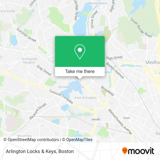
See Arlington Locks & Keys on the map
Public Transportation to Arlington Locks & Keys
Wondering how to get to Arlington Locks & Keys? Moovit helps you find the best way to get to Arlington Locks & Keys with step-by-step directions from the nearest public transit station.
Moovit provides free maps and live directions to help you navigate through your city. View schedules, routes, timetables, and find out how long does it take to get to Arlington Locks & Keys in real time.
Looking for the nearest stop or station to Arlington Locks & Keys? Check out this list of stops closest to your destination: Massachusetts Ave @ Avon Pl; Broadway @ Franklin St; Medford St @ Massachusetts Ave; Pleasant St @ Wellington St; Alewife; Medford/Tufts Station; Belmont; West Medford.
Bus: 350, 77, 80, 87.Train: FITCHBURG, LOWELL.Subway: RED LINE, GREEN LINE B, GREEN LINE C, GREEN LINE E.
Want to see if there’s another route that gets you there at an earlier time? Moovit helps you find alternative routes or times. Get directions from and directions to Arlington Locks & Keys easily from the Moovit App or Website.
We make riding to Arlington Locks & Keys easy, which is why over 1.7 million users, including users in Arlington, trust Moovit as the best app for public transit. You don’t need to download an individual bus app or train app, Moovit is your all-in-one transit app that helps you find the best bus time or train time available.
For information on prices of bus, subway and train, costs and ride fares to Arlington Locks & Keys, please check the Moovit app.
Use the app to navigate to popular places including to the airport, hospital, stadium, grocery store, mall, coffee shop, school, college, and university.
Arlington Locks & Keys Address: 20 Pond Ln Arlington, MA 02474 street in Arlington
- Perreault Law Offices,
- Stephen Joseph Ma LMHC,
- Dr Catherine Glenn,
- Arlington Acupuncture Wellness,
- Danny Miller Massage Therapist,
- DUNKIN',
- Arlington Aveto Parts,
- Arlington Center,
- Eco Massage,
- Journeywomen Psychotherapy,
- Andon C,
- Friends of the Fox Thrift,
- Prose Restaurant,
- MBTA Bus Stop 77/79/350,
- Arlington Periodontal,
- Arlington Elks,
- Summer Dey Kuempel,
- Ammon Embry-Pelrine, LMT,
- Pegasus Consulting, Assessment, & Psychological Services, LLC,
- Dey Summer
Places Near Arlington Locks & Keys
- Faneuil Hall, Boston,
- Boston Convention & Exhibition Center, Boston,
- Seaport District, Boston,
- Prudential Center, Boston,
- Quincy Market, Boston,
- House Of Blues, Boston,
- Td Garden, Boston,
- Museum Of Science, Boston,
- Castle Island, Boston,
- Cheers, Boston,
- Mgm Music Hall, Boston,
- Boston Children's Hospital, Boston,
- Boston Common, Boston,
- Wilbur Theatre, Boston,
- North End, Boston,
- Leader Bank Pavilion (Leader Bank Pavillion), Boston,
- Boston Medical Center, Boston,
- Isabella Stewart Gardner Museum, Boston,
- Wang Theater, Boston,
- Massachusetts General Hospital, Boston
How to get to popular places in Boston with public transit
Get around Arlington by public transit!
Traveling around Arlington has never been so easy. See step by step directions as you travel to any attraction, street or major public transit station. View bus and train schedules, arrival times, service alerts and detailed routes on a map, so you know exactly how to get to anywhere in Arlington.
When traveling to any destination around Arlington use Moovit's Live Directions with Get Off Notifications to know exactly where and how far to walk, how long to wait for your line, and how many stops are left. Moovit will alert you when it's time to get off — no need to constantly re-check whether yours is the next stop.
Wondering how to use public transit in Arlington or how to pay for public transit in Arlington? Moovit public transit app can help you navigate your way with public transit easily, and at minimum cost. It includes public transit fees, ticket prices, and costs. Looking for a map of Arlington public transit lines? Moovit public transit app shows all public transit maps in Arlington with all Bus, Train, Subway and Ferry routes and stops on an interactive map.
Boston has 4 transit type(s), including: Bus, Train, Subway and Ferry, operated by several transit agencies, including MBTA, Southeastern Regional Transit Authority, MetroWest Regional Transit Authority, Rhode Island Public Transit Authority, WRTA, Lowell Regional Transit Authority, Merrimack Valley Transit, Montachusett Regional Transit Authority, Cape Cod Regional Transit Authority, Brockton Area Transit Authority, Martha's Vineyard Transit Authority, the WAVE - Nantucket Regional Transit Authority, GATRA, Cape Ann Transportation Authority and Massport