How to get to Art Trends by bus?
Click on the bus route to see step by step directions with maps, line arrival times and updated time schedules.
From U Street Metro Station, Washington
76 minFrom 2121, Washington
75 minFrom Long Bridge Aquatics & Fitness Center, Arlington County
95 minFrom Ted's Bulletin, Washington
73 minFrom 2150 Pennsylvania Ave NW, Washington
74 minFrom Astoria, Washington
77 minFrom The Pentagon, Hall Of Heroes, Arlington County
71 minFrom Colombian Consulate, Washington
76 minFrom DC9 Nightclub, Washington
74 minFrom Hyatt Place Washington DC/US Capitol, Washington
75 min
How to get to Art Trends by metro?
Click on the metro route to see step by step directions with maps, line arrival times and updated time schedules.
From U Street Metro Station, Washington
37 minFrom 2121, Washington
47 minFrom Long Bridge Aquatics & Fitness Center, Arlington County
55 minFrom Ted's Bulletin, Washington
43 minFrom 2150 Pennsylvania Ave NW, Washington
45 minFrom Astoria, Washington
48 minFrom The Pentagon, Hall Of Heroes, Arlington County
41 minFrom Colombian Consulate, Washington
41 minFrom DC9 Nightclub, Washington
42 minFrom Hyatt Place Washington DC/US Capitol, Washington
47 min
Bus stops near Art Trends in Prince George's County
Metro station near Art Trends in Prince George's County
- Southern Ave Metro Station, 26 min walk,VIEW
Bus lines to Art Trends in Prince George's County
What are the closest stations to Art Trends?
The closest stations to Art Trends are:
- 28th Parkway at Afton Street is 552 yards away, 7 min walk.
- 27th Ave + 28th Pkwy is 679 yards away, 9 min walk.
- Southern Ave Metro Station is 2199 yards away, 26 min walk.
Which bus lines stop near Art Trends?
These bus lines stop near Art Trends: C27, D1X.
Which metro line stops near Art Trends?
GREEN (Branch Av)
What’s the nearest metro station to Art Trends in Prince George's County?
The nearest metro station to Art Trends in Prince George's County is Southern Ave Metro Station. It’s a 26 min walk away.
What’s the nearest bus station to Art Trends in Prince George's County?
The nearest bus station to Art Trends in Prince George's County is 28th Parkway at Afton Street. It’s a 7 min walk away.
What time is the first metro to Art Trends in Prince George's County?
The GREEN is the first metro that goes to Art Trends in Prince George's County. It stops nearby at 5:03 AM.
What time is the last metro to Art Trends in Prince George's County?
The GREEN is the last metro that goes to Art Trends in Prince George's County. It stops nearby at 12:31 AM.
What time is the first bus to Art Trends in Prince George's County?
The P83 is the first bus that goes to Art Trends in Prince George's County. It stops nearby at 6:06 AM.
What time is the last bus to Art Trends in Prince George's County?
The P83 is the last bus that goes to Art Trends in Prince George's County. It stops nearby at 8:59 PM.
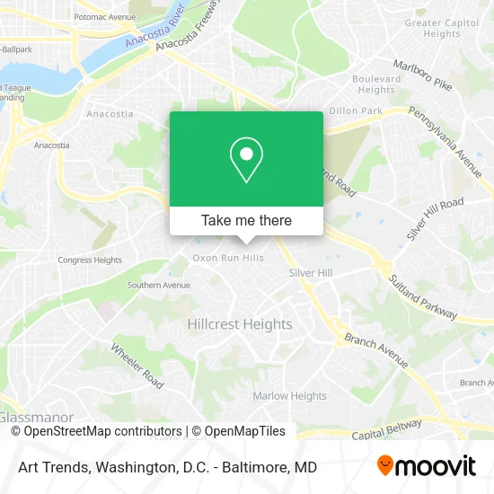
See Art Trends, Prince George's County, on the map
Public Transit to Art Trends in Prince George's County
Wondering how to get to Art Trends in Prince George's County? Moovit helps you find the best way to get to Art Trends with step-by-step directions from the nearest public transit station.
Moovit provides free maps and live directions to help you navigate through your city. View schedules, routes, timetables, and find out how long does it take to get to Art Trends in real time.
Looking for the nearest stop or station to Art Trends? Check out this list of stops closest to your destination: 28th Parkway at Afton Street; 27th Ave + 28th Pkwy; Southern Ave Metro Station.
Bus: C27, D1X, P86, P83.Metro: GREEN.
Want to see if there’s another route that gets you there at an earlier time? Moovit helps you find alternative routes or times. Get directions from and directions to Art Trends easily from the Moovit App or Website.
We make riding to Art Trends easy, which is why over 1.5 million users, including users in Prince George's County, trust Moovit as the best app for public transit. You don’t need to download an individual bus app or train app, Moovit is your all-in-one transit app that helps you find the best bus time or train time available.
For information on prices of metro and bus, costs and ride fares to Art Trends, please check the Moovit app.
Use the app to navigate to popular places including to the airport, hospital, stadium, grocery store, mall, coffee shop, school, college, and university.
Art Trends Address: 3113 Bellbrook Ct Temple Hills, MD 20748 street in Prince George's County
- Bennett Realty Solutions,
- Painting Plus,
- 28th Pkwy & Oxon Run Dr,
- Sunset Mart,
- Suncoast Locksmith,
- Sangs Seafood Grocery,
- Branch Avenue Convenience,
- Strick's Restaurant (Stricks Restaurant and Liquor Store),
- Oxon Run Neighborhood Park,
- Arrowup,
- Elite Metro,
- Naylor Convenience,
- KeyMe,
- H11/H12 - Naylor Road Station,
- Naylor Road Station,
- Hillcrest Heights Community Center,
- Temple Hills Skate Palace,
- Not About Me Ministries,
- USPS Collection Box - Blue Box,
- Branch Ave & Pennsylvania Ave SE
Places Near Art Trends (Prince George's County)
- Amazon Hq2, Arlington County,
- M&T Bank Stadium, Baltimore,
- National Museum of African American History and Culture, Washington,
- Capital One Arena, Washington,
- Westfield Montgomery Mall, Montgomery County,
- Warner Theatre, Washington,
- Pennsylvania Ave NW (3rd st and pennsylvania), Washington,
- Georgetown, Washington,
- Washington DC VA Medical Center, Washington,
- National Mall, Washington,
- Washington National Cathedral, Washington,
- Camden Yards, Baltimore,
- Rock Creek Tennis Center, Washington,
- PG Mall, Prince George's County,
- Museum Of The Bible, Washington,
- Marriott Marquis Washington, DC, Washington,
- National Zoo, Washington,
- Sibley Memorial Hospital, Washington,
- The Anthem, Washington,
- Basilica of the National Shrine, Washington
How to get to popular places in Washington, D.C. - Baltimore, MD with public transit
Get around Prince George's County by public transit!
Traveling around Prince George's County has never been so easy. See step by step directions as you travel to any attraction, street or major public transit station. View bus and train schedules, arrival times, service alerts and detailed routes on a map, so you know exactly how to get to anywhere in Prince George's County.
When traveling to any destination around Prince George's County use Moovit's Live Directions with Get Off Notifications to know exactly where and how far to walk, how long to wait for your line, and how many stops are left. Moovit will alert you when it's time to get off — no need to constantly re-check whether yours is the next stop.
Wondering how to use public transit in Prince George's County or how to pay for public transit in Prince George's County? Moovit public transit app can help you navigate your way with public transit easily, and at minimum cost. It includes public transit fees, ticket prices, and costs. Looking for a map of Prince George's County public transit lines? Moovit public transit app shows all public transit maps in Prince George's County with all Bus, Train, Metro, Light Rail and Ferry routes and stops on an interactive map.
Washington, D.C. - Baltimore, MD has 5 transit type(s), including: Bus, Train, Metro, Light Rail and Ferry, operated by several transit agencies, including WMATA, Montgomery County Ride On, Fairfax Connector, TheBus, PRTC, DASH - Alexandria, Arlington Transit (ART), RTA of Central Maryland, MDOT MTA, MDOT MTA Light RailLink, MDOT MTA Commuter Bus, MDOT MTA Local Bus, FXBGO!, Virginia Railway Express (VRE) and MARC