Directions to Ascend Collection (Baltimore) with public transportation
The following transit lines have routes that pass near Ascend Collection
 Bus: CITYLINK NAVY, GREEN ROUTE, 150, CITYLINK GOLD.
- Train: MARC.
- Metro: METRO.
- Ferry: HC1.
How to get to Ascend Collection by bus?
Click on the bus route to see step by step directions with maps, line arrival times and updated time schedules.
From Pimlico Race Course, Baltimore
75 minFrom Coppin State University, Baltimore
47 minFrom Guinness Open Gate Brewery & Barrel House, Baltimore County
75 minFrom Druid Hill Park, Baltimore
47 minFrom Mva, Baltimore
65 minFrom Dundalk, Maryland, Baltimore County
32 minFrom Loyola University Maryland, Baltimore
47 minFrom University Of Maryland Baltimore (Umbc), Baltimore County
53 minFrom Morgan State University, Baltimore
56 minFrom I-70 at Security Blvd Baltimore City Lot Park & Ride, Baltimore
62 min
How to get to Ascend Collection by train?
Click on the train route to see step by step directions with maps, line arrival times and updated time schedules.
How to get to Ascend Collection by metro?
Click on the metro route to see step by step directions with maps, line arrival times and updated time schedules.
Bus stops near Ascend Collection in Baltimore
Ferry stations near Ascend Collection in Baltimore
Metro station near Ascend Collection in Baltimore
- Shot Tower Metro, 64 min walk,VIEW
Bus lines to Ascend Collection in Baltimore
What are the closest stations to Ascend Collection?
The closest stations to Ascend Collection are:
- Maritime Park (Wb) is 302 yards away, 4 min walk.
- Maritime Park is 468 yards away, 6 min walk.
- Eastern Ave & Broadway is 509 yards away, 7 min walk.
- Fleet St & Caroline St Eb is 557 yards away, 7 min walk.
- Caroline St & Eastern Ave FS Sb is 688 yards away, 9 min walk.
- Fleet St & Wolfe St Eb is 689 yards away, 9 min walk.
- Pier Five is 1457 yards away, 18 min walk.
- Shot Tower Metro is 5378 yards away, 64 min walk.
Which bus lines stop near Ascend Collection?
These bus lines stop near Ascend Collection: CITYLINK NAVY, GREEN ROUTE.
Which train line stops near Ascend Collection?
MARC (Inbound - Camden)
Which metro line stops near Ascend Collection?
METRO (Towards John Hopkins)
What’s the nearest bus station to Ascend Collection in Baltimore?
The nearest bus station to Ascend Collection in Baltimore is Maritime Park (Wb). It’s a 4 min walk away.
What’s the nearest ferry station to Ascend Collection in Baltimore?
The nearest ferry station to Ascend Collection in Baltimore is Maritime Park. It’s a 6 min walk away.
What time is the first metro to Ascend Collection in Baltimore?
The METRO is the first metro that goes to Ascend Collection in Baltimore. It stops nearby at 5:07 AM.
What time is the last metro to Ascend Collection in Baltimore?
The METRO is the last metro that goes to Ascend Collection in Baltimore. It stops nearby at 12:27 AM.
What time is the first bus to Ascend Collection in Baltimore?
The CITYLINK NAVY is the first bus that goes to Ascend Collection in Baltimore. It stops nearby at 3:32 AM.
What time is the last bus to Ascend Collection in Baltimore?
The CITYLINK NAVY is the last bus that goes to Ascend Collection in Baltimore. It stops nearby at 3:13 AM.
What time is the first ferry to Ascend Collection in Baltimore?
The HC1 is the first ferry that goes to Ascend Collection in Baltimore. It stops nearby at 6:00 AM.
What time is the last ferry to Ascend Collection in Baltimore?
The HC3 is the last ferry that goes to Ascend Collection in Baltimore. It stops nearby at 8:07 PM.
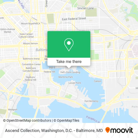
See Ascend Collection, Baltimore, on the map
Public Transit to Ascend Collection in Baltimore
Wondering how to get to Ascend Collection in Baltimore? Moovit helps you find the best way to get to Ascend Collection with step-by-step directions from the nearest public transit station.
Moovit provides free maps and live directions to help you navigate through your city. View schedules, routes, timetables, and find out how long does it take to get to Ascend Collection in real time.
Looking for the nearest stop or station to Ascend Collection? Check out this list of stops closest to your destination: Maritime Park (Wb); Maritime Park; Eastern Ave & Broadway; Fleet St & Caroline St Eb; Caroline St & Eastern Ave FS Sb; Fleet St & Wolfe St Eb; Pier Five; Shot Tower Metro.
Bus: CITYLINK NAVY, GREEN ROUTE, 150, CITYLINK GOLD.Train: MARC.Metro: METRO.Ferry: HC1.
Want to see if there’s another route that gets you there at an earlier time? Moovit helps you find alternative routes or times. Get directions from and directions to Ascend Collection easily from the Moovit App or Website.
We make riding to Ascend Collection easy, which is why over 1.5 million users, including users in Baltimore, trust Moovit as the best app for public transit. You don’t need to download an individual bus app or train app, Moovit is your all-in-one transit app that helps you find the best bus time or train time available.
For information on prices of bus, metro and train, costs and ride fares to Ascend Collection, please check the Moovit app.
Use the app to navigate to popular places including to the airport, hospital, stadium, grocery store, mall, coffee shop, school, college, and university.
Ascend Collection Address: 888 S Broadway Baltimore, MD 21231 street in Baltimore
- Osteria Pirata,
- Pendry Baltimore F&B,
- Insomnia Cookies,
- Six Feet Under The Stars,
- Soigne,
- The Spice & Tea Exchange of Fells Point,
- Waterfront Gem,
- Mid-Atlantic Settlement Services,
- Shane Ensor at Guaranteed Rate Affinity (NMLS #1395792),
- Coldwell Banker Realty,
- And Wealth Partners,
- Fells Point,
- The Horse You Came In On Saloon,
- Broadway Square,
- Fell's Point Farmers Market (The Point Restaurant),
- Pretzel Twist T LL,
- Fells Point Psychic,
- Port Comedy Club,
- Historic Fell's Point Trail,
- Inner Harbor, Baltimore MD
Places Near Ascend Collection (Baltimore)
- Washington National Cathedral, Washington,
- Sibley Memorial Hospital, Washington,
- Museum Of The Bible, Washington,
- Basilica of the National Shrine, Washington,
- Warner Theatre, Washington,
- National Mall, Washington,
- Rock Creek Tennis Center, Washington,
- Westfield Montgomery Mall, Montgomery County,
- Washington DC VA Medical Center, Washington,
- Amazon Hq2, Arlington County,
- Camden Yards, Baltimore,
- Pennsylvania Ave NW (3rd st and pennsylvania), Washington,
- M&T Bank Stadium, Baltimore,
- The Anthem, Washington,
- Georgetown, Washington,
- Marriott Marquis Washington, DC, Washington,
- Capital One Arena, Washington,
- National Museum of African American History and Culture, Washington,
- National Zoo, Washington,
- PG Mall, Prince George's County
How to get to popular places in Washington, D.C. - Baltimore, MD with public transit
Get around Baltimore by public transit!
Traveling around Baltimore has never been so easy. See step by step directions as you travel to any attraction, street or major public transit station. View bus and train schedules, arrival times, service alerts and detailed routes on a map, so you know exactly how to get to anywhere in Baltimore.
When traveling to any destination around Baltimore use Moovit's Live Directions with Get Off Notifications to know exactly where and how far to walk, how long to wait for your line, and how many stops are left. Moovit will alert you when it's time to get off — no need to constantly re-check whether yours is the next stop.
Wondering how to use public transit in Baltimore or how to pay for public transit in Baltimore? Moovit public transit app can help you navigate your way with public transit easily, and at minimum cost. It includes public transit fees, ticket prices, and costs. Looking for a map of Baltimore public transit lines? Moovit public transit app shows all public transit maps in Baltimore with all Bus, Train, Metro, Light Rail and Ferry routes and stops on an interactive map.
Washington, D.C. - Baltimore, MD has 5 transit type(s), including: Bus, Train, Metro, Light Rail and Ferry, operated by several transit agencies, including WMATA, Montgomery County Ride On, Fairfax Connector, TheBus, PRTC, DASH - Alexandria, Arlington Transit (ART), RTA of Central Maryland, MDOT MTA, MDOT MTA Light RailLink, MDOT MTA Commuter Bus, MDOT MTA Local Bus, FXBGO!, Virginia Railway Express (VRE) and MARC