How to get to Asnc Store by bus?
Click on the bus route to see step by step directions with maps, line arrival times and updated time schedules.
From The Watermark Hotel, Fairfax County
41 minFrom McLean, Virginia, Fairfax County
66 minFrom Tysons Corner Center, Fairfax County
33 minFrom Hollywood Casino at Charles Town Races, Fairfax County
47 minFrom Burke, VA, Fairfax County
98 minFrom Thomas Jefferson High School for Science and Technology, Fairfax County
46 minFrom Cia Headquarters, Fairfax County
66 minFrom [I-495] Exit 54 - Braddock Road, Fairfax County
67 minFrom Springfield, VA, Fairfax County
65 min
How to get to Asnc Store by metro?
Click on the metro route to see step by step directions with maps, line arrival times and updated time schedules.
Bus stops near Asnc Store in Fairfax County
Metro station near Asnc Store in Fairfax County
- Dunn Loring Merrifield Metro Station, 34 min walk,VIEW
Bus lines to Asnc Store in Fairfax County
What are the closest stations to Asnc Store?
The closest stations to Asnc Store are:
- Nutley Street And Lee Highway is 318 yards away, 4 min walk.
- Nutley St+Hermosa Dr is 335 yards away, 4 min walk.
- Dunn Loring Merrifield Metro Station is 2841 yards away, 34 min walk.
Which bus lines stop near Asnc Store?
These bus lines stop near Asnc Store: 660, 670, 671, F24, F50.
Which metro line stops near Asnc Store?
ORANGE (Vienna)
What’s the nearest bus station to Asnc Store in Fairfax County?
The nearest bus stations to Asnc Store in Fairfax County are Nutley Street And Lee Highway and Nutley St+Hermosa Dr. The closest one is a 4 min walk away.
What time is the first metro to Asnc Store in Fairfax County?
The ORANGE is the first metro that goes to Asnc Store in Fairfax County. It stops nearby at 5:00 AM.
What time is the last metro to Asnc Store in Fairfax County?
The ORANGE is the last metro that goes to Asnc Store in Fairfax County. It stops nearby at 12:32 AM.
What time is the first bus to Asnc Store in Fairfax County?
The F61 is the first bus that goes to Asnc Store in Fairfax County. It stops nearby at 4:57 AM.
What time is the last bus to Asnc Store in Fairfax County?
The F61 is the last bus that goes to Asnc Store in Fairfax County. It stops nearby at 2:41 AM.
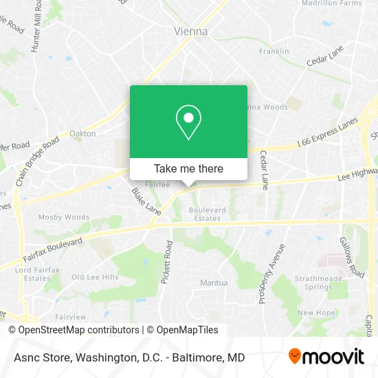
See Asnc Store, Fairfax County, on the map
Public Transit to Asnc Store in Fairfax County
Wondering how to get to Asnc Store in Fairfax County? Moovit helps you find the best way to get to Asnc Store with step-by-step directions from the nearest public transit station.
Moovit provides free maps and live directions to help you navigate through your city. View schedules, routes, timetables, and find out how long does it take to get to Asnc Store in real time.
Looking for the nearest stop or station to Asnc Store? Check out this list of stops closest to your destination: Nutley Street And Lee Highway; Nutley St+Hermosa Dr; Dunn Loring Merrifield Metro Station.
Bus: 660, 670, 671, F24, F50, GREEN 1, GREEN 2, F61.Metro: ORANGE.
Want to see if there’s another route that gets you there at an earlier time? Moovit helps you find alternative routes or times. Get directions from and directions to Asnc Store easily from the Moovit App or Website.
We make riding to Asnc Store easy, which is why over 1.5 million users, including users in Fairfax County, trust Moovit as the best app for public transit. You don’t need to download an individual bus app or train app, Moovit is your all-in-one transit app that helps you find the best bus time or train time available.
For information on prices of bus and metro, costs and ride fares to Asnc Store, please check the Moovit app.
Use the app to navigate to popular places including to the airport, hospital, stadium, grocery store, mall, coffee shop, school, college, and university.
Asnc Store Address: 9302 Lee Hwy Fairfax, VA 22031 street in Fairfax County
- PGP Title - Virginia,
- Bull Run Mobile Home Community,
- Newsprint,
- Dept of Defense & Strategic Studies,
- Lee Hwy Goldenwave Ct,
- John's Cafe,
- Walgreens,
- Shine Select,
- BMO Harris Bank,
- WESTERN UNION,
- Walgreens - Fairfax, VA #11927,
- SH-243,
- Lee Hwy & Nutley St,
- Lee Hwy Nutley,
- Nutley St & Lee,
- Lee Hwy (lee hwy / VA-243),
- Lee Hwy and Nutley,
- Pat Hanley Consulting,
- Incourage Martial Arts,
- Regent's Park
Places Near Asnc Store (Fairfax County)
- National Museum of African American History and Culture, Washington,
- National Zoo, Washington,
- National Mall, Washington,
- Basilica of the National Shrine, Washington,
- Museum Of The Bible, Washington,
- Georgetown, Washington,
- Amazon Hq2, Arlington County,
- Pennsylvania Ave NW (3rd st and pennsylvania), Washington,
- PG Mall, Prince George's County,
- Marriott Marquis Washington, DC, Washington,
- Capital One Arena, Washington,
- Westfield Montgomery Mall, Montgomery County,
- Rock Creek Tennis Center, Washington,
- M&T Bank Stadium, Baltimore,
- Sibley Memorial Hospital, Washington,
- The Anthem, Washington,
- Washington National Cathedral, Washington,
- Washington DC VA Medical Center, Washington,
- Camden Yards, Baltimore,
- Warner Theatre, Washington
How to get to popular places in Washington, D.C. - Baltimore, MD with public transit
Get around Fairfax County by public transit!
Traveling around Fairfax County has never been so easy. See step by step directions as you travel to any attraction, street or major public transit station. View bus and train schedules, arrival times, service alerts and detailed routes on a map, so you know exactly how to get to anywhere in Fairfax County.
When traveling to any destination around Fairfax County use Moovit's Live Directions with Get Off Notifications to know exactly where and how far to walk, how long to wait for your line, and how many stops are left. Moovit will alert you when it's time to get off — no need to constantly re-check whether yours is the next stop.
Wondering how to use public transit in Fairfax County or how to pay for public transit in Fairfax County? Moovit public transit app can help you navigate your way with public transit easily, and at minimum cost. It includes public transit fees, ticket prices, and costs. Looking for a map of Fairfax County public transit lines? Moovit public transit app shows all public transit maps in Fairfax County with all Bus, Train, Metro, Light Rail and Ferry routes and stops on an interactive map.
Washington, D.C. - Baltimore, MD has 5 transit type(s), including: Bus, Train, Metro, Light Rail and Ferry, operated by several transit agencies, including WMATA, Montgomery County Ride On, Fairfax Connector, TheBus, PRTC, DASH - Alexandria, Arlington Transit (ART), RTA of Central Maryland, MDOT MTA, MDOT MTA Light RailLink, MDOT MTA Commuter Bus, MDOT MTA Local Bus, FXBGO!, Virginia Railway Express (VRE) and MARC